close
-
Layers w
- Weather Layers
- Pro
- Pro
- Pro
- Pro
- Pro
- Pro
- More Layers
- Pro
- Pro
- Pro
- Pro
-
Upgrade to

3D
Trail Conditions
- Unknown
- Snow Groomed
- Snow Packed
- Snow Covered
- Snow Cover Partial
- Freeze/thaw Cycle
- Icy
- Prevalent Mud
- Wet
- Variable
- Ideal
- Dry
- Very Dry
Trail Flow (Ridden Direction)
Trailforks scans users ridelogs to determine the most popular direction each trail is ridden. A good flowing trail network will have most trails flowing in a single direction according to their intension.
The colour categories are based on what percentage of riders are riding a trail in its intended direction.
The colour categories are based on what percentage of riders are riding a trail in its intended direction.
- > 96%
- > 90%
- > 80%
- > 70%
- > 50%
- < 50%
- bi-directional trail
- no data
Trail Last Ridden
Trailforks scans ridelogs to determine the last time a trail was ridden.
- < 2 days
- < 1 week
- < 2 weeks
- < 1 month
- < 6 months
- > 6 months
Trail Ridden Direction
The intended direction a trail should be ridden.
- Downhill Only
- Downhill Primary
- Both Directions
- Uphill Primary
- Uphill Only
- One Direction
Contribute Details
Colors indicate trail is missing specified detail.
- Description
- Photos
- Description & Photos
- Videos
Trail Popularity ?
Trailforks scans ridelogs to determine which trails are ridden the most in the last 9 months.
Trails are compared with nearby trails in the same city region with a possible 25 colour shades.
Think of this as a heatmap, more rides = more kinetic energy = warmer colors.
- most popular
- popular
- less popular
- not popular
ATV/ORV/OHV Filter
Max Vehicle Width
inches
US Cell Coverage
Legend

Radar Time
Activity Recordings
Trailforks uses anonymized public activity data.
?
Activity Recordings
Trailforks uses anonymized public activity data.
?
Personal Heatmap
▶
Activity Types
all
/
none
▶
Options
2
Date range
month
–
Winter Trails
Warning
A routing network for winter maps does not exist. Selecting trails using the winter trails layer has been disabled.
Missing Trails
Most Popular
Least Popular
Trails are colored based on popularity. The more popular a trail is, the more red. Less popular trails trend towards green.
Jump Magnitude Heatmap
Heatmap of where riders jump on trails. Zoom in to see individual jumps, click circles to view jump details.
BC Backroad Status
![map legend]()
Service Road Atlas is a free to use, community-driven service for viewing and creating reports on the numerous back-country service roads around B.C. and Alberta.

Slope Aspect
Direction the slope faces
Trails Deemphasized
Trails are shown in grey.
Only show trails with no bike usage.
Suggested Layers
Based on selected activity type
Save the current map location and zoom level as your default home location whenever this page is loaded.
Save
No description for Pale has been added yet!
Login or register to submit one.
 google parking directions
Primary Trail Type: All-Mountain & Downhill
google parking directionsThis region uses the Uk/Euro style trail grading system.
Activities Click to view
- Mountain Bike
108 trails
- E-Bike
97 trails
- Horse
6 trails
- Hike
80 trails
- Trail Running
69 trails
- Dirtbike/Moto
5 trails
- ATV/ORV/OHV
1 trails
- Nordic Ski
3 trails
Region Details
- 23
- 38
- 30
- 1
Region Status
Caution as of 2 daysStats
- Avg Trail Rating
- Trails (view details)
- 99
- Trails Mountain Bike
- 108
- Trails E-Bike
- 97
- Trails Horse
- 6
- Trails Hike
- 80
- Trails Trail Running
- 69
- Trails Dirtbike/Moto
- 5
- Trails ATV/ORV/OHV
- 1
- Trails Nordic Ski
- 3
- Total Distance
- 80 miles
- Total Descent
- 22,838 ft
- Total Vertical
- 2,631 ft
- Highest Trailhead
- 3,437 ft
- Reports
- 846
- Photos
- 7
- Ridden Counter
- 3,764
Popular Pale Mountain Biking Trails
• 95 ★ 4.0 • 1,427 ft • 14 ft • 83 •
Popular blue difficulty singletrack. This mountain bike primary trail can be used downhill primary. On average it takes 3 minutes to complete this trail.
• 80 ★ 3.5 • 1 mile • 124 ft • 75 •
Popular green difficulty singletrack. This mountain bike primary trail can be used both directions and has a easy overall physical rating with a 124 ft green climb. Trail visibility is always easy to follow. On average it takes 8 minutes to complete this trail.
• 80 ★ 5.0 • 1,404 ft • 0 ft • 65 •
Popular blue difficulty singletrack. This mountain bike primary trail can be used downhill primary. On average it takes 2 minutes to complete this trail.
• 80 ★ 4.4 • 4,720 ft • 289 ft • 65 •
Popular green difficulty singletrack. This mountain bike primary trail can be used both directions and has a moderate overall physical rating with a 289 ft green climb. Trail visibility is always easy to follow. On average it takes 11 minutes to complete this trail.
• 85 ★ 3.5 • 2,372 ft • 68 ft • 64 •
Popular green difficulty singletrack. This mountain bike primary trail can be used downhill primary and has a easy overall physical rating with a 68 ft blue climb. Trail visibility is always easy to follow. On average it takes 3 minutes to complete this trail.
• 90 ★ 5.0 • 1 mile • 482 ft • 58 •
Variante dalla salita per Ravignano allo -Capodacqua
• 85 ★ 5.0 • 3,126 ft • 7 ft • 52 •
Popular green difficulty singletrack. This mountain bike primary trail can be used both directions and has a moderate overall physical rating with a 7 ft blue climb. Trail visibility is always easy to follow. On average it takes 7 minutes to complete this trail.
Pale Mountain Bike Routes
16 miles • 4,037 ft • 11 • Loop •
Con questo giro si possono fare quasi tutte le discese di pale versante capo d,aqua
Videos of Pale Mountain Bike
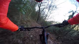
trail: Carpineto
0:17 |
375 |
Jan 3, 2019 , Foligno
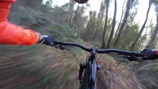
trail: La Carogna
0:54 |
403 |
Jan 3, 2019 , Foligno
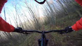
trail: Morte +
5:08 |
836 |
Jan 3, 2019 , Foligno
Current Trail Warnings
| status | trail | date | condition | user | info |
|---|---|---|---|---|---|
| Daviducciu Track | Jun 16, 2026 @ 7:00am (Europe/Rome) 2 days | Unknown | Lumoru34 | Sentiero non percorribile in mtb,fondo... |
Recent Trail Reports
| status | trail | date | condition | info | user |
|---|---|---|---|---|---|
| Carpineto | Jun 7, 2026 @ 8:16am (Europe/Rome) Jun 6, 2026 | Ideal | Lomans FFR | ||
| La Carogna | Jun 7, 2026 @ 8:16am (Europe/Rome) Jun 6, 2026 | Dry | Lomans FFR | ||
| Hey Des | Jun 7, 2026 @ 8:16am (Europe/Rome) Jun 6, 2026 | Ideal | Lomans FFR | ||
| Tronchetti finale | May 2, 2026 @ 12:41pm (Europe/Rome) May 2, 2026 | Ideal | Carlosdelafuente | ||
| Morte + | May 2, 2026 @ 12:41pm (Europe/Rome) May 2, 2026 | Dry | Carlosdelafuente | ||
| Boschetto | Apr 28, 2026 @ 9:52pm (Europe/Rome) Apr 28, 2026 | Unknown | Lumoru34 | ||
| Treggio - bivio Chiona | Mar 15, 2026 @ 8:48am (Europe/San_Marino) Mar 15, 2026 | Ideal | Alepg88 | ||
| Stradone Foligno - Treggio | Mar 15, 2026 @ 8:48am (Europe/San_Marino) Mar 15, 2026 | Ideal | Alepg88 | ||
| Cucuruzze Escape | Jan 11, 2026 @ 9:10am (Europe/San_Marino) Jan 11, 2026 | Ideal | Alepg88 | ||
| Lu fossu de lu tassu | Jan 11, 2026 @ 9:10am (Europe/San_Marino) Jan 11, 2026 | Ideal | Alepg88 |
Activity Feed
| username | action | type | title | date |
|---|---|---|---|---|
| Lumoru34 | add | report | activity #97087579 | Jun 15, 2026 @ 10:00pm 2 days |
| Lomans | add | report | activity #96458650 and 2 more | Jun 7, 2026 @ 7:28am Jun 7, 2026 |
| azd11 | wishlist | trail | activity #95114954 | May 20, 2026 @ 9:46am May 20, 2026 |
| Carlosdelafuente | add | report | activity #93868895 and 1 more | May 2, 2026 @ 9:25am May 2, 2026 |
| Lumoru34 | add | report | activity #93600278 | Apr 28, 2026 @ 12:52pm Apr 28, 2026 |
Recent Comments
| username | type | title | comment | date |
|---|---|---|---|---|
| trail | Il sentiero è chiuso da una recinzione | Jan 30, 2025 @ 8:20am Jan 30, 2025 | ||
| trail | Veramente top, bello guidato, divertente,... | Mar 25, 2024 @ 4:57am Mar 25, 2024 | ||
| trail | Ultimo pezzo nel canalone non praticabile per... | Jan 15, 2023 @ 2:17am Jan 15, 2023 |
Nearby Areas
| name | distance | ||||
|---|---|---|---|---|---|
| Sassovivo | 46 | 31 | 6 | 3 | 2.5 km |
| Cupacci-Chiona | 6 | 5 | 1 | 2.8 km | |
| Subasio | 16 | 16 | 5.1 km | ||
| Trevi | 23 | 27 | 3 | 7.7 km | |
| Col Caprile | 3 | 2 | 1 | 10.1 km |
Local Badges
-

Completionist0 awarded
Activity Type Stats
| activitytype | trails | distance | descent | descent distance | total vertical | rating | global rank | state rank | photos | reports | routes | ridelogs |
|---|---|---|---|---|---|---|---|---|---|---|---|---|
| Mountain Bike | 108 | 80 miles | 22,838 ft | 36 miles | 2,631 ft | #2,008 | #65 | 7 | 846 | 2 | 1,981 | |
| E-Bike | 97 | 72 miles | 19,255 ft | 32 miles | 2,631 ft | #1,779 | #132 | 831 | 1 | 535 | ||
| Horse | 6 | 1 mile | 26 ft | 768 ft | 735 ft | #1,996 | #106 | 18 | ||||
| Hike | 80 | 69 miles | 16,798 ft | 28 miles | 2,631 ft | #3,028 | #69 | 838 | 140 | |||
| Trail Running | 69 | 64 miles | 14,738 ft | 25 miles | 2,631 ft | #2,572 | #62 | 838 | 115 | |||
| Dirtbike/Moto | 5 | 3,366 ft | 26 ft | 768 ft | 112 ft | #564 | #18 | 20 | ||||
| ATV/ORV/OHV | 1 | 3,366 ft | 26 ft | 768 ft | 112 ft | #274 | #13 | 18 | ||||
| Nordic Ski | 3 | 3,366 ft | 26 ft | 768 ft | 112 ft | #244 | #10 |
Frequently Asked Questions About Pale
▼
What are the highest rated mountain biking trails in Pale?
The highest rated mountain biking trails in Pale are:
- La Marruca (4.3/5)
- Lu fossu de lu tassu (4.3/5)
- Lo Spaghetto (4.2/5)
- Gas Trek (4.2/5)
- sentiero san giovanni profiamma (4.1/5)
▼
What is the best time of the year to ride in Pale?
Based on ride log data, the most popular months to ride in Pale are:
- December (7 activities)
- April (5 activities)
- July (4 activities)
▼
Where can I park to ride in Pale?
There are 1 parking locations listed in Pale. The most popular parking spots are:
▼
What is the longest trail in Pale?
The longest trail in Pale is Sentiero Menotre at 6.0 km. View all trails sorted by distance.
- By DanyPG89 FFR & contributors
- Admins: magnomagnini, RiccardoPG, MTBio Foligno
- #23400 - 2,724 views
- pale activity log | embed map of Pale mountain bike trails | pale mountain biking points of interest
Downloading of trail gps tracks in kml & gpx formats is enabled for Pale.
You must login to download files.