close
-
Layers w
- Weather Layers
- Pro
- Pro
- Pro
- Pro
- Pro
- Pro
- More Layers
- Pro
- Pro
- Pro
- Pro
-
Upgrade to

3D
Trail Conditions
- Unknown
- Snow Groomed
- Snow Packed
- Snow Covered
- Snow Cover Partial
- Freeze/thaw Cycle
- Icy
- Prevalent Mud
- Wet
- Variable
- Ideal
- Dry
- Very Dry
Trail Flow (Ridden Direction)
Trailforks scans users ridelogs to determine the most popular direction each trail is ridden. A good flowing trail network will have most trails flowing in a single direction according to their intension.
The colour categories are based on what percentage of riders are riding a trail in its intended direction.
The colour categories are based on what percentage of riders are riding a trail in its intended direction.
- > 96%
- > 90%
- > 80%
- > 70%
- > 50%
- < 50%
- bi-directional trail
- no data
Trail Last Ridden
Trailforks scans ridelogs to determine the last time a trail was ridden.
- < 2 days
- < 1 week
- < 2 weeks
- < 1 month
- < 6 months
- > 6 months
Trail Ridden Direction
The intended direction a trail should be ridden.
- Downhill Only
- Downhill Primary
- Both Directions
- Uphill Primary
- Uphill Only
- One Direction
Contribute Details
Colors indicate trail is missing specified detail.
- Description
- Photos
- Description & Photos
- Videos
Trail Popularity ?
Trailforks scans ridelogs to determine which trails are ridden the most in the last 9 months.
Trails are compared with nearby trails in the same city region with a possible 25 colour shades.
Think of this as a heatmap, more rides = more kinetic energy = warmer colors.
- most popular
- popular
- less popular
- not popular
ATV/ORV/OHV Filter
Max Vehicle Width
inches
US Cell Coverage
Legend

Radar Time
Activity Recordings
Trailforks uses anonymized public activity data.
?
Activity Recordings
Trailforks uses anonymized public activity data.
?
Personal Heatmap
▶
Activity Types
all
/
none
▶
Options
2
Date range
month
–
Winter Trails
Warning
A routing network for winter maps does not exist. Selecting trails using the winter trails layer has been disabled.
Missing Trails
Most Popular
Least Popular
Trails are colored based on popularity. The more popular a trail is, the more red. Less popular trails trend towards green.
Jump Magnitude Heatmap
Heatmap of where riders jump on trails. Zoom in to see individual jumps, click circles to view jump details.
BC Backroad Status
![map legend]()
Service Road Atlas is a free to use, community-driven service for viewing and creating reports on the numerous back-country service roads around B.C. and Alberta.

Slope Aspect
Direction the slope faces
Trails Deemphasized
Trails are shown in grey.
Only show trails with no bike usage.
Suggested Layers
Based on selected activity type
Save the current map location and zoom level as your default home location whenever this page is loaded.
Save
No description for Palermo has been added yet!
Login or register to submit one.
This region uses the Uk/Euro style trail grading system.
Activities Click to view
- Mountain Bike
33 trails
- E-Bike
30 trails
- Horse
5 trails
- Hike
23 trails
- Trail Running
14 trails
Region Details
- 8
- 7
- 13
Stats
- Avg Trail Rating
- Trails (view details)
- 33
- Trails Mountain Bike
- 33
- Trails E-Bike
- 30
- Trails Horse
- 5
- Trails Hike
- 23
- Trails Trail Running
- 14
- Trails Dirtbike/Moto
- 3
- Trails ATV/ORV/OHV
- 1
- Total Distance
- 46 miles
- Total Descent
- 16,129 ft
- Total Vertical
- 6,404 ft
- Highest Trailhead
- 6,456 ft
- Reports
- 29
- Photos
- 68
- Ridden Counter
- 298
Sub Regions
- Castelbuono (3)
- Monreale (5)
- Palermo (9)
- Petralia (3)
- Polizzi Generosa (9)
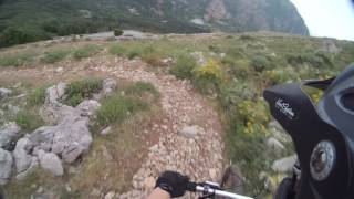
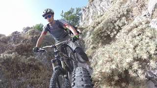
Popular Palermo Mountain Biking Trails
• 70 ★ 5.0 • 3,373 ft • 239 ft • 11 •
Sentiero naturale che inizia nei pressi delle antenne di M. Pellegrino, e che ci lascia verso la metà del monte. Sentiero abbastanza tecnico.
• 5 ★ 3.0 • 1 mile • 5 ft • 8 •
Less popular blue difficulty singletrack. This mountain bike primary trail can be used downhill only. On average it takes 13 minutes to complete this trail.
• 75 ★ 4.5 • 2 miles • 13 ft • 5 •
Popular red difficulty alpine singletrack. This mountain bike primary trail can be used downhill only.
• 60 ★ 3.0 • 3,517 ft • 328 ft • 5 •
Moderately popular blue difficulty singletrack. This multi-use trail can be used both directions and has a moderate overall physical rating with a 328 ft blue climb. Trail visibility is always easy to follow.
• 100 ★ 0.0 • 4 miles • 63 ft • 4 •
Jeeppabile caratterizzata da fondo in parte allentato e in alcuni punti scavato dall'acqua; pendenze buone ma mai esagerate; andamento abbastanza sinuoso soprattutto nella parte centrale. Ciclabilità 100% Difficoltà S1 (non do S0 per...
• 20 ★ 5.0 • 1 mile • 53 ft • 4 •
Less popular red difficulty singletrack. This mountain bike primary trail can be used downhill only. On average it takes 20 minutes to complete this trail.
• 70 ★ 3.0 • 466 ft • 0 ft • 4 •
Popular blue difficulty singletrack. This mountain bike primary trail can be used downhill only. On average it takes minutes to complete this trail.
Palermo Mountain Bike Routes
22 miles • 2,382 ft • 0 •
Percorso ricco di grossi massi che rendono la percorrenza davvero difficile e tecnica. Panorama...
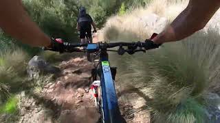
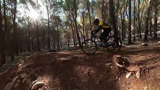
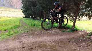
Photos of Palermo Mountain Bike
Videos of Palermo Mountain Bike
trail: Cataldi Lo Cicero P1
9:16 |
31 |
Oct 9, 2025 , Palermo
trail: Vacca morta
2:43 |
26 |
Sep 9, 2025 , Palermo
trail: Landolina
11:45 |
41 |
Sep 8, 2025 , Palermo
trail: Landolina
6:33 |
33 |
Sep 8, 2025 , Palermo

trail: Trail 03 Casaboli
5:40 |
339 |
Nov 12, 2019 , Monreale

trail: Trail 01 Casaboli
5:40 |
431 |
Nov 12, 2019 , Monreale
trail: Discesa del Carbonara
9:41 |
662 |
Nov 12, 2019 , Polizzi generosa
trail: Discesa del Carbonara
17:57 |
261 |
Nov 12, 2019 , Polizzi generosa
Recent Trail Reports
| status | trail | date | condition | info | user |
|---|---|---|---|---|---|
| Salita per Belvedere - Inizio Mototopo Palermo | May 30, 2025 @ 3:38pm May 30, 2025 | Dry | AlfonsoTraverso | ||
| Landolina Palermo | May 30, 2025 @ 3:38pm May 30, 2025 | Dry | AlfonsoTraverso | ||
| Pellegrino Palermo | May 29, 2025 @ 4:31pm May 29, 2025 | Ideal | AlfonsoTraverso | ||
| Volo dell'aquila - Prima parte Palermo | Dec 31, 2024 @ 10:18am Dec 31, 2024 | Wet | axltuzzo | ||
| Vacca morta Palermo | Oct 16, 2022 @ 1:02pm Oct 16, 2022 | Dry | menukunz Thun Kandertal | ||
| Mototopo Palermo | Oct 16, 2022 @ 1:00pm Oct 16, 2022 | Dry | menukunz Thun Kandertal | ||
| Trail 04 S. Salvatore Polizzi Generosa | Aug 25, 2021 @ 1:42am Aug 25, 2021 | Very Dry | IlSac | ||
| Sentiero degli Abies Nebrodensis Polizzi Generosa | Aug 25, 2021 @ 1:42am Aug 25, 2021 | Very Dry | IlSac | ||
| Madonna dell'Alto DH S1 (S2) Petralia | Aug 25, 2021 @ 1:42am Aug 25, 2021 | Very Dry | IlSac | ||
| Salita S. Salvatore Polizzi Generosa | Aug 25, 2021 @ 1:42am Aug 25, 2021 | Very Dry | IlSac |
Activity Feed
| username | action | type | title | date |
|---|---|---|---|---|
| YWAXqA | ridden | trail | activity #95650897 | May 27, 2026 @ 11:49am May 27, 2026 |
| OlekkbKSKM | wishlist | trail | activity #88237991 | Feb 2, 2026 @ 3:03pm Feb 2, 2026 |
| ChristianDehhC6 | vote | trail | activity #86848498 | Jan 8, 2026 @ 8:01am Jan 8, 2026 |
| ChristianDehhC6 | ridden | trail | activity #86848420 | Jan 8, 2026 @ 7:59am Jan 8, 2026 |
| menukunz | add | photo | activity #85389283 and 1 more | Dec 11, 2025 @ 10:32pm Dec 11, 2025 |
Recent Comments
| username | type | title | comment | date |
|---|---|---|---|---|
| trail | good technical trail. some short uphills. | Dec 10, 2025 @ 12:12pm Dec 10, 2025 | ||
| trail | Tecnical climb with lots of loose rocks... | Sep 25, 2025 @ 2:28am Sep 25, 2025 | ||
| trail | Il sentiero è interrotto qualche curva priva... | Mar 7, 2021 @ 8:32am Mar 7, 2021 |
Activity Type Stats
| activitytype | trails | distance | descent | descent distance | total vertical | rating | global rank | state rank | photos | reports | routes | ridelogs |
|---|---|---|---|---|---|---|---|---|---|---|---|---|
| Mountain Bike | 33 | 46 miles | 16,129 ft | 25 miles | 6,404 ft | 68 | 29 | 2 | 4,226 | |||
| E-Bike | 30 | 43 miles | 13,320 ft | 22 miles | 6,404 ft | 27 | 1 | 858 | ||||
| Horse | 5 | 9 miles | 3,976 ft | 7 miles | 4,262 ft | 5 | ||||||
| Hike | 23 | 28 miles | 13,376 ft | 21 miles | 6,404 ft | 19 | 263 | |||||
| Trail Running | 14 | 14 miles | 7,365 ft | 10 miles | 6,060 ft | 18 | 43 | |||||
| Dirtbike/Moto | 3 | 7 miles | 2,982 ft | 6 miles | 3,091 ft | 5 | ||||||
| ATV/ORV/OHV | 1 | 5 |
Frequently Asked Questions About Palermo
▼
What are the best places to ride in Palermo?
Palermo has 1 areas to explore for mountain biking.
▼
What are the highest rated mountain biking trails in Palermo?
The highest rated mountain biking trails in Palermo are:
- Landolina (4.1/5)
- Sentiero 16-03 (4.1/5)
- Volo dell'aquila - Prima parte (4.1/5)
- Trigonometrico (4.1/5)
- Discesa del Carbonara (4.1/5)
▼
What is the best time of the year to ride in Palermo?
Based on ride log data, the most popular months to ride in Palermo are:
- June (17 activities)
- August (10 activities)
- October (7 activities)
▼
What is the longest trail in Palermo?
The longest trail in Palermo is Pian delle Fate - Case Lanzeria DH S1 at 5.8 km. View all trails sorted by distance.
Activities
Trails
- By denitopia
 TRAILFORKS VTA & contributors
 - Admins: denitopia, marcoangeletti, cemoorelife
- #11713 - 2,803 views
- palermo activity log | embed map of Palermo mountain bike trails | palermo mountain biking points of interest
Downloading of trail gps tracks in kml & gpx formats is enabled for Palermo.
You must login to download files.