close
-
Layers w
- Weather Layers
- Pro
- Pro
- Pro
- Pro
- Pro
- Pro
- More Layers
- Pro
- Pro
- Pro
- Pro
-
Upgrade to

3D
Trail Conditions
- Unknown
- Snow Groomed
- Snow Packed
- Snow Covered
- Snow Cover Partial
- Freeze/thaw Cycle
- Icy
- Prevalent Mud
- Wet
- Variable
- Ideal
- Dry
- Very Dry
Trail Flow (Ridden Direction)
Trailforks scans users ridelogs to determine the most popular direction each trail is ridden. A good flowing trail network will have most trails flowing in a single direction according to their intension.
The colour categories are based on what percentage of riders are riding a trail in its intended direction.
The colour categories are based on what percentage of riders are riding a trail in its intended direction.
- > 96%
- > 90%
- > 80%
- > 70%
- > 50%
- < 50%
- bi-directional trail
- no data
Trail Last Ridden
Trailforks scans ridelogs to determine the last time a trail was ridden.
- < 2 days
- < 1 week
- < 2 weeks
- < 1 month
- < 6 months
- > 6 months
Trail Ridden Direction
The intended direction a trail should be ridden.
- Downhill Only
- Downhill Primary
- Both Directions
- Uphill Primary
- Uphill Only
- One Direction
Contribute Details
Colors indicate trail is missing specified detail.
- Description
- Photos
- Description & Photos
- Videos
Trail Popularity ?
Trailforks scans ridelogs to determine which trails are ridden the most in the last 9 months.
Trails are compared with nearby trails in the same city region with a possible 25 colour shades.
Think of this as a heatmap, more rides = more kinetic energy = warmer colors.
- most popular
- popular
- less popular
- not popular
ATV/ORV/OHV Filter
Max Vehicle Width
inches
US Cell Coverage
Legend

Radar Time
Activity Recordings
Trailforks uses anonymized public activity data.
?
Activity Recordings
Trailforks uses anonymized public activity data.
?
Personal Heatmap
▶
Activity Types
all
/
none
▶
Options
2
Date range
month
–
Winter Trails
Warning
A routing network for winter maps does not exist. Selecting trails using the winter trails layer has been disabled.
Missing Trails
Most Popular
Least Popular
Trails are colored based on popularity. The more popular a trail is, the more red. Less popular trails trend towards green.
Jump Magnitude Heatmap
Heatmap of where riders jump on trails. Zoom in to see individual jumps, click circles to view jump details.
BC Backroad Status
![map legend]()
Service Road Atlas is a free to use, community-driven service for viewing and creating reports on the numerous back-country service roads around B.C. and Alberta.

Slope Aspect
Direction the slope faces
Trails Deemphasized
Trails are shown in grey.
Only show trails with no bike usage.
Suggested Layers
Based on selected activity type
Save the current map location and zoom level as your default home location whenever this page is loaded.
Save
No description for Palmas-TO has been added yet!
Login or register to submit one.
Activities Click to view
- Mountain Bike
79 trails
- E-Bike
75 trails
- Adaptive Bike
0 trails
- Winter Fat Bike
0 trails
- Horse
7 trails
- Hike
74 trails
- Trail Running
76 trails
- Dirtbike/Moto
21 trails
Region Details
- 3
- 10
- 41
- 15
- 5
Region Status
Open as of Apr 10, 2026Stats
- Avg Trail Rating
- Trails (view details)
- 74
- Trails Mountain Bike
- 79
- Trails E-Bike
- 75
- Trails Horse
- 7
- Trails Hike
- 74
- Trails Trail Running
- 76
- Trails Dirtbike/Moto
- 21
- Total Distance
- 66 miles
- Total Descent
- 9,423 ft
- Total Vertical
- 1,143 ft
- Highest Trailhead
- 1,958 ft
- Reports
- 175
- Photos
- 17
- Ridden Counter
- 544
Sub Regions
-
Araras e Vale do Água Fria
- 7
- 32
- 13
- 5
-
Cidão
- 1
- 7
- 1
-
Parque Cesamar
- 1
- 2
Popular Palmas-TO Mountain Biking Trails
• 100 ★ 5.0 • 2,208 ft • 0 ft • 20 •
Popular blue difficulty family friendly singletrack. This mountain bike primary trail can be used downhill primary and has a moderate overall physical rating with a 0 ft blue climb. It features drop and rock garden. On average it takes 2 minutes to complete this trail.
• 100 ★ 0.0 • 1,529 ft • 92 ft • 20 •
Popular black diamond difficulty family friendly singletrack. This mountain bike primary trail can be used uphill primary and has a easy overall physical rating with a 92 ft blue climb. Trail visibility is always easy to follow. On average it takes 9 minutes to complete this trail.
• 80 ★ 5.0 • 3,091 ft • 244 ft • 19 •
Popular blue difficulty family friendly doubletrack. This mountain bike primary trail can be used uphill primary and has a hard overall physical rating with a 244 ft blue climb. On average it takes 14 minutes to complete this trail.
• 95 ★ 5.0 • 1 mile • 373 ft • 14 •
Popular green difficulty family friendly singletrack. This mountain bike primary trail can be used uphill only and has a easy overall physical rating with a 373 ft green climb. On average it takes 15 minutes to complete this trail.
• 5 ★ 5.0 • 1 mile • 3 ft • 11 •
Uma trilha bastante técnica e longa, que permite descer desde o alto do Araras até a antiga trilha do água fria. Umas das maiores em altimetria de descida da região, com obstáculos famosos, como a Avenida das Trevas e a Pedra do Ciro.
• 90 ★ 5.0 • 4,346 ft • 34 ft • 11 •
Popular blue difficulty family friendly singletrack. This mountain bike primary trail can be used downhill primary and has a moderate overall physical rating with a 34 ft blue climb. It features rock face and rock garden. On average it takes 8 minutes to complete this trail.
• 85 ★ 5.0 • 2,525 ft • 23 ft • 11 •
Popular black diamond difficulty singletrack. This mountain bike primary trail can be used downhill only and has a moderate overall physical rating with a 23 ft double black diamond climb. It features drop and rock garden. On average it takes 5 minutes to complete this trail.
• 75 ★ 5.0 • 3,593 ft • 0 ft • 9 •
Popular blue difficulty singletrack. This mountain bike primary trail can be used downhill primary and has a moderate overall physical rating with a 0 ft blue climb. It features rock garden. Trail visibility is always easy to follow. On average it takes 2 minutes to complete this trail.
Palmas-TO Mountain Bike Routes
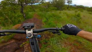
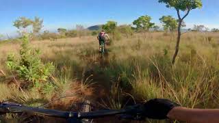
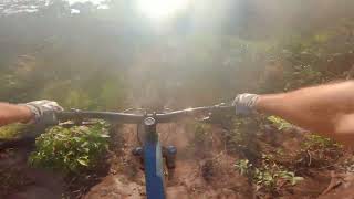
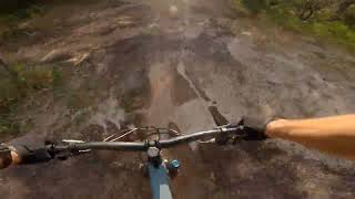
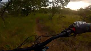
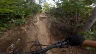
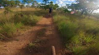
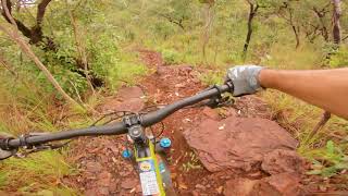
Photos of Palmas-TO Mountain Bike
Videos of Palmas-TO Mountain Bike
trail: Trilha da Jibóia
5:00 |
57 |
Mar 4, 2024 , Palmas-TO
trail: DH Lobo Guará
11:29 |
181 |
Aug 28, 2022 , Palmas-TO
trail: DH Gravity
2:02 |
139 |
Aug 28, 2022 , Palmas-TO
trail: Descida dos Degraus
4:05 |
154 |
Aug 28, 2022 , Palmas-TO
trail: Descida da Cascavel
2:38 |
168 |
Aug 28, 2022 , Palmas-TO
trail: Trilha do Beiço da Pulga
3:19 |
152 |
Aug 28, 2022 , Palmas-TO
trail: ForFun Line
3:10 |
204 |
Aug 28, 2022 , Palmas-TO
trail: Trilha di Vovô
5:02 |
159 |
Aug 28, 2022 , Palmas-TO
Recent Trail Reports
| status | trail | date | condition | info | user |
|---|---|---|---|---|---|
| Conexão Trevão Ararinhas | Aug 23, 2025 @ 3:49pm Aug 23, 2025 | Dry | jorgebernardino | ||
| Descida da Cascavel | Aug 23, 2025 @ 3:49pm Aug 23, 2025 | Very Dry | jorgebernardino | ||
| Contemplação Jardim do Tiago | Aug 23, 2025 @ 3:49pm Aug 23, 2025 | Very Dry | jorgebernardino | ||
| Rego do Ronald | Aug 23, 2025 @ 3:49pm Aug 23, 2025 | Very Dry | jorgebernardino | ||
| Trilha do Zoião | Aug 23, 2025 @ 3:49pm Aug 23, 2025 | Very Dry | jorgebernardino | ||
| Pista 3 | Jun 25, 2025 @ 11:50am Jun 25, 2025 | Dry | dimtri3zFJDg | ||
| ForFun Line | Sep 15, 2024 @ 6:37am Sep 15, 2024 | Very Dry | jorgebernardino | ||
| Trilha dos Cupins | Sep 15, 2024 @ 6:37am Sep 15, 2024 | Very Dry | jorgebernardino | ||
| Descida da Prova | Sep 15, 2024 @ 6:37am Sep 15, 2024 | Very Dry | jorgebernardino | ||
| Trilha do Beiço da Pulga | Sep 15, 2024 @ 6:37am Sep 15, 2024 | Very Dry | jorgebernardino |
Activity Feed
| username | action | type | title | date |
|---|---|---|---|---|
| jorgebernardino | add | report | activity #78786011 and 4 more | Aug 23, 2025 @ 3:08pm Aug 23, 2025 |
| dimtri3zFJDg | add | report | activity #74549672 | Jun 25, 2025 @ 11:50am Jun 25, 2025 |
| dimtri3zFJDg | ridden | trail | activity #62203161 | Nov 23, 2024 @ 2:53pm Nov 23, 2024 |
| quFY8Q | wishlist | trail | activity #61799843 | Nov 14, 2024 @ 6:23pm Nov 14, 2024 |
| dimtri3zFJDg | ridden | trail | activity #61791044 | Nov 14, 2024 @ 1:59pm Nov 14, 2024 |
Recent Comments
| username | type | title | comment | date |
|---|---|---|---|---|
| trail | Trilha bem técnica. Muito divertida. Possui... | Jul 12, 2022 @ 3:32am Jul 12, 2022 |
Local Badges
-

Epic Ride Climb 2k2 awarded -

Climbing 10k Badge8 awarded -

Climbing 100k Badge3 awarded -

Epic Ride Descent 2k2 awarded -

Descent 10k Badge8 awarded -

Descent 100k Badge3 awarded
Activity Type Stats
| activitytype | trails | distance | descent | descent distance | total vertical | rating | global rank | state rank | photos | reports | routes | ridelogs |
|---|---|---|---|---|---|---|---|---|---|---|---|---|
| Mountain Bike | 79 | 66 miles | 9,423 ft | 34 miles | 1,142 ft | #1,617 | #15 | 11 | 175 | 1 | 5,292 | |
| E-Bike | 75 | 64 miles | 9,019 ft | 33 miles | 1,142 ft | #1,538 | #25 | 6 | 171 | 1 | 673 | |
| Horse | 7 | 29 miles | 1,335 ft | 11 miles | 528 ft | #362 | #8 | 1 | ||||
| Hike | 74 | 36 miles | 7,234 ft | 22 miles | 1,142 ft | #3,934 | #51 | 174 | 1 | 51 | ||
| Trail Running | 76 | 63 miles | 8,451 ft | 32 miles | 1,142 ft | #2,661 | #41 | 174 | 1 | 10 | ||
| Dirtbike/Moto | 21 | 32 miles | 2,523 ft | 14 miles | 610 ft | #236 | #6 | 1 |
Frequently Asked Questions About Palmas-TO
▼
What are the best places to ride in Palmas-TO?
Palmas-TO has 4 areas to explore for mountain biking. The top rated areas are:
▼
What are the highest rated mountain biking trails in Palmas-TO?
The highest rated mountain biking trails in Palmas-TO are:
- Trilha Panorâmica do Araras (4.1/5)
- Palmas - Taquaruçu do Porto (4.1/5)
- Conexão Trevão Ararinhas (4.1/5)
- Descida da Cascavel (4.1/5)
- Trilha Ararinhas (4.1/5)
▼
What is the best time of the year to ride in Palmas-TO?
Based on ride log data, the most popular months to ride in Palmas-TO are:
- July (5 activities)
- September (4 activities)
- August (4 activities)
▼
Where can I park to ride in Palmas-TO?
There are 2 parking locations listed in Palmas-TO. The most popular parking spots are:
Activities
Trails
- By jorgebernardino & contributors
- Admins: chpw, fabanha
- #24768 - 2,119 views
- palmas-to activity log | embed map of Palmas-TO mountain bike trails | palmas-to mountain biking points of interest
Downloading of trail gps tracks in kml & gpx formats is enabled for Palmas-TO.
You must login to download files.