close
-
Layers w
- Weather Layers
- Pro
- Pro
- Pro
- Pro
- Pro
- Pro
- More Layers
- Pro
- Pro
- Pro
- Pro
-
Upgrade to

3D
Trail Conditions
- Unknown
- Snow Groomed
- Snow Packed
- Snow Covered
- Snow Cover Partial
- Freeze/thaw Cycle
- Icy
- Prevalent Mud
- Wet
- Variable
- Ideal
- Dry
- Very Dry
Trail Flow (Ridden Direction)
Trailforks scans users ridelogs to determine the most popular direction each trail is ridden. A good flowing trail network will have most trails flowing in a single direction according to their intension.
The colour categories are based on what percentage of riders are riding a trail in its intended direction.
The colour categories are based on what percentage of riders are riding a trail in its intended direction.
- > 96%
- > 90%
- > 80%
- > 70%
- > 50%
- < 50%
- bi-directional trail
- no data
Trail Last Ridden
Trailforks scans ridelogs to determine the last time a trail was ridden.
- < 2 days
- < 1 week
- < 2 weeks
- < 1 month
- < 6 months
- > 6 months
Trail Ridden Direction
The intended direction a trail should be ridden.
- Downhill Only
- Downhill Primary
- Both Directions
- Uphill Primary
- Uphill Only
- One Direction
Contribute Details
Colors indicate trail is missing specified detail.
- Description
- Photos
- Description & Photos
- Videos
Trail Popularity ?
Trailforks scans ridelogs to determine which trails are ridden the most in the last 9 months.
Trails are compared with nearby trails in the same city region with a possible 25 colour shades.
Think of this as a heatmap, more rides = more kinetic energy = warmer colors.
- most popular
- popular
- less popular
- not popular
ATV/ORV/OHV Filter
Max Vehicle Width
inches
US Cell Coverage
Legend

Radar Time
Activity Recordings
Trailforks uses anonymized public activity data.
?
Activity Recordings
Trailforks uses anonymized public activity data.
?
Personal Heatmap
▶
Activity Types
all
/
none
▶
Options
2
Date range
month
–
Winter Trails
Warning
A routing network for winter maps does not exist. Selecting trails using the winter trails layer has been disabled.
Missing Trails
Most Popular
Least Popular
Trails are colored based on popularity. The more popular a trail is, the more red. Less popular trails trend towards green.
Jump Magnitude Heatmap
Heatmap of where riders jump on trails. Zoom in to see individual jumps, click circles to view jump details.
BC Backroad Status
![map legend]()
Service Road Atlas is a free to use, community-driven service for viewing and creating reports on the numerous back-country service roads around B.C. and Alberta.

Slope Aspect
Direction the slope faces
Trails Deemphasized
Trails are shown in grey.
Only show trails with no bike usage.
Suggested Layers
Based on selected activity type
Save the current map location and zoom level as your default home location whenever this page is loaded.
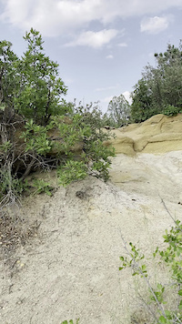
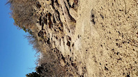
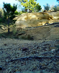
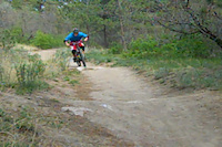
SavePalmer Park is a technical rocky maze located in the center of Colorado Springs. There is flow to be had here but piecing together a good route requires experience and knowledge of the trails. The signage is terrible and there are unmarked spur trails everywhere just waiting to get you lost or turned around. However, with all that being said there are still some fun trails in this park with technical rocks, roots, and drops that pop up out of nowhere. Ride with a local to find some flow in this park. Beware this park is heavily used thus there are hikers, horses, and dogs most trails so keep your speed in check.
Primary Trail Type: All-Mountain & Downhill
Land Status: City Managed
 google parking directions
 Activities Click to view
- Mountain Bike
74 trails
- Hike
74 trails
- Trail Running
74 trails
Region Details
- 7
- 1
- 23
- 19
- 19
Region Status
Open as of Jun 17, 2026Stats
- Avg Trail Rating
- Trails (view details)
- 69
- Trails Mountain Bike
- 74
- Trails E-Bike
- 1
- Trails Winter Fat Bike
- 1
- Trails Horse
- 1
- Trails Hike
- 74
- Trails Trail Running
- 74
- Total Distance
- 34 miles
- Total Descent
- 5,708 ft
- Total Vertical
- 610 ft
- Highest Trailhead
- 6,865 ft
- Reports
- 813
- Photos
- 101
- Ridden Counter
- 23,633
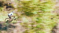
Popular Palmer Park Mountain Biking Trails
• 100 ★ 4.0 • 900 ft • 9 ft • 839 •
Popular green difficulty singletrack. This mountain bike primary trail can be used both directions. On average it takes 1 minutes to complete this trail.
• 90 ★ 5.0 • 620 ft • 6 ft • 747 •
Popular black diamond difficulty singletrack. This mountain bike primary trail can be used downhill primary. On average it takes 1 minutes to complete this trail.
• 95 ★ 3.5 • 402 ft • 4 ft • 614 •
Popular blue difficulty singletrack. This mountain bike primary trail can be used both directions. On average it takes minutes to complete this trail.
• 90 ★ 4.3 • 1,493 ft • 65 ft • 603 •
Popular blue difficulty singletrack. This mountain bike primary trail can be used both directions. On average it takes 3 minutes to complete this trail.
• 90 ★ 4.5 • 1 mile • 204 ft • 602 •
Popular blue difficulty singletrack. This mountain bike primary trail can be used both directions. On average it takes 13 minutes to complete this trail.
• 85 ★ 5.0 • 885 ft • 48 ft • 593 •
Popular green difficulty singletrack. This mountain bike primary trail can be used both directions. On average it takes 2 minutes to complete this trail.
• 90 ★ 4.0 • 831 ft • 38 ft • 580 •
Popular green difficulty singletrack. This mountain bike primary trail can be used both directions. On average it takes minutes to complete this trail.
• 90 ★ 3.5 • 2,552 ft • 25 ft • 562 •
Popular black diamond difficulty singletrack. This mountain bike primary trail can be used both directions. On average it takes 5 minutes to complete this trail.
Palmer Park Mountain Bike Routes
★ 4.0 • 11 miles • 1,138 ft • 4 •
Apex stage 1 - The Pikes Peak APEX presented by RockShox is a unique 4-day mountain bike challenge on the...
10 miles • 908 ft • 12 • Loop •
Start off of the north trailhead off of Brenner Place. You'll see a wooden sign for , follow this sign...
5 miles • 416 ft • 5 • Loop •
Start in Palmer at the northeast entrance off of Brenner Place. There is a " " sign with trails on either...
10 miles • 1,026 ft • 11 • Loop •
Start off Brenner Pl, you can park there if needed. Climb up the older pavilion parking lot to jump on ....
12 miles • 1,163 ft • 11 •
Starting at the south east corner of by the intersection of Academy Blvd. and Maizeland Rd. There is...
7 miles • 694 ft • 11 • Loop •
My best guess at coming up with a moderate-to-kinda-easy loop in . What is "green" in Palmer is "blue"...
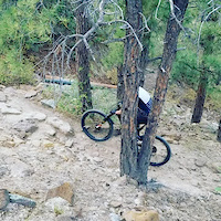
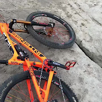
Photos of Palmer Park Mountain Bike
Videos of Palmer Park Mountain Bike
trail: Grandview Alt
0:07 |
102 |
Oct 20, 2021
trail: Grandview
0:37 |
72 |
May 25, 2021

trail: Grandview
0:37 |
50 |
May 23, 2021
trail: Palmer Park
0:18 |
52 |
Nov 26, 2018
trail: Palmer Park
0:11 |
60 |
Nov 18, 2018
trail: Palmer Park
0:16 |
54 |
Nov 18, 2018
trail: Little Moab Alt
0:13 |
2550 |
Jun 21, 2017
trail: Palmer Park
0:55 |
642 |
May 20, 2014
Current Trail Warnings
| status | trail | date | condition | user | info |
|---|---|---|---|---|---|
| Fence Line | Jun 1, 2026 @ 2:16pm (America/Denver) Jun 1, 2026 | Unknown | Markxbrother | Looks to me like this trail is blocked... |
Recent Trail Reports
| status | trail | date | condition | info | user |
|---|---|---|---|---|---|
| Kinnickinnick | Jun 17, 2026 @ 5:05pm (America/Denver) Jun 17, 2026 | Dry | dashraces | ||
| Kinnickinnick | Jun 17, 2026 @ 5:05pm (America/Denver) Jun 17, 2026 | Dry | dashraces | ||
| South Canyon | Jun 17, 2026 @ 5:05pm (America/Denver) Jun 17, 2026 | Dry | dashraces | ||
| Kinnickinnick (Council) | Jun 17, 2026 @ 5:05pm (America/Denver) Jun 17, 2026 | Dry | dashraces | ||
| Palmer Point | Mar 18, 2026 @ 1:40pm (America/Denver) Mar 18, 2026 | Dry | dashraces | ||
| Mark Reyner Stables | Mar 18, 2026 @ 1:40pm (America/Denver) Mar 18, 2026 | Dry | dashraces | ||
| Grandview Conn | Mar 18, 2026 @ 1:40pm (America/Denver) Mar 18, 2026 | Dry | dashraces | ||
| East Cheyenne | Mar 18, 2026 @ 1:40pm (America/Denver) Mar 18, 2026 | Dry | dashraces | ||
| Kinnickinnick Conn | Mar 18, 2026 @ 1:40pm (America/Denver) Mar 18, 2026 | Dry | dashraces | ||
| Jedi | Mar 18, 2026 @ 1:40pm (America/Denver) Mar 18, 2026 | Dry | dashraces |
Activity Feed
| username | action | type | title | date |
|---|---|---|---|---|
| rustymay | wishlist | route | activity #97686323 | Jun 24, 2026 @ 4:01am 14 hours |
| dashraces | add | report | activity #97268154 and 3 more | Jun 18, 2026 @ 12:05pm Jun 18, 2026 |
| calypso423 | wishlist | route | activity #97063957 | Jun 15, 2026 @ 1:56pm Jun 15, 2026 |
| TomukzIAT | wishlist | route | activity #96881715 | Jun 13, 2026 @ 8:38am Jun 13, 2026 |
| JGspark | wishlist | route | activity #96782846 | Jun 11, 2026 @ 8:52pm Jun 11, 2026 |
Recent Comments
| username | type | title | comment | date |
|---|---|---|---|---|
| trail | Trail blocked?! | Jun 1, 2026 @ 10:24am Jun 1, 2026 | ||
| trail | Fun, technical. Runs better S to N | Feb 16, 2026 @ 4:56pm Feb 16, 2026 | ||
| trail | If you like techy climbing with hike a bike... | Sep 18, 2025 @ 11:15am Sep 18, 2025 | ||
| trail | Trail should be a Black. Short and pretty low... | Apr 9, 2024 @ 5:18pm Apr 9, 2024 | ||
| trail | This is very steep, huge rocks and chunk meant... | May 2, 2023 @ 3:44pm May 2, 2023 |
Nearby Areas
| name | distance | ||||
|---|---|---|---|---|---|
| Austin Bluffs | 42 | 22 | 7 | 2.7 km | |
| High Chaparral Open Space | 15 | 3.3 km | |||
| Sand Creek | 1 | 3.7 km | |||
| Fountain Park | 2 | 2 | 1 | 1 | 4.3 km |
| Dorchester Park | 1 | 2 | 5 km |
Local Badges
-

Completionist0 awarded
Activity Type Stats
| activitytype | trails | distance | descent | descent distance | total vertical | rating | global rank | state rank | photos | reports | routes | ridelogs |
|---|---|---|---|---|---|---|---|---|---|---|---|---|
| Mountain Bike | 74 | 34 miles | 5,709 ft | 17 miles | 610 ft | #612 | #223 | 100 | 813 | 9 | 17,378 | |
| E-Bike | 1 | 2,605 ft | 138 ft | 735 | 390 | |||||||
| Winter Fat Bike | 1 | #377 | #188 | 1 | ||||||||
| Horse | 1 | 2,605 ft | 138 ft | 136 | 1 | |||||||
| Hike | 74 | 34 miles | 5,709 ft | 17 miles | 610 ft | #4,328 | #1,543 | 3 | 814 | 3 | 1,787 | |
| Trail Running | 74 | 34 miles | 5,709 ft | 17 miles | 610 ft | #3,694 | #1,018 | 814 | 3 | 990 |
Frequently Asked Questions About Palmer Park
▼
What are the highest rated mountain biking trails in Palmer Park?
The highest rated mountain biking trails in Palmer Park are:
- Little Moab Alt (4.4/5)
- Grandview (4.2/5)
- Lazy Land (4.2/5)
- Templeton (4.2/5)
- Grandview Alt (4.1/5)
▼
What is the best time of the year to ride in Palmer Park?
Based on ride log data, the most popular months to ride in Palmer Park are:
- September (106 activities)
- October (89 activities)
- April (85 activities)
▼
Where can I park to ride in Palmer Park?
There are 13 parking locations listed in Palmer Park. The most popular parking spots are: View all parking and trailhead locations on the map to plan your visit.
▼
What is the longest trail in Palmer Park?
The longest trail in Palmer Park is Homestead Trail at 5.5 miles. View all trails sorted by distance.
Activities
- By brenthillier
 NSMBA TRAILFORKS & contributors
 - Admins: MWTA, COSMBA, GoPP
- #4071 - 21,306 views
- palmer park activity log | embed map of Palmer Park mountain bike trails | palmer park mountain biking points of interest
Downloading of trail gps tracks in kml & gpx formats is enabled for Palmer Park.
You must login to download files.