close
-
Layers w
- Weather Layers
- Pro
- Pro
- Pro
- Pro
- Pro
- Pro
- More Layers
- Pro
- Pro
- Pro
- Pro
-
Upgrade to

3D
Trail Conditions
- Unknown
- Snow Groomed
- Snow Packed
- Snow Covered
- Snow Cover Partial
- Freeze/thaw Cycle
- Icy
- Prevalent Mud
- Wet
- Variable
- Ideal
- Dry
- Very Dry
Trail Flow (Ridden Direction)
Trailforks scans users ridelogs to determine the most popular direction each trail is ridden. A good flowing trail network will have most trails flowing in a single direction according to their intension.
The colour categories are based on what percentage of riders are riding a trail in its intended direction.
The colour categories are based on what percentage of riders are riding a trail in its intended direction.
- > 96%
- > 90%
- > 80%
- > 70%
- > 50%
- < 50%
- bi-directional trail
- no data
Trail Last Ridden
Trailforks scans ridelogs to determine the last time a trail was ridden.
- < 2 days
- < 1 week
- < 2 weeks
- < 1 month
- < 6 months
- > 6 months
Trail Ridden Direction
The intended direction a trail should be ridden.
- Downhill Only
- Downhill Primary
- Both Directions
- Uphill Primary
- Uphill Only
- One Direction
Contribute Details
Colors indicate trail is missing specified detail.
- Description
- Photos
- Description & Photos
- Videos
Trail Popularity ?
Trailforks scans ridelogs to determine which trails are ridden the most in the last 9 months.
Trails are compared with nearby trails in the same city region with a possible 25 colour shades.
Think of this as a heatmap, more rides = more kinetic energy = warmer colors.
- most popular
- popular
- less popular
- not popular
ATV/ORV/OHV Filter
Max Vehicle Width
inches
US Cell Coverage
Legend

Radar Time
Activity Recordings
Trailforks uses anonymized public activity data.
?
Activity Recordings
Trailforks uses anonymized public activity data.
?
Personal Heatmap
▶
Activity Types
all
/
none
▶
Options
2
Date range
month
–
Winter Trails
Warning
A routing network for winter maps does not exist. Selecting trails using the winter trails layer has been disabled.
Missing Trails
Most Popular
Least Popular
Trails are colored based on popularity. The more popular a trail is, the more red. Less popular trails trend towards green.
Jump Magnitude Heatmap
Heatmap of where riders jump on trails. Zoom in to see individual jumps, click circles to view jump details.
BC Backroad Status
![map legend]()
Service Road Atlas is a free to use, community-driven service for viewing and creating reports on the numerous back-country service roads around B.C. and Alberta.

Slope Aspect
Direction the slope faces
Trails Deemphasized
Trails are shown in grey.
Only show trails with no bike usage.
Suggested Layers
Based on selected activity type
Save the current map location and zoom level as your default home location whenever this page is loaded.
SavePopular Trail Networks
view all areas »
No description for Panama has been added yet!
Login or register to submit one.
Region Details
- 108
- 1
- 27
- 120
- 32
- 2
Stats
- Avg Trail Rating
- Trails (view details)
- 294
- Trails Mountain Bike
- 293
- Trails E-Bike
- 230
- Trails Gravel Bike
- 8
- Trails Horse
- 10
- Trails Hike
- 237
- Trails Trail Running
- 245
- Trails Dirtbike/Moto
- 10
- Trails Observed Trials
- 10
- Trails ATV/ORV/OHV
- 9
- Trails Snowshoe
- 1
- Trails Downhill Ski
- 1
- Trails Backcountry Ski
- 1
- Trails Nordic Ski
- 1
- Total Distance
- 583 miles
- Total Descent
- 137,174 ft
- Total Vertical
- 11,162 ft
- Highest Trailhead
- 11,169 ft
- Reports
- 175
- Photos
- 292
- Ridden Counter
- 2,329
Sub Regions
- Bocas Del Toro (provincia) (6)
- Changuinola (5)
- Isla Colón (1)
- Changuinola (5)
- Chiriquí (provincia) (4)
- Volcan (5)
- Volcan (5)
- Coclé (provincia) (107)
- Colón (provincia) (11)
- Herrera (provincia) (0)
- Los Santos (provincia) (2)
- Las Tablas (2)
- Las Tablas (2)
- Panamá (provincia) (83)
- Panama City (79)
- Panamá Oeste (provincia) (34)
- Arraijan (7)
- Chorrera (17)
- Altos De Campana National Park (10)
- Cerro Chame (3)
- Fat Hill (4)
- Trillo Tití (7)
- Bike Park El Rosal (7)
- Arraijan (7)
- Veraguas (provincia) (23)
- Santiago (22)
- La Yeguada (13)
- Santiago De Veraguas (1)
- Santiago (22)
Popular Panama Mountain Biking Trails
• 85 ★ 4.5 • 4 miles • 343 ft • 66 •
An amazing singletrack very simple and light for any level A lot of curves small uphills and small downhills that get the trail very flowy with nice turns. It s inside a forest , so be ready for the high humidity level
• 80 ★ 0.0 • 1 mile • 89 ft • 50 •
Popular blue difficulty singletrack. This mountain bike primary trail can be used both directions. On average it takes 12 minutes to complete this trail.
• 90 ★ 0.0 • 2,241 ft • 52 ft • 46 •
Popular blue difficulty singletrack. This mountain bike primary trail can be used both directions. On average it takes 3 minutes to complete this trail.
• 75 ★ 4.0 • 2 miles • 246 ft • 29 •
Popular black diamond difficulty singletrack. This multi-use trail can be used downhill primary. On average it takes 41 minutes to complete this trail.
• 100 ★ 4.0 • 4,117 ft • 187 ft • 26 •
Popular green difficulty singletrack. This mountain bike primary trail can be used both directions. On average it takes 12 minutes to complete this trail.
• 75 ★ 0.0 • 3,445 ft • 18 ft • 23 •
Popular blue difficulty singletrack. This mountain bike primary trail. It features bridge, drop, jump, gap jump and ladder bridge. On average it takes 4 minutes to complete this trail.
• 70 ★ 3.0 • 1 mile • 242 ft • 22 •
Camino que lleva a la calle de mantenimiento del campo de
Panama Mountain Bike Routes
11 miles • 2,226 ft • 1 • Loop •
This loop takes you to , probably the most scenic Singletrack in all of Panama. You leave the car and the...
8 miles • 861 ft • 2 • Point to Point •
This is an old access road build by the US Armed forces during the Panama Canal Zone era, the Jungle had...
21 miles • 763 ft • 1 • Loop •
Good adventure, which will require crossing the Chame River six times, carrying the bicycle and possibly...
43 miles • 5,211 ft • 10 • Loop •
Massive loop with the best the Valle has to offer
★ 5.0 • 15 miles • 729 ft • 0 • Loop •
Vuelta al selfie ride con retorno hacia el single track
Photos of Panama Mountain Bike
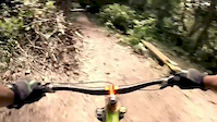
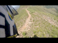
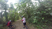
Videos of Panama Mountain Bike
trail: Antenas
0:15 |
41 |
Oct 16, 2021
0:00 |
50 |
Sep 12, 2021
0:09 |
|
Sep 12, 2021
trail: Linea 1 BG
0:09 |
32 |
Oct 13, 2020
trail: Cocoa Plantation
0:52 |
199 |
May 23, 2016

trail: La Silla
6:30 |
447 |
May 10, 2016
trail: La Silla
0:33 |
351 |
Jun 14, 2015
trail: Cocoa Plantation
3:28 |
167 |
Jun 11, 2015
Recent Comments
| username | type | title | comment | date |
|---|---|---|---|---|
| trail | mostly rideable, some sections are too far... | Jun 11, 2026 @ 6:54pm Jun 11, 2026 | ||
| trail | Gravel road, great views, it's not technical.... | Aug 13, 2025 @ 7:54am Aug 13, 2025 | ||
| trail | NOT a mountain bike trail. Not eaven a hiking... | Aug 2, 2025 @ 11:35am Aug 2, 2025 | ||
| trail | I’ve hiked this and it’s a gravel road,... | Jun 19, 2025 @ 8:44pm Jun 19, 2025 | ||
| trail | Super cool , very fast , very fun , amazing... | Apr 23, 2025 @ 5:02am Apr 23, 2025 |
Bike & Skill Parks
| name | type | city | rating |
|---|---|---|---|
| Gamboa Bike Park | bike park | Colón City | |
| Bike Park El Rosal | bike park | ||
| BLUEGONG MTB CAMP | skill park | Panama City |
Activity Type Stats
| activitytype | trails | distance | descent | descent distance | total vertical | rating | global rank | state rank | photos | reports | routes | ridelogs |
|---|---|---|---|---|---|---|---|---|---|---|---|---|
| Mountain Bike | 290 | 576 miles | 136,217 ft | 322 miles | 11,161 ft | #50 | 278 | 175 | 22 | 23,868 | ||
| E-Bike | 230 | 438 miles | 99,875 ft | 245 miles | 4,406 ft | #47 | 7 | 149 | 13 | 995 | ||
| Gravel Bike | 8 | #40 | 1 | 53 | ||||||||
| Horse | 10 | 53 miles | 5,420 ft | 26 miles | 1,952 ft | #49 | 12 | 2 | ||||
| Hike | 236 | 457 miles | 98,996 ft | 248 miles | 11,161 ft | #59 | 10 | 172 | 4 | 1,571 | ||
| Trail Running | 245 | 454 miles | 99,442 ft | 248 miles | 11,161 ft | #53 | 3 | 172 | 4 | 512 | ||
| Dirtbike/Moto | 10 | 31 miles | 4,209 ft | 15 miles | 2,523 ft | #53 | 7 | 15 | ||||
| Observed Trials | 10 | 2 miles | 154 ft | 4,560 ft | 135 ft | #47 | ||||||
| ATV/ORV/OHV | 9 | 6 miles | 276 ft | 2 miles | 43 ft | #55 | 7 | 2 | ||||
| Snowshoe | 1 | #46 | ||||||||||
| Downhill Ski | 1 | #42 | 3 | |||||||||
| Backcountry Ski | 1 | #44 | 2 | |||||||||
| Nordic Ski | 1 | #43 | 3 |
Activities
Trails
Points of Interest
- Tres Torres Viewpoint
- Mirador Viewpoint
- Mirador Viewpoint
- partidor Viewpoint
- Playa Tortuguilla Viewpoint
- Castillo de San Lorenzo Viewpoint
- Embarcadero Viewpoint
- Torre de Vigilancia Summit
- Bateria Mckenzie Viewpoint
- [falls] Hidden Waterfalls Other
- Kamuk (11,585 ft)
- Cerro Fabrega (10,961 ft)
- Cerro Itamut (10,755 ft)
- By canadaka
 Trailforks & contributors
 - Admins: JonyA, FernandoMantovani, Mudelos
- #3217 - 22,708 views
- panama activity log | embed map of Panama mountain bike trails | panama mountain biking points of interest
Downloading of trail gps tracks in kml & gpx formats is enabled for Panama.
You must login to download files.