close
-
Layers w
- Weather Layers
- Pro
- Pro
- Pro
- Pro
- Pro
- Pro
- More Layers
- Pro
- Pro
- Pro
- Pro
-
Upgrade to

3D
Trail Conditions
- Unknown
- Snow Groomed
- Snow Packed
- Snow Covered
- Snow Cover Partial
- Freeze/thaw Cycle
- Icy
- Prevalent Mud
- Wet
- Variable
- Ideal
- Dry
- Very Dry
Trail Flow (Ridden Direction)
Trailforks scans users ridelogs to determine the most popular direction each trail is ridden. A good flowing trail network will have most trails flowing in a single direction according to their intension.
The colour categories are based on what percentage of riders are riding a trail in its intended direction.
The colour categories are based on what percentage of riders are riding a trail in its intended direction.
- > 96%
- > 90%
- > 80%
- > 70%
- > 50%
- < 50%
- bi-directional trail
- no data
Trail Last Ridden
Trailforks scans ridelogs to determine the last time a trail was ridden.
- < 2 days
- < 1 week
- < 2 weeks
- < 1 month
- < 6 months
- > 6 months
Trail Ridden Direction
The intended direction a trail should be ridden.
- Downhill Only
- Downhill Primary
- Both Directions
- Uphill Primary
- Uphill Only
- One Direction
Contribute Details
Colors indicate trail is missing specified detail.
- Description
- Photos
- Description & Photos
- Videos
Trail Popularity ?
Trailforks scans ridelogs to determine which trails are ridden the most in the last 9 months.
Trails are compared with nearby trails in the same city region with a possible 25 colour shades.
Think of this as a heatmap, more rides = more kinetic energy = warmer colors.
- most popular
- popular
- less popular
- not popular
ATV/ORV/OHV Filter
Max Vehicle Width
inches
US Cell Coverage
Legend

Radar Time
Activity Recordings
Trailforks uses anonymized public activity data.
?
Activity Recordings
Trailforks uses anonymized public activity data.
?
Personal Heatmap
▶
Activity Types
all
/
none
▶
Options
2
Date range
month
–
Winter Trails
Warning
A routing network for winter maps does not exist. Selecting trails using the winter trails layer has been disabled.
Missing Trails
Most Popular
Least Popular
Trails are colored based on popularity. The more popular a trail is, the more red. Less popular trails trend towards green.
Jump Magnitude Heatmap
Heatmap of where riders jump on trails. Zoom in to see individual jumps, click circles to view jump details.
BC Backroad Status
![map legend]()
Service Road Atlas is a free to use, community-driven service for viewing and creating reports on the numerous back-country service roads around B.C. and Alberta.

Slope Aspect
Direction the slope faces
Trails Deemphasized
Trails are shown in grey.
Only show trails with no bike usage.
Suggested Layers
Based on selected activity type
Save the current map location and zoom level as your default home location whenever this page is loaded.
Save
No description for Park County has been added yet!
Login or register to submit one.
Activities Click to view
- Mountain Bike
49 trails
- E-Bike
6 trails
- Horse
32 trails
- Hike
91 trails
- Trail Running
90 trails
- Dirtbike/Moto
6 trails
- ATV/ORV/OHV
3 trails
- Snowmobile
0 trails
- Snowshoe
4 trails
- Backcountry Ski
0 trails
- Nordic Ski
2 trails
Region Details
- 13
- 5
- 25
- 6
Stats
- Avg Trail Rating
- Trails (view details)
- 86
- Trails Mountain Bike
- 49
- Trails E-Bike
- 6
- Trails Horse
- 32
- Trails Hike
- 91
- Trails Trail Running
- 90
- Trails Dirtbike/Moto
- 6
- Trails ATV/ORV/OHV
- 3
- Trails Snowshoe
- 4
- Trails Nordic Ski
- 2
- Total Distance
- 275 miles
- Total Descent
- 55,096 ft
- Total Vertical
- 6,898 ft
- Highest Trailhead
- 14,261 ft
- Reports
- 135
- Photos
- 140
- Ridden Counter
- 4,690
Sub Regions
- Bailey (4)
- Fairplay (27)
- Lake George (3)
Popular Park County Mountain Biking Trails
• 95 ★ 3.8 • 6 miles • 767 ft • 789 •
Popular blue difficulty singletrack. This multi-use trail can be used both directions. On average it takes 1 hour2 minutes to complete this trail.
• 55 ★ 3.4 • 6 miles • 1,048 ft • 251 •
For Segment 5 (Long Gulch Trailhead to Kenosha East Trailhead), bikes are not allowed beyond/east of the Rock Creek Road/NFSR 133 from the Rock Creek Trailhead.
• 90 ★ 3.0 • 1 mile • 252 ft • 245 • • hike
Popular green difficulty mixed. This hike primary trail can be used uphill primary and has a moderate overall physical rating with a 252 ft green climb. On average it takes 10 minutes to complete this trail.
• 100 ★ 0.0 • 2 miles • 99 ft • 68 •
Popular blue difficulty singletrack. This mountain bike primary trail can be used both directions. On average it takes 10 minutes to complete this trail.
• 100 ★ 3.0 • 2 miles • 788 ft • 62 •
Popular blue difficulty singletrack. This mountain bike primary trail can be used both directions. On average it takes 43 minutes to complete this trail.
• 50 ★ 2.0 • 5,167 ft • 3 ft • 17 •
single-track comes off USFS trail 600 & descends to road. Fast, non-steep trail with some rocky parts. COMBA trail work in 2022 has improved the descent and ascent of this trail, fun in both directions.
Park County Mountain Bike Routes
★ 5.0 • 22 miles • 3,219 ft • 4 • Loop •
Awesome high alpine loop going up to 11,800ft
7 miles • 1,427 ft • 2 • Loop •
Route rides best clockwise, starting at the Bruno campground area. Counterclockwise requires some longer...
27 miles • 3,573 ft • 1 •
Kenosha Pass to Keystone resort - Includes West Ridge
Photos of Park County Mountain Bike
Videos of Park County Mountain Bike
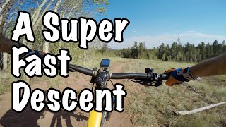


trail: Gold Dust
8:25 |
451 |
Dec 22, 2020 , My City
9:13 |
246 |
Sep 10, 2020

6:47 |
211 |
Sep 10, 2020

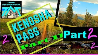
trail: CT - Kenosha Pass West
552 |
Oct 11, 2017 , Montezuma
youtuber
![Mountain Biking Kenosha to Georgia Pass :||:...]()
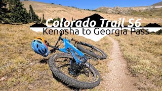
trail: CT - Kenosha Pass West
1019 |
Oct 4, 2017 , Montezuma
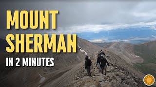
trail: Mount Sherman Trail
2:00 |
73 |
Dec 31, 2025 , Fairplay
Recent Trail Reports
| status | trail | date | condition | info | user |
|---|---|---|---|---|---|
| CDT - Montezuma-Deer Creek Park County | Jun 13, 2026 @ 9:27pm (America/Denver) Jun 13, 2026 | Variable | nolanvanharte Reporter | ||
| Handcart Gulch Park County | Jun 11, 2026 @ 5:29am (America/Denver) Jun 11, 2026 | Dry | nolanvanharte Reporter | ||
| Kirby Gulch Park County | Jun 11, 2026 @ 5:25am (America/Denver) Jun 11, 2026 | Unknown | nolanvanharte Reporter | ||
| CT - Kenosha Pass West Park County | May 11, 2026 @ 10:32am (America/Denver) May 11, 2026 | Variable | jmeyertf | ||
| Peru Creek High Park County | Sep 26, 2025 @ 12:26pm (America/Denver) Sep 26, 2025 | Ideal | J4m3z420 SCoMBA | ||
| Horseshoe Fairplay | Sep 25, 2025 @ 9:48am (America/Denver) Sep 25, 2025 | Variable | JCWarrick | ||
| Tie Hack Fairplay | Sep 25, 2025 @ 9:48am (America/Denver) Sep 25, 2025 | Variable | JCWarrick | ||
| Gold Dust Park County | Jun 20, 2025 @ 4:20pm Jun 20, 2025 | Variable | rbenn | ||
| Tie Hack Fairplay | Oct 12, 2024 @ 5:23pm Oct 12, 2024 | Ideal | giniek27 | ||
| Beaver Creek Trail Fairplay | Oct 12, 2024 @ 12:30pm Oct 12, 2024 | Dry | giniek27 |
National Scenic Trails & Official Routes
-
Colorado Trail (Bike)
- Mountain Bike
-
Continental Divide Trail
- Mountain Bike
- Hike
- Trail Running

Activity Feed
| username | action | type | title | date |
|---|---|---|---|---|
| dcraig814 | wishlist | route | activity #97522779 | Jun 21, 2026 @ 2:51pm 1 hours |
| dcraig814 | wishlist | trail | activity #97522151 | Jun 21, 2026 @ 2:42pm 1 hours |
| soonerfitz | wishlist | trail | activity #97326647 | Jun 19, 2026 @ 10:04am 2 days |
| soonerfitz | ridden | trail | activity #97326626 | Jun 19, 2026 @ 10:03am 2 days |
| nolanvanharte | add | report | activity #96936539 | Jun 13, 2026 @ 8:27pm Jun 13, 2026 |
Recent Comments
| username | type | title | comment | date |
|---|---|---|---|---|
| trail | Unless you’re a star, there’s a fair bit... | Aug 15, 2025 @ 4:03pm Aug 15, 2025 | ||
| trail | Not super fun on an MTB but could be a lot... | Jun 21, 2025 @ 5:21pm Jun 21, 2025 | ||
| trail | Not super fun on an MTB but could be a lot... | Jun 21, 2025 @ 5:21pm Jun 21, 2025 | ||
| trail | Not really worth it except the views are... | Jun 28, 2024 @ 8:12pm Jun 28, 2024 | ||
| trail | This is a green trail. The climb isn't hard... | Sep 15, 2023 @ 7:39am Sep 15, 2023 |
Local Badges
-

Epic Ride Descent 2k2 awarded -

Descent 10k Badge1 awarded -

Descent 100k Badge0 awarded -

Epic Mountain Bike Climb 2k0 awarded -

Climbing 10k Badge0 awarded -

Mountain Biking 100k Badge0 awarded
Activity Type Stats
| activitytype | trails | distance | descent | descent distance | total vertical | rating | global rank | state rank | photos | reports | routes | ridelogs |
|---|---|---|---|---|---|---|---|---|---|---|---|---|
| Mountain Bike | 49 | 130 miles | 21,483 ft | 56 miles | 6,680 ft | 125 | 134 | 17 | 3,019 | |||
| E-Bike | 6 | 27 miles | 4,629 ft | 11 miles | 3,041 ft | 89 | 1 | 64 | ||||
| Horse | 32 | 149 miles | 32,674 ft | 71 miles | 6,680 ft | 39 | 6 | |||||
| Hike | 91 | 275 miles | 55,095 ft | 126 miles | 6,896 ft | 14 | 135 | 26 | 2,603 | |||
| Trail Running | 90 | 274 miles | 55,079 ft | 126 miles | 6,896 ft | 135 | 24 | 144 | ||||
| Dirtbike/Moto | 6 | 21 miles | 4,718 ft | 10 miles | 2,884 ft | 27 | 2 | 13 | ||||
| ATV/ORV/OHV | 3 | 13 miles | 3,553 ft | 8 miles | 2,884 ft | 2 | 26 | 2 | ||||
| Snowshoe | 4 | 14 miles | 1,453 ft | 3 miles | 3,950 ft | 10 | 12 | 21 | ||||
| Nordic Ski | 2 | 5 miles | 36 ft | 1,273 ft | 3,291 ft | 9 | 1 | 52 |
Frequently Asked Questions About Park County
▼
What are the best places to ride in Park County?
Park County has 4 areas to explore for mountain biking. The top rated areas are:
▼
What are the highest rated mountain biking trails in Park County?
The highest rated mountain biking trails in Park County are:
- Wheeler Lake Trail (3.9/5)
- CT - Kenosha Pass West (3.8/5)
- Tie Hack (3.8/5)
- Bruno Gulch (3.7/5)
- Gold Dust (3.7/5)
▼
What is the best time of the year to ride in Park County?
Based on ride log data, the most popular months to ride in Park County are:
- July (61 activities)
- September (44 activities)
- August (32 activities)
▼
What is the longest trail in Park County?
The longest trail in Park County is Gold Dust at 8.4 miles. View all trails sorted by distance.
Activities
Trails
Points of Interest
- Eleven Mile Dam Overlook Viewpoint
- Pennsylvaina Mountain Viewpoint
- Spruce Grove Campground Camping
- Riverside Campground Camping
- Blue Mountain Campground Camping
- Spillway Campground Camping
- Kenosha Campground Camping
- Backcountry Camping
- Geneva Park Campground Camping
- Lost Park Campground Camping
- Mount Lincoln (14,265 ft)
- Mount Cameron (14,222 ft)
- Mount Bross (14,183 ft)
- By J4m3z420
 SCoMBA & contributors
 - Admins: jpmcghee, msmcfate, cmcquade
- #37609 - 3,915 views
- park county activity log | embed map of Park County mountain bike trails | park county mountain biking points of interest
Downloading of trail gps tracks in kml & gpx formats is enabled for Park County.
You must login to download files.