close
-
Layers w
- Weather Layers
- Pro
- Pro
- Pro
- Pro
- Pro
- Pro
- More Layers
- Pro
- Pro
- Pro
- Pro
-
Upgrade to

3D
Trail Conditions
- Unknown
- Snow Groomed
- Snow Packed
- Snow Covered
- Snow Cover Partial
- Freeze/thaw Cycle
- Icy
- Prevalent Mud
- Wet
- Variable
- Ideal
- Dry
- Very Dry
Trail Flow (Ridden Direction)
Trailforks scans users ridelogs to determine the most popular direction each trail is ridden. A good flowing trail network will have most trails flowing in a single direction according to their intension.
The colour categories are based on what percentage of riders are riding a trail in its intended direction.
The colour categories are based on what percentage of riders are riding a trail in its intended direction.
- > 96%
- > 90%
- > 80%
- > 70%
- > 50%
- < 50%
- bi-directional trail
- no data
Trail Last Ridden
Trailforks scans ridelogs to determine the last time a trail was ridden.
- < 2 days
- < 1 week
- < 2 weeks
- < 1 month
- < 6 months
- > 6 months
Trail Ridden Direction
The intended direction a trail should be ridden.
- Downhill Only
- Downhill Primary
- Both Directions
- Uphill Primary
- Uphill Only
- One Direction
Contribute Details
Colors indicate trail is missing specified detail.
- Description
- Photos
- Description & Photos
- Videos
Trail Popularity ?
Trailforks scans ridelogs to determine which trails are ridden the most in the last 9 months.
Trails are compared with nearby trails in the same city region with a possible 25 colour shades.
Think of this as a heatmap, more rides = more kinetic energy = warmer colors.
- most popular
- popular
- less popular
- not popular
ATV/ORV/OHV Filter
Max Vehicle Width
inches
US Cell Coverage
Legend

Radar Time
Activity Recordings
Trailforks uses anonymized public activity data.
?
Activity Recordings
Trailforks uses anonymized public activity data.
?
Personal Heatmap
▶
Activity Types
all
/
none
▶
Options
2
Date range
month
–
Winter Trails
Warning
A routing network for winter maps does not exist. Selecting trails using the winter trails layer has been disabled.
Missing Trails
Most Popular
Least Popular
Trails are colored based on popularity. The more popular a trail is, the more red. Less popular trails trend towards green.
Jump Magnitude Heatmap
Heatmap of where riders jump on trails. Zoom in to see individual jumps, click circles to view jump details.
BC Backroad Status
![map legend]()
Service Road Atlas is a free to use, community-driven service for viewing and creating reports on the numerous back-country service roads around B.C. and Alberta.

Slope Aspect
Direction the slope faces
Trails Deemphasized
Trails are shown in grey.
Only show trails with no bike usage.
Suggested Layers
Based on selected activity type
Save the current map location and zoom level as your default home location whenever this page is loaded.
SaveSituated midway between Deer Lake and Corner Brook in the Humber Valley, Pasadena offers small town charm and instant access to rugged, backcountry terrain and stunning views. Trails vary from cross country to flow and beginner jump lines.
Activities Click to view
- Mountain Bike
42 trails
- E-Bike
8 trails
- Adaptive Bike
0 trails
- Winter Fat Bike
0 trails
- Hike
23 trails
- Trail Running
23 trails
- Dirtbike/Moto
6 trails
- ATV/ORV/OHV
9 trails
- Snowmobile
9 trails
- Snowshoe
12 trails
- Nordic Ski
9 trails
Region Details
- 8
- 19
- 11
- 2
- 1
- 1
Region Status
Caution as of Jun 15, 2026Stats
- Avg Trail Rating
- Trails (view details)
- 45
- Trails Mountain Bike
- 42
- Trails E-Bike
- 8
- Trails Hike
- 23
- Trails Trail Running
- 23
- Trails Dirtbike/Moto
- 6
- Trails ATV/ORV/OHV
- 9
- Trails Snowmobile
- 9
- Trails Snowshoe
- 12
- Trails Backcountry Ski
- 3
- Trails Nordic Ski
- 9
- Total Distance
- 60 miles
- Total Descent Distance
- 30 miles
- Total Descent
- 8,800 ft
- Total Vertical
- 1,289 ft
- Highest Trailhead
- 1,306 ft
- Reports
- 605
- Photos
- 108
- Ridden Counter
- 1,121
Sub Regions
-
Academy Hill
- 3
- 7
- 2
- 1
- 1
-
Pasadena Ski and Nature Park
-
South Brook Valley
- 3
- 3
Popular Pasadena Mountain Biking Trails
• 100 ★ 5.0 • 1,115 ft • 0 ft • 110 •
Named for the abundance of old fire logs that scatter the area, sports flow and several modest features. Great for riders of all skill levels. SFT ends at the entrance to & and can be easily lapped.
• 100 ★ 5.0 • 2,018 ft • 0 ft • 87 •
My favourite post ride snack. acts as a progression from and is full of jumps, pumps, drops and berms making it highly sessionable just like it's cookie counterpart. Although all features can be rolled OR have a ride around, several...
• 85 ★ 4.4 • 1,319 ft • 0 ft • 66 •
A techy rake'n ride that winds through the top of the domestic cutting area. Features some off camber and awkward corners that will challenge most riders as well as a couple low consequence skinnies.
• 85 ★ 4.8 • 3,415 ft • 20 ft • 66 •
is a tough, but beginner friendly trail with multiple features. It meanders along a stream in the domestic cutting block and offers some cool old forest views!
• 95 ★ 3.5 • 1,010 ft • 0 ft • 55 •
A short and fast bit of trail with tight trees, lots of roots and stumps. Flows down from the groomed trail and can be easily lapped. Trail exits onto an ATV trail, so be mindful.
• 90 ★ 4.4 • 1 mile • 776 ft • 50 •
is a machine built climb trail used to access the upper reaches of the Academy Hill network. The terrain here is beautiful but challenging and would not be accessible without this dedicated climb trail. While not technically difficult,...
• 80 ★ 4.0 • 1,864 ft • 0 ft • 44 •
This trail offers old school vibes and is littered with roots, abrupt and off-camber turns, jumps and drops. It is significantly more technical than most other trails in the Academy Hill network, especially during wet weather. All...
• 90 ★ 4.5 • 1,024 ft • 0 ft • 41 •
A tight and technical bit of singletrack with lots of roots and flat corners.
Pasadena Mountain Bike Routes
★ 5.0 • 4 miles • 584 ft • 8 •
Updated lap of the network. Parking at PSNP, ride up down then proceed up the ATV trail / groomed trail to...
★ 4.0 • 5 miles • 378 ft • 6 • Point to Point •
Solid loop for a hike or run, can be completed in either direction. A portion of this route takes you...
★ 4.0 • 5 miles • 197 ft • 2 • Loop •
Good loop for fatbikes, do it twice for good measure!
5 miles • 315 ft • 2 • Point to Point •
Scenic hike through the Pasadena side country. Can be looped by using pavement between the end of Midland...
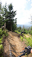
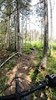
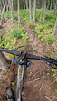
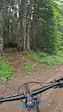
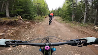
Photos of Pasadena Mountain Bike
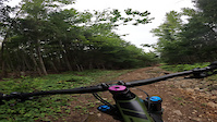
Videos of Pasadena Mountain Bike
trail: Howler
4:54 |
139 |
Jul 21, 2025
trail: Swedish Fire Torch
0:00 |
44 |
Jul 20, 2025
trail: Clumsy Thumbs
0:31 |
|
Aug 27, 2023
trail: Grumpy Stump
5:43 |
67 |
Jul 24, 2023
trail: Chuck It
2:54 |
196 |
Jul 24, 2023
trail: Hazel Hollow
0:05 |
59 |
Nov 4, 2022
Current Trail Warnings
| status | trail | date | condition | user | info |
|---|---|---|---|---|---|
| Long Time Listener | May 27, 2026 @ 1:38pm (America/St_Johns) May 27, 2026 | Variable | nlinstinct | Moose still present. Some blowdowns.... |
Recent Trail Reports
| status | trail | date | condition | info | user |
|---|---|---|---|---|---|
| Lower Academy Hill | Jun 15, 2026 @ 12:49pm (America/Miquelon) Jun 15, 2026 | Very Dry | nlinstinct | ||
| Jam Jam | Jun 15, 2026 @ 12:49pm (America/Miquelon) Jun 15, 2026 | Variable | nlinstinct | ||
| Swedish Fire Torch | Jun 15, 2026 @ 12:49pm (America/Miquelon) Jun 15, 2026 | Ideal | nlinstinct | ||
| Nar Spruce | Jun 15, 2026 @ 12:49pm (America/Miquelon) Jun 15, 2026 | Wet | nlinstinct | ||
| Howler | Jun 5, 2026 @ 3:26pm (America/St_Johns) Jun 5, 2026 | Dry | brydoncooper | ||
| Hazel Hollow | May 23, 2026 @ 5:00pm (America/St_Johns) May 23, 2026 | Variable | brydoncooper | ||
| Clumsy Thumbs | May 23, 2026 @ 4:59pm (America/St_Johns) May 23, 2026 | Variable | brydoncooper | ||
| Chuck It | May 23, 2026 @ 4:58pm (America/St_Johns) May 23, 2026 | Variable | brydoncooper | ||
| Snakes'n Ladders | May 23, 2026 @ 4:55pm (America/St_Johns) May 23, 2026 | Variable | brydoncooper | ||
| South Brook | May 22, 2026 @ 2:05pm (America/St_Johns) May 22, 2026 | Variable | brydoncooper |
Activity Feed
| username | action | type | title | date |
|---|---|---|---|---|
| nlinstinct | add | report | activity #97044678 and 3 more | Jun 15, 2026 @ 8:54am Jun 15, 2026 |
| nlinstinct | checkin | trail | activity #96675682 and 2 more | Jun 10, 2026 @ 8:43am Jun 10, 2026 |
| brydoncooper | add | report | activity #96308734 | Jun 5, 2026 @ 10:56am Jun 5, 2026 |
| Katieb03 | ridden | trail | activity #96166557 | Jun 3, 2026 @ 10:43am Jun 3, 2026 |
| Katieb03 | wishlist | trail | activity #96033296 | Jun 1, 2026 @ 12:10pm Jun 1, 2026 |
Recent Comments
| username | type | title | comment | date |
|---|---|---|---|---|
| report | Yes definitely. | Jul 26, 2025 @ 3:40pm Jul 26, 2025 | ||
| report | The roots are spicy in the wet! | Jul 26, 2025 @ 6:36am Jul 26, 2025 | ||
| trail | Trail dogs beware! Many, if not all, of the... | Jun 23, 2025 @ 12:58pm Jun 23, 2025 | ||
| trail | Has anyone seen the horseshoe that was hanging... | Apr 24, 2025 @ 4:43am Apr 24, 2025 | ||
| trail | Jam jam is really fun and it is very well... | Sep 29, 2024 @ 9:27am Sep 29, 2024 |
Local Badges
-

Extra Credit3 awarded -

Advanced Placement3 awarded -

Top of the Class1 awarded -

Epic Mountain Bike Climb 2k0 awarded -

Climbing 10k Badge4 awarded -

Mountain Biking 100k Badge0 awarded
Activity Type Stats
| activitytype | trails | distance | descent | descent distance | total vertical | rating | global rank | state rank | photos | reports | routes | ridelogs |
|---|---|---|---|---|---|---|---|---|---|---|---|---|
| Mountain Bike | 42 | 54 miles | 8,005 ft | 27 miles | 1,289 ft | #4,111 | #4 | 106 | 602 | 5 | 2,145 | |
| E-Bike | 8 | 9 miles | 2,448 ft | 4 miles | 1,227 ft | #6,661 | #10 | 68 | 1 | 33 | ||
| Hike | 23 | 35 miles | 3,399 ft | 15 miles | 1,283 ft | #1,863 | #6 | 454 | 2 | 259 | ||
| Trail Running | 23 | 33 miles | 3,176 ft | 14 miles | 1,283 ft | #5,878 | #11 | 435 | 2 | 65 | ||
| Dirtbike/Moto | 6 | 15 miles | 1,781 ft | 7 miles | 876 ft | #1,003 | #4 | 343 | 14 | |||
| ATV/ORV/OHV | 9 | 24 miles | 2,310 ft | 10 miles | 1,198 ft | #672 | #2 | 2 | 357 | 11 | ||
| Snowmobile | 9 | 16 miles | 2,700 ft | 10 miles | 919 ft | #54 | #4 | 343 | 5 | |||
| Snowshoe | 12 | 10 miles | 1,578 ft | 5 miles | 1,198 ft | #173 | #3 | 350 | 29 | |||
| Backcountry Ski | 3 | 4,954 ft | 180 ft | 4,035 ft | 112 ft | 35 | ||||||
| Nordic Ski | 9 | 11 miles | 1,099 ft | 5 miles | 469 ft | #319 | #2 | 219 | 233 |
Frequently Asked Questions About Pasadena
▼
What are the best places to ride in Pasadena?
Pasadena has 4 areas to explore for mountain biking. The top rated areas are:
▼
What are the highest rated mountain biking trails in Pasadena?
The highest rated mountain biking trails in Pasadena are:
- Swedish Fire Torch (4.4/5)
- Jam Jam (4.4/5)
- Howler (4.3/5)
- Grumpy Stump (4.3/5)
- Looper Run (4.1/5)
▼
What is the best time of the year to ride in Pasadena?
Based on ride log data, the most popular months to ride in Pasadena are:
- June (9 activities)
- December (9 activities)
- July (8 activities)
▼
Where can I park to ride in Pasadena?
There are 2 parking locations listed in Pasadena. The most popular parking spots are:
Activities
Trails
- By brydoncooper
 & contributors
 - Admins: adrianricketts, wbruce, brydoncooper
- #30257 - 7,298 views
- pasadena activity log | embed map of Pasadena mountain bike trails | pasadena mountain biking points of interest
Downloading of trail gps tracks in kml & gpx formats is enabled for Pasadena.
You must login to download files.