close
-
Layers w
- Weather Layers
- Pro
- Pro
- Pro
- Pro
- Pro
- Pro
- More Layers
- Pro
- Pro
- Pro
- Pro
-
Upgrade to

3D
Trail Conditions
- Unknown
- Snow Groomed
- Snow Packed
- Snow Covered
- Snow Cover Partial
- Freeze/thaw Cycle
- Icy
- Prevalent Mud
- Wet
- Variable
- Ideal
- Dry
- Very Dry
Trail Flow (Ridden Direction)
Trailforks scans users ridelogs to determine the most popular direction each trail is ridden. A good flowing trail network will have most trails flowing in a single direction according to their intension.
The colour categories are based on what percentage of riders are riding a trail in its intended direction.
The colour categories are based on what percentage of riders are riding a trail in its intended direction.
- > 96%
- > 90%
- > 80%
- > 70%
- > 50%
- < 50%
- bi-directional trail
- no data
Trail Last Ridden
Trailforks scans ridelogs to determine the last time a trail was ridden.
- < 2 days
- < 1 week
- < 2 weeks
- < 1 month
- < 6 months
- > 6 months
Trail Ridden Direction
The intended direction a trail should be ridden.
- Downhill Only
- Downhill Primary
- Both Directions
- Uphill Primary
- Uphill Only
- One Direction
Contribute Details
Colors indicate trail is missing specified detail.
- Description
- Photos
- Description & Photos
- Videos
Trail Popularity ?
Trailforks scans ridelogs to determine which trails are ridden the most in the last 9 months.
Trails are compared with nearby trails in the same city region with a possible 25 colour shades.
Think of this as a heatmap, more rides = more kinetic energy = warmer colors.
- most popular
- popular
- less popular
- not popular
ATV/ORV/OHV Filter
Max Vehicle Width
inches
US Cell Coverage
Legend

Radar Time
Activity Recordings
Trailforks uses anonymized public activity data.
?
Activity Recordings
Trailforks uses anonymized public activity data.
?
Personal Heatmap
▶
Activity Types
all
/
none
▶
Options
2
Date range
month
–
Winter Trails
Warning
A routing network for winter maps does not exist. Selecting trails using the winter trails layer has been disabled.
Missing Trails
Most Popular
Least Popular
Trails are colored based on popularity. The more popular a trail is, the more red. Less popular trails trend towards green.
Jump Magnitude Heatmap
Heatmap of where riders jump on trails. Zoom in to see individual jumps, click circles to view jump details.
BC Backroad Status
![map legend]()
Service Road Atlas is a free to use, community-driven service for viewing and creating reports on the numerous back-country service roads around B.C. and Alberta.

Slope Aspect
Direction the slope faces
Trails Deemphasized
Trails are shown in grey.
Only show trails with no bike usage.
Suggested Layers
Based on selected activity type
Save the current map location and zoom level as your default home location whenever this page is loaded.
Save
No description for Pavia has been added yet!
Login or register to submit one.
This region uses the Uk/Euro style trail grading system.
Activities Click to view
- Mountain Bike
141 trails
- E-Bike
129 trails
- Horse
8 trails
- Hike
110 trails
- Trail Running
104 trails
Region Details
- 36
- 9
- 39
- 36
- 7
- 1
Stats
- Avg Trail Rating
- Trails (view details)
- 140
- Trails Mountain Bike
- 141
- Trails E-Bike
- 129
- Trails Adaptive Bike
- 1
- Trails Horse
- 8
- Trails Hike
- 110
- Trails Trail Running
- 104
- Total Distance
- 132 miles
- Total Descent
- 41,680 ft
- Total Vertical
- 3,870 ft
- Highest Trailhead
- 4,105 ft
- Reports
- 1,030
- Photos
- 195
- Ridden Counter
- 2,981
Sub Regions
- Borgo Priolo (21)
- Costa Pelata (3)
- Montalto Pavese (15)
- Brallo Di Pregola (9)
- Nibbiano (2)
- Pavia (3)
- Ponte Nizza (3)
- Rivanazzano Terme (17)
- Nazzano Trail Area (16)
- San Ponzo Semola (22)
- Val di Nizza (53)
- Varzi (9)
- Vigevano (2)
Popular Pavia Mountain Biking Trails
• 90 ★ 4.7 • 3,150 ft • 0 ft • 104 •
Un trail all'insegna del flow, per gran parte una veloce e fluida pump trak naturale, condita con alcuni giochetti che aggiungono ulteriore divertimento: ponticelli in legno, drop, salti e road gap con difficoltà da media e elevata. Il...
• 90 ★ 4.5 • 2,989 ft • 15 ft • 81 •
Il versante più lento e tecnico di Guardamonte, con numerosi affioramenti rocciosi, rock garden propriamente detti, ripidi, compressioni, curve e controcurve. Molto guidato e altrettanto divertente almeno per chi ama questo tipo di...
• 50 ★ 4.3 • 1 mile • 28 ft • 69 •
Uno dei classici dell'area di Guardamonte, rivitalizzato dopo la gara enduro tenutasi nel 2016. La partenza è più in alto, nei pressi del Monte Vallassa (arrivo pareti d'arrampicata) con un tratto introduttivo relativamente pedalato...
• 70 ★ 4.2 • 3,301 ft • 0 ft • 65 •
Il sentiero CAI 135 recuperato e adattato per ospitare la terza PS della gara enduro tenutasi a Gremiasco nel 2016. Parte come sterrata e poi, dopo un paio di cancelli in legno, inizia il sentiero vero e proprio, molto fluido e veloce...
• 85 ★ 4.3 • 4,997 ft • 0 ft • 62 •
Nuovo trail in Val Curone, con accesso nei pressi del già noto e arrivo lungo la strada asfaltata che va da San Sebastiano Curone a Musigliano. Sentiero per tutti, dai principianti ai biker più smaliziati.
• 85 ★ 4.0 • 1,073 ft • 0 ft • 58 •
Un classico di Nazzano Trail Area, il sentiero flow che scende dalla fine della seconda rampa ripida che parte dall'asfalto che collega Nazzano a Buscofà (solo una se si arriva da Ca' del Conte, parte appena dopo l'ex giardino...
• 60 ★ 3.0 • 2,293 ft • 55 ft • 57 •
La traccia che parte dall'orrido di Cà del Monte e scende alla scenica grotta naturale a picco sulla Val Curone, per poi inoltrarsi nel boschetto cambiando decisamente fondo e tipologia: prima soffice terra e pendenze elevate, poi...
Pavia Mountain Bike Routes
25 miles • 5,410 ft • 1 • Loop •
Nice and various route. Starting from Park Hotel Olimpia, you will discover all the beauties of Alto...
14 miles • 2,303 ft • 2 • Loop •
Very nice tour considering the easy access of the hill. The difficult level is not so high but is very...
★ 3.0 • 24 miles • 602 ft • 0 • Loop •
Easy path from Pavia to Ponte di Barche and back, on both sides of Ticino. You can find some panoramic...
1 mile • 34 ft • 0 •
Anello del golf club...........................................
3 miles • 142 ft • 0 •
Anello XC con punto di partenza/arrivo alla cascina Santa Sofia (Massaua)
4,334 ft • 31 ft • 0 •
Some up and down on the area :-) The gps track crosses itself because there is a bridge.
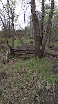
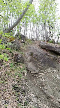
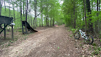
Photos of Pavia Mountain Bike
Videos of Pavia Mountain Bike
trail: Valhalla Trail
0:09 |
17 |
Apr 24, 2025
trail: Valhalla Trail
0:08 |
15 |
Apr 24, 2025
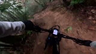
trail: Nazzano Flow - 1st Half
0:16 |
|
Apr 18, 2020
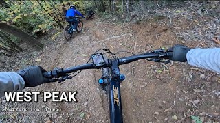
trail: West Peak
2:24 |
136 |
Jan 14, 2024 , Rivanazzano Terme
trail: West Peak
2:36 |
92 |
Nov 1, 2023 , Rivanazzano Terme
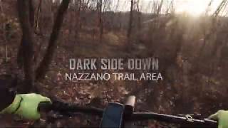
trail: Dark Side Down
2:11 |
122 |
Mar 20, 2023 , Rivanazzano Terme
trail: Nazzano Flow - 1st Half
3:12 |
137 |
Mar 20, 2023 , Rivanazzano Terme
trail: Nazzano Flow - 1st Half
0:34 |
124 |
Mar 20, 2023 , Rivanazzano Terme
Recent Trail Reports
Activity Feed
| username | action | type | title | date |
|---|---|---|---|---|
| damianou2IHyt | comment | trail | activity #97029688 | Jun 15, 2026 @ 2:55am Jun 15, 2026 |
| damianou2IHyt | add | report | activity #96890982 and 2 more | Jun 13, 2026 @ 10:02am Jun 13, 2026 |
| LucaGuxx | add | report | activity #96524986 and 5 more | Jun 8, 2026 @ 12:39am Jun 8, 2026 |
| AlBella | add | report | activity #95444638 and 1 more | May 24, 2026 @ 2:10pm May 24, 2026 |
| MargheritaPremuroso | wishlist | route | activity #95290010 | May 22, 2026 @ 10:08pm May 22, 2026 |
Recent Comments
| username | type | title | comment | date |
|---|---|---|---|---|
| trail | Le trial abbastanza pulito e scorrevole! | Jun 15, 2026 @ 2:55am Jun 15, 2026 | ||
| trail | esposto ma molto bello | May 15, 2026 @ 6:53am May 15, 2026 | ||
| trail | La cresta finale fa impressione. Forse... | May 3, 2026 @ 3:25pm May 3, 2026 | ||
| trail | non esiste più questo trail | Oct 3, 2025 @ 7:52am Oct 3, 2025 | ||
| trail | Tutto ok. Sterrato ottimo x raggiungere il... | May 4, 2025 @ 1:36pm May 4, 2025 |
Local Badges
-

Big Ride 30k323 awarded -

Epic Mountain Bike Climb 2k24 awarded -

10 Green Trails1 awarded -

Epic Ride 50k307 awarded -
Epic Ride 50k110 awarded -

Descent 100k Badge0 awarded
Bike & Skill Parks
| name | type | city | rating |
|---|---|---|---|
| Il Butta BMX Park | skill park | Pavia | |
| MX Dorno | skill park | Pavia | |
| Crossdromo Castelletto Branduzzo (MX & SUMO) | skill park | Pavia | |
| vicobarone | skill park | Nibbiano | |
| MX Vidigulfo | skill park | Pavia |
Activity Type Stats
| activitytype | trails | distance | descent | descent distance | total vertical | rating | global rank | state rank | photos | reports | routes | ridelogs |
|---|---|---|---|---|---|---|---|---|---|---|---|---|
| Mountain Bike | 141 | 132 miles | 41,680 ft | 74 miles | 3,871 ft | 162 | 1,030 | 4 | 6,915 | |||
| E-Bike | 129 | 123 miles | 39,741 ft | 69 miles | 3,789 ft | 33 | 1,022 | 4 | 1,364 | |||
| Adaptive Bike | 1 | 2 | ||||||||||
| Horse | 8 | 14 miles | 2,749 ft | 6 miles | 2,572 ft | 68 | ||||||
| Hike | 110 | 114 miles | 32,126 ft | 61 miles | 3,871 ft | 916 | 2 | 177 | ||||
| Trail Running | 104 | 108 miles | 28,980 ft | 57 miles | 3,871 ft | 917 | 2 | 62 |
Frequently Asked Questions About Pavia
▼
What are the best places to ride in Pavia?
Pavia has 4 areas to explore for mountain biking. The top rated areas are:
▼
What are the highest rated mountain biking trails in Pavia?
The highest rated mountain biking trails in Pavia are:
- West Peak (4.4/5)
- Guardamonte Bidon Trail (4.4/5)
- Dead or Alive Project (4.3/5)
- Rock side (4.2/5)
- Montagne Russe (4.2/5)
▼
What is the best time of the year to ride in Pavia?
Based on ride log data, the most popular months to ride in Pavia are:
- May (39 activities)
- March (32 activities)
- April (26 activities)
▼
What is the longest trail in Pavia?
The longest trail in Pavia is Farfalle Ponte delle Barche at 7.8 miles. View all trails sorted by distance.
Activities
Trails
Points of Interest
- Balze di Guardamonte Viewpoint
- Agriturismo Ca' del Monte Viewpoint
- Orrido di Cà del Monte Viewpoint
- Bar-Ristorante Italia Information
- Planetario e Osservatorio Astronomico "G. Giacomotti" Viewpoint
- Croce di Ca' del Monte - Punto panoramico Viewpoint
- Ca del Conte - Punto panoramico Viewpoint
- Rifugio Cabin
- Monte Lesima (5,584 ft)
- Monte Chiappo (5,538 ft)
- Monte Tartago (5,492 ft)
- By brenthillier
 NSMBA TRAILFORKS & contributors
 - Admins: denitopia, marcoangeletti, cemoorelife, marcoangeletti, adessoomaipiu, micheletraversi, roybatty
- #9511 - 4,119 views
- pavia activity log | embed map of Pavia mountain bike trails | pavia mountain biking points of interest
Downloading of trail gps tracks in kml & gpx formats is enabled for Pavia.
You must login to download files.