close
-
Layers w
- Weather Layers
- Pro
- Pro
- Pro
- Pro
- Pro
- Pro
- More Layers
- Pro
- Pro
- Pro
- Pro
-
Upgrade to

3D
Trail Conditions
- Unknown
- Snow Groomed
- Snow Packed
- Snow Covered
- Snow Cover Partial
- Freeze/thaw Cycle
- Icy
- Prevalent Mud
- Wet
- Variable
- Ideal
- Dry
- Very Dry
Trail Flow (Ridden Direction)
Trailforks scans users ridelogs to determine the most popular direction each trail is ridden. A good flowing trail network will have most trails flowing in a single direction according to their intension.
The colour categories are based on what percentage of riders are riding a trail in its intended direction.
The colour categories are based on what percentage of riders are riding a trail in its intended direction.
- > 96%
- > 90%
- > 80%
- > 70%
- > 50%
- < 50%
- bi-directional trail
- no data
Trail Last Ridden
Trailforks scans ridelogs to determine the last time a trail was ridden.
- < 2 days
- < 1 week
- < 2 weeks
- < 1 month
- < 6 months
- > 6 months
Trail Ridden Direction
The intended direction a trail should be ridden.
- Downhill Only
- Downhill Primary
- Both Directions
- Uphill Primary
- Uphill Only
- One Direction
Contribute Details
Colors indicate trail is missing specified detail.
- Description
- Photos
- Description & Photos
- Videos
Trail Popularity ?
Trailforks scans ridelogs to determine which trails are ridden the most in the last 9 months.
Trails are compared with nearby trails in the same city region with a possible 25 colour shades.
Think of this as a heatmap, more rides = more kinetic energy = warmer colors.
- most popular
- popular
- less popular
- not popular
ATV/ORV/OHV Filter
Max Vehicle Width
inches
US Cell Coverage
Legend

Radar Time
Activity Recordings
Trailforks uses anonymized public activity data.
?
Activity Recordings
Trailforks uses anonymized public activity data.
?
Personal Heatmap
▶
Activity Types
all
/
none
▶
Options
2
Date range
month
–
Winter Trails
Warning
A routing network for winter maps does not exist. Selecting trails using the winter trails layer has been disabled.
Missing Trails
Most Popular
Least Popular
Trails are colored based on popularity. The more popular a trail is, the more red. Less popular trails trend towards green.
Jump Magnitude Heatmap
Heatmap of where riders jump on trails. Zoom in to see individual jumps, click circles to view jump details.
BC Backroad Status
![map legend]()
Service Road Atlas is a free to use, community-driven service for viewing and creating reports on the numerous back-country service roads around B.C. and Alberta.

Slope Aspect
Direction the slope faces
Trails Deemphasized
Trails are shown in grey.
Only show trails with no bike usage.
Suggested Layers
Based on selected activity type
Save the current map location and zoom level as your default home location whenever this page is loaded.
Save
No description for Payson Canyon has been added yet!
Login or register to submit one.
 google parking directions
google parking directions Region Supporters & Maintainers
![USFS]()
USFSMaintainer
Activities Click to view
- Mountain Bike
37 trails
- E-Bike
9 trails
- Horse
6 trails
- Hike
40 trails
- Trail Running
40 trails
- Dirtbike/Moto
0 trails
- ATV/ORV/OHV
0 trails
Region Details
- 6
- 13
- 6
- 3
Region Status
Caution as of Jun 13, 2026Stats
- Avg Trail Rating
- Trails (view details)
- 32
- Trails Mountain Bike
- 37
- Trails E-Bike
- 9
- Trails Horse
- 6
- Trails Hike
- 40
- Trails Trail Running
- 40
- Trails Snowshoe
- 3
- Trails Nordic Ski
- 3
- Total Distance
- 25 miles
- Total Descent
- 7,801 ft
- Total Vertical
- 5,478 ft
- Highest Trailhead
- 10,692 ft
- Reports
- 275
- Photos
- 58
- Ridden Counter
- 6,032
Popular Payson Canyon Mountain Biking Trails
• 85 ★ 4.3 • 3,481 ft • 11 ft • 264 •
Really smooth and nice flowing trail from the camp to the and Pipeline .
• 80 ★ 4.0 • 2,149 ft • 102 ft • 247 •
Popular black diamond difficulty singletrack. This multi-use trail can be used both directions. On average it takes 6 minutes to complete this trail.
• 85 ★ 2.6 • 1 mile • 13 ft • 164 •
Alternate route avoiding all the erosion gullies, tighter turns, some flowing sections, great as climber or downhill, connects to
• 65 ★ 3.2 • 4,042 ft • 0 ft • 164 •
Some locals put this trail together. Super steep in sections, and some grom jumps at the bottom. This section of trail is very steep and loose. If you are not an experienced rider, you will have a bad time. P.S. Don't get decapitated by...
• 60 ★ 4.7 • 1,703 ft • 0 ft • 162 •
Fun trail to combine with . Multiple jumps, with a couple stream crossings
• 50 ★ 5.0 • 1,382 ft • 0 ft • 114 •
This stretch of trail is used as an extension of the trail to return to parking areas. For advanced riders only. The trail ends at the road so look out for cars.
• 65 ★ 2.5 • 3,018 ft • 23 ft • 111 •
Trail used to link over to and do a little more downhill after riding Bennie Creek
Payson Canyon Mountain Bike Routes
13 miles • 1,994 ft • 2 • Loop •
Pete Parking lot, Take Pete Road to Sheephearders Trail, Ride up Sheepnhearders to Kunz Flats, Take Kunz...
★ 4.3 • 12 miles • 1,769 ft • 0 • Loop •
Head out at loafer trail up a few ups and downs. Swing down through Campground and then make the climb...
20 miles • 3,419 ft • 5 • Loop •
Start at Pete Winward parking area, Sheepherder to Rock Springs, Rock Springs to Frank Young Canyon, Frank...
5 miles • 1,777 ft • 3 •
11 miles • 2,191 ft • 12 •
Start at Bennie Creek TH then up Lizard Lake to Rock Spring then over to Blackhawk and finish down Bennie...
Photos of Payson Canyon Mountain Bike
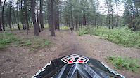
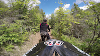
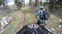
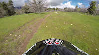
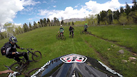
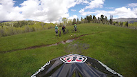
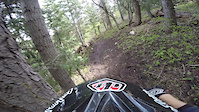
Videos of Payson Canyon Mountain Bike
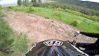
trail: Pine Forest Trail
3:16 |
119 |
Jun 4, 2015
trail: Pine Forest Trail
3:36 |
101 |
Jun 4, 2015
trail: Pine Forest Trail
3:43 |
55 |
Jun 4, 2015
trail: Payson Pipeline
2:41 |
223 |
Jun 3, 2015
trail: Payson Pipeline
2:29 |
47 |
Jun 3, 2015
trail: Payson Pipeline
5:15 |
54 |
Jun 3, 2015
trail: Payson Pipeline
3:43 |
44 |
Jun 3, 2015
trail: Payson Pipeline
5:08 |
106 |
Jun 3, 2015
Current Trail Warnings
| status | trail | date | condition | user | info |
|---|---|---|---|---|---|
| Vaquero | Jun 7, 2026 @ 8:34pm (America/Denver) Jun 7, 2026 | Unknown | Fabotti | Large burnt trees down across trail,... |
Recent Trail Reports
| status | trail | date | condition | info | user |
|---|---|---|---|---|---|
| More Cowbones Summer | Jun 13, 2026 @ 8:39pm (America/Denver) Jun 13, 2026 | Dry | tomsp694 | ||
| Magic Kingdom | Mar 22, 2026 @ 5:39pm (America/Denver) Mar 22, 2026 | Unknown | joshowen1 | ||
| Payson Pipeline Alt | Mar 22, 2026 @ 12:53pm (America/Boise) Mar 22, 2026 | Dry | JasonFarns | ||
| Pine Forest Trail | Mar 22, 2026 @ 12:53pm (America/Boise) Mar 22, 2026 | Dry | JasonFarns | ||
| Pine Forest Trail | Mar 22, 2026 @ 12:53pm (America/Boise) Mar 22, 2026 | Ideal | JasonFarns | ||
| Lower Magic Kingdom | May 20, 2025 @ 7:29pm May 20, 2025 | Ideal | Pjohnson440 | ||
| Pine Forest Detour | Jan 20, 2025 @ 9:50am Jan 20, 2025 | Snow Groomed | Pocahontas1978 | ||
| Lower Grotto Flow Line | Jun 22, 2024 @ 12:55am Jun 22, 2024 | Variable | jeffdayley | ||
| Grotto Jump Line | Jun 22, 2024 @ 12:55am Jun 22, 2024 | Dry | jeffdayley | ||
| Maple Lake | Jan 5, 2024 @ 11:52pm Jan 5, 2024 | Snow Covered | jeffdayley |
Activity Feed
| username | action | type | title | date |
|---|---|---|---|---|
| JamespU7bDA | ridden | trail | activity #97022027 | Jun 14, 2026 @ 9:12pm 3 days |
| tomsp694 | add | report | activity #96934834 | Jun 13, 2026 @ 7:39pm Jun 13, 2026 |
| 1bZjoz | comment | report | activity #96650096 | Jun 9, 2026 @ 8:02pm Jun 9, 2026 |
| Fabotti | add | report | activity #96516684 | Jun 7, 2026 @ 7:34pm Jun 7, 2026 |
| e3NKNUnd | wishlist | trail | activity #94789024 and 2 more | May 15, 2026 @ 9:20pm May 15, 2026 |
Recent Comments
| username | type | title | comment | date |
|---|---|---|---|---|
| report | Any pictures you can share of the trail &... | Jun 9, 2026 @ 8:02pm Jun 9, 2026 | ||
| trail | Nothing advanced about this trail. Honestly... | Mar 18, 2026 @ 7:37am Mar 18, 2026 | ||
| trail | Dry conditions, Lots of cow pies to dodge. | Aug 25, 2025 @ 11:17pm Aug 25, 2025 | ||
| trail | Trail marked as private property and no... | Jul 3, 2025 @ 10:08am Jul 3, 2025 | ||
| trail | Trail closed | Jul 3, 2025 @ 10:07am Jul 3, 2025 |
Nearby Areas
| name | distance | ||||
|---|---|---|---|---|---|
| Forebay | 13 | 16 | 4 | 1 | 2.2 km |
| Santaquin Bench | 6 | 7 | 2 | 4.2 km | |
| Prospector View Park | 11 | 6 | 2 | 4.3 km | |
| Mt. Loafer Wildlife Management Area | 1 | 1 | 1 | 7.4 km | |
| Mt. Nebo | 7 | 15 | 19 | 2 | 8.1 km |
Local Badges
-

Completionist0 awarded
Activity Type Stats
| activitytype | trails | distance | descent | descent distance | total vertical | rating | global rank | state rank | photos | reports | routes | ridelogs |
|---|---|---|---|---|---|---|---|---|---|---|---|---|
| Mountain Bike | 37 | 21 miles | 7,051 ft | 12 miles | 3,064 ft | #4,862 | #1,744 | 52 | 275 | 15 | 2,179 | |
| E-Bike | 9 | 6 miles | 1,339 ft | 2 miles | 2,628 ft | #6,843 | #1,973 | 1 | 241 | 1 | 160 | |
| Horse | 6 | 9 miles | 4,016 ft | 6 miles | 2,795 ft | #1,129 | #575 | 40 | 1 | 19 | ||
| Hike | 40 | 25 miles | 7,792 ft | 13 miles | 5,479 ft | #1,075 | #538 | 275 | 12 | 316 | ||
| Trail Running | 40 | 25 miles | 7,802 ft | 13 miles | 5,479 ft | #4,976 | #1,480 | 5 | 275 | 12 | 163 | |
| Snowshoe | 3 | 1 mile | 7 ft | 282 ft | 2,405 ft | #495 | #218 | 3 | 5 | 11 | ||
| Nordic Ski | 3 | 1 mile | 7 ft | 282 ft | 2,405 ft | #1,345 | #742 | 3 | 2 |
Frequently Asked Questions About Payson Canyon
▼
What are the highest rated mountain biking trails in Payson Canyon?
The highest rated mountain biking trails in Payson Canyon are:
- Maple Lake (4.2/5)
- Grotto Jump Line (4.2/5)
- Payson Pipeline Alt (4.1/5)
- Maple Lake (4.1/5)
- Pine Forest Trail (4.1/5)
▼
What is the best time of the year to ride in Payson Canyon?
Based on ride log data, the most popular months to ride in Payson Canyon are:
- July (89 activities)
- August (74 activities)
- June (70 activities)
▼
Where can I park to ride in Payson Canyon?
There are 3 parking locations listed in Payson Canyon. The most popular parking spots are: View all parking and trailhead locations on the map to plan your visit.
▼
What is the longest trail in Payson Canyon?
The longest trail in Payson Canyon is Vaquero at 4.0 miles. View all trails sorted by distance.
Activities
Trails
Points of Interest
- By todd
 Trailforks & contributors
 - Admins: URMB, UVTA
- #4734 - 17,118 views
- payson canyon activity log | embed map of Payson Canyon mountain bike trails | payson canyon mountain biking points of interest
Downloading of trail gps tracks in kml & gpx formats is enabled for Payson Canyon.
You must login to download files.