close
-
Layers w
- Weather Layers
- Pro
- Pro
- Pro
- Pro
- Pro
- Pro
- More Layers
- Pro
- Pro
- Pro
- Pro
-
Upgrade to

3D
Trail Conditions
- Unknown
- Snow Groomed
- Snow Packed
- Snow Covered
- Snow Cover Partial
- Freeze/thaw Cycle
- Icy
- Prevalent Mud
- Wet
- Variable
- Ideal
- Dry
- Very Dry
Trail Flow (Ridden Direction)
Trailforks scans users ridelogs to determine the most popular direction each trail is ridden. A good flowing trail network will have most trails flowing in a single direction according to their intension.
The colour categories are based on what percentage of riders are riding a trail in its intended direction.
The colour categories are based on what percentage of riders are riding a trail in its intended direction.
- > 96%
- > 90%
- > 80%
- > 70%
- > 50%
- < 50%
- bi-directional trail
- no data
Trail Last Ridden
Trailforks scans ridelogs to determine the last time a trail was ridden.
- < 2 days
- < 1 week
- < 2 weeks
- < 1 month
- < 6 months
- > 6 months
Trail Ridden Direction
The intended direction a trail should be ridden.
- Downhill Only
- Downhill Primary
- Both Directions
- Uphill Primary
- Uphill Only
- One Direction
Contribute Details
Colors indicate trail is missing specified detail.
- Description
- Photos
- Description & Photos
- Videos
Trail Popularity ?
Trailforks scans ridelogs to determine which trails are ridden the most in the last 9 months.
Trails are compared with nearby trails in the same city region with a possible 25 colour shades.
Think of this as a heatmap, more rides = more kinetic energy = warmer colors.
- most popular
- popular
- less popular
- not popular
ATV/ORV/OHV Filter
Max Vehicle Width
inches
US Cell Coverage
Legend

Radar Time
Activity Recordings
Trailforks uses anonymized public activity data.
?
Activity Recordings
Trailforks uses anonymized public activity data.
?
Personal Heatmap
▶
Activity Types
all
/
none
▶
Options
2
Date range
month
–
Winter Trails
Warning
A routing network for winter maps does not exist. Selecting trails using the winter trails layer has been disabled.
Missing Trails
Most Popular
Least Popular
Trails are colored based on popularity. The more popular a trail is, the more red. Less popular trails trend towards green.
Jump Magnitude Heatmap
Heatmap of where riders jump on trails. Zoom in to see individual jumps, click circles to view jump details.
BC Backroad Status
![map legend]()
Service Road Atlas is a free to use, community-driven service for viewing and creating reports on the numerous back-country service roads around B.C. and Alberta.

Slope Aspect
Direction the slope faces
Trails Deemphasized
Trails are shown in grey.
Only show trails with no bike usage.
Suggested Layers
Based on selected activity type
Save the current map location and zoom level as your default home location whenever this page is loaded.
Save
No description for Pedro Mountain has been added yet!
Login or register to submit one.
Primary Trail Type: All-Mountain & Downhill
Access Info:
Higgins Rd OR Grey Whale Cove Parking Lot
Activities Click to view
- Mountain Bike
6 trails
- E-Bike
3 trails
- Horse
1 trails
- Hike
10 trails
- Trail Running
10 trails
Region Details
- 1
- 1
- 2
- 1
Region Status
Caution as of May 31, 2026Stats
- Avg Trail Rating
- Trails (view details)
- 7
- Trails Mountain Bike
- 10
- Trails E-Bike
- 3
- Trails Horse
- 1
- Trails Hike
- 10
- Trails Trail Running
- 10
- Total Distance
- 5 miles
- Total Descent Distance
- 3 miles
- Total Descent
- 2,838 ft
- Total Vertical
- 1,182 ft
- Highest Trailhead
- 1,340 ft
- Reports
- 376
- Photos
- 222
- Ridden Counter
- 17,836
Popular Pedro Mountain Mountain Biking Trails
• 100 ★ 4.7 • 3,451 ft • 35 ft • 1,960 •
As close as you can get to a bike park in the bay area right now!! Don't be fooled by the blue/intermediate designation - there are some serious jumps and drops there, but they can all be bypassed. Clean up trash!
• 100 ★ 4.4 • 2,749 ft • 0 ft • 1,375 •
The only reason this is rated as a Dbl Black diamond is due to the rock garden during the first half of this trail. Second half can be done by anyone with at least intermediate biking skills. Originally part of an indigenous population...
• 65 ★ 4.8 • 1,270 ft • 0 ft • 689 •
Steep rutted chunky gnarly natural fall line trail. Makes feel like a cake walk.
• 65 ★ 2.0 • 2,421 ft • 313 ft • 439 •
Moderately popular black diamond difficulty singletrack. This mountain bike primary trail can be used uphill primary and has a moderate overall physical rating with a 313 ft black diamond climb. Trail visibility is always easy to follow. On average it takes 11 minutes to complete this trail.
• 45 ★ 3.9 • 1,263 ft • 0 ft • 400 •
An alternate route of Boy Scout. The main route has various jumps and other features - this alternate route is a pretty rough, pretty steep trail with only a couple of minor jumps. You probably want to go down this trail - it's too...
• 95 ★ 5.0 • 1,299 ft • 0 ft • 282 •
Alternate line to , that's not as sketchy, and avoids the waterfall.
• 45 ★ 4.4 • 1,526 ft • 0 ft • 127 •
Moderately popular double black diamond difficulty singletrack. This mountain bike primary trail can be used downhill only with a 0 ft double black diamond climb. It features rock face and rock garden. Trail visibility is sometimes hard to follow. On average it takes 8 minutes to complete this trail.
Pedro Mountain Mountain Bike Routes
★ 2.3 • 10 miles • 1,596 ft • 7 • Loop •
A nice little sample of the Pacifica goods brought to you by local legend Brian Gong. Climb up Pedro...
16 miles • 3,060 ft • 10 •
beginner level ride at pacifica that avoids anything technical
★ 2.0 • 166 miles • 26,323 ft • 60 • Point to Point •
If you wanna bikepack in the bay, here is your route, should take a few days.
12 miles • 2,974 ft • 13 • Loop •
good tour of pacifica hitting more tame trails. all mountain bike
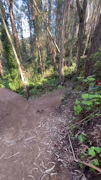
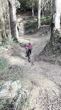
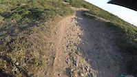
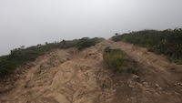
Photos of Pedro Mountain Mountain Bike
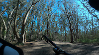
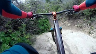
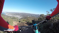
Videos of Pedro Mountain Mountain Bike
trail: Boy Scout Trail
0:14 |
164 |
Mar 10, 2025
trail: Boy Scout Trail
0:07 |
273 |
Nov 27, 2023
trail: Boy Scout Trail
0:54 |
|
Oct 28, 2023
trail: Mile
0:23 |
157 |
Oct 8, 2022
trail: Mile
0:01 |
179 |
Jun 23, 2022
trail: Mile
0:11 |
207 |
May 16, 2022
trail: Crack
0:40 |
286 |
May 8, 2022
trail: Mile
0:19 |
187 |
Dec 9, 2021
Recent Trail Reports
| status | trail | date | condition | info | user |
|---|---|---|---|---|---|
| Boy Scout Trail | May 31, 2026 @ 10:19am (America/Los_Angeles) May 31, 2026 | Dry | shill WDOSS | ||
| What Trail? | May 25, 2026 @ 12:47am (America/Los_Angeles) May 25, 2026 | Ideal | daveprimmer | ||
| Mile | Mar 30, 2026 @ 8:08pm (America/Los_Angeles) Mar 30, 2026 | Ideal | AaronOa2usy | ||
| Nelson's | Jan 13, 2026 @ 3:25pm (America/Los_Angeles) Jan 13, 2026 | Wet | dstark70sf | ||
| Mellow Mile | Dec 30, 2025 @ 5:40pm (America/Los_Angeles) Dec 30, 2025 | Ideal | soverania | ||
| Crack | Nov 26, 2025 @ 1:25pm (America/Los_Angeles) Nov 26, 2025 | Ideal | Bulldog69420 | ||
| 911 | Jul 29, 2025 @ 6:43pm Jul 29, 2025 | Wet | RafaBMX | ||
| Crack Climb | Jun 2, 2024 @ 2:25am Jun 2, 2024 | Variable | IainpVHsYa | ||
| Boy Scout Connector | Jun 29, 2023 @ 8:54am Jun 29, 2023 | Ideal | RohitSengupta |
Activity Feed
| username | action | type | title | date |
|---|---|---|---|---|
| rowdyrulez | wishlist | trail | activity #97260850 and 2 more | Jun 18, 2026 @ 10:19am 16 hours |
| danshumaker | wishlist | trail | activity #97221930 and 1 more | Jun 17, 2026 @ 5:58pm 1 day |
| AlecPMqAYT | wishlist | route | activity #97147369 and 2 more | Jun 16, 2026 @ 4:54pm 2 days |
| JordanZIy1FQ | wishlist | route | activity #96877514 | Jun 13, 2026 @ 7:59am Jun 13, 2026 |
| dysh0686 | wishlist | route | activity #96812650 | Jun 12, 2026 @ 10:21am Jun 12, 2026 |
Recent Comments
| username | type | title | comment | date |
|---|---|---|---|---|
| trail | Extremely washed out. The old lines are... | May 10, 2026 @ 6:46pm May 10, 2026 | ||
| trail | Great trail enjoying learning the jumps | May 2, 2026 @ 11:34pm May 2, 2026 | ||
| trail | My favorite trail in the bay area | Jan 25, 2026 @ 6:02pm Jan 25, 2026 | ||
| trail | Fun trail! Quite steep in a few places... | Jan 24, 2026 @ 10:25pm Jan 24, 2026 | ||
| trail | Correction, a few days without rain and... | Dec 24, 2025 @ 10:53am Dec 24, 2025 |
Nearby Areas
| name | distance | ||||
|---|---|---|---|---|---|
| Pedro Mountain | 1.8 km | ||||
| Quarry Park | 7 | 6 | 5 | 1 | 5.8 km |
| San Bruno Mountain Park | 4 | 8 km | |||
| San Bruno Mountain State & County Park | 8.6 km | ||||
| Fort Funston | 1 | 9.2 km |
Activity Type Stats
| activitytype | trails | distance | descent | descent distance | total vertical | rating | global rank | state rank | photos | reports | routes | ridelogs |
|---|---|---|---|---|---|---|---|---|---|---|---|---|
| Mountain Bike | 6 | 3 miles | 2,277 ft | 2 miles | 1,181 ft | #3,935 | #1,379 | 222 | 384 | 8 | 18,187 | |
| E-Bike | 3 | 1,526 ft | 404 ft | 1,434 ft | 404 ft | #8,231 | #2,552 | 1 | 275 | 2 | 2,153 | |
| Horse | 1 | #3,525 | #2,122 | 20 | ||||||||
| Hike | 10 | 4 miles | 1,795 ft | 2 miles | 1,181 ft | #12,166 | #5,018 | 351 | 1 | 659 | ||
| Trail Running | 10 | 4 miles | 1,795 ft | 2 miles | 1,181 ft | #11,947 | #4,715 | 351 | 1 | 277 |
Frequently Asked Questions About Pedro Mountain
▼
What are the highest rated mountain biking trails in Pedro Mountain?
The highest rated mountain biking trails in Pedro Mountain are:
- Boy Scout Trail (4.6/5)
- Crack (4.5/5)
- Mile (4.3/5)
- 911 (4.2/5)
- Nelson's (3.9/5)
▼
What is the best time of the year to ride in Pedro Mountain?
Based on ride log data, the most popular months to ride in Pedro Mountain are:
- July (204 activities)
- May (171 activities)
- November (169 activities)
▼
Where can I park to ride in Pedro Mountain?
Check the Pedro Mountain trail map for trailhead and parking information. Community members regularly update access and parking details for trails in the area.
▼
What is the longest trail in Pedro Mountain?
The longest trail in Pedro Mountain is Boy Scout Trail at 3,451 ft. View all trails sorted by distance.
Activities
Trails
Points of Interest
- By brenthillier
 NSMBA TRAILFORKS & contributors
 - Admins: banq, COB
- #3928 - 17,198 views
- pedro mountain activity log | embed map of Pedro Mountain mountain bike trails | pedro mountain mountain biking points of interest
Downloading of trail gps tracks in kml & gpx formats is enabled for Pedro Mountain.
You must login to download files.