close
-
Layers w
- Weather Layers
- Pro
- Pro
- Pro
- Pro
- Pro
- Pro
- More Layers
- Pro
- Pro
- Pro
- Pro
-
Upgrade to

3D
Trail Conditions
- Unknown
- Snow Groomed
- Snow Packed
- Snow Covered
- Snow Cover Partial
- Freeze/thaw Cycle
- Icy
- Prevalent Mud
- Wet
- Variable
- Ideal
- Dry
- Very Dry
Trail Flow (Ridden Direction)
Trailforks scans users ridelogs to determine the most popular direction each trail is ridden. A good flowing trail network will have most trails flowing in a single direction according to their intension.
The colour categories are based on what percentage of riders are riding a trail in its intended direction.
The colour categories are based on what percentage of riders are riding a trail in its intended direction.
- > 96%
- > 90%
- > 80%
- > 70%
- > 50%
- < 50%
- bi-directional trail
- no data
Trail Last Ridden
Trailforks scans ridelogs to determine the last time a trail was ridden.
- < 2 days
- < 1 week
- < 2 weeks
- < 1 month
- < 6 months
- > 6 months
Trail Ridden Direction
The intended direction a trail should be ridden.
- Downhill Only
- Downhill Primary
- Both Directions
- Uphill Primary
- Uphill Only
- One Direction
Contribute Details
Colors indicate trail is missing specified detail.
- Description
- Photos
- Description & Photos
- Videos
Trail Popularity ?
Trailforks scans ridelogs to determine which trails are ridden the most in the last 9 months.
Trails are compared with nearby trails in the same city region with a possible 25 colour shades.
Think of this as a heatmap, more rides = more kinetic energy = warmer colors.
- most popular
- popular
- less popular
- not popular
ATV/ORV/OHV Filter
Max Vehicle Width
inches
US Cell Coverage
Legend

Radar Time
Activity Recordings
Trailforks uses anonymized public activity data.
?
Activity Recordings
Trailforks uses anonymized public activity data.
?
Personal Heatmap
▶
Activity Types
all
/
none
▶
Options
2
Date range
month
–
Winter Trails
Warning
A routing network for winter maps does not exist. Selecting trails using the winter trails layer has been disabled.
Missing Trails
Most Popular
Least Popular
Trails are colored based on popularity. The more popular a trail is, the more red. Less popular trails trend towards green.
Jump Magnitude Heatmap
Heatmap of where riders jump on trails. Zoom in to see individual jumps, click circles to view jump details.
BC Backroad Status
![map legend]()
Service Road Atlas is a free to use, community-driven service for viewing and creating reports on the numerous back-country service roads around B.C. and Alberta.

Slope Aspect
Direction the slope faces
Trails Deemphasized
Trails are shown in grey.
Only show trails with no bike usage.
Suggested Layers
Based on selected activity type
Save the current map location and zoom level as your default home location whenever this page is loaded.
Save
No description for Peekskill has been added yet!
Login or register to submit one.
Activities Click to view
- Mountain Bike
51 trails
- Gravel Bike
16 trails
- Adaptive Bike
16 trails
- Winter Fat Bike
1 trails
- Hike
55 trails
- Trail Running
56 trails
Region Details
- 13
- 7
- 21
- 8
- 2
Region Status
Open as of Jun 17, 2026Stats
- Avg Trail Rating
- Trails (view details)
- 56
- Trails Mountain Bike
- 51
- Trails E-Bike
- 2
- Trails Gravel Bike
- 16
- Trails Adaptive Bike
- 16
- Trails Winter Fat Bike
- 1
- Trails Hike
- 55
- Trails Trail Running
- 56
- Total Distance
- 35 miles
- Total Descent
- 5,364 ft
- Total Vertical
- 618 ft
- Highest Trailhead
- 712 ft
- Reports
- 1,443
- Photos
- 305
- Ridden Counter
- 21,768
Sub Regions
-
Blue Mountain Reservation
- 5
- 17
- 8
- 1
-
Fort Hill Park
- 2
- 4
- 1
Popular Peekskill Mountain Biking Trails
• 95 ★ 4.7 • 5,010 ft • 106 ft • 882 •
Numerous fun technical sections with ride around options.i like to start at North end
• 90 ★ 4.6 • 3,097 ft • 25 ft • 813 •
Popular blue difficulty singletrack. This multi-use trail can be used both directions and has a moderate overall physical rating with a 25 ft blue climb. On average it takes 9 minutes to complete this trail.
• 100 ★ 3.7 • 2,159 ft • 121 ft • 812 •
Popular black diamond difficulty singletrack. This multi-use trail can be used both directions and has a hard overall physical rating with a 121 ft black diamond climb. On average it takes 7 minutes to complete this trail.
• 95 ★ 4.9 • 4,646 ft • 119 ft • 780 •
Highly rated popular blue difficulty singletrack. This multi-use trail can be used both directions. On average it takes 10 minutes to complete this trail.
• 95 ★ 5.0 • 2,133 ft • 10 ft • 772 •
Popular blue difficulty singletrack. This multi-use trail can be used both directions and has a moderate overall physical rating with a 10 ft blue climb. On average it takes 3 minutes to complete this trail.
• 90 ★ 4.5 • 1 mile • 95 ft • 759 •
Highly rated popular blue difficulty singletrack. This multi-use trail can be used downhill primary and has a moderate overall physical rating with a 95 ft blue climb. On average it takes 13 minutes to complete this trail.
• 85 ★ 4.2 • 2 miles • 312 ft • 733 •
Popular blue difficulty singletrack. This multi-use trail can be used both directions and has a moderate overall physical rating with a 312 ft blue climb. On average it takes 25 minutes to complete this trail.
Peekskill Mountain Bike Routes
★ 3.6 • 13 miles • 1,568 ft • 31 • Loop •
Sampling of s at Blue Mountain Reservation
★ 5.0 • 6 miles • 642 ft • 6 •
A ride with lots of up and all intermidate trails. If you like to climb this ones for you
6 miles • 776 ft • 7 • Loop •
Park on Washington St, Warm up going up Montrose station, cross gas line and continue on summit trail,...
9 miles • 1,089 ft • 11 •
Elevation changes, boulders, rock gardens, steep ravines.
• 28 miles • 3,031 ft • 29 •
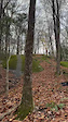
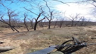
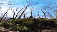
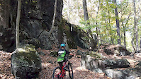
Photos of Peekskill Mountain Bike
Videos of Peekskill Mountain Bike
trail: On Your Marc
0:16 |
41 |
Nov 16, 2025

trail: Blue Mountain Summit Trail
0:10 |
11 |
Nov 16, 2025

0:05 |
10 |
Jun 9, 2025
trail: On Your Marc
0:30 |
501 |
Apr 25, 2023
trail: My Favorite Trail
0:24 |
139 |
Apr 13, 2023
4:25 |
494 |
Oct 4, 2019
5:36 |
566 |
Feb 11, 2019
trail: Blue Mountain Summit Trail
3:52 |
348 |
Oct 30, 2015
Recent Trail Reports
Activity Feed
| username | action | type | title | date |
|---|---|---|---|---|
| specie | comment | report | activity #97277549 | Jun 18, 2026 @ 2:55pm Jun 18, 2026 |
| negativenelly | add | report | activity #97179261 | Jun 17, 2026 @ 6:38am Jun 17, 2026 |
| negativenelly | vote | trail | activity #97179204 | Jun 17, 2026 @ 6:37am Jun 17, 2026 |
| tz172 | comment | report | activity #97176949 and 2 more | Jun 17, 2026 @ 5:49am Jun 17, 2026 |
| specie | add | report | activity #97143634 | Jun 16, 2026 @ 4:03pm Jun 16, 2026 |
Recent Comments
| username | type | title | comment | date |
|---|---|---|---|---|
| report | thank you for keeping everything clear, TZ | Jun 18, 2026 @ 2:55pm Jun 18, 2026 | ||
| report | This issue has been cleared.. | Jun 17, 2026 @ 5:54am Jun 17, 2026 | ||
| report | Thank you for the report..This issue is has... | Jun 17, 2026 @ 5:53am Jun 17, 2026 | ||
| report | Thank you for the report..its on the list.. | Jun 17, 2026 @ 5:49am Jun 17, 2026 | ||
| report | This issue has been cleared.. | Jun 15, 2026 @ 4:32pm Jun 15, 2026 |
Local Badges
-

Blue 100 for 100 Challenge: Speed0 awarded -

Blue 100 for 100 Challenge: Rider0 awarded -

Blue 100 for 100 Challenge: Distance0 awarded -

Completionist13 awarded -

Epic Ride 50k264 awarded -

Top 10 Trails480 awarded
Activity Type Stats
| activitytype | trails | distance | descent | descent distance | total vertical | rating | global rank | state rank | photos | reports | routes | ridelogs |
|---|---|---|---|---|---|---|---|---|---|---|---|---|
| Mountain Bike | 51 | 32 miles | 4,738 ft | 12 miles | 574 ft | #1,193 | #463 | 305 | 1,439 | 5 | 17,126 | |
| E-Bike | 2 | 3,514 ft | 102 ft | 1,706 ft | 112 ft | 1,113 | 1 | 802 | ||||
| Gravel Bike | 16 | 10 miles | 869 ft | 3 miles | 564 ft | #561 | #1,086 | 243 | 14 | |||
| Adaptive Bike | 16 | 10 miles | 869 ft | 3 miles | 564 ft | #507 | #1,802 | 247 | 1 | |||
| Winter Fat Bike | 1 | 2,326 ft | 56 ft | 1,083 ft | 89 ft | #428 | #1,171 | |||||
| Hike | 55 | 35 miles | 5,328 ft | 14 miles | 620 ft | #5,229 | #1,845 | 1,424 | 536 | |||
| Trail Running | 56 | 35 miles | 5,364 ft | 14 miles | 620 ft | #5,073 | 1,424 | 201 |
Frequently Asked Questions About Peekskill
▼
What are the best places to ride in Peekskill?
Peekskill has 3 areas to explore for mountain biking. The top rated areas are:
▼
What are the highest rated mountain biking trails in Peekskill?
The highest rated mountain biking trails in Peekskill are:
- My Favorite Trail (4.4/5)
- Upper SIS - WMBA (4.4/5)
- Esscapade (4.4/5)
- Stinger - Pedal Peekskill - WMBA Trail Hunt (4.3/5)
- Stinger (middle) (4.3/5)
▼
What is the best time of the year to ride in Peekskill?
Based on ride log data, the most popular months to ride in Peekskill are:
- July (279 activities)
- September (256 activities)
- August (244 activities)
▼
Where can I park to ride in Peekskill?
There are 3 parking locations listed in Peekskill. The most popular parking spots are: View all parking and trailhead locations on the map to plan your visit.
Activities
Trails
Points of Interest
- By nyrangerfan222
 PWMBA & contributors
 - Admins: PWMBA
- #10043 - 5,606 views
- peekskill activity log | embed map of Peekskill mountain bike trails | peekskill mountain biking points of interest
Downloading of trail gps tracks in kml & gpx formats is enabled for Peekskill.
You must login to download files.