close
-
Layers w
- Weather Layers
- Pro
- Pro
- Pro
- Pro
- Pro
- Pro
- More Layers
- Pro
- Pro
- Pro
- Pro
-
Upgrade to

3D
Trail Conditions
- Unknown
- Snow Groomed
- Snow Packed
- Snow Covered
- Snow Cover Partial
- Freeze/thaw Cycle
- Icy
- Prevalent Mud
- Wet
- Variable
- Ideal
- Dry
- Very Dry
Trail Flow (Ridden Direction)
Trailforks scans users ridelogs to determine the most popular direction each trail is ridden. A good flowing trail network will have most trails flowing in a single direction according to their intension.
The colour categories are based on what percentage of riders are riding a trail in its intended direction.
The colour categories are based on what percentage of riders are riding a trail in its intended direction.
- > 96%
- > 90%
- > 80%
- > 70%
- > 50%
- < 50%
- bi-directional trail
- no data
Trail Last Ridden
Trailforks scans ridelogs to determine the last time a trail was ridden.
- < 2 days
- < 1 week
- < 2 weeks
- < 1 month
- < 6 months
- > 6 months
Trail Ridden Direction
The intended direction a trail should be ridden.
- Downhill Only
- Downhill Primary
- Both Directions
- Uphill Primary
- Uphill Only
- One Direction
Contribute Details
Colors indicate trail is missing specified detail.
- Description
- Photos
- Description & Photos
- Videos
Trail Popularity ?
Trailforks scans ridelogs to determine which trails are ridden the most in the last 9 months.
Trails are compared with nearby trails in the same city region with a possible 25 colour shades.
Think of this as a heatmap, more rides = more kinetic energy = warmer colors.
- most popular
- popular
- less popular
- not popular
ATV/ORV/OHV Filter
Max Vehicle Width
inches
US Cell Coverage
Legend

Radar Time
Activity Recordings
Trailforks uses anonymized public activity data.
?
Activity Recordings
Trailforks uses anonymized public activity data.
?
Personal Heatmap
▶
Activity Types
all
/
none
▶
Options
2
Date range
month
–
Winter Trails
Warning
A routing network for winter maps does not exist. Selecting trails using the winter trails layer has been disabled.
Missing Trails
Most Popular
Least Popular
Trails are colored based on popularity. The more popular a trail is, the more red. Less popular trails trend towards green.
Jump Magnitude Heatmap
Heatmap of where riders jump on trails. Zoom in to see individual jumps, click circles to view jump details.
BC Backroad Status
![map legend]()
Service Road Atlas is a free to use, community-driven service for viewing and creating reports on the numerous back-country service roads around B.C. and Alberta.

Slope Aspect
Direction the slope faces
Trails Deemphasized
Trails are shown in grey.
Only show trails with no bike usage.
Suggested Layers
Based on selected activity type
Save the current map location and zoom level as your default home location whenever this page is loaded.
SavePopular Trail Networks
view all areas »
No description for Peel Region has been added yet!
Login or register to submit one.
Activities Click to view
- Mountain Bike
477 trails
- E-Bike
137 trails
- Horse
8 trails
- Hike
482 trails
- Trail Running
486 trails
- Snowshoe
185 trails
- Nordic Ski
90 trails
Region Details
- 127
- 31
- 128
- 128
- 42
- 7
Stats
- Avg Trail Rating
- Trails (view details)
- 496
- Trails Mountain Bike
- 477
- Trails E-Bike
- 137
- Trails Gravel Bike
- 9
- Trails Adaptive Bike
- 2
- Trails Winter Fat Bike
- 5
- Trails Horse
- 8
- Trails Hike
- 482
- Trails Trail Running
- 486
- Trails Dirtbike/Moto
- 1
- Trails Snowshoe
- 185
- Trails Nordic Ski
- 90
- Total Distance
- 361 miles
- Total Descent
- 18,048 ft
- Total Vertical
- 1,271 ft
- Highest Trailhead
- 1,517 ft
- Reports
- 8,184
- Photos
- 2,648
- Ridden Counter
- 106,145
Articles

Grow Cycling Foundation's Inglewood Pumptrack is Officially Open
Sep 27, 2023 from pinkbike.com
This weekend was the official opening of the Inglewood Pumptrack, thanks to the work of Grow Cycling and its founder, Eliot Jackson.
Sub Regions
- Alton (3)
- Brampton (99)
- Caledon (184)
- Mississauga (192)
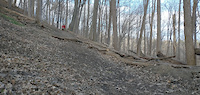
Popular Peel Region Mountain Biking Trails
• 95 ★ 4.9 • 1,913 ft • 0 ft • 1,698 •
Fast, mostly downhill trail with switchbacks and wide open straightaway. Watch for road crossing half way through trail.
• 100 ★ 3.5 • 489 ft • 0 ft • 1,649 •
(Very) short descent from the lookout (formerly of the lake). Nice twisty route, quick left then right near the bottom. Slow down at end before road crossing and check for cars.
• 100 ★ 3.8 • 1,276 ft • 0 ft • 1,647 •
Witch Trail heads north-west, after a Morraine Momentum run, just head north take a right at , mainly through twisting pines, much fun with a log roller easy bypass, few berms, with some fast sections mainly 'down' with nice drops and...
• 100 ★ 4.2 • 2,241 ft • 25 ft • 1,645 •
Fun fast technical trail through The Pines with a rock garden option, rock drops, rock jump, new berms, new section, and few quick switchback climbs to hammer.
• 90 ★ 4.8 • 3,323 ft • 67 ft • 1,624 •
A fun trail for intermediate riders. Large turns with big downhills and uphills and plenty of log and root features to practice on. Ends on doubletrack heading beside the Marsh.
• 100 ★ 3.5 • 1,184 ft • 11 ft • 1,566 •
Flat windy section to begin, keep your momentum descending into the valley to make the exit easy. The ascent from the valley can be sandy when conditions are dry or eroded after rain, but is generally well-maintained by the park. After...
• 80 ★ 3.9 • 2,684 ft • 46 ft • 1,555 •
Fun intermediate friendly trail. Short climbs and switchbacks riding through the woods with sweet rollers to pump on with never a dull moment. Huzzah!
• 95 ★ 3.3 • 2,835 ft • 37 ft • 1,507 •
Begins with a steep curving climb, at top turn to the right, with a few rock obstacles, and rewards your power efforts once up as the trail soon turns into rolling short hills punctuated by berms and sweeping turns with a steep flowy...
Peel Region Mountain Bike Routes
★ 5.0 • 11 miles • 712 ft • 13 •
The Complete Essential Palgrave CALEDON Impossible Route, With The Best Trails. Counter Clockwise 2022....
★ 5.0 • 14 miles • 1,414 ft • 92 • Loop •
A loop around all the main trails at Albion Hills ending with a lung-busting climb up The Green Monster!
★ 5.0 • 1,309 ft • 1 • Loop •
Beginner friendly, single track loop using the start of into Inner Zaichuk and back onto the end of...
★ 5.0 • 4,629 ft • 31 ft • 2 • Loop •
The top loop in Riverwood along the 403. Great for sessioning.
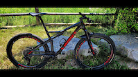
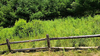
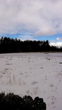
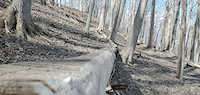
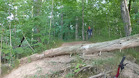
Photos of Peel Region Mountain Bike
Videos of Peel Region Mountain Bike
trail: Finnerty Entrance
0:20 |
7 |
Jul 15, 2025
trail: Finnerty Entrance
0:19 |
15 |
Jul 12, 2025
7:27 |
38 |
Oct 11, 2022
trail: Remastered
0:18 |
82 |
Jul 17, 2022
trail: Remastered
0:07 |
76 |
Jul 17, 2022
0:35 |
19 |
Jul 17, 2022
0:12 |
74 |
Jul 17, 2022
trail: Chute to Kill
0:15 |
122 |
Jul 16, 2022
Current Trail Warnings
| status | trail | date | condition | user | info |
|---|---|---|---|---|---|
| Swift Thistle Riverwood | Jun 5, 2026 @ 5:59pm (America/Toronto) Jun 5, 2026 | Dry | YurieqkmR0 | trail is pretty much gone for the most... |
Recent Trail Reports
| status | trail | date | condition | info | user |
|---|---|---|---|---|---|
| Sugar Shack Shuffle Albion Hills | May 9, 2026 @ 2:04pm (America/Toronto) May 9, 2026 | Ideal | extremumadventura | ||
| Albion Witch Albion Hills | Jun 15, 2026 @ 3:57pm (America/Toronto) 2 days | Dry | extremumadventura | ||
| The Wall Albion Hills | Jun 15, 2026 @ 6:09pm (America/Toronto) 2 days | Variable | extremumadventura | ||
| Connector Trail Albion Hills | Jun 15, 2026 @ 6:07pm (America/Toronto) 2 days | Dry | extremumadventura | ||
| The Red Trail Albion Hills | Jun 15, 2026 @ 6:07pm (America/Toronto) 2 days | Ideal | extremumadventura | ||
| Pinecomb Express Albion Hills | Jun 15, 2026 @ 4:05pm (America/Toronto) 2 days | Dry | extremumadventura | ||
| Erratic Avenue Albion Hills | Jun 15, 2026 @ 4:04pm (America/Toronto) 2 days | Ideal | extremumadventura | ||
| Epic Ride / S13 Albion Hills | Jun 15, 2026 @ 4:03pm (America/Toronto) 2 days | Dry | extremumadventura | ||
| Live and Learn Albion Hills | Jun 15, 2026 @ 4:02pm (America/Toronto) 2 days | Dry | extremumadventura | ||
| Sugar Rush Albion Hills | Jun 15, 2026 @ 4:01pm (America/Toronto) 2 days | Dry | extremumadventura |
Activity Feed
| username | action | type | title | date |
|---|---|---|---|---|
| chrisnicholson | rsvp | event | activity #97191905 | Jun 17, 2026 @ 9:58am 9 hours |
| chrisnicholson | ridden | route | activity #97191847 | Jun 17, 2026 @ 9:57am 9 hours |
| extremumadventura | comment | report | activity #97068220 | Jun 15, 2026 @ 3:13pm 2 days |
| extremumadventura | ridden | trail | activity #97067995 and 1 more | Jun 15, 2026 @ 3:09pm 2 days |
| extremumadventura | add | report | activity #97060800 and 14 more | Jun 15, 2026 @ 12:55pm 2 days |
Recent Comments
| username | type | title | comment | date |
|---|---|---|---|---|
| report | Recommend race viewing area | Jun 15, 2026 @ 3:13pm 2 days | ||
| trail | Long Double Track with many downhills and... | Jun 9, 2026 @ 7:56am Jun 9, 2026 | ||
| report | Trail not real* | Mar 26, 2026 @ 6:21am Mar 26, 2026 | ||
| report | Xc Nordic track set | Jan 4, 2026 @ 12:55pm Jan 4, 2026 | ||
| trail | Double track xc track set, climbs are packed,... | Jan 4, 2026 @ 12:06pm Jan 4, 2026 |
Local Badges
-

10 Blue Trails68 awarded -

Completionist2 awarded -
Completionist0 awarded -
Completionist0 awarded -
10 Blue Trails60 awarded -

Epic Mountain Bike Climb 2k0 awarded
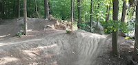
Bike & Skill Parks
| name | type | city | rating |
|---|---|---|---|
| Ellis Leuschner Challenge Park | skill park | Mississauga | |
| Clarkson Dirt Jump Park | skill park | Mississauga | |
| Windrush Woods Dirt Jump Bike Park | skill park | Mississauga | |
| Chinguacousy Skatepark | skill park | Brampton | |
| Alton Village Pumptrack | skill park | Alton |
Upcoming Local Events
Activity Type Stats
| activitytype | trails | distance | descent | descent distance | total vertical | rating | global rank | state rank | photos | reports | routes | ridelogs |
|---|---|---|---|---|---|---|---|---|---|---|---|---|
| Mountain Bike | 477 | 337 miles | 15,961 ft | 118 miles | 1,270 ft | 1,408 | 8,110 | 26 | 60,651 | |||
| E-Bike | 137 | 116 miles | 5,413 ft | 39 miles | 758 ft | 11 | 6,333 | 718 | ||||
| Gravel Bike | 9 | 60 | 2 | 344 | ||||||||
| Adaptive Bike | 2 | 30 | 3 | |||||||||
| Winter Fat Bike | 5 | 1 | 36 | 2 | 14 | |||||||
| Horse | 8 | 5 miles | 289 ft | 2 miles | 771 ft | 1,661 | 6 | |||||
| Hike | 482 | 352 miles | 17,625 ft | 124 miles | 1,270 ft | 1,226 | 8,001 | 1 | 2,398 | |||
| Trail Running | 486 | 352 miles | 17,638 ft | 124 miles | 1,270 ft | 1 | 8,002 | 7 | 3,080 | |||
| Dirtbike/Moto | 1 | 696 ft | 10 ft | 417 ft | 13 ft | 1,526 | 1 | 5 | ||||
| Snowshoe | 185 | 138 miles | 7,362 ft | 50 miles | 1,270 ft | 655 | 87 | |||||
| Nordic Ski | 90 | 90 miles | 3,930 ft | 33 miles | 1,270 ft | 492 | 249 |
Frequently Asked Questions About Peel Region
▼
What are the best places to ride in Peel Region?
Peel Region has 24 areas to explore for mountain biking. The top rated areas are:
▼
What are the highest rated mountain biking trails in Peel Region?
The highest rated mountain biking trails in Peel Region are:
- Sugar Rush (4.6/5)
- Gnarly Berms (4.5/5)
- UTM Nature Trail (4.4/5)
- Section 11 - The Northeast Passage SB (4.4/5)
- Section 3 (4.4/5)
▼
What is the best time of the year to ride in Peel Region?
Based on ride log data, the most popular months to ride in Peel Region are:
- July (1,200 activities)
- June (1,189 activities)
- August (998 activities)
▼
What is the longest trail in Peel Region?
The longest trail in Peel Region is Caledon Trailway at 39.1 km. View all trails sorted by distance.
Activities
Trails
- By markholloway
 Trailforks Map Team & contributors
 - Admins: Canadmos
- #10087 - 8,915 views
- peel region activity log | embed map of Peel Region mountain bike trails | peel region mountain biking points of interest
Downloading of trail gps tracks in kml & gpx formats is enabled for Peel Region.
You must login to download files.