close
-
Layers w
- Weather Layers
- Pro
- Pro
- Pro
- Pro
- Pro
- Pro
- More Layers
- Pro
- Pro
- Pro
- Pro
-
Upgrade to

3D
Trail Conditions
- Unknown
- Snow Groomed
- Snow Packed
- Snow Covered
- Snow Cover Partial
- Freeze/thaw Cycle
- Icy
- Prevalent Mud
- Wet
- Variable
- Ideal
- Dry
- Very Dry
Trail Flow (Ridden Direction)
Trailforks scans users ridelogs to determine the most popular direction each trail is ridden. A good flowing trail network will have most trails flowing in a single direction according to their intension.
The colour categories are based on what percentage of riders are riding a trail in its intended direction.
The colour categories are based on what percentage of riders are riding a trail in its intended direction.
- > 96%
- > 90%
- > 80%
- > 70%
- > 50%
- < 50%
- bi-directional trail
- no data
Trail Last Ridden
Trailforks scans ridelogs to determine the last time a trail was ridden.
- < 2 days
- < 1 week
- < 2 weeks
- < 1 month
- < 6 months
- > 6 months
Trail Ridden Direction
The intended direction a trail should be ridden.
- Downhill Only
- Downhill Primary
- Both Directions
- Uphill Primary
- Uphill Only
- One Direction
Contribute Details
Colors indicate trail is missing specified detail.
- Description
- Photos
- Description & Photos
- Videos
Trail Popularity ?
Trailforks scans ridelogs to determine which trails are ridden the most in the last 9 months.
Trails are compared with nearby trails in the same city region with a possible 25 colour shades.
Think of this as a heatmap, more rides = more kinetic energy = warmer colors.
- most popular
- popular
- less popular
- not popular
ATV/ORV/OHV Filter
Max Vehicle Width
inches
US Cell Coverage
Legend

Radar Time
Activity Recordings
Trailforks uses anonymized public activity data.
?
Activity Recordings
Trailforks uses anonymized public activity data.
?
Personal Heatmap
▶
Activity Types
all
/
none
▶
Options
2
Date range
month
–
Winter Trails
Warning
A routing network for winter maps does not exist. Selecting trails using the winter trails layer has been disabled.
Missing Trails
Most Popular
Least Popular
Trails are colored based on popularity. The more popular a trail is, the more red. Less popular trails trend towards green.
Jump Magnitude Heatmap
Heatmap of where riders jump on trails. Zoom in to see individual jumps, click circles to view jump details.
BC Backroad Status
![map legend]()
Service Road Atlas is a free to use, community-driven service for viewing and creating reports on the numerous back-country service roads around B.C. and Alberta.

Slope Aspect
Direction the slope faces
Trails Deemphasized
Trails are shown in grey.
Only show trails with no bike usage.
Suggested Layers
Based on selected activity type
Save the current map location and zoom level as your default home location whenever this page is loaded.
Save
No description for Peguera has been added yet!
Login or register to submit one.
This region uses the Uk/Euro style trail grading system.
Activities Click to view
- Mountain Bike
22 trails
- E-Bike
21 trails
- Hike
22 trails
- Trail Running
22 trails
Region Details
- 4
- 18
Region Status
Open as of 2 daysStats
- Avg Trail Rating
- Trails (view details)
- 22
- Trails Mountain Bike
- 22
- Trails E-Bike
- 21
- Trails Hike
- 22
- Trails Trail Running
- 22
- Total Distance
- 6 miles
- Total Descent
- 3,364 ft
- Total Vertical
- 689 ft
- Highest Trailhead
- 850 ft
- Reports
- 48
- Photos
- 58
- Ridden Counter
- 417
Sub Regions
-
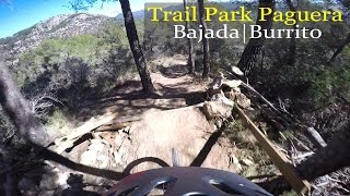
Trailpark Paguera
- 18
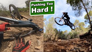
Popular Peguera Mountain Biking Trails
• 100 ★ 5.0 • 564 ft • 0 ft • 25 •
Popular blue difficulty singletrack. This multi-use trail can be used downhill primary and has a easy overall physical rating with a 0 ft blue climb. Trail visibility is always easy to follow. On average it takes 3 minutes to complete this trail.
• 95 ★ 5.0 • 640 ft • 0 ft • 22 •
Popular blue difficulty singletrack. This multi-use trail can be used downhill primary and has a easy overall physical rating with a 0 ft blue climb. Trail visibility is always easy to follow. On average it takes 2 minutes to complete this trail.
• 80 ★ 5.0 • 646 ft • 0 ft • 22 •
Popular blue difficulty singletrack. This multi-use trail can be used downhill primary and has a easy overall physical rating with a 0 ft blue climb. Trail visibility is always easy to follow. On average it takes 1 minutes to complete this trail.
• 75 ★ 4.0 • 1,260 ft • 0 ft • 15 •
Popular blue difficulty singletrack. This multi-use trail can be used downhill primary and has a easy overall physical rating with a 0 ft green climb. Trail visibility is always easy to follow. On average it takes 3 minutes to complete this trail.
• 35 ★ 4.0 • 1,325 ft • 37 ft • 15 •
Less popular blue difficulty singletrack. This multi-use trail can be used both directions and has a easy overall physical rating with a 37 ft green climb. Trail visibility is always easy to follow. On average it takes 3 minutes to complete this trail.
• 45 ★ 4.0 • 2,507 ft • 0 ft • 14 •
Moderately popular blue difficulty singletrack. This multi-use trail can be used downhill primary and has a easy overall physical rating with a 0 ft blue climb. Trail visibility is always easy to follow. On average it takes 4 minutes to complete this trail.
• 40 ★ 4.0 • 1,660 ft • 8 ft • 9 •
Moderately popular blue difficulty singletrack. This multi-use trail can be used downhill primary and has a easy overall physical rating with a 8 ft blue climb. Trail visibility is always easy to follow. On average it takes 4 minutes to complete this trail.
Peguera Mountain Bike Routes
★ 5.0 • 2 miles • 440 ft • 0 •
Easy track. Easy two jumps. A lot of loose stones. Very scenic
Photos of Peguera Mountain Bike


Recent Trail Reports
| status | trail | date | condition | info | user |
|---|---|---|---|---|---|
| Burrito a Túnel Son Vic | Nov 9, 2023 @ 4:35am Nov 9, 2023 | Dry | bigbin | ||
| Supermercado | Apr 3, 2023 @ 4:43pm Apr 3, 2023 | Unknown | trailforks Trailforks | ||
| Variante Supermercado | Apr 3, 2023 @ 4:42pm Apr 3, 2023 | Unknown | trailforks Trailforks | ||
| Variante La Corta | Apr 3, 2023 @ 4:42pm Apr 3, 2023 | Unknown | trailforks Trailforks | ||
| Supermercado a La Calobra | Apr 3, 2023 @ 4:42pm Apr 3, 2023 | Unknown | trailforks Trailforks | ||
| Supermercado | Apr 3, 2023 @ 4:42pm Apr 3, 2023 | Unknown | trailforks Trailforks | ||
| Recto | Apr 3, 2023 @ 4:42pm Apr 3, 2023 | Unknown | trailforks Trailforks | ||
| Loca Loca a Supermercado | Apr 3, 2023 @ 4:42pm Apr 3, 2023 | Unknown | trailforks Trailforks | ||
| Loca Loca | Apr 3, 2023 @ 4:42pm Apr 3, 2023 | Unknown | trailforks Trailforks | ||
| La Ola | Apr 3, 2023 @ 4:42pm Apr 3, 2023 | Unknown | trailforks Trailforks |
Activity Feed
| username | action | type | title | date |
|---|---|---|---|---|
| tackerli | ridden | trail | activity #96487541 and 5 more | Jun 7, 2026 @ 12:24pm Jun 7, 2026 |
| redwoodz | wishlist | region | activity #94884805 | May 17, 2026 @ 3:39am May 17, 2026 |
| ftigu30 | vote | trail | activity #91379116 and 4 more | Mar 27, 2026 @ 9:21am Mar 27, 2026 |
| FreiherrvonBoekent6WAzeL | wishlist | route | activity #90790523 | Mar 18, 2026 @ 4:37am Mar 18, 2026 |
| LiSt | wishlist | route | activity #86164221 | Dec 27, 2025 @ 12:27pm Dec 27, 2025 |
Local Badges
-

Epic Mountain Bike Climb 2k51 awarded -

Climbing 10k Badge2 awarded -

Mountain Biking 100k Badge0 awarded -

Epic Ride Descent 2k51 awarded -

Descent 10k Badge2 awarded -

Descent 100k Badge0 awarded
Activity Type Stats
| activitytype | trails | distance | descent | descent distance | total vertical | rating | global rank | state rank | photos | reports | routes | ridelogs |
|---|---|---|---|---|---|---|---|---|---|---|---|---|
| Mountain Bike | 22 | 6 miles | 3,363 ft | 5 miles | 689 ft | #5,005 | #295 | 58 | 48 | 2 | 1,360 | |
| E-Bike | 21 | 6 miles | 2,900 ft | 4 miles | 689 ft | #5,877 | #468 | 48 | 1 | 126 | ||
| Hike | 22 | 6 miles | 3,363 ft | 5 miles | 689 ft | #9,208 | #466 | 48 | 107 | |||
| Trail Running | 22 | 6 miles | 3,363 ft | 5 miles | 689 ft | #8,731 | #464 | 48 | 23 |
Frequently Asked Questions About Peguera
▼
What are the best places to ride in Peguera?
Peguera has 1 areas to explore for mountain biking. The top rated areas are:
▼
What are the highest rated mountain biking trails in Peguera?
The highest rated mountain biking trails in Peguera are:
- Variante Supermercado (4.1/5)
- Supermercado a La Calobra (4.1/5)
- La Ola (4.1/5)
- Burrito (4.1/5)
- La Corta (4.1/5)
▼
What is the best time of the year to ride in Peguera?
Based on ride log data, the most popular months to ride in Peguera are:
- August (23 activities)
- April (9 activities)
- September (8 activities)
▼
Where can I park to ride in Peguera?
Check the Peguera trail map for trailhead and parking information. Community members regularly update access and parking details for trails in the area.
- By lines
 TRAILFORKS & contributors
 - Admins: apply
- #13430 - 2,261 views
- peguera activity log | embed map of Peguera mountain bike trails |
Downloading of trail gps tracks in kml & gpx formats is enabled for Peguera.
You must login to download files.