close
-
Layers w
- Weather Layers
- Pro
- Pro
- Pro
- Pro
- Pro
- Pro
- More Layers
- Pro
- Pro
- Pro
- Pro
-
Upgrade to

3D
Trail Conditions
- Unknown
- Snow Groomed
- Snow Packed
- Snow Covered
- Snow Cover Partial
- Freeze/thaw Cycle
- Icy
- Prevalent Mud
- Wet
- Variable
- Ideal
- Dry
- Very Dry
Trail Flow (Ridden Direction)
Trailforks scans users ridelogs to determine the most popular direction each trail is ridden. A good flowing trail network will have most trails flowing in a single direction according to their intension.
The colour categories are based on what percentage of riders are riding a trail in its intended direction.
The colour categories are based on what percentage of riders are riding a trail in its intended direction.
- > 96%
- > 90%
- > 80%
- > 70%
- > 50%
- < 50%
- bi-directional trail
- no data
Trail Last Ridden
Trailforks scans ridelogs to determine the last time a trail was ridden.
- < 2 days
- < 1 week
- < 2 weeks
- < 1 month
- < 6 months
- > 6 months
Trail Ridden Direction
The intended direction a trail should be ridden.
- Downhill Only
- Downhill Primary
- Both Directions
- Uphill Primary
- Uphill Only
- One Direction
Contribute Details
Colors indicate trail is missing specified detail.
- Description
- Photos
- Description & Photos
- Videos
Trail Popularity ?
Trailforks scans ridelogs to determine which trails are ridden the most in the last 9 months.
Trails are compared with nearby trails in the same city region with a possible 25 colour shades.
Think of this as a heatmap, more rides = more kinetic energy = warmer colors.
- most popular
- popular
- less popular
- not popular
ATV/ORV/OHV Filter
Max Vehicle Width
inches
US Cell Coverage
Legend

Radar Time
Activity Recordings
Trailforks uses anonymized public activity data.
?
Activity Recordings
Trailforks uses anonymized public activity data.
?
Personal Heatmap
▶
Activity Types
all
/
none
▶
Options
2
Date range
month
–
Winter Trails
Warning
A routing network for winter maps does not exist. Selecting trails using the winter trails layer has been disabled.
Missing Trails
Most Popular
Least Popular
Trails are colored based on popularity. The more popular a trail is, the more red. Less popular trails trend towards green.
Jump Magnitude Heatmap
Heatmap of where riders jump on trails. Zoom in to see individual jumps, click circles to view jump details.
BC Backroad Status
![map legend]()
Service Road Atlas is a free to use, community-driven service for viewing and creating reports on the numerous back-country service roads around B.C. and Alberta.

Slope Aspect
Direction the slope faces
Trails Deemphasized
Trails are shown in grey.
Only show trails with no bike usage.
Suggested Layers
Based on selected activity type
Save the current map location and zoom level as your default home location whenever this page is loaded.
SaveA Biking Community
With our great weather, extended season and world-class variety of routes and trails, it's no surprise that Penticton is a cycling community. We like to get out and about-- whether we're cruising a leisurely path between wineries, taking a technical route down the side of a mountain, racing in international competitions like Axel-Merckx Granfondo or spending a Sunday at the local BMX park.
Thousands of cyclists are drawn here every year for our numerous events and cyclo-attractions-- regardless of what kind (or what level) of cyclist they are. As a community, we've mapped out beginner and professional routes for road cyclists, mountain bikers, off-roaders, singletrack-ers and families-- we even have cycling wine tours
If that wasn't enough, many of our local businesses are cyclist-friendly too. We have top notch tour companies, rental shops, equipment providers, accommodations, cafes and breweries who are happy to accommodate you when you need a break. We also have a large trail map, bike repair kit and several bike racks right beside the beach in the heart of downtown.
Lastly, our cycling community is thriving. Thanks to countless volunteers, avid community members and passionate cyclists, we launched a city-wide biking initiative to keep our trail network growing and improving. They offer an active voice in trail design and maintenance, as well as event support and organizing rides. Their coaches and long-time members provide a wealth of knowledge to the community, for residents and new-comers alike.
The City of Penticton is delighted to announce our newly declared status as a Biking Precinct by the BC Ministry of transportation for all these reasons, and more. To learn more about our biking events, trails, shops, services and clubs, read on below or click on the tabs to the left. It's time to explore!
Bike Facilities
Mountain Bike Hub - Many mountain bikers go to the parking lot and port-o-potty at the intersection of Naramata Road and the KVR trail to suit up before hitting the Three Blind Mice trail network. Penticton and Area Cycling Association (PACA) is working to set up a hub (including a bike wash, bike pump, bike tools, picnic tables, and potentially a BBQ) for cyclists-- whether locals or tourists-- to meet up and socialize. Stay tuned as plans progress!
Penticton Youth Park - Penticton's skate and BMX park is located in Riverside Park on Riverside Drive. It's a great space for young BMX and mountain bikers to practice and gain confidence in their skills on a variety of bowls, ramps and stairs.
source: City Of Penitcton website
Activities Click to view
- Mountain Bike
261 trails
- E-Bike
247 trails
- Gravel Bike
45 trails
- Adaptive Bike
0 trails
- Winter Fat Bike
0 trails
- Horse
14 trails
- Hike
259 trails
- Trail Running
252 trails
- Dirtbike/Moto
4 trails
- ATV/ORV/OHV
4 trails
- Snowmobile
5 trails
- Snowshoe
43 trails
- Downhill Ski
61 trails
- Nordic Ski
61 trails
Region Details
- 48
- 4
- 47
- 109
- 49
- 2
Region Status
Caution as of Jun 17, 2026Stats
- Avg Trail Rating
- Trails (view details)
- 375
- Trails Mountain Bike
- 261
- Trails E-Bike
- 247
- Trails Gravel Bike
- 45
- Trails Horse
- 14
- Trails Hike
- 259
- Trails Trail Running
- 252
- Trails Dirtbike/Moto
- 4
- Trails Observed Trials
- 2
- Trails ATV/ORV/OHV
- 4
- Trails Snowmobile
- 5
- Trails Snowshoe
- 43
- Trails Downhill Ski
- 61
- Trails Backcountry Ski
- 2
- Trails Nordic Ski
- 61
- Total Distance
- 420 miles
- Total Descent
- 112,660 ft
- Total Vertical
- 6,098 ft
- Highest Trailhead
- 7,212 ft
- Reports
- 7,272
- Photos
- 2,277
- Ridden Counter
- 108,749
Articles
Details Announced for 2024 PeachFest PeachDuro
Jul 9, 2024 from pinkbike.com
This year's race will once again offer a "Short Course" and a "Long Course" on the Three Blind Mice trail network.
Video & Photo Recap: The 2024 Mega Volt eMTB Festival
Jun 11, 2024 from pinkbike.com
Three days of challenges, group rides and more.
Sub Regions
-
Apex
- 2
- 13
- 7
-
Brent Mountain Protected Area
- 5
- 3
-
Campbell Mountain
- 21
- 20
- 1
-
Carmi
- 8
- 4
- 1
-
Esplanade Trail Network
- 1
- 2
-
Skaha Bluffs
- 1
- 5
- 2
-
Three Blind Mice
- 9
- 54
- 21
- 2
-
Wiltse
- 2
- 5
- 6
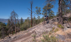
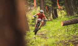
Popular Penticton Mountain Biking Trails
• 100 ★ 4.1 • 2 miles • 656 ft • 2,152 •
An intertwining climbing trail that switchbacks its way up across and . It takes most of the gut punch out of the climb but you can still ride that technical climbing line. Currently it ends at , but is planned for continuation all the...
• 100 ★ 4.2 • 1,699 ft • 11 ft • 2,113 •
The lowest portion of , this is a Green trail for riders looking to avoid .
• 100 ★ 3.5 • 3 miles • 951 ft • 2,098 •
One of the major end-end trunks of the Mice. If you are looking to climb from the bottom, you will 99% likely be on this for some stretch of time. It is a green level climb ... mostly, there are some s that bump it to a blue but nothing...
• 95 ★ 3.0 • 923 ft • 0 ft • 1,698 •
An alternative for those who do not like the steep gullys or the potential blown out corners of . It takes you down a short and lesser used singletrack that spits you out at the Pearly Gates.
• 95 ★ 4.5 • 1 mile • 31 ft • 1,501 •
(formerly -On-Grade) is a remarkable showcasing the Mice's signature rocky s. 400 Enduro'rs tore through in 2014 and you wouldn't even know it.
• 95 ★ 4.3 • 3,617 ft • 43 ft • 1,457 •
is a fun, technical descent that can be as fast you want. No mandatory stunts/features.
• 90 ★ 4.2 • 2 miles • 212 ft • 1,455 •
; she's a temper mental beast. Claimed a few pounds of skin at a recent Enduro race. Rocks, , speed, flat turns, drop turns, etc. Its got enough to keep you on your toes. After your cross the creek on the Bridge (not yet painted as of...
• 95 ★ 4.5 • 2 miles • 702 ft • 1,306 •
This segment was constructed by Cabin Forestry in 2017 and is nearing completion of our final segment of the north end climbing trail, . It was funded in part by a grant from the Canada150 Foundation, local donors, and volunteer...
Penticton Mountain Bike Routes
Lookout Loop Featured
★ 3.7 • 8 miles • 1,154 ft • 13 • Loop •
A good intro to the Three Blind Mice trails. Easy up and back. Just follow the round blue signs that say...
Rock Oven Featured
★ 3.5 • 9 miles • 2,014 ft • 6 • Loop •
A popular ride that can be as epic as you want. Stop and take photos from the several wicked view points...
PACA Route: Black 2+hrs Advanced Featured
9 miles • 1,666 ft • 11 •
One of our best and most well-ridden loops. Be sure to catch your breath and take in the view before you...
87 miles • 16,565 ft • 66 • Loop •
Almost everything in the mice
★ 4.0 • 14 miles • 2,247 ft • 11 •
Swagman's Backyard Ride Guide is back - this time, in two parts for the largest of the Penticton Trail...
★ 4.0 • 5 miles • 202 ft • 11 • Shuttled •
So, you find yourself at the top of 3 Blind Mice, you may ask yourself the following questions. What's the...
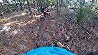
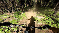
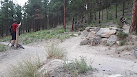
Photos of Penticton Mountain Bike
Videos of Penticton Mountain Bike
trail: Trench Fickler
3:43 |
88 |
Dec 23, 2025
trail: Wedding Crashers
0:42 |
154 |
Nov 8, 2021
trail: High Roller
0:32 |
126 |
Nov 8, 2021

trail: Jose
4:37 |
103 |
Nov 8, 2021
trail: Drops A Lot
0:30 |
188 |
Jun 2, 2021
trail: Flow Coaster - Jumps
0:09 |
317 |
May 7, 2021
trail: Boneyard
0:32 |
70 |
Jan 14, 2021

0:21 |
215 |
Jul 21, 2020
Current Trail Warnings
| status | trail | date | condition | user | info |
|---|---|---|---|---|---|
| Naramata Beer Run | Jun 17, 2026 @ 9:01am (America/Creston) Jun 17, 2026 | Dry | traildad604 | Lots of trees down, especially near the... | |
| Flow Coaster - Jumps | Jun 1, 2026 @ 12:46pm (America/Creston) Jun 1, 2026 | Dry | raidue |
Recent Trail Reports
| status | trail | date | condition | info | user |
|---|---|---|---|---|---|
| Arawana Rd to Reservoir | Jun 17, 2026 @ 9:01am (America/Creston) Jun 17, 2026 | Dry | traildad604 | ||
| Neverland - Upper | Jun 17, 2026 @ 9:01am (America/Creston) Jun 17, 2026 | Dry | traildad604 | ||
| Neverland - Lower | Jun 17, 2026 @ 9:01am (America/Creston) Jun 17, 2026 | Dry | traildad604 | ||
| Black Bear | Jun 12, 2026 @ 2:31pm (America/Vancouver) Jun 12, 2026 | Dry | warrene | ||
| Poplar to Pearly Gates. | Jun 12, 2026 @ 11:23am (America/Vancouver) Jun 12, 2026 | Ideal | Sackbut | ||
| Three Witches | Jun 11, 2026 @ 6:59pm (America/Vancouver) Jun 11, 2026 | Unknown | Anadeau | ||
| Rainbow | Jun 11, 2026 @ 6:11pm (America/Vancouver) Jun 11, 2026 | Dry | earthrider | ||
| She Goes Down | Jun 10, 2026 @ 2:11pm (America/Vancouver) Jun 10, 2026 | Unknown | 9M5HGd1 | ||
| Sourkraut | Jun 6, 2026 @ 7:08pm (America/Vancouver) Jun 6, 2026 | Ideal | chris-mcintyre | ||
| Rock Oven | Jun 4, 2026 @ 3:39pm (America/Creston) Jun 4, 2026 | Ideal | Spiral23 |
Activity Feed
| username | action | type | title | date |
|---|---|---|---|---|
| bigbluesky | ridden | trail | activity #97348823 and 4 more | Jun 19, 2026 @ 3:30pm 1 day |
| meladlazar | wishlist | trail | activity #97299120 and 1 more | Jun 18, 2026 @ 11:20pm 2 days |
| 9djvXn | wishlist | route | activity #97297607 | Jun 18, 2026 @ 10:23pm 2 days |
| ismytirepressureright | wishlist | route | activity #97295787 | Jun 18, 2026 @ 9:16pm 2 days |
| j-p-i | comment | trail | activity #97292110 | Jun 18, 2026 @ 7:40pm 2 days |
Recent Comments
| username | type | title | comment | date |
|---|---|---|---|---|
| trail | Yes | Jun 18, 2026 @ 7:40pm 2 days | ||
| trail | 1 | Jun 16, 2026 @ 8:55pm Jun 16, 2026 | ||
| trail | The Nora ivyuyyiyuiimm s | Jun 13, 2026 @ 9:05am Jun 13, 2026 | ||
| report | The tree is down around a steep blind corner... | Jun 10, 2026 @ 3:37pm Jun 10, 2026 | ||
| trail | Really steep pitches after the Saurkraut... | Jun 6, 2026 @ 8:16pm Jun 6, 2026 |
Local Badges
-

Completionist0 awarded -

Big Ride 30k5,086 awarded -

Epic Ride 50k1,432 awarded -

Top 10 Trails8 awarded -
Completionist3 awarded -
Completionist0 awarded
Bike & Skill Parks
| name | type | city | rating |
|---|---|---|---|
| Poplar Grove KVR Pump Track | skill park | Penticton | |
| Penticton BMX (Old Track) | skill park | Penticton |
Local Products
Local Trail Supporters
- Trails BC
- Summerland Trans Canada Trail Society
Activity Type Stats
| activitytype | trails | distance | descent | descent distance | total vertical | rating | global rank | state rank | photos | reports | routes | ridelogs |
|---|---|---|---|---|---|---|---|---|---|---|---|---|
| Mountain Bike | 261 | 330 miles | 73,980 ft | 143 miles | 6,099 ft | #122 | #16 | 2,117 | 7,181 | 90 | 64,002 | |
| E-Bike | 247 | 320 miles | 73,451 ft | 142 miles | 6,099 ft | #121 | #19 | 45 | 6,955 | 29 | 5,816 | |
| Gravel Bike | 45 | 104 miles | 9,035 ft | 25 miles | 5,469 ft | #28 | #59 | 1 | 705 | 1 | 210 | |
| Horse | 14 | 42 miles | 846 ft | 6 miles | 2,782 ft | #358 | #19 | 3,392 | 1 | 16 | ||
| Hike | 259 | 337 miles | 73,461 ft | 145 miles | 6,099 ft | #157 | #13 | 37 | 7,117 | 1 | 6,743 | |
| Trail Running | 252 | 325 miles | 71,627 ft | 139 miles | 6,099 ft | #245 | #23 | 3 | 7,101 | 1 | 3,517 | |
| Dirtbike/Moto | 4 | 30 miles | 643 ft | 3 miles | 5,082 ft | #185 | #30 | 2,937 | 80 | |||
| Observed Trials | 2 | 28 miles | 387 ft | 2 miles | 2,730 ft | 13 | 27 | |||||
| ATV/ORV/OHV | 4 | 30 miles | 643 ft | 3 miles | 5,082 ft | #109 | #17 | 2,932 | 1 | 19 | ||
| Snowmobile | 5 | 8 miles | 922 ft | 3 miles | 3,054 ft | #78 | #7 | 56 | 2 | |||
| Snowshoe | 43 | 50 miles | 7,687 ft | 21 miles | 5,079 ft | #19 | #5 | 52 | 553 | 742 | ||
| Downhill Ski | 61 | 25 miles | 30,128 ft | 25 miles | 1,850 ft | #142 | #14 | 51 | 2,482 | |||
| Backcountry Ski | 2 | 6 miles | 1,309 ft | 3 miles | 1,033 ft | 2 | 53 | 265 | ||||
| Nordic Ski | 61 | 55 miles | 6,499 ft | 22 miles | 5,131 ft | #33 | #7 | 19 | 525 | 5 | 2,177 |
Frequently Asked Questions About Penticton
▼
What are the best places to ride in Penticton?
Penticton has 11 areas to explore for mountain biking. The top rated areas are:
▼
What are the highest rated mountain biking trails in Penticton?
The highest rated mountain biking trails in Penticton are:
- Flow Coaster Upper (4.6/5)
- Code 4 (4.5/5)
- High Roller (4.5/5)
- Drops A Lot (4.4/5)
- Slabs (4.4/5)
▼
What is the best time of the year to ride in Penticton?
Based on ride log data, the most popular months to ride in Penticton are:
- July (1,199 activities)
- August (889 activities)
- May (830 activities)
▼
Where can I park to ride in Penticton?
There are 21 parking locations listed in Penticton. The most popular parking spots are:
- Poplar Grove Parking Lot
- Arawana FSR Parking
- Campbell Mtn. Parking spot
- Mortgenstern's gate
- Top of Wiltse Parking
Activities
Trails
Points of Interest
- Rainbow Roll TTF
- Egg Rock Viewpoint
- KVR - Chipmunk Kiosk Information
- Grand Canyon Viewpoint
- Chatsworth Viewpoint
- Waterfall Sight
- Nickel Plate Nordic Lodge Cabin
- August 18, 2020 Mt Christie Wild Fire Ignition Point (suspected) Other
- Rock roll TTF
- Behemoth Viewpoint
- Apex Mountain (2,248 m)
- Mount Brent (2,201 m)
- Sheep Rock (2,196 m)
- By canadaka
 Trailforks & contributors
 - Admins: canadianenduro, NPCCSC, 1partatatime, terrymcw, PACApenticton, PACA, 1partatatime, PACApenticton
- #3031 - 91,894 views
- penticton activity log | embed map of Penticton mountain bike trails | penticton mountain biking points of interest polygons
Downloading of trail gps tracks in kml & gpx formats is enabled for Penticton.
You must login to download files.