close
-
Layers w
- Weather Layers
- Pro
- Pro
- Pro
- Pro
- Pro
- Pro
- More Layers
- Pro
- Pro
- Pro
- Pro
-
Upgrade to

3D
Trail Conditions
- Unknown
- Snow Groomed
- Snow Packed
- Snow Covered
- Snow Cover Partial
- Freeze/thaw Cycle
- Icy
- Prevalent Mud
- Wet
- Variable
- Ideal
- Dry
- Very Dry
Trail Flow (Ridden Direction)
Trailforks scans users ridelogs to determine the most popular direction each trail is ridden. A good flowing trail network will have most trails flowing in a single direction according to their intension.
The colour categories are based on what percentage of riders are riding a trail in its intended direction.
The colour categories are based on what percentage of riders are riding a trail in its intended direction.
- > 96%
- > 90%
- > 80%
- > 70%
- > 50%
- < 50%
- bi-directional trail
- no data
Trail Last Ridden
Trailforks scans ridelogs to determine the last time a trail was ridden.
- < 2 days
- < 1 week
- < 2 weeks
- < 1 month
- < 6 months
- > 6 months
Trail Ridden Direction
The intended direction a trail should be ridden.
- Downhill Only
- Downhill Primary
- Both Directions
- Uphill Primary
- Uphill Only
- One Direction
Contribute Details
Colors indicate trail is missing specified detail.
- Description
- Photos
- Description & Photos
- Videos
Trail Popularity ?
Trailforks scans ridelogs to determine which trails are ridden the most in the last 9 months.
Trails are compared with nearby trails in the same city region with a possible 25 colour shades.
Think of this as a heatmap, more rides = more kinetic energy = warmer colors.
- most popular
- popular
- less popular
- not popular
ATV/ORV/OHV Filter
Max Vehicle Width
inches
US Cell Coverage
Legend

Radar Time
Activity Recordings
Trailforks uses anonymized public activity data.
?
Activity Recordings
Trailforks uses anonymized public activity data.
?
Personal Heatmap
▶
Activity Types
all
/
none
▶
Options
2
Date range
month
–
Winter Trails
Warning
A routing network for winter maps does not exist. Selecting trails using the winter trails layer has been disabled.
Missing Trails
Most Popular
Least Popular
Trails are colored based on popularity. The more popular a trail is, the more red. Less popular trails trend towards green.
Jump Magnitude Heatmap
Heatmap of where riders jump on trails. Zoom in to see individual jumps, click circles to view jump details.
BC Backroad Status
![map legend]()
Service Road Atlas is a free to use, community-driven service for viewing and creating reports on the numerous back-country service roads around B.C. and Alberta.

Slope Aspect
Direction the slope faces
Trails Deemphasized
Trails are shown in grey.
Only show trails with no bike usage.
Suggested Layers
Based on selected activity type
Save the current map location and zoom level as your default home location whenever this page is loaded.
Save
No description for Peterborough has been added yet!
Login or register to submit one.
Activities Click to view
- Mountain Bike
98 trails
- E-Bike
6 trails
- Gravel Bike
0 trails
- Adaptive Bike
0 trails
- Winter Fat Bike
0 trails
- Hike
92 trails
- Trail Running
92 trails
- Nordic Ski
24 trails
Region Details
- 6
- 9
- 35
- 40
- 5
Region Status
Open as of 6 hoursStats
- Avg Trail Rating
- Trails (view details)
- 119
- Trails Mountain Bike
- 98
- Trails E-Bike
- 6
- Trails Hike
- 92
- Trails Trail Running
- 92
- Trails Snowshoe
- 1
- Trails Nordic Ski
- 24
- Total Distance
- 68 miles
- Total Descent
- 4,557 ft
- Total Vertical
- 357 ft
- Highest Trailhead
- 984 ft
- Reports
- 1,077
- Photos
- 147
- Ridden Counter
- 9,916
Sub Regions
-
Ashburnham Park
- 2
-
Harold Town Conservation Area
- 3
- 5
- 10
- 4
-
Jackson Park / Fairbairn
- 2
- 7
- 12
- 1
-
Meadow Wood Park
- 3
-
Sir Sanford Fleming College
- 8
- 7
-
Trent University
- 10
- 6
Popular Peterborough Mountain Biking Trails
• 100 ★ 4.7 • 2,438 ft • 14 ft • 499 •
is a fast and flowing descent with some bermed corner and some features to get the tires off the ground. It's sacrilegious to ride Harold Town and not include one run down on your lap. Trail is named for the sound of the cedars when the...
• 100 ★ 4.9 • 2,221 ft • 3 ft • 412 •
Everyone`s favourite new baby added in 2015 and refined in 2016 with improved berms and added features. Scratches that `go fast` and `get them tires off the ground` itch. Can be climbed but keep your ears open. Those coming in the...
• 90 ★ 4.2 • 3,802 ft • 132 ft • 409 •
Best ridden from the side closer to the parking lot (corners flow better). The first half is old-school tight single-track with descents and traverses, including a IMBA Trail Crew Work Party Berm and Corner. The second half is a...
• 95 ★ 4.2 • 1 mile • 221 ft • 379 •
Primarily a switchback climb, but it makes for a great descent as well. Great flow with lots of ups and downs and well-designed corners.
• 90 ★ 3.9 • 1,834 ft • 31 ft • 379 •
A great piece of fast single-track with some high-speed berms near the top. Also works in the opposite direction to get back to the top of the property.
• 100 ★ 3.9 • 3,652 ft • 83 ft • 377 •
A 2015 addition to the Harold Town Trails. provides an around-the-back option to get to the top. Trail is less technical for less-advanced riders, but plenty fast for those pushing the pedals hard.
• 95 ★ 3.8 • 1,073 ft • 8 ft • 363 •
A flowy trail with berms and twists through cedar clumps and wild apples. Can be used to climb back up following a Barfa or Shackwacky run as an alternative to to reach the top of the drumlin, or combined in a figure 8: north to south,...
• 95 ★ 4.0 • 978 ft • 0 ft • 348 •
GeeWiliker is a beginner trail with a smooth aggregate surface suitable for striders.
Peterborough Mountain Bike Routes
★ 5.0 • 7 miles • 829 ft • 15 • Loop •
A look through all the different types of terrain at Harold Town. There are only a few spots where there...
• 13 miles • 1,235 ft • 24 •
• 14 miles • 1,351 ft • 37 •
• 13 miles • 1,288 ft • 36 •
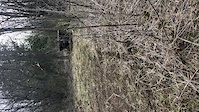
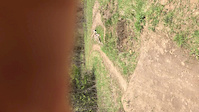
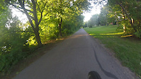
Photos of Peterborough Mountain Bike
Videos of Peterborough Mountain Bike
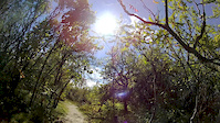
trail: Tunnel Visions
0:09 |
|
May 22, 2020
trail: Fairbairn
0:07 |
|
May 22, 2020
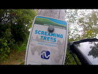
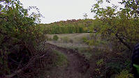
trail: Screaming Trees
2:47 |
318 |
Sep 9, 2019
trail: Long the River
2:43 |
20 |
Aug 29, 2019
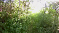
trail: Hot Breakfast
2:11 |
418 |
Sep 22, 2018
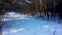
trail: Armour Hill
0:15 |
56 |
Feb 4, 2016
trail: Berm Valley
0:49 |
251 |
Oct 10, 2015
trail: Tunnel Visions
0:07 |
285 |
Jul 16, 2015
Current Trail Warnings
| status | trail | date | condition | user | info |
|---|---|---|---|---|---|
| Runway | Jun 8, 2026 @ 3:40pm (America/Toronto) Jun 8, 2026 | Variable | turfjon |
Recent Trail Reports
| status | trail | date | condition | info | user |
|---|---|---|---|---|---|
| Breakwall | Jun 20, 2026 @ 6:22pm (America/Toronto) 6 hours | Unknown | werkinit HAFTA | ||
| Trent 2 | Jun 16, 2026 @ 7:28pm (America/Toronto) Jun 16, 2026 | Ideal | turfjon | ||
| Trent 5 | Jun 8, 2026 @ 2:51pm (America/Toronto) Jun 8, 2026 | Ideal | turfjon | ||
| Trent 3 | Jun 8, 2026 @ 2:51pm (America/Toronto) Jun 8, 2026 | Ideal | turfjon | ||
| Connector | Jun 8, 2026 @ 2:51pm (America/Toronto) Jun 8, 2026 | Ideal | turfjon | ||
| Screaming Trees | Jun 8, 2026 @ 3:40pm (America/Toronto) Jun 8, 2026 | Ideal | turfjon | ||
| Shack Wacky Extension | Jun 8, 2026 @ 3:40pm (America/Toronto) Jun 8, 2026 | Ideal | turfjon | ||
| Barfa Lounger | Jun 8, 2026 @ 3:40pm (America/Toronto) Jun 8, 2026 | Ideal | turfjon | ||
| Cellar Door | Jun 8, 2026 @ 3:40pm (America/Toronto) Jun 8, 2026 | Ideal | turfjon | ||
| Hot Breakfast | Jun 8, 2026 @ 3:40pm (America/Toronto) Jun 8, 2026 | Ideal | turfjon |
Activity Feed
| username | action | type | title | date |
|---|---|---|---|---|
| werkinit | add | report | activity #97437313 and 1 more | Jun 20, 2026 @ 3:22pm 6 hours |
| turfjon | add | report | activity #97150655 | Jun 16, 2026 @ 5:39pm Jun 16, 2026 |
| Adderley75 | wishlist | badge | activity #97137121 | Jun 16, 2026 @ 2:11pm Jun 16, 2026 |
| Sauljea | vote | trail | activity #97056331 and 2 more | Jun 15, 2026 @ 11:44am Jun 15, 2026 |
| Sauljea | vote | trail | activity #97056217 and 1 more | Jun 15, 2026 @ 11:42am Jun 15, 2026 |
Recent Comments
| username | type | title | comment | date |
|---|---|---|---|---|
| trail | E go p yryou n ou | Jun 13, 2026 @ 8:31am Jun 13, 2026 | ||
| trail | Fastest and most direct route to the top, my... | Jul 19, 2024 @ 11:42am Jul 19, 2024 | ||
| trail | Peterborough trail builders are a bunch of... | Jun 18, 2024 @ 7:23pm Jun 18, 2024 | ||
| trail | Closed at the moment | Jul 2, 2022 @ 11:58am Jul 2, 2022 | ||
| trail | Nice small little run | Jul 1, 2022 @ 6:11pm Jul 1, 2022 |
Local Badges
-

10 Green Trails97 awarded -

10 Blue Trails179 awarded -

Epic Ride Climb 2k6 awarded -

Climbing 10k Badge39 awarded -

Climbing 100k Badge0 awarded -

Epic Ride Descent 2k5 awarded
Activity Type Stats
| activitytype | trails | distance | descent | descent distance | total vertical | rating | global rank | state rank | photos | reports | routes | ridelogs |
|---|---|---|---|---|---|---|---|---|---|---|---|---|
| Mountain Bike | 98 | 43 miles | 4,078 ft | 18 miles | 312 ft | #1,178 | #29 | 147 | 1,077 | 3 | 16,686 | |
| E-Bike | 6 | 5 miles | 98 ft | 2 miles | 164 ft | #6,803 | #109 | 895 | 130 | |||
| Hike | 92 | 42 miles | 3,842 ft | 17 miles | 312 ft | #4,363 | #82 | 1,066 | 482 | |||
| Trail Running | 92 | 42 miles | 3,852 ft | 17 miles | 312 ft | #3,361 | #54 | 1,068 | 3 | 2,373 | ||
| Snowshoe | 1 | 1,886 ft | 33 ft | 469 ft | 43 ft | 6 | 29 | |||||
| Nordic Ski | 24 | 25 miles | 479 ft | 5 miles | 157 ft | #754 | #52 | 1 | 484 |
Frequently Asked Questions About Peterborough
▼
What are the best places to ride in Peterborough?
Peterborough has 7 areas to explore for mountain biking. The top rated areas are:
▼
What are the highest rated mountain biking trails in Peterborough?
The highest rated mountain biking trails in Peterborough are:
- Laundry Chute (4.6/5)
- Hot Breakfast (4.5/5)
- Screaming Trees (4.5/5)
- Fairbairn (4.4/5)
- Kessel Run (4.4/5)
▼
What is the best time of the year to ride in Peterborough?
Based on ride log data, the most popular months to ride in Peterborough are:
- July (328 activities)
- August (221 activities)
- May (186 activities)
▼
Where can I park to ride in Peterborough?
There are 4 parking locations listed in Peterborough. The most popular parking spots are: View all parking and trailhead locations on the map to plan your visit.
Activities
Trails
Points of Interest
- By brenthillier
 NSMBA TRAILFORKS & contributors
 - Admins: PTA
- #3502 - 17,519 views
- peterborough activity log | embed map of Peterborough mountain bike trails | peterborough mountain biking points of interest
Downloading of trail gps tracks in kml & gpx formats is enabled for Peterborough.
You must login to download files.