close
-
Layers w
- Weather Layers
- Pro
- Pro
- Pro
- Pro
- Pro
- Pro
- More Layers
- Pro
- Pro
- Pro
- Pro
-
Upgrade to

3D
Trail Conditions
- Unknown
- Snow Groomed
- Snow Packed
- Snow Covered
- Snow Cover Partial
- Freeze/thaw Cycle
- Icy
- Prevalent Mud
- Wet
- Variable
- Ideal
- Dry
- Very Dry
Trail Flow (Ridden Direction)
Trailforks scans users ridelogs to determine the most popular direction each trail is ridden. A good flowing trail network will have most trails flowing in a single direction according to their intension.
The colour categories are based on what percentage of riders are riding a trail in its intended direction.
The colour categories are based on what percentage of riders are riding a trail in its intended direction.
- > 96%
- > 90%
- > 80%
- > 70%
- > 50%
- < 50%
- bi-directional trail
- no data
Trail Last Ridden
Trailforks scans ridelogs to determine the last time a trail was ridden.
- < 2 days
- < 1 week
- < 2 weeks
- < 1 month
- < 6 months
- > 6 months
Trail Ridden Direction
The intended direction a trail should be ridden.
- Downhill Only
- Downhill Primary
- Both Directions
- Uphill Primary
- Uphill Only
- One Direction
Contribute Details
Colors indicate trail is missing specified detail.
- Description
- Photos
- Description & Photos
- Videos
Trail Popularity ?
Trailforks scans ridelogs to determine which trails are ridden the most in the last 9 months.
Trails are compared with nearby trails in the same city region with a possible 25 colour shades.
Think of this as a heatmap, more rides = more kinetic energy = warmer colors.
- most popular
- popular
- less popular
- not popular
ATV/ORV/OHV Filter
Max Vehicle Width
inches
US Cell Coverage
Legend

Radar Time
Activity Recordings
Trailforks uses anonymized public activity data.
?
Activity Recordings
Trailforks uses anonymized public activity data.
?
Personal Heatmap
▶
Activity Types
all
/
none
▶
Options
2
Date range
month
–
Winter Trails
Warning
A routing network for winter maps does not exist. Selecting trails using the winter trails layer has been disabled.
Missing Trails
Most Popular
Least Popular
Trails are colored based on popularity. The more popular a trail is, the more red. Less popular trails trend towards green.
Jump Magnitude Heatmap
Heatmap of where riders jump on trails. Zoom in to see individual jumps, click circles to view jump details.
BC Backroad Status
![map legend]()
Service Road Atlas is a free to use, community-driven service for viewing and creating reports on the numerous back-country service roads around B.C. and Alberta.

Slope Aspect
Direction the slope faces
Trails Deemphasized
Trails are shown in grey.
Only show trails with no bike usage.
Suggested Layers
Based on selected activity type
Save the current map location and zoom level as your default home location whenever this page is loaded.
SaveLe massif du Luberon est un massif montagneux peu élevé qui s'étend d'est en ouest entre les Alpes-de-Haute-Provence et le département de Vaucluse, en France.Le massif, comprenant notamment les montagnes du Grand et du Petit Luberon, mesure plus de 60 kilomètres de long pour une largeur de 5 kilomètres environ, et son point culminant est le Mourre Nègre, sommet arrondi qui s'élève à 1 125 mètres d'altitude, dans le Grand Luberon.
///
The Luberon is a massif in central Provence in the south of France. It has a maximum altitude of 1,256 metres (4,121 ft) and an area of about 600 square kilometres (230 sq mi). It is composed of three mountain ranges: (from west to east) the Lesser Luberon (Petit Luberon), the Greater Luberon (Grand Luberon) and the Eastern Luberon (Luberon oriental). The valleys north and south of them contain a number of towns and villages as well as agricultural land.
source: Parc Naturel du Luberon
Primary Trail Type: All-Mountain & Downhill
eBikes Allowed:
Yes
AKA: Luberon
Land Status: Provincial Park
 google parking directions
This region uses the Uk/Euro style trail grading system.
Activities Click to view
- Mountain Bike
130 trails
- E-Bike
127 trails
- Horse
2 trails
- Hike
127 trails
- Trail Running
126 trails
Region Details
- 33
- 23
- 56
- 11
- 4
Region Status
Open as of May 18, 2026Local Trail Association
Stats
- Avg Trail Rating
- Trails (view details)
- 128
- Trails Mountain Bike
- 130
- Trails E-Bike
- 127
- Trails Horse
- 2
- Trails Hike
- 127
- Trails Trail Running
- 126
- Trails ATV/ORV/OHV
- 2
- Total Distance
- 145 miles
- Total Descent
- 45,177 ft
- Total Vertical
- 2,040 ft
- Highest Trailhead
- 2,369 ft
- Reports
- 198
- Photos
- 56
- Ridden Counter
- 3,258
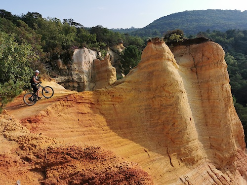
Popular Petit Luberon Mountain Biking Trails
• 100 ★ 4.0 • 3,074 ft • 333 ft • 63 •
Last part of the Vallon des Séyès Climb. It's hard to get to the top but you won't regret it as the to downhill starting from there are 5 stars enduro all natural trails
• 90 ★ 4.5 • 2 miles • 21 ft • 61 •
A long enduro stage ! Rocky and loose all way long ! You will find big rocks, rolling rocks, tight turns, ruff sections, wide open sections... the trail exit just outside Lourmarin Village
• 85 ★ 3.8 • 3,360 ft • 0 ft • 52 •
Popular red difficulty singletrack. This mountain bike primary trail can be used one direction and has a hard overall physical rating. It features rock garden. Trail visibility is always easy to follow. On average it takes 5 minutes to complete this trail.
• 60 ★ 0.0 • 1 mile • 9 ft • 51 •
Rocky and technical downhill section on the crest of "Petit Luberon" range of hills
• 80 ★ 5.0 • 1 mile • 185 ft • 39 •
Popular green difficulty singletrack. This mountain bike primary trail can be used both directions and has a moderate overall physical rating. Trail visibility is sometimes hard to follow. On average it takes 10 minutes to complete this trail.
• 60 ★ 3.7 • 2 miles • 40 ft • 36 •
Enduro Trail/Stage mainly rocky and wide open. One nasty right switchback around the end before a long off camber section.
• 55 ★ 0.0 • 1 mile • 443 ft • 35 •
A nice part of the Great Vaucluse Traversée (GTV). The downhill way should be funnier
• 100 ★ 0.0 • 3,484 ft • 21 ft • 32 •
Popular blue difficulty singletrack. This mountain bike primary trail can be used downhill primary and has a moderate overall physical rating with a 21 ft blue climb. Trail visibility is always easy to follow. On average it takes 7 minutes to complete this trail.
Petit Luberon Mountain Bike Routes
★ 4.0 • 25 miles • 4,461 ft • 9 • Loop •
La trace 42km de la rando du Luberon 2018 - Superbe tracé alternant pistes, chemins techniques et...
26 miles • 5,065 ft • 9 •
LE CYCLO CLUB DE MÉRINDOL PROPOSE SA RANDONNÉE ANNUELLE VTT . Pour cette nouvelle édition,6 nouveaux...
★ 1.0 • 41 miles • 7,978 ft • 5 • Loop •
All Mountain Raid around the Luberon mountain range ! Lots of technical sections so be careful ! You nedd...
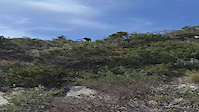
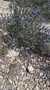
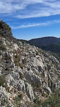
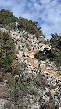
Photos of Petit Luberon Mountain Bike
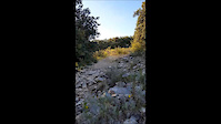
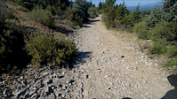
Videos of Petit Luberon Mountain Bike
trail: Onze Heures
0:27 |
|
Apr 4, 2024
trail: retourne toi
0:36 |
22 |
Feb 14, 2024
trail: retourne toi
0:22 |
19 |
Feb 14, 2024
trail: retourne toi
0:33 |
22 |
Feb 13, 2024
trail: Croix de Fer
0:09 |
169 |
Oct 13, 2018
trail: Sais
0:00 |
60 |
Feb 3, 2018
trail: Barraquet
2:03 |
63 |
Jun 23, 2016

trail: Grande Combe
0:45 |
54 |
Dec 2, 2015
Recent Trail Reports
| status | trail | date | condition | info | user |
|---|---|---|---|---|---|
| La Surfeuse | May 18, 2026 @ 4:26pm (Europe/Paris) May 18, 2026 | Ideal | tIJzUD | ||
| Tour Philippe | May 6, 2026 @ 11:24am (Europe/Paris) May 6, 2026 | Dry | freerider48 TRAILFORKS | ||
| Croix de Fer | Mar 31, 2026 @ 7:41am (Europe/Paris) Mar 30, 2026 | Ideal | zestyman | ||
| Combe du Bon Dieu | Dec 10, 2025 @ 9:47am (Europe/Monaco) Dec 10, 2025 | Ideal | BryanbaEN8V | ||
| Cap de Serre | Dec 10, 2025 @ 9:47am (Europe/Monaco) Dec 10, 2025 | Dry | BryanbaEN8V | ||
| Say Yes | Dec 10, 2025 @ 9:47am (Europe/Monaco) Dec 10, 2025 | Ideal | BryanbaEN8V | ||
| Vieux Mérindol Est | Oct 2, 2025 @ 11:35pm (Europe/Paris) Oct 2, 2025 | Ideal | casperjah | ||
| Les Buisses | Aug 3, 2025 @ 9:06am Aug 3, 2025 | Dry | RomainH | ||
| DFCI Pérussier | May 24, 2025 @ 9:35am May 24, 2025 | Dry | Alexair06 | ||
| L'Aiguebrun | May 24, 2025 @ 9:35am May 24, 2025 | Dry | Alexair06 |
National Scenic Trails & Official Routes
-
Grande Traversée VTT du Vaucluse
- Mountain Bike
- E-Bike
Activity Feed
| username | action | type | title | date |
|---|---|---|---|---|
| Georg753r9j | vote | trail | activity #95852218 | May 30, 2026 @ 7:57am May 30, 2026 |
| Georg753r9j | comment | trail | activity #95730650 | May 28, 2026 @ 1:39pm May 28, 2026 |
| tIJzUD | ridden | trail | activity #95101795 and 3 more | May 20, 2026 @ 5:48am May 20, 2026 |
| tIJzUD | vote | trail | activity #94974486 | May 18, 2026 @ 7:26am May 18, 2026 |
| tIJzUD | add | report | activity #94974471 | May 18, 2026 @ 7:26am May 18, 2026 |
Recent Comments
| username | type | title | comment | date |
|---|---|---|---|---|
| trail | Schwierigkeitsgrad auf jeden Fall S4. Wege oft... | May 28, 2026 @ 1:39pm May 28, 2026 | ||
| trail | Very overgrown and not bikable. Take an... | May 6, 2026 @ 1:52am May 6, 2026 | ||
| report | Tout à fait d'accord par de difficulté... | Jan 19, 2026 @ 4:46am Jan 19, 2026 | ||
| trail | Génial ! Super flowy. Pas de pièges. Rouge... | Nov 15, 2025 @ 12:53am Nov 15, 2025 | ||
| trail | Pierrier à la fin Ça passe en ebike mais... | Nov 15, 2025 @ 12:52am Nov 15, 2025 |
Nearby Areas
| name | distance | ||||
|---|---|---|---|---|---|
| Collines du Calavon | 19 | 12 | 5.1 km | ||
| La Roque d'Anthéron | 10 | 10 | 7.4 km | ||
| Le Défends d'Eyguières | 22 | 24 | 10.7 km | ||
| Grand Luberon | 11 | 38 | 13.9 km | ||
| Parc Naturel Régional du Mont-Ventoux | 2 | 61 | 20.3 km |
Local Badges
-

Completionist0 awarded
Activity Type Stats
| activitytype | trails | distance | descent | descent distance | total vertical | rating | global rank | state rank | photos | reports | routes | ridelogs |
|---|---|---|---|---|---|---|---|---|---|---|---|---|
| Mountain Bike | 130 | 142 miles | 44,019 ft | 84 miles | 2,041 ft | #715 | #20 | 50 | 198 | 5 | 1,022 | |
| E-Bike | 127 | 139 miles | 41,759 ft | 82 miles | 2,041 ft | #440 | #29 | 6 | 193 | 3 | 279 | |
| Horse | 2 | #501 | #16 | 23 | ||||||||
| Hike | 127 | 143 miles | 44,613 ft | 86 miles | 2,041 ft | #645 | #18 | 196 | 73 | |||
| Trail Running | 126 | 143 miles | 44,429 ft | 86 miles | 2,041 ft | #331 | #15 | 196 | 46 | |||
| ATV/ORV/OHV | 2 | 2 miles | 938 ft | 1 mile | 961 ft | 25 |
Frequently Asked Questions About Petit Luberon
▼
What are the highest rated mountain biking trails in Petit Luberon?
The highest rated mountain biking trails in Petit Luberon are:
- Combe du Bon Dieu (4.2/5)
- tête de suzede (4.1/5)
- Pic De l'Aigle Nord Ouest (4.1/5)
- Olibélix (4.1/5)
- retourne toi (4.1/5)
▼
What is the best time of the year to ride in Petit Luberon?
Based on ride log data, the most popular months to ride in Petit Luberon are:
- August (7 activities)
- October (5 activities)
- June (4 activities)
▼
Where can I park to ride in Petit Luberon?
There are 4 parking locations listed in Petit Luberon. The most popular parking spots are: View all parking and trailhead locations on the map to plan your visit.
▼
What is the longest trail in Petit Luberon?
The longest trail in Petit Luberon is SBCT at 4.4 miles. View all trails sorted by distance.
Activities
Trails
Points of Interest
- By tomzaniroli
 TRAILFORKS TFFRANCE & contributors
 - Admins: tomzaniroli
- #23562 - 8,058 views
- petit luberon activity log | embed map of Petit Luberon mountain bike trails | petit luberon mountain biking points of interest
Downloading of trail gps tracks in kml & gpx formats is enabled for Petit Luberon.
You must login to download files.