close
-
Layers w
- Weather Layers
- Pro
- Pro
- Pro
- Pro
- Pro
- Pro
- More Layers
- Pro
- Pro
- Pro
- Pro
-
Upgrade to

3D
Trail Conditions
- Unknown
- Snow Groomed
- Snow Packed
- Snow Covered
- Snow Cover Partial
- Freeze/thaw Cycle
- Icy
- Prevalent Mud
- Wet
- Variable
- Ideal
- Dry
- Very Dry
Trail Flow (Ridden Direction)
Trailforks scans users ridelogs to determine the most popular direction each trail is ridden. A good flowing trail network will have most trails flowing in a single direction according to their intension.
The colour categories are based on what percentage of riders are riding a trail in its intended direction.
The colour categories are based on what percentage of riders are riding a trail in its intended direction.
- > 96%
- > 90%
- > 80%
- > 70%
- > 50%
- < 50%
- bi-directional trail
- no data
Trail Last Ridden
Trailforks scans ridelogs to determine the last time a trail was ridden.
- < 2 days
- < 1 week
- < 2 weeks
- < 1 month
- < 6 months
- > 6 months
Trail Ridden Direction
The intended direction a trail should be ridden.
- Downhill Only
- Downhill Primary
- Both Directions
- Uphill Primary
- Uphill Only
- One Direction
Contribute Details
Colors indicate trail is missing specified detail.
- Description
- Photos
- Description & Photos
- Videos
Trail Popularity ?
Trailforks scans ridelogs to determine which trails are ridden the most in the last 9 months.
Trails are compared with nearby trails in the same city region with a possible 25 colour shades.
Think of this as a heatmap, more rides = more kinetic energy = warmer colors.
- most popular
- popular
- less popular
- not popular
ATV/ORV/OHV Filter
Max Vehicle Width
inches
US Cell Coverage
Legend

Radar Time
Activity Recordings
Trailforks uses anonymized public activity data.
?
Activity Recordings
Trailforks uses anonymized public activity data.
?
Personal Heatmap
▶
Activity Types
all
/
none
▶
Options
2
Date range
month
–
Winter Trails
Warning
A routing network for winter maps does not exist. Selecting trails using the winter trails layer has been disabled.
Missing Trails
Most Popular
Least Popular
Trails are colored based on popularity. The more popular a trail is, the more red. Less popular trails trend towards green.
Jump Magnitude Heatmap
Heatmap of where riders jump on trails. Zoom in to see individual jumps, click circles to view jump details.
BC Backroad Status
![map legend]()
Service Road Atlas is a free to use, community-driven service for viewing and creating reports on the numerous back-country service roads around B.C. and Alberta.

Slope Aspect
Direction the slope faces
Trails Deemphasized
Trails are shown in grey.
Only show trails with no bike usage.
Suggested Layers
Based on selected activity type
Save the current map location and zoom level as your default home location whenever this page is loaded.
Save
No description for Petrich has been added yet!
Login or register to submit one.
Activities Click to view
- Mountain Bike
14 trails
- Gravel Bike
0 trails
- Adaptive Bike
0 trails
- Hike
13 trails
- Trail Running
13 trails
Region Details
- 2
- 3
- 6
- 2
- 1
Region Status
Caution as of Mar 13, 2026Stats
- Avg Trail Rating
- Trails (view details)
- 14
- Trails Mountain Bike
- 14
- Trails E-Bike
- 3
- Trails Horse
- 1
- Trails Hike
- 13
- Trails Trail Running
- 13
- Trails Dirtbike/Moto
- 1
- Trails ATV/ORV/OHV
- 1
- Total Distance
- 14 miles
- Total Descent
- 5,705 ft
- Total Vertical
- 3,366 ft
- Highest Trailhead
- 4,167 ft
- Reports
- 21
- Photos
- 77
- Ridden Counter
- 257
Sub Regions
-
Belasitsa
- 2
- 3
- 2
- 1
Popular Petrich Mountain Biking Trails
• 100 ★ 4.5 • 1 mile • 96 ft • 39 •
Popular black diamond difficulty wilderness trail. This mountain bike primary trail can be used downhill primary and has a moderate overall physical rating. It features berm, drop, gap jump and rock garden. On average it takes 8 minutes to complete this trail.
• 80 ★ 5.0 • 853 ft • 18 ft • 31 •
Popular green difficulty family friendly singletrack. This mountain bike primary trail can be used downhill primary with a 18 ft green climb. On average it takes minutes to complete this trail.
• 5 ★ 5.0 • 3,466 ft • 1 ft • 30 •
Easy fun trail for XC and all-mtn riding. It crosses the road a couple ot times.
• 5 ★ 4.7 • 4,413 ft • 5 ft • 26 •
Less popular double black diamond difficulty singletrack. This mountain bike primary trail can be used downhill primary and has a moderate overall physical rating. It features drop and jump. On average it takes 7 minutes to complete this trail.
• 95 ★ 3.5 • 1 mile • 269 ft • 22 •
Popular blue difficulty singletrack. This mountain bike primary trail can be used downhill primary. It features berm, rock garden and wallride. On average it takes 8 minutes to complete this trail.
• 90 ★ 4.0 • 1,155 ft • 0 ft • 19 •
Popular blue difficulty singletrack. This mountain bike primary trail can be used downhill primary with a 0 ft blue climb. It features berm and rock garden. On average it takes minutes to complete this trail.
• 65 ★ 4.0 • 276 ft • 4 ft • 18 •
Moderately popular blue difficulty singletrack. This mountain bike primary trail can be used downhill primary and has a hard overall physical rating. It features berm. On average it takes minutes to complete this trail.
• 75 ★ 5.0 • 315 ft • 0 ft • 16 •
Popular green difficulty singletrack. This mountain bike primary trail can be used downhill primary. It features berm and jump. On average it takes minutes to complete this trail.
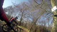
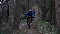
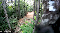
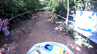
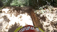
Photos of Petrich Mountain Bike
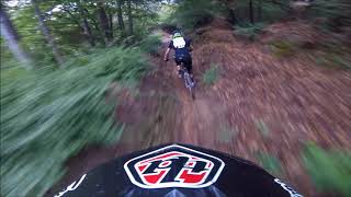
Videos of Petrich Mountain Bike
trail: Petrich Mini DH
0:55 |
44 |
Feb 10, 2020
trail: Petrich Mini DH
2:05 |
629 |
Mar 8, 2019
trail: Kongur Air DH
0:10 |
105 |
Jan 28, 2018

trail: Kongur Air DH
0:30 |
736 |
Aug 12, 2016
trail: Kongur Air DH
0:25 |
454 |
Jun 8, 2016
trail: Kongur Air DH
0:13 |
87 |
Aug 10, 2015

trail: Kongur Air DH
5:09 |
368 |
Aug 25, 2018 , Petrich
trail: Petrich Mini DH
4:02 |
332 |
Aug 25, 2018 , Petrich
Recent Trail Reports
| status | trail | date | condition | info | user |
|---|---|---|---|---|---|
| Short Path 2 | Feb 21, 2026 @ 11:03am (Europe/Sofia) Feb 21, 2026 | Wet | aplced | ||
| Short Path 1 | Feb 21, 2026 @ 11:03am (Europe/Sofia) Feb 21, 2026 | Wet | aplced | ||
| Connector Trail | Feb 21, 2026 @ 11:03am (Europe/Sofia) Feb 21, 2026 | Wet | aplced | ||
| Vizdolska Path | Feb 21, 2026 @ 11:03am (Europe/Sofia) Feb 21, 2026 | Wet | aplced | ||
| Petrich Mini DH | Feb 21, 2026 @ 11:03am (Europe/Sofia) Feb 21, 2026 | Wet | aplced | ||
| Душеваднико/Soulmate | Feb 21, 2026 @ 11:03am (Europe/Sofia) Feb 21, 2026 | Wet | aplced | ||
| Paprenitsa | May 15, 2021 @ 1:39am May 15, 2021 | Dry | 1stamenov | ||
| Kongur Air DH | Sep 26, 2020 @ 11:28pm Sep 26, 2020 | Wet | 1stamenov |
Activity Feed
| username | action | type | title | date |
|---|---|---|---|---|
| aplced | vote | trail | activity #89414878 and 1 more | Feb 23, 2026 @ 8:12am Feb 23, 2026 |
| aplced | vote | trail | activity #89414872 and 3 more | Feb 23, 2026 @ 8:12am Feb 23, 2026 |
| aplced | add | report | activity #89281525 and 1 more | Feb 21, 2026 @ 7:32am Feb 21, 2026 |
| aplced | add | report | activity #89281524 and 3 more | Feb 21, 2026 @ 7:32am Feb 21, 2026 |
| radeviq | add | trail | activity #89228152 | Feb 20, 2026 @ 9:03am Feb 20, 2026 |
Recent Comments
| username | type | title | comment | date |
|---|---|---|---|---|
| trail | Maybe you disabled the GPS download function.... | Nov 21, 2014 @ 12:06am Nov 21, 2014 | ||
| trail | GPS track was updated with the trail itself ,... | Nov 20, 2014 @ 11:09pm Nov 20, 2014 | ||
| trail | I don't see a GPS track. Do you have any? | Nov 19, 2014 @ 9:05am Nov 19, 2014 |
Local Badges
-

Epic Ride Climb 2k17 awarded -

Climbing 10k Badge4 awarded -

Climbing 100k Badge0 awarded -

Epic Ride Descent 2k55 awarded -

Descent 10k Badge9 awarded -

Descent 100k Badge1 awarded
Activity Type Stats
| activitytype | trails | distance | descent | descent distance | total vertical | rating | global rank | state rank | photos | reports | routes | ridelogs |
|---|---|---|---|---|---|---|---|---|---|---|---|---|
| Mountain Bike | 14 | 14 miles | 5,705 ft | 7 miles | 3,366 ft | #1,976 | #7 | 77 | 21 | 462 | ||
| E-Bike | 3 | 7 miles | 1,824 ft | 2 miles | 3,238 ft | 21 | 6 | |||||
| Horse | 1 | 5 miles | 95 ft | 2,657 ft | 1,955 ft | |||||||
| Hike | 13 | 13 miles | 4,678 ft | 5 miles | 3,294 ft | #2,404 | #11 | 21 | 13 | |||
| Trail Running | 13 | 13 miles | 4,678 ft | 5 miles | 3,294 ft | #1,932 | #11 | 21 | 4 | |||
| Dirtbike/Moto | 1 | 5 miles | 95 ft | 2,657 ft | 1,955 ft | |||||||
| ATV/ORV/OHV | 1 | 5 miles | 95 ft | 2,657 ft | 1,955 ft |
Frequently Asked Questions About Petrich
▼
What are the best places to ride in Petrich?
Petrich has 1 areas to explore for mountain biking. The top rated areas are:
▼
What are the highest rated mountain biking trails in Petrich?
The highest rated mountain biking trails in Petrich are:
- Ябълката (4.2/5)
- Kongur Air DH (4.2/5)
- Short Path 1 (4.1/5)
- Vizdolska Path (4.1/5)
- Paprenitsa (4.1/5)
▼
What is the best time of the year to ride in Petrich?
Based on ride log data, the most popular months to ride in Petrich are:
- May (7 activities)
- July (4 activities)
- December (2 activities)
▼
Where can I park to ride in Petrich?
Check the Petrich trail map for trailhead and parking information. Community members regularly update access and parking details for trails in the area.
Trails
Points of Interest
- By brenthillier
 NSMBA TRAILFORKS & contributors
 - Admins: pufalot
- #6500 - 3,465 views
- petrich activity log | embed map of Petrich mountain bike trails |
Downloading of trail gps tracks in kml & gpx formats is enabled for Petrich.
You must login to download files.