close
-
Layers w
- Weather Layers
- Pro
- Pro
- Pro
- Pro
- Pro
- Pro
- More Layers
- Pro
- Pro
- Pro
- Pro
-
Upgrade to

3D
Trail Conditions
- Unknown
- Snow Groomed
- Snow Packed
- Snow Covered
- Snow Cover Partial
- Freeze/thaw Cycle
- Icy
- Prevalent Mud
- Wet
- Variable
- Ideal
- Dry
- Very Dry
Trail Flow (Ridden Direction)
Trailforks scans users ridelogs to determine the most popular direction each trail is ridden. A good flowing trail network will have most trails flowing in a single direction according to their intension.
The colour categories are based on what percentage of riders are riding a trail in its intended direction.
The colour categories are based on what percentage of riders are riding a trail in its intended direction.
- > 96%
- > 90%
- > 80%
- > 70%
- > 50%
- < 50%
- bi-directional trail
- no data
Trail Last Ridden
Trailforks scans ridelogs to determine the last time a trail was ridden.
- < 2 days
- < 1 week
- < 2 weeks
- < 1 month
- < 6 months
- > 6 months
Trail Ridden Direction
The intended direction a trail should be ridden.
- Downhill Only
- Downhill Primary
- Both Directions
- Uphill Primary
- Uphill Only
- One Direction
Contribute Details
Colors indicate trail is missing specified detail.
- Description
- Photos
- Description & Photos
- Videos
Trail Popularity ?
Trailforks scans ridelogs to determine which trails are ridden the most in the last 9 months.
Trails are compared with nearby trails in the same city region with a possible 25 colour shades.
Think of this as a heatmap, more rides = more kinetic energy = warmer colors.
- most popular
- popular
- less popular
- not popular
ATV/ORV/OHV Filter
Max Vehicle Width
inches
US Cell Coverage
Legend

Radar Time
Activity Recordings
Trailforks uses anonymized public activity data.
?
Activity Recordings
Trailforks uses anonymized public activity data.
?
Personal Heatmap
▶
Activity Types
all
/
none
▶
Options
2
Date range
month
–
Winter Trails
Warning
A routing network for winter maps does not exist. Selecting trails using the winter trails layer has been disabled.
Missing Trails
Most Popular
Least Popular
Trails are colored based on popularity. The more popular a trail is, the more red. Less popular trails trend towards green.
Jump Magnitude Heatmap
Heatmap of where riders jump on trails. Zoom in to see individual jumps, click circles to view jump details.
BC Backroad Status
![map legend]()
Service Road Atlas is a free to use, community-driven service for viewing and creating reports on the numerous back-country service roads around B.C. and Alberta.

Slope Aspect
Direction the slope faces
Trails Deemphasized
Trails are shown in grey.
Only show trails with no bike usage.
Suggested Layers
Based on selected activity type
Save the current map location and zoom level as your default home location whenever this page is loaded.
Save
No description for Pezinok has been added yet!
Login or register to submit one.
Activities Click to view
- Mountain Bike
28 trails
- E-Bike
16 trails
- Adaptive Bike
0 trails
- Winter Fat Bike
0 trails
- Hike
14 trails
- Trail Running
14 trails
Region Details
- 4
- 10
- 5
- 3
Region Status
Open as of May 31, 2026Stats
- Avg Trail Rating
- Global Ranking
- #1,977
- State Ranking
- #22
- Trails (view details)
- 23
- Trails Mountain Bike
- 28
- Trails E-Bike
- 16
- Trails Hike
- 14
- Trails Trail Running
- 14
- Trails Snowshoe
- 1
- Trails Nordic Ski
- 1
- Total Distance
- 26 miles
- Total Descent
- 7,348 ft
- Total Vertical
- 1,717 ft
- Highest Trailhead
- 2,226 ft
- Reports
- 476
- Photos
- 70
- Ridden Counter
- 1,779
Sub Regions
-
Babské Traily
- 2
- 1
- 3
-
Modra
- 2
-
Svaty Jur
- 2
- 2
Popular Pezinok Mountain Biking Trails
• 90 ★ 1.4 • 4,347 ft • 206 ft • 182 •
Popular green difficulty mixed. This multi-use trail can be used both directions and has a easy overall physical rating with a 206 ft blue climb. Adaptive MTB rating: amtb green. Trail visibility is always easy to follow. On average it takes 10 minutes to complete this trail.
• 100 ★ 0.0 • 5,000 ft • 122 ft • 146 •
Popular green difficulty singletrack. This mountain bike primary trail can be used both directions. On average it takes 7 minutes to complete this trail.
• 95 ★ 4.0 • 2,195 ft • 0 ft • 106 •
Legálny trail vytvorený v rámci OZ Babské traily. Začiatok je na konci trailu , resp. pár metrov od závory po modrej smerom na Pezinok.
• 75 ★ 4.4 • 2 miles • 41 ft • 103 •
Popular green difficulty singletrack. This mountain bike primary trail can be used both directions and has a easy overall physical rating with a 41 ft green climb. On average it takes 10 minutes to complete this trail.
• 100 ★ 5.0 • 1,814 ft • 0 ft • 97 •
Legálny trail vytvorený v rámci OZ Babské traily. Začiatok je na hornej stanici vleku VL1000. Prístup k trailu cez alebo
• 80 ★ 4.8 • 5,000 ft • 10 ft • 82 •
Popular blue difficulty singletrack. This mountain bike primary trail can be used downhill primary. It features jump and rock garden. On average it takes 6 minutes to complete this trail.
• 85 ★ 5.0 • 4,898 ft • 16 ft • 69 •
Nový legálny trail vytvorený v rámci OZ Babské traily. Začiatok ide cez pôvodný Secret trail ktorý ide smerom do PK. Odpája sa z neho po dvojvlne hned za rockgardenom a pokračuje k dolnej stanici vleku VL1000.
• 5 ★ 0.0 • 1 mile • 10 ft • 67 •
Less popular blue difficulty other. This mountain bike primary trail and has a easy overall physical rating. It features jump. Trail visibility is always easy to follow.
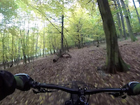
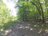
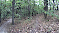
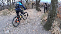
Pezinok Mountain Bike Routes
Photos of Pezinok Mountain Bike
Videos of Pezinok Mountain Bike
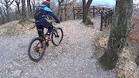
trail: 3 Zamky
0:55 |
201 |
Oct 27, 2020
trail: Biely Kameň
5:02 |
240 |
Aug 13, 2020
trail: Whyte trail
2:11 |
274 |
Oct 4, 2019
trail: 3 Zamky
4:22 |
1034 |
Nov 18, 2018
trail: 3 Zamky
|
Nov 18, 2018
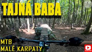
trail: Tajná Baba
6:27 |
35 |
Jan 29, 2026 , Pezinok
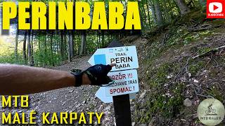
trail: PerinBaba
6:01 |
47 |
Jan 6, 2026 , Pezinok

trail: Trail pod Konskými hlavami
5:14 |
126 |
Mar 10, 2024 , Pezinok
Recent Trail Reports
| status | trail | date | condition | info | user |
|---|---|---|---|---|---|
| Secret Trail PKBABA | May 31, 2026 @ 11:07pm (America/Los_Angeles) May 31, 2026 | Dry | MatejBraun | ||
| Výšlapka Krátka | May 31, 2026 @ 11:06pm (America/Los_Angeles) May 31, 2026 | Dry | MatejBraun | ||
| Prvá Baba | May 31, 2026 @ 11:05pm (America/Los_Angeles) May 31, 2026 | Dry | MatejBraun | ||
| Slnečný Chodník Trail | Jun 1, 2026 @ 8:04am (Europe/Bratislava) May 31, 2026 | Dry | MatejBraun | ||
| PerinBaba | May 31, 2026 @ 11:49am (America/Vancouver) May 31, 2026 | Dry | mimozemstan | ||
| Výšlapka Dlhá | May 24, 2026 @ 1:45pm (Europe/Bratislava) May 24, 2026 | Very Dry | Konikpk | ||
| Trail pod Konskými hlavami | May 24, 2026 @ 1:45pm (Europe/Bratislava) May 24, 2026 | Very Dry | Konikpk | ||
| Vyšlapka extrem | May 21, 2026 @ 10:43am (Europe/Bratislava) May 21, 2026 | Ideal | miskolci | ||
| Prvá Baba | May 21, 2026 @ 10:43am (Europe/Bratislava) May 21, 2026 | Ideal | miskolci | ||
| 3 Zamky | May 5, 2026 @ 7:27am (Europe/Bratislava) May 4, 2026 | Very Dry | slinko |
Activity Feed
| username | action | type | title | date |
|---|---|---|---|---|
| MatejBraun | add | report | activity #96000584 and 2 more | May 31, 2026 @ 11:06pm May 31, 2026 |
| MatejBraun | add | report | activity #96000533 | May 31, 2026 @ 11:04pm May 31, 2026 |
| mimozemstan | add | report | activity #95964271 | May 31, 2026 @ 11:49am May 31, 2026 |
| Konikpk | add | report | activity #95440337 and 1 more | May 24, 2026 @ 1:18pm May 24, 2026 |
| miskolci | add | report | activity #95186458 | May 21, 2026 @ 10:43am May 21, 2026 |
Recent Comments
| username | type | title | comment | date |
|---|---|---|---|---|
| report | potvrdzujem, totálne zarastené, západné... | Mar 26, 2025 @ 7:24am Mar 26, 2025 | ||
| report | Pekny trail. | May 28, 2024 @ 3:49am May 28, 2024 | ||
| trail | Velmi vela velmi nizkych klopeniek. | Apr 4, 2024 @ 2:32am Apr 4, 2024 | ||
| trail | Neznaceny, velmi tazko sledovatelny chodnik po... | Oct 22, 2023 @ 12:18pm Oct 22, 2023 | ||
| trail | vrchna cast krasny flow trail, potom od hradu... | Oct 8, 2023 @ 11:50am Oct 8, 2023 |
Local Badges
-

Epic Ride Climb 2k109 awarded -

Climbing 10k Badge50 awarded -

Climbing 100k Badge11 awarded -

Epic Ride Descent 2k109 awarded -

Descent 10k Badge50 awarded -

Descent 100k Badge11 awarded
Bike & Skill Parks
| name | type | city | rating |
|---|---|---|---|
| Panšula Park Báhoň | skill park | Pezinok |
Activity Type Stats
| activitytype | trails | distance | descent | descent distance | total vertical | rating | global rank | state rank | photos | reports | routes | ridelogs |
|---|---|---|---|---|---|---|---|---|---|---|---|---|
| Mountain Bike | 28 | 24 miles | 7,238 ft | 16 miles | 1,716 ft | #1,977 | #22 | 70 | 475 | 4 | 12,247 | |
| E-Bike | 16 | 10 miles | 2,333 ft | 4 miles | 1,467 ft | #1,399 | #16 | 401 | 4 | 1,241 | ||
| Hike | 14 | 20 miles | 5,469 ft | 14 miles | 1,716 ft | #2,062 | #22 | 399 | 1 | 939 | ||
| Trail Running | 14 | 20 miles | 5,469 ft | 14 miles | 1,716 ft | #1,633 | #21 | 399 | 177 | |||
| Snowshoe | 1 | 4,347 ft | 49 ft | 1,181 ft | 157 ft | 1 | ||||||
| Nordic Ski | 1 | 4,347 ft | 49 ft | 1,181 ft | 157 ft | 123 |
Frequently Asked Questions About Pezinok
▼
What are the best places to ride in Pezinok?
Pezinok has 3 areas to explore for mountain biking. The top rated areas are:
▼
What are the highest rated mountain biking trails in Pezinok?
The highest rated mountain biking trails in Pezinok are:
- Secret Trail PKBABA (4.4/5)
- 3 Zamky (4.3/5)
- Tajná Baba (4.2/5)
- Slnečný Chodník Trail (4.2/5)
- Prvá Baba (4.1/5)
▼
What is the best time of the year to ride in Pezinok?
Based on ride log data, the most popular months to ride in Pezinok are:
- June (107 activities)
- July (100 activities)
- May (87 activities)
▼
Where can I park to ride in Pezinok?
There are 1 parking locations listed in Pezinok. The most popular parking spots are:
Activities
Trails
Points of Interest
- By 4bob & contributors
- Admins: apply
- #20477 - 7,079 views
- pezinok activity log | embed map of Pezinok mountain bike trails | pezinok mountain biking points of interest
Downloading of trail gps tracks in kml & gpx formats is enabled for Pezinok.
You must login to download files.