close
-
Layers w
- Weather Layers
- Pro
- Pro
- Pro
- Pro
- Pro
- Pro
- More Layers
- Pro
- Pro
- Pro
- Pro
-
Upgrade to

3D
Trail Conditions
- Unknown
- Snow Groomed
- Snow Packed
- Snow Covered
- Snow Cover Partial
- Freeze/thaw Cycle
- Icy
- Prevalent Mud
- Wet
- Variable
- Ideal
- Dry
- Very Dry
Trail Flow (Ridden Direction)
Trailforks scans users ridelogs to determine the most popular direction each trail is ridden. A good flowing trail network will have most trails flowing in a single direction according to their intension.
The colour categories are based on what percentage of riders are riding a trail in its intended direction.
The colour categories are based on what percentage of riders are riding a trail in its intended direction.
- > 96%
- > 90%
- > 80%
- > 70%
- > 50%
- < 50%
- bi-directional trail
- no data
Trail Last Ridden
Trailforks scans ridelogs to determine the last time a trail was ridden.
- < 2 days
- < 1 week
- < 2 weeks
- < 1 month
- < 6 months
- > 6 months
Trail Ridden Direction
The intended direction a trail should be ridden.
- Downhill Only
- Downhill Primary
- Both Directions
- Uphill Primary
- Uphill Only
- One Direction
Contribute Details
Colors indicate trail is missing specified detail.
- Description
- Photos
- Description & Photos
- Videos
Trail Popularity ?
Trailforks scans ridelogs to determine which trails are ridden the most in the last 9 months.
Trails are compared with nearby trails in the same city region with a possible 25 colour shades.
Think of this as a heatmap, more rides = more kinetic energy = warmer colors.
- most popular
- popular
- less popular
- not popular
ATV/ORV/OHV Filter
Max Vehicle Width
inches
US Cell Coverage
Legend

Radar Time
Activity Recordings
Trailforks uses anonymized public activity data.
?
Activity Recordings
Trailforks uses anonymized public activity data.
?
Personal Heatmap
▶
Activity Types
all
/
none
▶
Options
2
Date range
month
–
Winter Trails
Warning
A routing network for winter maps does not exist. Selecting trails using the winter trails layer has been disabled.
Missing Trails
Most Popular
Least Popular
Trails are colored based on popularity. The more popular a trail is, the more red. Less popular trails trend towards green.
Jump Magnitude Heatmap
Heatmap of where riders jump on trails. Zoom in to see individual jumps, click circles to view jump details.
BC Backroad Status
![map legend]()
Service Road Atlas is a free to use, community-driven service for viewing and creating reports on the numerous back-country service roads around B.C. and Alberta.

Slope Aspect
Direction the slope faces
Trails Deemphasized
Trails are shown in grey.
Only show trails with no bike usage.
Suggested Layers
Based on selected activity type
Save the current map location and zoom level as your default home location whenever this page is loaded.
SavePopular Trail Networks
view all areas »
No description for Philippines has been added yet!
Login or register to submit one.
Region Details
- 31
- 7
- 56
- 113
- 46
- 1
Stats
- Avg Trail Rating
- Trails (view details)
- 267
- Trails Mountain Bike
- 277
- Trails E-Bike
- 99
- Trails Horse
- 15
- Trails Hike
- 199
- Trails Trail Running
- 197
- Trails Dirtbike/Moto
- 12
- Trails Observed Trials
- 2
- Trails ATV/ORV/OHV
- 9
- Total Distance
- 485 miles
- Total Descent
- 139,517 ft
- Total Vertical
- 9,557 ft
- Highest Trailhead
- 9,564 ft
- Reports
- 624
- Photos
- 803
- Ridden Counter
- 1,750
Articles

Race Report: The Tarlac Enduro Attack 6 - Monasterio de Tarla, Philippines
Jan 20, 2020 from pinkbike.com
Monasterio de Tarlac hosted the 6th installment of the Tarlac Enduro Attack presented by Specialized PH and Fox Philippines.
Sub Regions
- Bangsamoro Autonomous Region in Muslim Mindanao (0)
- Bicol (11)
- Albay (8)
- Guinobatan (3)
- Legazpi City (6)
- Camarines Sur (3)
- Naga City (3)
- Albay (8)
- Cagayan Valley (0)
- Cagayan (1)
- Tuguegarao (1)
- Cagayan (1)
- Calabarzon (58)
- Caraga (0)
- Central Luzon (41)
- Bataan (3)
- Balanga (2)
- Nueva Ecija (3)
- Bongabon (4)
- San Jose City, Nueva Ecija (3)
- Pampanga (5)
- Tarlac (8)
- Capas (1)
- Tarlac City (8)
- Zambales (15)
- Olongapo (14)
- Bataan (3)
- Central Visayas (54)
- Cordillera Administrative Region (2)
- Abra (3)
- Bangued (3)
- Benguet (5)
- Baguio City (4)
- Mountain Province (1)
- Abra (3)
- Davao Region (32)
- Davao De Oro (1)
- Maco (1)
- Davao del Norte (1)
- Panabo City (3)
- Tagum City (1)
- Davao del Sur (23)
- Davao City (25)
- Malalag (0)
- Davao Oriental (1)
- Mati (1)
- Davao De Oro (1)
- Eastern Visayas (1)
- Leyte (1)
- Tacloban City (1)
- Leyte (1)
- Ilocos Region (0)
- Ilocos Norte (10)
- Batac (8)
- Laoag City (4)
- Ilocos Sur (22)
- Pidigan (4)
- Vigan City (20)
- La Union (1)
- Ilocos Norte (10)
- MIMAROPA (0)
- National Capitol Region (0)
- Marikina (1)
- Muntinlupa (1)
- Quezon City (4)
- Marikina (1)
- Northern Mindanao (15)
- Misamis Occidental (4)
- Clarin (4)
- Oroquieta City (1)
- Misamis Oriental (6)
- Cagayan De Oro (5)
- Misamis Occidental (4)
- Soccsksargen (0)
- North Cotabato (2)
- Kidapawan (2)
- North Cotabato (2)
- Western Visayas (0)
- Aklan (0)
- Capiz (2)
- Roxas City (2)
- Iloilo (3)
- Anilao (1)
- Dingle (1)
- Santa Barbara (1)
- Negros Occidental (1)
- Escalante (1)
- Aklan (0)
- Zamboanga Peninsula (10)
- Zamboanga del Norte (9)
- Dapitan (2)
- Dipolog City (5)
- Katipunan (2)
- Zamboanga del Norte (9)
Popular Philippines Mountain Biking Trails
• 100 ★ 3.5 • 3 miles • 211 ft • 64 •
Popular green difficulty singletrack. This mountain bike primary trail can be used both directions and has a moderate overall physical rating with a 211 ft green climb. On average it takes 1 hour7 minutes to complete this trail.
• 5 ★ 4.0 • 1 mile • 111 ft • 50 •
Less popular blue difficulty singletrack. This mountain bike primary trail can be used both directions and has a moderate overall physical rating with a 111 ft blue climb. It features berm. On average it takes 18 minutes to complete this trail.
• 5 ★ 5.0 • 5 miles • 344 ft • 45 •
Less popular blue difficulty singletrack. This mountain bike primary trail can be used both directions and has a hard overall physical rating with a 344 ft green climb. It features berm and roller coaster. On average it takes 44 minutes to complete this trail.
Maarat Basic Permanently Closed
• 40 ★ 4.0 • 1 mile • 41 ft • 41 •
Double track dirt road that leads towards Gate 2
• 45 ★ 5.0 • 3 miles • 382 ft • 36 •
Moderately popular blue difficulty singletrack. This mountain bike primary trail can be used one direction and has a hard overall physical rating with a 382 ft blue climb. It features drop and roller coaster. Trail visibility is sometimes hard to follow. On average it takes 37 minutes to complete this trail.
• 100 ★ 4.0 • 3,317 ft • 278 ft • 32 •
BILL & TED is a climbing trail that meanders through a forested area before meeting up with SKYLINE and ending at the LAUNCH PAD.
• 80 ★ 3.0 • 4 miles • 323 ft • 32 •
Popular green difficulty singletrack. This mountain bike primary trail can be used both directions and has a moderate overall physical rating with a 323 ft green climb. Trail visibility is always easy to follow. On average it takes 3 hours38 minutes to complete this trail.
• 85 ★ 5.0 • 4,662 ft • 0 ft • 30 •
A local trail located in SBMA can be either climbed or descended.
Philippines Mountain Bike Routes
★ 5.0 • 2 miles • 417 ft • 7 • Loop •
From LAUNCH PAD, Clear Dragon's Breath & Dragon's Belly, then turn left via into the techy Travel back...
★ 5.0 • 2 miles • 387 ft • 4 • Point to Point •
This flowy and fun route stacks two awesome trails into one tasty ride. Layer 1: * Flow like water through...
★ 5.0 • 2 miles • 406 ft • 6 • Loop •
From LAUNCH PAD, surf down the upper portion of Keep right to get technical at After clearing the step up,...
★ 4.0 • 3 miles • 531 ft • 5 • Loop •
Start with Add a dash of Snake up Re- ! Climb at your own pace up M*A*S*H* Finish strong with BILL & TED
★ 4.0 • 2 miles • 439 ft • 4 • Loop •
Spring Roll is a fun starter loop that avoids most of the technical features on and the climbs of . Riders...
★ 4.0 • 4 miles • 652 ft • 8 • Loop •
Start with Sharp left to Snake your way through Head down (and up) Re- Take your time up M*A*S*H* Finish...
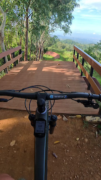
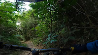
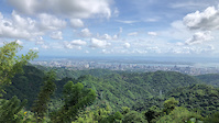
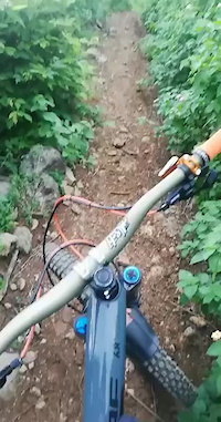
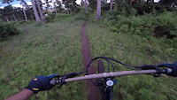
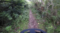
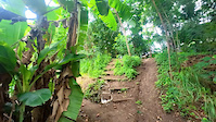
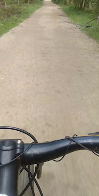
Photos of Philippines Mountain Bike
Videos of Philippines Mountain Bike
0:29 |
10 |
May 25, 2025
trail: Leo Line
3:11 |
6 |
Mar 1, 2025
trail: Mt. Babag to Napo
0:05 |
|
Sep 14, 2024
trail: DJ Trail
0:06 |
15 |
Jun 26, 2023
trail: Sugcad Stage 2
0:56 |
33 |
Sep 22, 2022
trail: Nagas Treats
0:27 |
28 |
Sep 19, 2022
trail: Filinvest Bike Trails
0:09 |
172 |
Aug 9, 2022
trail: Green Rocky
0:09 |
14 |
May 6, 2022
Recent Comments
| username | type | title | comment | date |
|---|---|---|---|---|
| trail | February 20, 2026 This trail is closed... | Mar 16, 2026 @ 9:09pm Mar 16, 2026 | ||
| trail | This is G-Flow | Feb 20, 2026 @ 2:00pm Feb 20, 2026 | ||
| trail | Doesn't exist anymore! It's a road now. | Mar 7, 2025 @ 1:12pm Mar 7, 2025 | ||
| trail | test24 | Aug 20, 2024 @ 9:32am Aug 20, 2024 | ||
| trail | test1 | Aug 20, 2024 @ 9:22am Aug 20, 2024 |
Bike & Skill Parks
| name | type | city | rating |
|---|---|---|---|
| The Bike Playground | skill park | Taytay | |
| Rascal's Skill Park | skill park | Davao City | |
| DJ Park | skill park | Tacloban City |
Activity Type Stats
| activitytype | trails | distance | descent | descent distance | total vertical | rating | global rank | state rank | photos | reports | routes | ridelogs |
|---|---|---|---|---|---|---|---|---|---|---|---|---|
| Mountain Bike | 273 | 456 miles | 131,519 ft | 262 miles | 6,001 ft | #52 | 809 | 630 | 31 | 56,023 | ||
| E-Bike | 99 | 121 miles | 29,564 ft | 68 miles | 2,766 ft | #66 | 498 | 15 | 384 | |||
| Horse | 15 | 25 miles | 3,465 ft | 8 miles | 3,123 ft | #58 | 262 | |||||
| Hike | 199 | 393 miles | 117,972 ft | 215 miles | 9,557 ft | #61 | 562 | 2 | 1,520 | |||
| Trail Running | 197 | 397 miles | 118,199 ft | 217 miles | 9,557 ft | #57 | 559 | 2 | 367 | |||
| Dirtbike/Moto | 12 | 12 miles | 3,465 ft | 7 miles | 1,063 ft | #60 | 260 | 1 | 25 | |||
| Observed Trials | 2 | 3 miles | 850 ft | 3 miles | 771 ft | #48 | 1 | 1 | ||||
| ATV/ORV/OHV | 9 | 24 miles | 2,018 ft | 5 miles | 3,123 ft | #46 | 187 | 1 |
Activities
Trails
- By canadaka
 Trailforks & contributors
 - Admins: apply
- #5337 - 36,482 views
- philippines activity log | embed map of Philippines mountain bike trails | philippines mountain biking points of interest
Downloading of trail gps tracks in kml & gpx formats is enabled for Philippines.
You must login to download files.