close
-
Layers w
- Weather Layers
- Pro
- Pro
- Pro
- Pro
- Pro
- Pro
- More Layers
- Pro
- Pro
- Pro
- Pro
-
Upgrade to

3D
Trail Conditions
- Unknown
- Snow Groomed
- Snow Packed
- Snow Covered
- Snow Cover Partial
- Freeze/thaw Cycle
- Icy
- Prevalent Mud
- Wet
- Variable
- Ideal
- Dry
- Very Dry
Trail Flow (Ridden Direction)
Trailforks scans users ridelogs to determine the most popular direction each trail is ridden. A good flowing trail network will have most trails flowing in a single direction according to their intension.
The colour categories are based on what percentage of riders are riding a trail in its intended direction.
The colour categories are based on what percentage of riders are riding a trail in its intended direction.
- > 96%
- > 90%
- > 80%
- > 70%
- > 50%
- < 50%
- bi-directional trail
- no data
Trail Last Ridden
Trailforks scans ridelogs to determine the last time a trail was ridden.
- < 2 days
- < 1 week
- < 2 weeks
- < 1 month
- < 6 months
- > 6 months
Trail Ridden Direction
The intended direction a trail should be ridden.
- Downhill Only
- Downhill Primary
- Both Directions
- Uphill Primary
- Uphill Only
- One Direction
Contribute Details
Colors indicate trail is missing specified detail.
- Description
- Photos
- Description & Photos
- Videos
Trail Popularity ?
Trailforks scans ridelogs to determine which trails are ridden the most in the last 9 months.
Trails are compared with nearby trails in the same city region with a possible 25 colour shades.
Think of this as a heatmap, more rides = more kinetic energy = warmer colors.
- most popular
- popular
- less popular
- not popular
ATV/ORV/OHV Filter
Max Vehicle Width
inches
US Cell Coverage
Legend

Radar Time
Activity Recordings
Trailforks uses anonymized public activity data.
?
Activity Recordings
Trailforks uses anonymized public activity data.
?
Personal Heatmap
▶
Activity Types
all
/
none
▶
Options
2
Date range
month
–
Winter Trails
Warning
A routing network for winter maps does not exist. Selecting trails using the winter trails layer has been disabled.
Missing Trails
Most Popular
Least Popular
Trails are colored based on popularity. The more popular a trail is, the more red. Less popular trails trend towards green.
Jump Magnitude Heatmap
Heatmap of where riders jump on trails. Zoom in to see individual jumps, click circles to view jump details.
BC Backroad Status
![map legend]()
Service Road Atlas is a free to use, community-driven service for viewing and creating reports on the numerous back-country service roads around B.C. and Alberta.

Slope Aspect
Direction the slope faces
Trails Deemphasized
Trails are shown in grey.
Only show trails with no bike usage.
Suggested Layers
Based on selected activity type
Save the current map location and zoom level as your default home location whenever this page is loaded.
Save
No description for Philpstoun has been added yet!
Login or register to submit one.
This region uses the Uk/Euro style trail grading system.
Activities Click to view
- Mountain Bike
19 trails
- Adaptive Bike
0 trails
- Hike
19 trails
- Trail Running
19 trails
Region Details
- 1
- 1
- 7
- 3
- 7
Region Status
Open as of Jun 10, 2026Stats
- Avg Trail Rating
- Trails (view details)
- 19
- Trails Mountain Bike
- 19
- Trails E-Bike
- 1
- Trails Hike
- 19
- Trails Trail Running
- 19
- Total Distance
- 3 miles
- Total Descent
- 316 ft
- Total Vertical
- 109 ft
- Highest Trailhead
- 345 ft
- Reports
- 55
- Photos
- 1
- Ridden Counter
- 499
Popular Philpstoun Mountain Biking Trails
• 5 ★ 0.0 • 282 ft • 0 ft • 60 •
Less popular black difficulty singletrack. This mountain bike primary trail can be used one direction. On average it takes 1 minutes to complete this trail.
• 85 ★ 3.5 • 747 ft • 0 ft • 29 •
Popular red difficulty singletrack. This mountain bike primary trail can be used both directions. On average it takes 4 minutes to complete this trail.
• 90 ★ 3.0 • 464 ft • 0 ft • 24 •
Popular black difficulty singletrack. This mountain bike primary trail can be used both directions. On average it takes 2 minutes to complete this trail.
• 80 ★ 4.0 • 404 ft • 4 ft • 24 •
Popular black difficulty singletrack. This mountain bike primary trail can be used downhill primary. On average it takes 2 minutes to complete this trail.
• 5 ★ 0.0 • 513 ft • 0 ft • 21 •
Less popular black difficulty singletrack. This mountain bike primary trail can be used both directions. On average it takes 5 minutes to complete this trail.
• 5 ★ 0.0 • 304 ft • 23 ft • 20 •
Less popular red difficulty singletrack. This mountain bike primary trail can be used both directions. On average it takes 2 minutes to complete this trail.
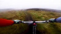
Videos of Philpstoun Mountain Bike
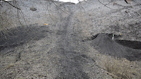
trail: Philpstoun Enduro
0:05 |
474 |
Mar 4, 2021

trail: Eastline
0:04 |
208 |
Jan 13, 2021

trail: Philpstoun Enduro
0:06 |
232 |
Jan 12, 2021

trail: True Story
17:28 |
862 |
May 4, 2018
trail: Drop Line
2:05 |
243 |
Jan 7, 2017
Recent Trail Reports
| status | trail | date | condition | info | user |
|---|---|---|---|---|---|
| True Story | Sep 16, 2024 @ 11:21am Sep 16, 2024 | Variable | Keeferoo | ||
| West Wall | Sep 16, 2024 @ 11:21am Sep 16, 2024 | Ideal | Keeferoo | ||
| Techy Link | Apr 21, 2023 @ 10:31pm Apr 21, 2023 | Ideal | Keeferoo | ||
| Loam Link | Apr 21, 2023 @ 10:31pm Apr 21, 2023 | Ideal | Keeferoo | ||
| Access Road | Apr 21, 2023 @ 10:31pm Apr 21, 2023 | Ideal | Keeferoo | ||
| League of Extraordinary Nobodies | Apr 21, 2023 @ 10:31pm Apr 21, 2023 | Ideal | Keeferoo | ||
| Deep Space 9mm | Apr 21, 2023 @ 10:31pm Apr 21, 2023 | Ideal | Keeferoo | ||
| Rocky Ridge | Apr 21, 2023 @ 10:31pm Apr 21, 2023 | Ideal | Keeferoo | ||
| Bing Circular | Apr 21, 2023 @ 10:31pm Apr 21, 2023 | Ideal | Keeferoo | ||
| Eastline | Apr 21, 2023 @ 10:31pm Apr 21, 2023 | Ideal | Keeferoo |
Activity Feed
| username | action | type | title | date |
|---|---|---|---|---|
| Keeferoo | add | report | activity #58966138 and 1 more | Sep 16, 2024 @ 6:31am Sep 16, 2024 |
| GIB-ON | add | photo | activity #52838606 | May 19, 2024 @ 1:56pm May 19, 2024 |
| GIB-ON | comment | trail | activity #52838508 | May 19, 2024 @ 1:54pm May 19, 2024 |
| GIB-ON | vote | trail | activity #52838450 | May 19, 2024 @ 1:53pm May 19, 2024 |
| SunnyToast17 | ridden | trail | activity #39953652 and 3 more | May 14, 2023 @ 8:41am May 14, 2023 |
Recent Comments
| username | type | title | comment | date |
|---|---|---|---|---|
| trail | Thanks for building this line | May 19, 2024 @ 1:54pm May 19, 2024 | ||
| report | will try and get along this week to clear | Jun 27, 2021 @ 12:08pm Jun 27, 2021 |
Local Badges
-

Epic Ride Climb 2k5 awarded -

Climbing 10k Badge1 awarded -

Climbing 100k Badge0 awarded -

Epic Ride Descent 2k5 awarded -

Descent 10k Badge1 awarded -

Descent 100k Badge0 awarded
Activity Type Stats
| activitytype | trails | distance | descent | descent distance | total vertical | rating | global rank | state rank | photos | reports | routes | ridelogs |
|---|---|---|---|---|---|---|---|---|---|---|---|---|
| Mountain Bike | 19 | 3 miles | 315 ft | 1 mile | 108 ft | #10,115 | #399 | 1 | 55 | 842 | ||
| E-Bike | 1 | 3,822 ft | 230 ft | 39 ft | 30 | 36 | ||||||
| Hike | 19 | 3 miles | 315 ft | 1 mile | 108 ft | #11,174 | #390 | 55 | 14 | |||
| Trail Running | 19 | 3 miles | 315 ft | 1 mile | 108 ft | #10,787 | #384 | 55 | 43 |
Frequently Asked Questions About Philpstoun
▼
What are the highest rated mountain biking trails in Philpstoun?
The highest rated mountain biking trails in Philpstoun are:
- Philpstoun XC (4/5)
- League of Extraordinary Nobodies (4/5)
- Philpstoun Enduro (4/5)
- EMG (4/5)
- Eastline (3.9/5)
▼
What is the best time of the year to ride in Philpstoun?
Based on ride log data, the most popular months to ride in Philpstoun are:
- June (5 activities)
- May (3 activities)
- April (2 activities)
▼
Where can I park to ride in Philpstoun?
There are 1 parking locations listed in Philpstoun. The most popular parking spots are:
▼
What is the longest trail in Philpstoun?
The longest trail in Philpstoun is Path at 3,822 ft. View all trails sorted by distance.
- By gmcc & contributors
- Admins: DMBinS, FLS
- #24836 - 2,378 views
- philpstoun activity log | embed map of Philpstoun mountain bike trails | philpstoun mountain biking points of interest
Downloading of trail gps tracks in kml & gpx formats is enabled for Philpstoun.
You must login to download files.