close
-
Layers w
- Weather Layers
- Pro
- Pro
- Pro
- Pro
- Pro
- Pro
- More Layers
- Pro
- Pro
- Pro
- Pro
-
Upgrade to

3D
Trail Conditions
- Unknown
- Snow Groomed
- Snow Packed
- Snow Covered
- Snow Cover Partial
- Freeze/thaw Cycle
- Icy
- Prevalent Mud
- Wet
- Variable
- Ideal
- Dry
- Very Dry
Trail Flow (Ridden Direction)
Trailforks scans users ridelogs to determine the most popular direction each trail is ridden. A good flowing trail network will have most trails flowing in a single direction according to their intension.
The colour categories are based on what percentage of riders are riding a trail in its intended direction.
The colour categories are based on what percentage of riders are riding a trail in its intended direction.
- > 96%
- > 90%
- > 80%
- > 70%
- > 50%
- < 50%
- bi-directional trail
- no data
Trail Last Ridden
Trailforks scans ridelogs to determine the last time a trail was ridden.
- < 2 days
- < 1 week
- < 2 weeks
- < 1 month
- < 6 months
- > 6 months
Trail Ridden Direction
The intended direction a trail should be ridden.
- Downhill Only
- Downhill Primary
- Both Directions
- Uphill Primary
- Uphill Only
- One Direction
Contribute Details
Colors indicate trail is missing specified detail.
- Description
- Photos
- Description & Photos
- Videos
Trail Popularity ?
Trailforks scans ridelogs to determine which trails are ridden the most in the last 9 months.
Trails are compared with nearby trails in the same city region with a possible 25 colour shades.
Think of this as a heatmap, more rides = more kinetic energy = warmer colors.
- most popular
- popular
- less popular
- not popular
ATV/ORV/OHV Filter
Max Vehicle Width
inches
US Cell Coverage
Legend

Radar Time
Activity Recordings
Trailforks uses anonymized public activity data.
?
Activity Recordings
Trailforks uses anonymized public activity data.
?
Personal Heatmap
▶
Activity Types
all
/
none
▶
Options
2
Date range
month
–
Winter Trails
Warning
A routing network for winter maps does not exist. Selecting trails using the winter trails layer has been disabled.
Missing Trails
Most Popular
Least Popular
Trails are colored based on popularity. The more popular a trail is, the more red. Less popular trails trend towards green.
Jump Magnitude Heatmap
Heatmap of where riders jump on trails. Zoom in to see individual jumps, click circles to view jump details.
BC Backroad Status
![map legend]()
Service Road Atlas is a free to use, community-driven service for viewing and creating reports on the numerous back-country service roads around B.C. and Alberta.

Slope Aspect
Direction the slope faces
Trails Deemphasized
Trails are shown in grey.
Only show trails with no bike usage.
Suggested Layers
Based on selected activity type
Save the current map location and zoom level as your default home location whenever this page is loaded.
SavePichincha is the state where Ecuador's capital, Quito, is located. The city is at 2800m elevation, surrounded by many of the Andes Mountains highest peaks, as well as being one of the countries with most volcanoes. There are 98 volcanoes out of which 31 are active. This means 1/3 volcanoes have some sismic activity. There are trails on every mountain
Stats
- Avg Trail Rating
- Trails (view details)
- 156
- Trails Mountain Bike
- 156
- Trails E-Bike
- 92
- Trails Hike
- 150
- Trails Trail Running
- 150
- Total Distance
- 177 miles
- Total Descent
- 103,866 ft
- Total Vertical
- 7,610 ft
- Highest Trailhead
- 15,021 ft
- Reports
- 164
- Photos
- 238
- Ridden Counter
- 2,944
Sub Regions
- Quito (162)
- El Cerro "Ungui" (23)
- Quito & Valleys (110)
- Santa Rita Andes Marin Bikepark (15)
- Reserva Natural Bosque Nambillo (0)
Popular Pichincha Mountain Biking Trails
• 75 ★ 5.0 • 1 mile • 41 ft • 91 •
is a trail built full of fun features like berms, switchbacks, jumps, drops and a couple of small road gaps. Very fast and flowy single track.
• 100 ★ 4.7 • 4,160 ft • 0 ft • 80 •
The DH clásico is one of the first singletrack trails in the Pinsha Forest, it has existed since the time the train used to work and was used by the locals to move through the forest with horses. Nowadays is one of the most popular DH...
• 85 ★ 4.0 • 4,378 ft • 30 ft • 69 •
Metro DH is the classic descent in the Metropolitan Park of Quito. It's filled with small jumps and fun features all the way to the bottom.
• 85 ★ 4.5 • 4,191 ft • 165 ft • 67 •
is an amazing trail right in the border of the cliff. Plenty of steep descents and ascents! From all the trail you can see the valleys surrounding the city!
• 60 ★ 4.4 • 2 miles • 287 ft • 54 •
is a very steep race track located in the mountain "Pichincha", the only one in Ecuador which has a lift almost till the summit.
• 100 ★ 5.0 • 2,283 ft • 308 ft • 54 •
The second climb trail of the Pinsha Forest. It climbs just to the middle of the region, allowing rider to make half laps instead of full climbs. Also enabling loops connecting the main descents or challenging yourself by climbing...
• 50 ★ 5.0 • 14 miles • 2,496 ft • 54 •
El es un sendero epico que desciende desde el refugio del volcán Guagua Pichincha hasta la ciudad, el mas largo de la region. La mayor parte es singletrack fluido y divertido. Se cruzan seis montañas.
Pichincha Mountain Bike Routes
★ 5.0 • 7 miles • 1,118 ft • 1 •
Salida al parque metropolitano de la ciudad de Quito, el 26 de septiembre de 2018
5 miles • 1,373 ft • 0 • Out & Back •
Subida y retorno de la cara de la caldera del volcan Ilalo. Se puede subir caminando a la cumbre
• 2 miles • 48 ft • 2 •
• 7 miles • 860 ft • 0 •
Photos of Pichincha Mountain Bike
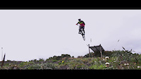
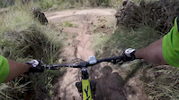
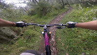
Videos of Pichincha Mountain Bike
trail: DH Nacional Metropolitano
0:16 |
48 |
Jul 24, 2022
trail: El Chaquiñan
0:35 |
59 |
Dec 11, 2020
trail: Alta Tensión
0:10 |
132 |
Jul 13, 2020

trail: DH Nacional Metropolitano
0:24 |
117 |
Nov 9, 2019
trail: Teleferico DH
0:14 |
192 |
Oct 9, 2019
trail: Mojanda DH
2:11 |
5423 |
Apr 7, 2018
trail: Falsa Coral
2:59 |
92 |
Apr 3, 2018
trail: Falsa Coral
4:24 |
43 |
Mar 4, 2018
Recent Trail Reports
| status | trail | date | condition | info | user |
|---|---|---|---|---|---|
| DH Clasico Quito & Valleys | Jun 17, 2025 @ 8:08am Jun 17, 2025 | Ideal | danpro81 | ||
| Teleferico DH Quito & Valleys | Sep 20, 2024 @ 12:36pm Sep 20, 2024 | Very Dry | Mykimike | ||
| Rocky Quito & Valleys | Sep 11, 2024 @ 7:57am Sep 11, 2024 | Very Dry | danpro81 | ||
| La Troncal Quito & Valleys | Sep 11, 2024 @ 7:57am Sep 11, 2024 | Very Dry | danpro81 | ||
| Periup Quito & Valleys | Sep 11, 2024 @ 7:57am Sep 11, 2024 | Very Dry | danpro81 | ||
| Pinguilmi Flow Trail Pichincha | Feb 9, 2024 @ 1:01am Feb 9, 2024 | Ideal | bongpill | ||
| Neo-Clasica Quito & Valleys | Oct 8, 2023 @ 8:39am Oct 8, 2023 | Very Dry | Santiago2t9eQM | ||
| deMORAs Quito & Valleys | Aug 22, 2023 @ 2:15pm Aug 22, 2023 | Unknown | kmachobike | ||
| Paso Alto Quito & Valleys | Jul 16, 2023 @ 4:43am Jul 16, 2023 | Dry | Santiago2t9eQM | ||
| Ilalo DH Quito & Valleys | Jun 17, 2023 @ 9:46am Jun 17, 2023 | Dry | Scrumjiggy |
Activity Feed
| username | action | type | title | date |
|---|---|---|---|---|
| update | event | activity #94981587 | May 18, 2026 @ 9:34am May 18, 2026 | |
| qwWMp | wishlist | trail | activity #94899580 and 1 more | May 17, 2026 @ 7:14am May 17, 2026 |
| Dominikld4JsF | ridden | trail | activity #93936979 | May 3, 2026 @ 5:27am May 3, 2026 |
| update | event | activity #89095780 | Feb 17, 2026 @ 2:56pm Feb 17, 2026 | |
| update | event | activity #88711931 | Feb 10, 2026 @ 10:16pm Feb 10, 2026 |
Recent Comments
| username | type | title | comment | date |
|---|---|---|---|---|
| trail | the uploaded video from 2016 is from the blue... | Aug 20, 2025 @ 5:42am Aug 20, 2025 | ||
| trail | second part (to the antennas) no more ridable... | Aug 20, 2025 @ 5:41am Aug 20, 2025 | ||
| trail | Epic Trail! One of the best we did on the... | Jan 10, 2020 @ 3:55pm Jan 10, 2020 | ||
| report | This trail is no longer rideable. Local... | Apr 12, 2019 @ 4:43am Apr 12, 2019 | ||
| trail | Greetings Friend, The lake’s name is... | Feb 11, 2018 @ 5:17pm Feb 11, 2018 |
Local Badges
-

Completionist0 awarded -

Big Ride 30k3,837 awarded -

Epic Ride 50k1,693 awarded -

Top 10 Trails0 awarded -

Descent 100k Badge40 awarded -

10 Green Trails28 awarded
Bike & Skill Parks
| name | type | city | rating |
|---|---|---|---|
| Campo Bici | skill park | Quito | |
| Pista 20&26 | skill park | Quito | |
| Carolina BMX Race Track | skill park | Quito | |
| Carolina BMX Park | skill park | Quito | |
| La Casita WIP | skill park | Quito |
Activity Type Stats
| activitytype | trails | distance | descent | descent distance | total vertical | rating | global rank | state rank | photos | reports | routes | ridelogs |
|---|---|---|---|---|---|---|---|---|---|---|---|---|
| Mountain Bike | 156 | 177 miles | 103,868 ft | 129 miles | 7,612 ft | 232 | 164 | 4 | 27,438 | |||
| E-Bike | 92 | 26 miles | 10,062 ft | 15 miles | 4,554 ft | 6 | 144 | 2 | 864 | |||
| Hike | 149 | 167 miles | 98,097 ft | 121 miles | 7,612 ft | 164 | 2 | 1,391 | ||||
| Trail Running | 150 | 167 miles | 98,097 ft | 121 miles | 7,612 ft | 164 | 1 | 408 |
Activities
Trails
- By brenthillier
 NSMBA TRAILFORKS & contributors
 - Admins: elyari, MTBECUADOR
- #9934 - 2,826 views
- pichincha activity log | embed map of Pichincha mountain bike trails | pichincha mountain biking points of interest
Downloading of trail gps tracks in kml & gpx formats is enabled for Pichincha.
You must login to download files.