close
-
Layers w
- Weather Layers
- Pro
- Pro
- Pro
- Pro
- Pro
- Pro
- More Layers
- Pro
- Pro
- Pro
- Pro
-
Upgrade to

3D
Trail Conditions
- Unknown
- Snow Groomed
- Snow Packed
- Snow Covered
- Snow Cover Partial
- Freeze/thaw Cycle
- Icy
- Prevalent Mud
- Wet
- Variable
- Ideal
- Dry
- Very Dry
Trail Flow (Ridden Direction)
Trailforks scans users ridelogs to determine the most popular direction each trail is ridden. A good flowing trail network will have most trails flowing in a single direction according to their intension.
The colour categories are based on what percentage of riders are riding a trail in its intended direction.
The colour categories are based on what percentage of riders are riding a trail in its intended direction.
- > 96%
- > 90%
- > 80%
- > 70%
- > 50%
- < 50%
- bi-directional trail
- no data
Trail Last Ridden
Trailforks scans ridelogs to determine the last time a trail was ridden.
- < 2 days
- < 1 week
- < 2 weeks
- < 1 month
- < 6 months
- > 6 months
Trail Ridden Direction
The intended direction a trail should be ridden.
- Downhill Only
- Downhill Primary
- Both Directions
- Uphill Primary
- Uphill Only
- One Direction
Contribute Details
Colors indicate trail is missing specified detail.
- Description
- Photos
- Description & Photos
- Videos
Trail Popularity ?
Trailforks scans ridelogs to determine which trails are ridden the most in the last 9 months.
Trails are compared with nearby trails in the same city region with a possible 25 colour shades.
Think of this as a heatmap, more rides = more kinetic energy = warmer colors.
- most popular
- popular
- less popular
- not popular
ATV/ORV/OHV Filter
Max Vehicle Width
inches
US Cell Coverage
Legend

Radar Time
Activity Recordings
Trailforks uses anonymized public activity data.
?
Activity Recordings
Trailforks uses anonymized public activity data.
?
Personal Heatmap
▶
Activity Types
all
/
none
▶
Options
2
Date range
month
–
Winter Trails
Warning
A routing network for winter maps does not exist. Selecting trails using the winter trails layer has been disabled.
Missing Trails
Most Popular
Least Popular
Trails are colored based on popularity. The more popular a trail is, the more red. Less popular trails trend towards green.
Jump Magnitude Heatmap
Heatmap of where riders jump on trails. Zoom in to see individual jumps, click circles to view jump details.
BC Backroad Status
![map legend]()
Service Road Atlas is a free to use, community-driven service for viewing and creating reports on the numerous back-country service roads around B.C. and Alberta.

Slope Aspect
Direction the slope faces
Trails Deemphasized
Trails are shown in grey.
Only show trails with no bike usage.
Suggested Layers
Based on selected activity type
Save the current map location and zoom level as your default home location whenever this page is loaded.
Save
No description for Piechowice has been added yet!
Login or register to submit one.
This region uses the Uk/Euro style trail grading system.
Activities Click to view
- Mountain Bike
86 trails
- E-Bike
86 trails
- Gravel Bike
0 trails
- Adaptive Bike
0 trails
- Winter Fat Bike
0 trails
- Hike
47 trails
- Trail Running
47 trails
Region Details
- 24
- 9
- 31
- 20
- 2
Region Status
Open as of May 23, 2026Stats
- Avg Trail Rating
- Trails (view details)
- 86
- Trails Mountain Bike
- 86
- Trails E-Bike
- 86
- Trails Hike
- 47
- Trails Trail Running
- 47
- Total Distance
- 64 miles
- Total Descent
- 15,841 ft
- Total Vertical
- 2,292 ft
- Highest Trailhead
- 3,498 ft
- Reports
- 1,681
- Photos
- 431
- Ridden Counter
- 26,926
Sub Regions
-
Olbrzymy
- 9
- 24
- 11
Popular Piechowice Mountain Biking Trails
• 90 ★ 4.9 • 3,921 ft • 65 ft • 659 •
Highly rated popular red difficulty machine groomed. This mountain bike primary trail can be used downhill only. On average it takes 9 minutes to complete this trail.
• 100 ★ 4.7 • 1 mile • 272 ft • 655 •
Highly rated popular red difficulty machine groomed. This mountain bike primary trail can be used one direction. It features rock garden. Trail visibility is always easy to follow. On average it takes 15 minutes to complete this trail.
• 100 ★ 4.5 • 3,130 ft • 145 ft • 647 •
Highly rated popular blue difficulty machine groomed. This mountain bike primary trail can be used one direction. It features rock garden. Trail visibility is always easy to follow. On average it takes 7 minutes to complete this trail.
• 95 ★ 4.8 • 2,211 ft • 17 ft • 613 •
Highly rated popular red difficulty machine groomed. This mountain bike primary trail can be used one direction. It features drop and rock garden. On average it takes 2 minutes to complete this trail.
• 70 ★ 4.9 • 4,820 ft • 50 ft • 597 •
Highly rated popular red difficulty machine groomed. This mountain bike primary trail can be used one direction. Trail visibility is always easy to follow. On average it takes 7 minutes to complete this trail.
• 60 ★ 4.4 • 2,651 ft • 160 ft • 588 •
Highly rated moderately popular blue difficulty machine groomed. This mountain bike primary trail can be used uphill only. On average it takes 7 minutes to complete this trail.
• 75 ★ 4.9 • 3,563 ft • 70 ft • 581 •
Highly rated popular red difficulty machine groomed. This mountain bike primary trail can be used one direction. It features drop and rock garden. On average it takes 4 minutes to complete this trail.
• 95 ★ 4.8 • 3,885 ft • 192 ft • 576 •
Highly rated popular blue difficulty machine groomed. This mountain bike primary trail can be used one direction. It features rock garden. Trail visibility is always easy to follow. On average it takes 10 minutes to complete this trail.
Piechowice Mountain Bike Routes
Olbrzymy, pętla Piechowice Featured
★ 4.0 • 12 miles • 2,086 ft • 13 • Loop •
Pętla zawierające wszystkie trasy tej "ciekawszej" części Olbrzymów, pierwsze 2/3 trochę męczą...
★ 5.0 • 18 miles • 1,997 ft • 0 • Loop •
Łatwiejsza część pasma rowerowego Olbrzymy, pętla wokół Przesieki.
★ 2.0 • 6 miles • 1,141 ft • 7 • Loop •
Krótka pętla wokół góry Żar - zaczyna się i kończy w Sobieszowie.
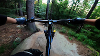
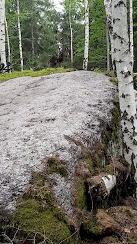
Photos of Piechowice Mountain Bike
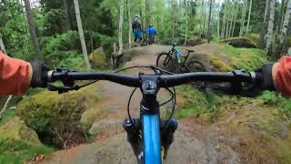
Videos of Piechowice Mountain Bike

trail: Czart Sekcja 43
5:53 |
65 |
Jun 21, 2023
trail: Rokitnik Sekcja 13
2:18 |
514 |
Feb 3, 2021
trail: Rokitnik Sekcja 13
0:17 |
609 |
Jun 24, 2019
youtuber
![Traily v Polských Krkonoších - v okolí...]()
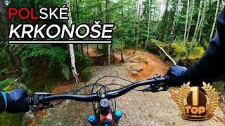
27:23 |
114 |
Sep 20, 2024
youtuber
![Traily v Polských Krkonoších - v okolí...]()

27:23 |
126 |
Aug 2, 2024

trail: Rokitnik Sekcja 13
10:37 |
279 |
May 17, 2024 , Piechowice
trail: Rokitnik Sekcja 12
10:37 |
223 |
May 17, 2024 , Piechowice
trail: Skarbek Sekcja 16
7:48 |
181 |
May 16, 2024 , Piechowice
Recent Trail Reports
| status | trail | date | condition | info | user |
|---|---|---|---|---|---|
| Rudnik | Jun 19, 2026 @ 9:42am (Europe/Warsaw) 2 days | Ideal | freemantpeter | ||
| Forest Road | Jun 4, 2026 @ 10:03am (Europe/Prague) Jun 4, 2026 | Ideal | gilbertos | ||
| Skrzat Sekcja 39 | Jun 4, 2026 @ 10:03am (Europe/Prague) Jun 4, 2026 | Ideal | gilbertos | ||
| Skrzat Sekcja 38 | Jun 4, 2026 @ 10:03am (Europe/Prague) Jun 4, 2026 | Ideal | gilbertos | ||
| Czart Sekcja 43 | Jun 4, 2026 @ 10:03am (Europe/Prague) Jun 4, 2026 | Dry | gilbertos | ||
| Błotnik Sekcja 47 | Jun 4, 2026 @ 10:03am (Europe/Prague) Jun 4, 2026 | Dry | gilbertos | ||
| Błotnik Sekcja 46 | Jun 4, 2026 @ 10:03am (Europe/Prague) Jun 4, 2026 | Dry | gilbertos | ||
| Błotnik Sekcja 45 | Jun 4, 2026 @ 10:03am (Europe/Prague) Jun 4, 2026 | Ideal | gilbertos | ||
| Poświst Sekcja 56 | Jun 4, 2026 @ 10:03am (Europe/Prague) Jun 4, 2026 | Ideal | gilbertos | ||
| Poświst Sekcja 55 | Jun 4, 2026 @ 10:03am (Europe/Prague) Jun 4, 2026 | Ideal | gilbertos |
Activity Feed
| username | action | type | title | date |
|---|---|---|---|---|
| RiFFu | add | report | activity #97314774 | Jun 19, 2026 @ 7:09am 2 days |
| freemantpeter | add | report | activity #97301381 | Jun 19, 2026 @ 12:42am 2 days |
| damianOcLwu | wishlist | route | activity #97244755 | Jun 18, 2026 @ 5:20am 3 days |
| rupnik | wishlist | route | activity #97130272 | Jun 16, 2026 @ 12:15pm Jun 16, 2026 |
| mawa | wishlist | route | activity #97046905 | Jun 15, 2026 @ 9:28am Jun 15, 2026 |
Recent Comments
| username | type | title | comment | date |
|---|---|---|---|---|
| trail | Najdłuższy zjazdowy odcinek Peruna. Szybki i... | Dec 14, 2025 @ 5:45am Dec 14, 2025 | ||
| trail | Niebieski szlak pieszy, taki trochę mix... | Aug 24, 2025 @ 9:08am Aug 24, 2025 | ||
| trail | Na tym odcinku (Trzmielak) to nic specjalnego... | Aug 24, 2025 @ 8:59am Aug 24, 2025 | ||
| trail | Great trail | Apr 16, 2025 @ 8:03am Apr 16, 2025 | ||
| trail | Wycinka, częściowo trasa zniszczona i... | Oct 2, 2023 @ 12:15am Oct 2, 2023 |
Local Badges
-

Epic Ride Climb 2k164 awarded -

Climbing 10k Badge46 awarded -

Climbing 100k Badge0 awarded -

Epic Ride Descent 2k188 awarded -

Descent 10k Badge54 awarded -

Descent 100k Badge0 awarded
Local Mountain Biking Directory
-
Wojczal-bikeBike Shop
Activity Type Stats
| activitytype | trails | distance | descent | descent distance | total vertical | rating | global rank | state rank | photos | reports | routes | ridelogs |
|---|---|---|---|---|---|---|---|---|---|---|---|---|
| Mountain Bike | 86 | 64 miles | 15,840 ft | 34 miles | 2,293 ft | #941 | #12 | 429 | 1,681 | 6 | 5,152 | |
| E-Bike | 86 | 64 miles | 15,840 ft | 34 miles | 2,293 ft | #1,354 | #277 | 1,514 | 3 | 377 | ||
| Hike | 47 | 39 miles | 10,741 ft | 23 miles | 2,293 ft | #3,519 | #61 | 2 | 1,524 | 900 | ||
| Trail Running | 47 | 39 miles | 10,741 ft | 23 miles | 2,293 ft | #3,199 | #53 | 1,525 | 96 |
Frequently Asked Questions About Piechowice
▼
What are the best places to ride in Piechowice?
Piechowice has 1 areas to explore for mountain biking. The top rated areas are:
▼
What are the highest rated mountain biking trails in Piechowice?
The highest rated mountain biking trails in Piechowice are:
- Rokitnik Sekcja 13 (4.6/5)
- Skrzat Sekcja 39 (4.6/5)
- Skarbek Sekcja 16 (4.6/5)
- Zmora Sekcja 19 (4.6/5)
- Doppler Sekcja 25 (4.5/5)
▼
What is the best time of the year to ride in Piechowice?
Based on ride log data, the most popular months to ride in Piechowice are:
- July (88 activities)
- June (67 activities)
- August (66 activities)
▼
Where can I park to ride in Piechowice?
Activities
Trails
- By micolai
 TRAILFORKS Poland & contributors
 - Admins: xaoo
- #11567 - 6,602 views
- piechowice activity log | embed map of Piechowice mountain bike trails | piechowice mountain biking points of interest
Downloading of trail gps tracks in kml & gpx formats is enabled for Piechowice.
You must login to download files.