close
-
Layers w
- Weather Layers
- Pro
- Pro
- Pro
- Pro
- Pro
- Pro
- More Layers
- Pro
- Pro
- Pro
- Pro
-
Upgrade to

3D
Trail Conditions
- Unknown
- Snow Groomed
- Snow Packed
- Snow Covered
- Snow Cover Partial
- Freeze/thaw Cycle
- Icy
- Prevalent Mud
- Wet
- Variable
- Ideal
- Dry
- Very Dry
Trail Flow (Ridden Direction)
Trailforks scans users ridelogs to determine the most popular direction each trail is ridden. A good flowing trail network will have most trails flowing in a single direction according to their intension.
The colour categories are based on what percentage of riders are riding a trail in its intended direction.
The colour categories are based on what percentage of riders are riding a trail in its intended direction.
- > 96%
- > 90%
- > 80%
- > 70%
- > 50%
- < 50%
- bi-directional trail
- no data
Trail Last Ridden
Trailforks scans ridelogs to determine the last time a trail was ridden.
- < 2 days
- < 1 week
- < 2 weeks
- < 1 month
- < 6 months
- > 6 months
Trail Ridden Direction
The intended direction a trail should be ridden.
- Downhill Only
- Downhill Primary
- Both Directions
- Uphill Primary
- Uphill Only
- One Direction
Contribute Details
Colors indicate trail is missing specified detail.
- Description
- Photos
- Description & Photos
- Videos
Trail Popularity ?
Trailforks scans ridelogs to determine which trails are ridden the most in the last 9 months.
Trails are compared with nearby trails in the same city region with a possible 25 colour shades.
Think of this as a heatmap, more rides = more kinetic energy = warmer colors.
- most popular
- popular
- less popular
- not popular
ATV/ORV/OHV Filter
Max Vehicle Width
inches
US Cell Coverage
Legend

Radar Time
Activity Recordings
Trailforks uses anonymized public activity data.
?
Activity Recordings
Trailforks uses anonymized public activity data.
?
Personal Heatmap
▶
Activity Types
all
/
none
▶
Options
2
Date range
month
–
Winter Trails
Warning
A routing network for winter maps does not exist. Selecting trails using the winter trails layer has been disabled.
Missing Trails
Most Popular
Least Popular
Trails are colored based on popularity. The more popular a trail is, the more red. Less popular trails trend towards green.
Jump Magnitude Heatmap
Heatmap of where riders jump on trails. Zoom in to see individual jumps, click circles to view jump details.
BC Backroad Status
![map legend]()
Service Road Atlas is a free to use, community-driven service for viewing and creating reports on the numerous back-country service roads around B.C. and Alberta.

Slope Aspect
Direction the slope faces
Trails Deemphasized
Trails are shown in grey.
Only show trails with no bike usage.
Suggested Layers
Based on selected activity type
Save the current map location and zoom level as your default home location whenever this page is loaded.
Save
No description for Pilot Point has been added yet!
Login or register to submit one.
Activities Click to view
- Mountain Bike
32 trails
- E-Bike
12 trails
- Gravel Bike
0 trails
- Adaptive Bike
0 trails
- Horse
7 trails
- Hike
32 trails
- Trail Running
32 trails
Region Details
- 7
- 4
- 8
- 7
- 3
Region Status
Open as of 1 dayStats
- Avg Trail Rating
- Trails (view details)
- 30
- Trails Mountain Bike
- 32
- Trails E-Bike
- 12
- Trails Horse
- 7
- Trails Hike
- 32
- Trails Trail Running
- 32
- Total Distance
- 48 miles
- Total Descent
- 2,215 ft
- Total Vertical
- 213 ft
- Highest Trailhead
- 733 ft
- Reports
- 4,625
- Photos
- 82
- Ridden Counter
- 4,636
Sub Regions
-
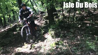
Ray Roberts Lake Isle Du Bois Unit
- 5
- 2
-
Ray Roberts Lake Isle Du Bois Unit Horse/Hiking Trails
- 1
- 5
-
Ray Roberts Lake Johnson Branch Unit
- 3
- 2
- 1
-
Ray Roberts Lake Johnson Branch Unit Hiking Trails
- 3
Popular Pilot Point Mountain Biking Trails
• 40 ★ 4.0 • 10 miles • 34 ft • 76 •
Moderately popular green difficulty singletrack. This multi-use trail can be used both directions. On average it takes 50 minutes to complete this trail.
• 55 ★ 0.0 • 4,354 ft • 0 ft • 58 •
Moderately popular white difficulty paved path. This multi-use trail can be used both directions. On average it takes 4 minutes to complete this trail.
• 50 ★ 3.0 • 1 mile • 48 ft • 49 •
Paved path through to Juniper Cove. Multiple park road crossings. Serves as a loop, but most prefer out-n-back on the east part of the
• 25 ★ 3.0 • 2 miles • 58 ft • 24 •
This is the East side which is the most popular section because of little cross traffic
• 60 ★ 0.0 • 3,209 ft • 18 ft • 17 •
Moderately popular green difficulty singletrack. This multi-use trail can be used both directions. On average it takes 3 minutes to complete this trail.
• 5 ★ 2.0 • 1,184 ft • 3 ft • 13 •
Less popular white difficulty paved path. This multi-use trail can be used both directions and has a easy overall physical rating with a 3 ft green climb. On average it takes minutes to complete this trail.
• 10 ★ 0.0 • 1,608 ft • 0 ft • 13 •
Less popular green difficulty singletrack. This multi-use trail can be used both directions. On average it takes 3 minutes to complete this trail.
• 55 ★ 0.0 • 1,775 ft • 12 ft • 8 •
Moderately popular green difficulty doubletrack. This multi-use trail can be used both directions. On average it takes 1 minutes to complete this trail.
Pilot Point Mountain Bike Routes
★ 5.0 • 6 miles • 270 ft • 4 • Loop •
Every trail but RED. This route covers all of Johnson Branch DORBRA trail except for the expert level RED...
8 miles • 514 ft • 0 •
This is the Johnson Branch 100 mile participant route for the 2024 DORBA Judgment Day.
4 miles • 450 ft • 2 • Race •
This is the route for the 70 mile and 100 mile participants in the 2024 DORBA Judgment Day. The 100 Mile...
★ 5.0 • 6 miles • 265 ft • 0 • Race •
This is the route for the 70 mile participants of the 2024 DORBA Judgment Day.
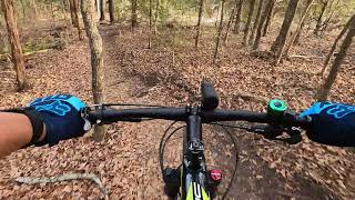
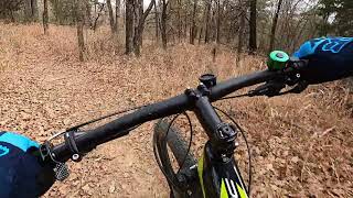
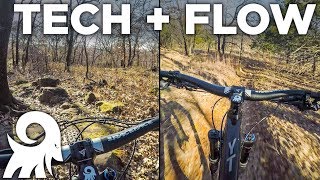
Photos of Pilot Point Mountain Bike
Videos of Pilot Point Mountain Bike
17:50 |
449 |
Apr 25, 2022
49:20 |
333 |
Jan 13, 2022
1:0:02 |
606 |
Jan 13, 2022

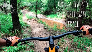
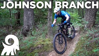
trail: IDB Loop D
7:21 |
1205 |
May 17, 2021 , Pilot Point
trail: IDB Loop C
7:21 |
875 |
May 17, 2021 , Pilot Point

25:32 |
804 |
Dec 27, 2020
10:12 |
604 |
Dec 27, 2020
trail: DORBA Red Loop
11:41 |
1647 |
Jul 29, 2019 , Pilot Point
Current Trail Warnings
| status | trail | date | condition | user | info |
|---|---|---|---|---|---|
| DORBA Yellow Loop | Jun 19, 2026 @ 6:30am (America/Chicago) 1 day | Unknown | O2bnaggie Trail Steward | ||
| DORBA Red Loop | Jun 19, 2026 @ 6:30am (America/Chicago) 1 day | Unknown | O2bnaggie Trail Steward | ||
| DORBA Pink Loop | Jun 19, 2026 @ 6:30am (America/Chicago) 1 day | Unknown | O2bnaggie Trail Steward |
Recent Trail Reports
| status | trail | date | condition | info | user |
|---|---|---|---|---|---|
| DORBA Blue Loop | Jun 19, 2026 @ 6:30am (America/Chicago) 1 day | Unknown | O2bnaggie Trail Steward | ||
| IDB Loop E (West) | Jun 12, 2026 @ 12:42pm (America/Chicago) Jun 12, 2026 | Prevalent Mud | Dstarr Trail Steward | ||
| IDB Loop E | Jun 12, 2026 @ 12:42pm (America/Chicago) Jun 12, 2026 | Prevalent Mud | Dstarr Trail Steward | ||
| IDB Loop D (Inner) | Jun 12, 2026 @ 12:42pm (America/Chicago) Jun 12, 2026 | Prevalent Mud | Dstarr Trail Steward | ||
| IDB Loop D | Jun 12, 2026 @ 12:42pm (America/Chicago) Jun 12, 2026 | Prevalent Mud | Dstarr Trail Steward | ||
| IDB Loop C | Jun 12, 2026 @ 12:42pm (America/Chicago) Jun 12, 2026 | Prevalent Mud | Dstarr Trail Steward | ||
| IDB Loop B | Jun 12, 2026 @ 12:42pm (America/Chicago) Jun 12, 2026 | Prevalent Mud | Dstarr Trail Steward | ||
| IDB Loop A | Jun 12, 2026 @ 12:42pm (America/Chicago) Jun 12, 2026 | Prevalent Mud | Dstarr Trail Steward | ||
| Deer Ridge | Jan 27, 2025 @ 4:02pm Jan 27, 2025 | Ideal | WillieJacobsz Trailforks | ||
| Randy Bell Scenic Trail | Nov 27, 2024 @ 3:28pm Nov 27, 2024 | Dry | csclark5253 |
Activity Feed
| username | action | type | title | date |
|---|---|---|---|---|
| O2bnaggie | add | report | activity #97307570 and 5 more | Jun 19, 2026 @ 4:30am 1 day |
| O2bnaggie | add | report | activity #97253649 and 5 more | Jun 18, 2026 @ 8:21am 2 days |
| Rybo90 | wishlist | trail | activity #97252725 and 2 more | Jun 18, 2026 @ 8:05am 2 days |
| Dstarr | add | report | activity #96814416 and 6 more | Jun 12, 2026 @ 10:42am Jun 12, 2026 |
| O2bnaggie | add | report | activity #96811635 and 5 more | Jun 12, 2026 @ 9:57am Jun 12, 2026 |
Recent Comments
| username | type | title | comment | date |
|---|---|---|---|---|
| trail | $7 entrance fee ( I assume it's per vehicle) | Nov 23, 2025 @ 4:49pm Nov 23, 2025 | ||
| report | Fast | Dec 15, 2024 @ 4:07pm Dec 15, 2024 | ||
| report | good to ride, hero dirt. | Mar 11, 2024 @ 11:29am Mar 11, 2024 | ||
| trail | I was traveling and thought I would check this... | Feb 2, 2024 @ 1:48pm Feb 2, 2024 | ||
| trail | I was traveling and thought I would check this... | Feb 2, 2024 @ 1:45pm Feb 2, 2024 |
Local Badges
-

10 Blue Trails111 awarded -

Epic Ride Climb 2k1 awarded -

Climbing 10k Badge5 awarded -

Climbing 100k Badge0 awarded -

Epic Ride Descent 2k1 awarded -

Descent 10k Badge5 awarded
Activity Type Stats
| activitytype | trails | distance | descent | descent distance | total vertical | rating | global rank | state rank | photos | reports | routes | ridelogs |
|---|---|---|---|---|---|---|---|---|---|---|---|---|
| Mountain Bike | 32 | 47 miles | 2,211 ft | 14 miles | 213 ft | #4,080 | #1,375 | 58 | 4,627 | 6 | 4,580 | |
| E-Bike | 12 | 18 miles | 1,030 ft | 5 miles | 98 ft | #2,716 | #1,059 | 12 | 4,572 | 191 | ||
| Horse | 7 | 10 miles | 358 ft | 4 miles | 144 ft | #2,762 | #1,530 | 703 | 1 | |||
| Hike | 32 | 47 miles | 2,182 ft | 14 miles | 213 ft | #3,263 | #1,147 | 19 | 4,619 | 1 | 176 | |
| Trail Running | 32 | 47 miles | 2,182 ft | 14 miles | 213 ft | #5,033 | #1,575 | 3 | 4,619 | 1 | 124 |
Frequently Asked Questions About Pilot Point
▼
What are the best places to ride in Pilot Point?
Pilot Point has 4 areas to explore for mountain biking. The top rated areas are:
▼
What are the highest rated mountain biking trails in Pilot Point?
The highest rated mountain biking trails in Pilot Point are:
- DORBA Orange Loop (4.1/5)
- IDB Loop E (4/5)
- RRL Greenbelt (4/5)
- IDB Loop D (3.9/5)
- IDB Loop E (West) (3.9/5)
▼
What is the best time of the year to ride in Pilot Point?
Based on ride log data, the most popular months to ride in Pilot Point are:
- September (42 activities)
- August (37 activities)
- June (35 activities)
▼
Where can I park to ride in Pilot Point?
There are 5 parking locations listed in Pilot Point. The most popular parking spots are: View all parking and trailhead locations on the map to plan your visit.
Activities
- By Larsacus
 TRAILFORKS & contributors
 - Admins: FWMBA, DORBA MAIN
- #19793 - 2,600 views
- pilot point activity log | embed map of Pilot Point mountain bike trails | pilot point mountain biking points of interest
Downloading of trail gps tracks in kml & gpx formats is enabled for Pilot Point.
You must login to download files.