close
-
Layers w
- Weather Layers
- Pro
- Pro
- Pro
- Pro
- Pro
- Pro
- More Layers
- Pro
- Pro
- Pro
- Pro
-
Upgrade to

3D
Trail Conditions
- Unknown
- Snow Groomed
- Snow Packed
- Snow Covered
- Snow Cover Partial
- Freeze/thaw Cycle
- Icy
- Prevalent Mud
- Wet
- Variable
- Ideal
- Dry
- Very Dry
Trail Flow (Ridden Direction)
Trailforks scans users ridelogs to determine the most popular direction each trail is ridden. A good flowing trail network will have most trails flowing in a single direction according to their intension.
The colour categories are based on what percentage of riders are riding a trail in its intended direction.
The colour categories are based on what percentage of riders are riding a trail in its intended direction.
- > 96%
- > 90%
- > 80%
- > 70%
- > 50%
- < 50%
- bi-directional trail
- no data
Trail Last Ridden
Trailforks scans ridelogs to determine the last time a trail was ridden.
- < 2 days
- < 1 week
- < 2 weeks
- < 1 month
- < 6 months
- > 6 months
Trail Ridden Direction
The intended direction a trail should be ridden.
- Downhill Only
- Downhill Primary
- Both Directions
- Uphill Primary
- Uphill Only
- One Direction
Contribute Details
Colors indicate trail is missing specified detail.
- Description
- Photos
- Description & Photos
- Videos
Trail Popularity ?
Trailforks scans ridelogs to determine which trails are ridden the most in the last 9 months.
Trails are compared with nearby trails in the same city region with a possible 25 colour shades.
Think of this as a heatmap, more rides = more kinetic energy = warmer colors.
- most popular
- popular
- less popular
- not popular
ATV/ORV/OHV Filter
Max Vehicle Width
inches
US Cell Coverage
Legend

Radar Time
Activity Recordings
Trailforks uses anonymized public activity data.
?
Activity Recordings
Trailforks uses anonymized public activity data.
?
Personal Heatmap
▶
Activity Types
all
/
none
▶
Options
2
Date range
month
–
Winter Trails
Warning
A routing network for winter maps does not exist. Selecting trails using the winter trails layer has been disabled.
Missing Trails
Most Popular
Least Popular
Trails are colored based on popularity. The more popular a trail is, the more red. Less popular trails trend towards green.
Jump Magnitude Heatmap
Heatmap of where riders jump on trails. Zoom in to see individual jumps, click circles to view jump details.
BC Backroad Status
![map legend]()
Service Road Atlas is a free to use, community-driven service for viewing and creating reports on the numerous back-country service roads around B.C. and Alberta.

Slope Aspect
Direction the slope faces
Trails Deemphasized
Trails are shown in grey.
Only show trails with no bike usage.
Suggested Layers
Based on selected activity type
Save the current map location and zoom level as your default home location whenever this page is loaded.
Save
No description for Pinerolo has been added yet!
Login or register to submit one.
This region uses the Uk/Euro style trail grading system.
Activities Click to view
- Mountain Bike
122 trails
- E-Bike
117 trails
- Adaptive Bike
0 trails
- Winter Fat Bike
0 trails
- Horse
12 trails
- Hike
71 trails
- Trail Running
102 trails
Region Details
- 26
- 6
- 32
- 1
Region Status
Caution as of Jun 11, 2026Stats
- Avg Trail Rating
- Trails (view details)
- 81
- Trails Mountain Bike
- 122
- Trails E-Bike
- 117
- Trails Horse
- 12
- Trails Hike
- 71
- Trails Trail Running
- 102
- Total Distance
- 57 miles
- Total Descent Distance
- 31 miles
- Total Descent
- 23,937 ft
- Total Vertical
- 4,117 ft
- Highest Trailhead
- 5,377 ft
- Reports
- 380
- Photos
- 56
- Ridden Counter
- 1,697
Popular Pinerolo Mountain Biking Trails
• 100 ★ 4.0 • 719 ft • 6 ft • 57 •
Popular green difficulty singletrack. This mountain bike primary trail can be used downhill primary. On average it takes 1 minutes to complete this trail.
• 95 ★ 4.5 • 3,104 ft • 25 ft • 51 •
Popular blue difficulty singletrack. This mountain bike primary trail can be used both directions. On average it takes 6 minutes to complete this trail.
• 90 ★ 4.0 • 3,770 ft • 35 ft • 41 •
Dal piazzale del Crò, dietro la trattoria, prendere la strada sterrata che presenta una salita ripida, sul piano si nota l'imbocco del sentiero che scende verso sx. Nella discesa notare il bivio e procedere verso sx su un leggero...
• 80 ★ 0.0 • 2,073 ft • 16 ft • 30 •
Popular blue difficulty singletrack. This mountain bike primary trail can be used downhill only. Trail visibility is always easy to follow. On average it takes 7 minutes to complete this trail.
• 95 ★ 0.0 • 1 mile • 53 ft • 30 •
Popular blue difficulty singletrack. This mountain bike primary trail can be used downhill only. It features drop and rock garden. Trail visibility is always easy to follow. On average it takes 9 minutes to complete this trail.
• 60 ★ 0.0 • 1,375 ft • 67 ft • 29 •
Moderately popular blue difficulty singletrack. This multi-use trail can be used both directions.
• 95 ★ 4.4 • 3,786 ft • 23 ft • 29 •
Popular blue difficulty singletrack. This mountain bike primary trail can be used downhill only. Trail visibility is always easy to follow. On average it takes 10 minutes to complete this trail.
• 85 ★ 0.0 • 3,707 ft • 27 ft • 26 •
Popular green difficulty mixed. This mountain bike primary trail can be used both directions. On average it takes 7 minutes to complete this trail.
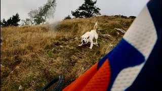
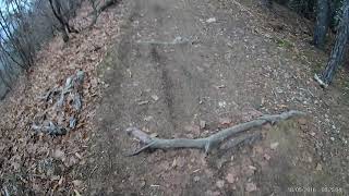
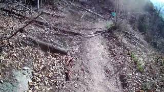
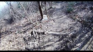
Photos of Pinerolo Mountain Bike
Videos of Pinerolo Mountain Bike
trail: Bicibirra secret trail
9:44 |
31 |
Sep 16, 2025 , Pinerolo
trail: Monte Muretto Trail
6:49 |
225 |
Mar 22, 2021 , Pinerolo
trail: Rocca Vautero Trail
6:15 |
276 |
Mar 22, 2021 , Pinerolo
trail: Trail del Colletto
6:51 |
322 |
Mar 3, 2021 , Pinerolo
Recent Trail Reports
| status | trail | date | condition | info | user |
|---|---|---|---|---|---|
| Pineta Costagrande | Jun 11, 2026 @ 4:06pm (Europe/Rome) Jun 11, 2026 | Ideal | Gianluca92 | ||
| Monte Muretto Trail | Apr 25, 2026 @ 3:14pm (Europe/Rome) Apr 25, 2026 | Ideal | Pistolero79 | ||
| Trail del Colletto | Apr 25, 2026 @ 10:19am (Europe/Rome) Apr 25, 2026 | Ideal | Pistolero79 | ||
| Salita Monte Muretto | Apr 25, 2026 @ 10:19am (Europe/Rome) Apr 25, 2026 | Ideal | Pistolero79 | ||
| Talucco's | Apr 25, 2026 @ 10:19am (Europe/Rome) Apr 25, 2026 | Ideal | Pistolero79 | ||
| Bosco dell'Impero | Apr 25, 2026 @ 10:19am (Europe/Rome) Apr 25, 2026 | Ideal | Pistolero79 | ||
| Cossulera Trail | Apr 25, 2026 @ 10:19am (Europe/Rome) Apr 25, 2026 | Ideal | Pistolero79 | ||
| Marines | Apr 18, 2026 @ 9:34pm (Europe/Rome) Apr 18, 2026 | Unknown | LeonardoKGhOvy | ||
| Direttissima S.Giuliardo | Apr 10, 2026 @ 11:40am (Europe/Rome) Apr 10, 2026 | Unknown | Murg89 | ||
| Dairin - Colle Ciardonet | Dec 28, 2025 @ 9:25am (Europe/Rome) Dec 28, 2025 | Snow Covered | Mauro-Grassi |
Activity Feed
| username | action | type | title | date |
|---|---|---|---|---|
| Gianluca92 | add | report | activity #96789365 | Jun 12, 2026 @ 1:03am Jun 12, 2026 |
| maser03 | wishlist | region | activity #95787593 | May 29, 2026 @ 10:29am May 29, 2026 |
| Rqx | comment | trail | activity #94628375 | May 13, 2026 @ 8:15am May 13, 2026 |
| Pistolero79 | add | report | activity #93348113 and 5 more | Apr 25, 2026 @ 6:12am Apr 25, 2026 |
| LeonardoKGhOvy | add | report | activity #92884846 | Apr 18, 2026 @ 12:34pm Apr 18, 2026 |
Recent Comments
| username | type | title | comment | date |
|---|---|---|---|---|
| trail | Durch Forstarbeiten zerstört. | May 13, 2026 @ 8:15am May 13, 2026 | ||
| trail | Needs to be reopened, will need work.. | Apr 18, 2026 @ 4:26am Apr 18, 2026 | ||
| trail | Very nice, recommend cut across to blue trail,... | Apr 18, 2026 @ 4:23am Apr 18, 2026 | ||
| trail | Dopo le pioggia, terriccio compatto bello... | Sep 24, 2025 @ 7:43am Sep 24, 2025 | ||
| trail | Inserisci il commento come “trail report”... | May 29, 2024 @ 3:05pm May 29, 2024 |
Local Badges
-

10 Blue Trails14 awarded -

10 Black Trails2 awarded -

Epic Mountain Bike Climb 2k108 awarded -

Climbing 10k Badge27 awarded -

Mountain Biking 100k Badge5 awarded -

Epic Ride Descent 2k108 awarded
Activity Type Stats
| activitytype | trails | distance | descent | descent distance | total vertical | rating | global rank | state rank | photos | reports | routes | ridelogs |
|---|---|---|---|---|---|---|---|---|---|---|---|---|
| Mountain Bike | 122 | 57 miles | 23,937 ft | 31 miles | 4,117 ft | #3,026 | #151 | 56 | 380 | 3,318 | ||
| E-Bike | 117 | 56 miles | 23,241 ft | 30 miles | 4,117 ft | #2,186 | #212 | 373 | 640 | |||
| Horse | 12 | 4 miles | 364 ft | 2 miles | 869 ft | #2,060 | #126 | 6 | ||||
| Hike | 71 | 28 miles | 8,780 ft | 13 miles | 3,881 ft | #5,243 | #230 | 327 | 121 | |||
| Trail Running | 102 | 54 miles | 22,710 ft | 30 miles | 3,904 ft | #3,178 | #111 | 344 | 81 |
Frequently Asked Questions About Pinerolo
▼
What are the best places to ride in Pinerolo?
Pinerolo has 1 areas to explore for mountain biking.
▼
What are the highest rated mountain biking trails in Pinerolo?
The highest rated mountain biking trails in Pinerolo are:
- Bicibirra secret trail (4.3/5)
- Dream trail (4.1/5)
- Bosco dell'Impero (4.1/5)
- Talucco's (4.1/5)
- Cossulera Trail (4/5)
▼
What is the best time of the year to ride in Pinerolo?
Based on ride log data, the most popular months to ride in Pinerolo are:
- October (5 activities)
- July (3 activities)
- September (2 activities)
▼
Where can I park to ride in Pinerolo?
Activities
Trails
- By Flpaskymtb & contributors
- Admins: silviu86, adessoomaipiu
- #37820 - 3,236 views
- pinerolo activity log | embed map of Pinerolo mountain bike trails | pinerolo mountain biking points of interest
Downloading of trail gps tracks in kml & gpx formats is enabled for Pinerolo.
You must login to download files.