close
-
Layers w
- Weather Layers
- Pro
- Pro
- Pro
- Pro
- Pro
- Pro
- More Layers
- Pro
- Pro
- Pro
- Pro
-
Upgrade to

3D
Trail Conditions
- Unknown
- Snow Groomed
- Snow Packed
- Snow Covered
- Snow Cover Partial
- Freeze/thaw Cycle
- Icy
- Prevalent Mud
- Wet
- Variable
- Ideal
- Dry
- Very Dry
Trail Flow (Ridden Direction)
Trailforks scans users ridelogs to determine the most popular direction each trail is ridden. A good flowing trail network will have most trails flowing in a single direction according to their intension.
The colour categories are based on what percentage of riders are riding a trail in its intended direction.
The colour categories are based on what percentage of riders are riding a trail in its intended direction.
- > 96%
- > 90%
- > 80%
- > 70%
- > 50%
- < 50%
- bi-directional trail
- no data
Trail Last Ridden
Trailforks scans ridelogs to determine the last time a trail was ridden.
- < 2 days
- < 1 week
- < 2 weeks
- < 1 month
- < 6 months
- > 6 months
Trail Ridden Direction
The intended direction a trail should be ridden.
- Downhill Only
- Downhill Primary
- Both Directions
- Uphill Primary
- Uphill Only
- One Direction
Contribute Details
Colors indicate trail is missing specified detail.
- Description
- Photos
- Description & Photos
- Videos
Trail Popularity ?
Trailforks scans ridelogs to determine which trails are ridden the most in the last 9 months.
Trails are compared with nearby trails in the same city region with a possible 25 colour shades.
Think of this as a heatmap, more rides = more kinetic energy = warmer colors.
- most popular
- popular
- less popular
- not popular
ATV/ORV/OHV Filter
Max Vehicle Width
inches
US Cell Coverage
Legend

Radar Time
Activity Recordings
Trailforks uses anonymized public activity data.
?
Activity Recordings
Trailforks uses anonymized public activity data.
?
Personal Heatmap
▶
Activity Types
all
/
none
▶
Options
2
Date range
month
–
Winter Trails
Warning
A routing network for winter maps does not exist. Selecting trails using the winter trails layer has been disabled.
Missing Trails
Most Popular
Least Popular
Trails are colored based on popularity. The more popular a trail is, the more red. Less popular trails trend towards green.
Jump Magnitude Heatmap
Heatmap of where riders jump on trails. Zoom in to see individual jumps, click circles to view jump details.
BC Backroad Status
![map legend]()
Service Road Atlas is a free to use, community-driven service for viewing and creating reports on the numerous back-country service roads around B.C. and Alberta.

Slope Aspect
Direction the slope faces
Trails Deemphasized
Trails are shown in grey.
Only show trails with no bike usage.
Suggested Layers
Based on selected activity type
Save the current map location and zoom level as your default home location whenever this page is loaded.
SavePopular Trail Networks
view all areas »
No description for Placer County has been added yet!
Login or register to submit one.
Activities Click to view
- Mountain Bike
667 trails
- E-Bike
157 trails
- Gravel Bike
177 trails
- Horse
357 trails
- Hike
729 trails
- Trail Running
724 trails
- Dirtbike/Moto
114 trails
- Observed Trials
38 trails
- ATV/ORV/OHV
73 trails
- Snowmobile
10 trails
- Snowshoe
7 trails
- Downhill Ski
352 trails
- Backcountry Ski
78 trails
- Nordic Ski
52 trails
Stats
- Avg Trail Rating
- Trails (view details)
- 1,142
- Trails Mountain Bike
- 667
- Trails E-Bike
- 157
- Trails Gravel Bike
- 177
- Trails Adaptive Bike
- 87
- Trails Winter Fat Bike
- 22
- Trails Horse
- 357
- Trails Hike
- 729
- Trails Trail Running
- 724
- Trails Dirtbike/Moto
- 114
- Trails Observed Trials
- 38
- Trails ATV/ORV/OHV
- 73
- Trails Snowmobile
- 10
- Trails Snowshoe
- 7
- Trails Downhill Ski
- 352
- Trails Backcountry Ski
- 78
- Trails Nordic Ski
- 52
- Total Distance
- 1,020 miles
- Total Descent
- 273,723 ft
- Total Vertical
- 9,057 ft
- Highest Trailhead
- 9,189 ft
- Reports
- 5,988
- Photos
- 1,918
- Ridden Counter
- 334,112
Articles
I’ve Hiked 11,000 Miles with My Wife. Here’s What I Learned on My First Solo Trip.
Sep 2, 2025 from outsideonline.com
After walking 11,000 miles across the United States with his wife, our hiking columnist finally hit the trail solo. Here’s what he learned about...
How Reno Tahoe Became an Adventure Capital of the West
Oct 12, 2023 from outsideonline.com
The Biggest Little City has earned major clout as a base camp for outdoor activities, and everyone—from vacationers to adventurers looking to...
Slopes to City: The Best Way to Spend 48 Hours in Reno and Tahoe
Jan 11, 2022 from skimag.com
With plenty of good food and drinks, events, and nightlife, there’s a lot more to Reno-Tahoe than its phenomenal skiing
Video: Greg Watts Explores the Trails of Woodward Tahoe
Aug 13, 2020 from pinkbike.com
Slabs, skate parks and more in Tahoe
Sub Regions
- Auburn (111)
- Carnelian Bay (29)
- Colfax (3)
- Foresthill (46)
- Foresthill OHV Area (39)
- NFA Upper Gorge (4)
- Granite Bay (9)
- Homewood (50)
- Kings Beach (60)
- Lower KB Trails (30)
- Stateline Lookout (1)
- Upper KB Trails (24)
- Lincoln (2)
- Meadow Vista (17)
- Olympic Valley (50)
- Rocklin (2)
- Roseville (3)
- Tahoe City (191)
- Alpine Meadows Palisades Tahoe (20)
- Mount Watson (21)
- Paige Meadows (43)
- Painted Rock (19)
- Stanford Rock (12)
- Tahoe City Neighborhood Trails (6)
- Tahoe Cross Country (58)
- Tahoe Vista (67)
- Weimar (17)
- French Meadows (6)
- North Fork American Headwaters (8)
Popular Placer County Mountain Biking Trails
• 100 ★ 4.4 • 1 mile • 3 ft • 2,219 •
An awesome trail, lots of jumps berms drops and rocky areas.
• 100 ★ 4.0 • 2 miles • 68 ft • 2,078 •
Fun little section leading down to the Auburn state recreation area parking. Has some built up jumps that are optional, and some pretty easy rocky sections. Its multi use so expect hikers and be on the look out to slow down.
• 95 ★ 3.2 • 2 miles • 429 ft • 1,828 •
Popular green difficulty singletrack. This mountain bike primary trail can be used uphill primary and has a easy overall physical rating with a 429 ft green climb. On average it takes 17 minutes to complete this trail.
• 95 ★ 4.4 • 1 mile • 30 ft • 1,622 •
Highly rated popular blue difficulty singletrack. This mountain bike primary trail and has a moderate overall physical rating with a 30 ft black diamond climb. On average it takes 8 minutes to complete this trail.
• 100 ★ 4.7 • 4,482 ft • 237 ft • 1,618 •
Highly rated popular blue difficulty singletrack. This multi-use trail can be used both directions and has a moderate overall physical rating with a 237 ft blue climb. Trail visibility is always easy to follow. On average it takes 9 minutes to complete this trail.
• 100 ★ 4.2 • 4 miles • 602 ft • 1,523 •
Flowy trail connecting and Foresthill.
• 100 ★ 3.7 • 4,295 ft • 67 ft • 1,460 •
Popular green difficulty family friendly mixed. This multi-use trail can be used both directions and has a easy overall physical rating with a 67 ft green climb. Trail visibility is always easy to follow. On average it takes 5 minutes to complete this trail.
• 100 ★ 4.4 • 1 mile • 55 ft • 1,361 •
Named for the numerous water bars across the trail - best ridden downhill for safety. Hey downhillers! Look out for users climbing this popular route!
Placer County Mountain Bike Routes
★ 3.7 • 19 miles • 2,277 ft • 11 • Loop •
The Tahoe Rim Trail around Tahoe City has some of the best MTB riding in the area, and this loop gives you...
★ 3.7 • 17 miles • 2,432 ft • 3 • Loop •
From Auburn Ravine Rd exit off Highway 80 go south over the Auburn Ravine Bridge. Continue 1 mile and turn...
★ 5.0 • 7 miles • 1,234 ft • 4 • Loop •
Just a route to get the legs burning in the first half of the route and mostly downhill after the climb!
★ 4.0 • 23 miles • 3,608 ft • 3 • Loop •
This is one of the best loops for Georgetown. This route gets you a bunch of DH runs and only has one hike...
★ 5.0 • 29 miles • 4,308 ft • 24 • Loop •
A massive 5 hour back-country style ride with 2 big major climbs and descents. Stop in town to refuel,...
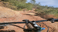
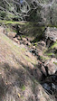
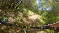
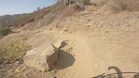
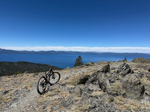
Photos of Placer County Mountain Bike
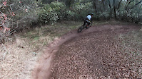
Videos of Placer County Mountain Bike
trail: Creek Side Trail
0:12 |
|
Oct 17, 2024

trail: Culvert Trail
28:31 |
50 |
May 2, 2024
trail: Foresthill Divide Trail
0:11 |
41 |
Feb 8, 2024
trail: Stonewall
3:00 |
93 |
Apr 10, 2021
trail: Culvert Trail
0:09 |
126 |
Jan 2, 2021
trail: Confluence Trail
0:00 |
112 |
Nov 2, 2020
trail: Culvert Trail
0:38 |
47 |
Aug 4, 2020
trail: Stonewall
0:30 |
50 |
Aug 4, 2020
Current Trail Warnings
| status | trail | date | condition | user | info |
|---|---|---|---|---|---|
| Old Stanford Rock Stanford Rock | Jun 15, 2026 @ 2:57pm (America/Los_Angeles) Jun 15, 2026 | Variable | sea1sak | I guess because of the new routing the... | |
| Deer Park (South) Alpine Meadows Palisades Tahoe | Jun 11, 2026 @ 2:13pm (America/Los_Angeles) Jun 11, 2026 | Dry | buzzoff | 36" tree down, blocking trail - less than... |
Recent Trail Reports
National Scenic Trails & Official Routes
-
Tahoe Rim Trail
- Mountain Bike
- E-Bike
- Horse
- Hike
- Trail Running
Activity Feed
| username | action | type | title | date |
|---|---|---|---|---|
| cqr | wishlist | route | activity #97357938 | Jun 19, 2026 @ 6:05pm 2 hours |
| stmacdonald | add | report | activity #97353017 | Jun 19, 2026 @ 4:38pm 3 hours |
| yXnygmMR | wishlist | region | activity #97347160 | Jun 19, 2026 @ 3:04pm 5 hours |
| buzzoff | add | report | activity #97345776 | Jun 19, 2026 @ 2:41pm 5 hours |
| chito | rsvp | event | activity #97289634 | Jun 18, 2026 @ 6:49pm 1 day |
Recent Comments
| username | type | title | comment | date |
|---|---|---|---|---|
| trail | I rode this on an adaptive mtb (Bowhead RX)... | Jun 17, 2026 @ 3:10pm 2 days | ||
| trail | Dried out, overgrown, a few downed... | Jun 9, 2026 @ 9:47pm Jun 9, 2026 | ||
| report | 🙌🏼 | May 18, 2026 @ 8:07am May 18, 2026 | ||
| report | Thanks for report! | May 16, 2026 @ 8:28am May 16, 2026 | ||
| trail | Trail is good to go! | May 9, 2026 @ 6:59pm May 9, 2026 |
Local Badges
-

Climbing 10k Badge4 awarded -

Epic Ride Descent 2k0 awarded -
Epic Ride Descent 2k55 awarded -

Mountain Biking 100k Badge0 awarded -

10 Blue Trails1 awarded -

Completionist0 awarded
Bike & Skill Parks
| name | type | city | rating |
|---|---|---|---|
| Alpine Meadows Palisades Tahoe | bike park | Tahoe City | |
| Olympic Valley Palisades Tahoe | bike park | Olympic Valley | |
| Homewood Mountain Resort | bike park | Homewood | |
| Mammoth Bar OHV | skill park | Auburn | |
| Whitney Park Pump Track By Velo Solutions | skill park | Rocklin |
Upcoming Local Events
-
-
-
-
Local Mountain Biking Directory
-
Folsom Auburn Trail Riders Action Coalition
![Folsom Auburn Trail Riders Action Coalition]()
-
Stray Dog Bicycles
![Stray Dog Bicycles]()
-
Tahoe Cross-Country Ski Area
-
Gravity Shop
Bike Shop
-
Roseville Cyclery
Bike Shop
-
Olympic Bike Shop
Bike Shop
Local Mountain Biking Directory
-
Folsom Auburn Trail Riders Action Coalition
![Folsom Auburn Trail Riders Action Coalition]()
-
Stray Dog Bicycles
![Stray Dog Bicycles]()
-
Tahoe Cross-Country Ski Area
-
Gravity ShopBike Shop
-
Roseville CycleryBike Shop
-
Olympic Bike ShopBike Shop
Activity Type Stats
| activitytype | trails | distance | descent | descent distance | total vertical | rating | global rank | state rank | photos | reports | routes | ridelogs |
|---|---|---|---|---|---|---|---|---|---|---|---|---|
| Mountain Bike | 667 | 737 miles | 131,138 ft | 324 miles | 9,058 ft | 1,802 | 5,894 | 138 | 125,520 | |||
| E-Bike | 157 | 310 miles | 49,633 ft | 127 miles | 8,235 ft | 21 | 4,537 | 16 | 14,588 | |||
| Gravel Bike | 177 | 198 miles | 21,506 ft | 68 miles | 8,675 ft | 1,763 | 9 | 364 | ||||
| Adaptive Bike | 87 | 128 miles | 13,944 ft | 38 miles | 8,241 ft | 784 | 12 | |||||
| Winter Fat Bike | 22 | 20 miles | 2,923 ft | 8 miles | 2,011 ft | 381 | 2 | |||||
| Horse | 357 | 468 miles | 81,096 ft | 207 miles | 8,776 ft | 2,335 | 3 | 55 | ||||
| Hike | 729 | 873 miles | 161,942 ft | 388 miles | 9,058 ft | 74 | 5,869 | 22 | 13,254 | |||
| Trail Running | 724 | 869 miles | 159,741 ft | 386 miles | 9,058 ft | 6 | 5,867 | 19 | 11,044 | |||
| Dirtbike/Moto | 114 | 261 miles | 40,597 ft | 105 miles | 8,235 ft | 6 | 1,558 | 7 | 222 | |||
| Observed Trials | 38 | 30 miles | 5,030 ft | 14 miles | 8,215 ft | 524 | 143 | |||||
| ATV/ORV/OHV | 73 | 144 miles | 17,096 ft | 55 miles | 8,235 ft | 4 | 1,464 | 42 | ||||
| Snowmobile | 10 | 25 miles | 2,231 ft | 8 miles | 7,904 ft | 497 | 33 | |||||
| Snowshoe | 7 | 18 miles | 1,759 ft | 7 miles | 7,904 ft | 457 | 833 | |||||
| Downhill Ski | 352 | 101 miles | 103,287 ft | 94 miles | 8,386 ft | 448 | 25,372 | |||||
| Backcountry Ski | 78 | 25 miles | 12,782 ft | 15 miles | 8,386 ft | 467 | 1 | 5,646 | ||||
| Nordic Ski | 52 | 33 miles | 3,107 ft | 14 miles | 6,795 ft | 462 | 1 | 5,757 |
Frequently Asked Questions About Placer County
▼
What are the best places to ride in Placer County?
Placer County has 33 areas to explore for mountain biking. The top rated areas are:
▼
What are the highest rated mountain biking trails in Placer County?
The highest rated mountain biking trails in Placer County are:
- Stanford Rock Trail (4.7/5)
- Lakeview Ridge Trail (4.6/5)
- Western States Trail (Three Bridges) (4.5/5)
- Paige Meadows Trail (West) (4.5/5)
- Tahoe Rim Trail (Painted Rock) (4.4/5)
▼
What is the best time of the year to ride in Placer County?
Based on ride log data, the most popular months to ride in Placer County are:
- July (2,351 activities)
- June (1,675 activities)
- August (1,458 activities)
▼
What is the longest trail in Placer County?
The longest trail in Placer County is Loop 6 at 15.2 miles. View all trails sorted by distance.
Activities
- Placer County Mountain Biking Trails
- Placer County E-Biking Trails
- Placer County Gravel Biking Trails
- Placer County Horseback Trails
- Placer County Hiking Trails
- Placer County Trail Running Trails
- Placer County Dirtbiking Trails
- Placer County Observed Trials Trails
- Placer County ATVing/Offroading Trails
- Placer County Snowmobiling Trails
- Placer County Snowshoeing Trails
- Placer County Skiing Trails
- Placer County Backcountry Skiing Trails
- Placer County Nordic Skiing Trails
Trails
- By brenthillier
 NSMBA TRAILFORKS & contributors
 - Admins: jpmcghee, sanfret, brianpetry, TheAngryTomato, Indorhino
- #7910 - 13,039 views
- placer county activity log | embed map of Placer County mountain bike trails | placer county mountain biking points of interest polygons
Downloading of trail gps tracks in kml & gpx formats is enabled for Placer County.
You must login to download files.