close
-
Layers w
- Weather Layers
- Pro
- Pro
- Pro
- Pro
- Pro
- Pro
- More Layers
- Pro
- Pro
- Pro
- Pro
-
Upgrade to

3D
Trail Conditions
- Unknown
- Snow Groomed
- Snow Packed
- Snow Covered
- Snow Cover Partial
- Freeze/thaw Cycle
- Icy
- Prevalent Mud
- Wet
- Variable
- Ideal
- Dry
- Very Dry
Trail Flow (Ridden Direction)
Trailforks scans users ridelogs to determine the most popular direction each trail is ridden. A good flowing trail network will have most trails flowing in a single direction according to their intension.
The colour categories are based on what percentage of riders are riding a trail in its intended direction.
The colour categories are based on what percentage of riders are riding a trail in its intended direction.
- > 96%
- > 90%
- > 80%
- > 70%
- > 50%
- < 50%
- bi-directional trail
- no data
Trail Last Ridden
Trailforks scans ridelogs to determine the last time a trail was ridden.
- < 2 days
- < 1 week
- < 2 weeks
- < 1 month
- < 6 months
- > 6 months
Trail Ridden Direction
The intended direction a trail should be ridden.
- Downhill Only
- Downhill Primary
- Both Directions
- Uphill Primary
- Uphill Only
- One Direction
Contribute Details
Colors indicate trail is missing specified detail.
- Description
- Photos
- Description & Photos
- Videos
Trail Popularity ?
Trailforks scans ridelogs to determine which trails are ridden the most in the last 9 months.
Trails are compared with nearby trails in the same city region with a possible 25 colour shades.
Think of this as a heatmap, more rides = more kinetic energy = warmer colors.
- most popular
- popular
- less popular
- not popular
ATV/ORV/OHV Filter
Max Vehicle Width
inches
US Cell Coverage
Legend

Radar Time
Activity Recordings
Trailforks uses anonymized public activity data.
?
Activity Recordings
Trailforks uses anonymized public activity data.
?
Personal Heatmap
▶
Activity Types
all
/
none
▶
Options
2
Date range
month
–
Winter Trails
Warning
A routing network for winter maps does not exist. Selecting trails using the winter trails layer has been disabled.
Missing Trails
Most Popular
Least Popular
Trails are colored based on popularity. The more popular a trail is, the more red. Less popular trails trend towards green.
Jump Magnitude Heatmap
Heatmap of where riders jump on trails. Zoom in to see individual jumps, click circles to view jump details.
BC Backroad Status
![map legend]()
Service Road Atlas is a free to use, community-driven service for viewing and creating reports on the numerous back-country service roads around B.C. and Alberta.

Slope Aspect
Direction the slope faces
Trails Deemphasized
Trails are shown in grey.
Only show trails with no bike usage.
Suggested Layers
Based on selected activity type
Save the current map location and zoom level as your default home location whenever this page is loaded.
Save
No description for Plano has been added yet!
Login or register to submit one.
Activities Click to view
- Mountain Bike
40 trails
- E-Bike
35 trails
- Gravel Bike
0 trails
- Adaptive Bike
0 trails
- Hike
63 trails
- Trail Running
63 trails
Region Details
- 6
- 27
- 5
- 1
Region Status
Open as of 23 hoursStats
- Avg Trail Rating
- Trails (view details)
- 62
- Trails Mountain Bike
- 40
- Trails E-Bike
- 35
- Trails Hike
- 63
- Trails Trail Running
- 63
- Total Distance
- 25 miles
- Total Descent Distance
- 6 miles
- Total Descent
- 735 ft
- Total Vertical
- 132 ft
- Highest Trailhead
- 656 ft
- Reports
- 483
- Photos
- 12
- Ridden Counter
- 2,461
Sub Regions
-
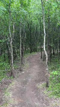
Arbor Hills Nature Preserve
- 6
- 4
-
Arbor Hills Nature Preserve Off Road Bike Trail
- 1
-
Bob Woodruff Park (North)
- 3
-
Bob Woodruff Park (South)
- 1
-
Oak Point Park And Nature Preserve
- 16
- 1
Popular Plano Mountain Biking Trails
• 70 ★ 5.0 • 902 ft • 2 ft • 99 •
Popular white difficulty paved path. This multi-use trail can be used both directions. On average it takes 1 minutes to complete this trail.
• 70 ★ 0.0 • 318 ft • 0 ft • 69 •
Popular white difficulty paved path. This multi-use trail can be used both directions. On average it takes minutes to complete this trail.
• 90 ★ 0.0 • 1,667 ft • 0 ft • 62 •
Popular white difficulty paved path. This multi-use trail can be used both directions and has a easy overall physical rating. Trail visibility is always easy to follow. On average it takes 1 minutes to complete this trail.
• 95 ★ 0.0 • 1,142 ft • 2 ft • 62 •
Popular white difficulty paved path. This multi-use trail can be used both directions and has a easy overall physical rating. Trail visibility is always easy to follow. On average it takes minutes to complete this trail.
• 85 ★ 0.0 • 3,061 ft • 9 ft • 57 •
Popular white difficulty paved path. This multi-use trail can be used both directions. On average it takes 2 minutes to complete this trail.
• 100 ★ 0.0 • 2 miles • 35 ft • 57 •
Popular white difficulty paved path. This multi-use trail can be used both directions and has a easy overall physical rating. Trail visibility is always easy to follow. On average it takes 10 minutes to complete this trail.
• 95 ★ 0.0 • 820 ft • 0 ft • 51 •
Popular white difficulty paved path. This multi-use trail can be used both directions and has a easy overall physical rating. Trail visibility is always easy to follow. On average it takes minutes to complete this trail.
Plano Mountain Bike Routes
• 1 mile • 90 ft • 1 •
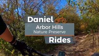
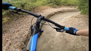
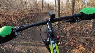
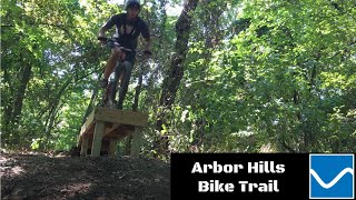
Videos of Plano Mountain Bike
0:02 |
108 |
Apr 29, 2025

331 |
Jul 12, 2024

3:32 |
637 |
Oct 23, 2022
18:56 |
328 |
Oct 23, 2022
8:26 |
765 |
Aug 12, 2022 , Plano

5:18 |
1882 |
Mar 19, 2022 , Plano
15:30 |
543 |
Jan 13, 2022
5:11 |
1577 |
Nov 16, 2020 , Plano
Current Trail Warnings
| status | trail | date | condition | user | info |
|---|---|---|---|---|---|
| Arbor Hills Off Road Bike Trail | Jun 19, 2026 @ 7:10am (America/Chicago) 23 hours | Variable | Bushwacker3 Trail Steward |
Recent Trail Reports
| status | trail | date | condition | info | user |
|---|---|---|---|---|---|
| Arbor Hills Rec | Nov 1, 2025 @ 8:56am (America/Matamoros) Nov 1, 2025 | Ideal | arthurdexter | ||
| Chisholm Hike And Bike Trail (south East Path) | Aug 24, 2024 @ 9:25am Aug 24, 2024 | Ideal | arthurdexter | ||
| Oak Point Park & Nature Preserve 2 | Apr 21, 2024 @ 12:10pm Apr 21, 2024 | Ideal | niladridas | ||
| Oak Point Paved Path | Apr 21, 2024 @ 12:10pm Apr 21, 2024 | Ideal | niladridas | ||
| Bob Woodruff Paved Path | Apr 21, 2024 @ 12:10pm Apr 21, 2024 | Ideal | niladridas | ||
| Oak Point Park & Nature Preserve 7 | Apr 21, 2024 @ 12:10pm Apr 21, 2024 | Ideal | niladridas | ||
| Bluebonnet Trail 1 | Feb 24, 2024 @ 3:20am Feb 24, 2024 | Ideal | arthurdexter | ||
| Bluebonnet Trail 2 | Feb 24, 2024 @ 3:20am Feb 24, 2024 | Ideal | arthurdexter | ||
| Oak Point Park & Nature Preserve 5 | Feb 24, 2024 @ 3:20am Feb 24, 2024 | Ideal | arthurdexter | ||
| Oak Point Park & Nature Preserve 6 | Feb 24, 2024 @ 3:20am Feb 24, 2024 | Ideal | arthurdexter |
Activity Feed
| username | action | type | title | date |
|---|---|---|---|---|
| Bushwacker3 | add | report | activity #97309031 | Jun 19, 2026 @ 5:10am 23 hours |
| Bushwacker3 | add | report | activity #97109449 | Jun 16, 2026 @ 7:40am Jun 16, 2026 |
| Bushwacker3 | add | report | activity #96993112 | Jun 14, 2026 @ 12:02pm Jun 14, 2026 |
| Bushwacker3 | add | report | activity #96740402 | Jun 11, 2026 @ 8:43am Jun 11, 2026 |
| Bushwacker3 | add | report | activity #96116414 | Jun 2, 2026 @ 4:12pm Jun 2, 2026 |
Recent Comments
| username | type | title | comment | date |
|---|---|---|---|---|
| report | Some mud still at the bottom of riparian trail... | Jan 2, 2025 @ 2:27pm Jan 2, 2025 | ||
| report | Went today around 1:30pm both parking lot... | Jul 28, 2024 @ 7:10pm Jul 28, 2024 | ||
| report | Trail is loosening up. Dirt around and under... | Jun 30, 2024 @ 9:29pm Jun 30, 2024 | ||
| report | jd | Nov 5, 2023 @ 10:16am Nov 5, 2023 | ||
| trail | A lot more washed out in the past 30 days,... | Sep 4, 2021 @ 8:06pm Sep 4, 2021 |
Local Badges
-

Epic Mountain Bike Climb 2k0 awarded -

Climbing 10k Badge10 awarded -

Mountain Biking 100k Badge0 awarded -

Epic Ride Descent 2k0 awarded -

Descent 10k Badge10 awarded -

Descent 100k Badge0 awarded
Activity Type Stats
| activitytype | trails | distance | descent | descent distance | total vertical | rating | global rank | state rank | photos | reports | routes | ridelogs |
|---|---|---|---|---|---|---|---|---|---|---|---|---|
| Mountain Bike | 40 | 18 miles | 535 ft | 4 miles | 131 ft | #4,153 | #1,400 | 15 | 483 | 2 | 7,945 | |
| E-Bike | 35 | 16 miles | 515 ft | 4 miles | 128 ft | #5,226 | #1,624 | 477 | 335 | |||
| Hike | 63 | 25 miles | 735 ft | 6 miles | 131 ft | #5,399 | #1,901 | 437 | 1 | 356 | ||
| Trail Running | 63 | 25 miles | 735 ft | 6 miles | 131 ft | #5,019 | #1,568 | 436 | 1 | 1,504 |
Frequently Asked Questions About Plano
▼
What are the best places to ride in Plano?
Plano has 5 areas to explore for mountain biking. The top rated areas are:
▼
What are the highest rated mountain biking trails in Plano?
The highest rated mountain biking trails in Plano are:
- Tower (arbor Hills) (4.1/5)
- Arbor Vista (4.1/5)
- Arbor Hills Off Road Bike Trail (4/5)
- Bob Woodruff Paved Path (0/5)
- Oak Point Paved Path (0/5)
▼
What is the best time of the year to ride in Plano?
Based on ride log data, the most popular months to ride in Plano are:
- September (57 activities)
- July (52 activities)
- November (41 activities)
▼
Where can I park to ride in Plano?
There are 4 parking locations listed in Plano. The most popular parking spots are: View all parking and trailhead locations on the map to plan your visit.
Activities
Trails
Points of Interest
- By canadaka
 Trailforks & contributors
 - Admins: FWMBA, DORBA MAIN
- #5023 - 7,400 views
- plano activity log | embed map of Plano mountain bike trails | plano mountain biking points of interest
Downloading of trail gps tracks in kml & gpx formats is enabled for Plano.
You must login to download files.