close
-
Layers w
- Weather Layers
- Pro
- Pro
- Pro
- Pro
- Pro
- Pro
- More Layers
- Pro
- Pro
- Pro
- Pro
-
Upgrade to

3D
Trail Conditions
- Unknown
- Snow Groomed
- Snow Packed
- Snow Covered
- Snow Cover Partial
- Freeze/thaw Cycle
- Icy
- Prevalent Mud
- Wet
- Variable
- Ideal
- Dry
- Very Dry
Trail Flow (Ridden Direction)
Trailforks scans users ridelogs to determine the most popular direction each trail is ridden. A good flowing trail network will have most trails flowing in a single direction according to their intension.
The colour categories are based on what percentage of riders are riding a trail in its intended direction.
The colour categories are based on what percentage of riders are riding a trail in its intended direction.
- > 96%
- > 90%
- > 80%
- > 70%
- > 50%
- < 50%
- bi-directional trail
- no data
Trail Last Ridden
Trailforks scans ridelogs to determine the last time a trail was ridden.
- < 2 days
- < 1 week
- < 2 weeks
- < 1 month
- < 6 months
- > 6 months
Trail Ridden Direction
The intended direction a trail should be ridden.
- Downhill Only
- Downhill Primary
- Both Directions
- Uphill Primary
- Uphill Only
- One Direction
Contribute Details
Colors indicate trail is missing specified detail.
- Description
- Photos
- Description & Photos
- Videos
Trail Popularity ?
Trailforks scans ridelogs to determine which trails are ridden the most in the last 9 months.
Trails are compared with nearby trails in the same city region with a possible 25 colour shades.
Think of this as a heatmap, more rides = more kinetic energy = warmer colors.
- most popular
- popular
- less popular
- not popular
ATV/ORV/OHV Filter
Max Vehicle Width
inches
US Cell Coverage
Legend

Radar Time
Activity Recordings
Trailforks uses anonymized public activity data.
?
Activity Recordings
Trailforks uses anonymized public activity data.
?
Personal Heatmap
▶
Activity Types
all
/
none
▶
Options
2
Date range
month
–
Winter Trails
Warning
A routing network for winter maps does not exist. Selecting trails using the winter trails layer has been disabled.
Missing Trails
Most Popular
Least Popular
Trails are colored based on popularity. The more popular a trail is, the more red. Less popular trails trend towards green.
Jump Magnitude Heatmap
Heatmap of where riders jump on trails. Zoom in to see individual jumps, click circles to view jump details.
BC Backroad Status
![map legend]()
Service Road Atlas is a free to use, community-driven service for viewing and creating reports on the numerous back-country service roads around B.C. and Alberta.

Slope Aspect
Direction the slope faces
Trails Deemphasized
Trails are shown in grey.
Only show trails with no bike usage.
Suggested Layers
Based on selected activity type
Save the current map location and zoom level as your default home location whenever this page is loaded.
SavePlenty Gorge Park contains many natural trails to suit a wide range of MTB skills. The trail network is currently being assessed with the local Plenty Gorge MTB Club and Parks Victoria. Trails will be marked accordingly as the verdict becomes known.
Primary Trail Type: Cross-Country
eBikes Allowed:
Yes
Land Status: Provincial Park
 google parking directions
Links
Activities Click to view
- Mountain Bike
218 trails
- E-Bike
197 trails
- Hike
38 trails
- Trail Running
38 trails
Region Details
- 32
- 8
- 40
- 98
- 26
- 5
- 1
Region Status
Open as of May 24, 2026Stats
- Avg Trail Rating
- Trails (view details)
- 210
- Trails Mountain Bike
- 218
- Trails E-Bike
- 197
- Trails Hike
- 38
- Trails Trail Running
- 38
- Total Distance
- 86 miles
- Total Descent
- 9,467 ft
- Total Vertical
- 440 ft
- Highest Trailhead
- 546 ft
- Reports
- 2,580
- Photos
- 582
- Ridden Counter
- 76,521
Popular Plenty Gorge Park Mountain Biking Trails
• 100 ★ 3.9 • 2,333 ft • 12 ft • 1,251 •
Pleasant single track climb from the plank bridge with a couple of technical features to keep the trail interesting. Downhill is equally rewarding especially when winding down the tight trail from the top.
• 90 ★ 2.7 • 390 ft • 40 ft • 914 •
The very top part of , between fence and the Triangle
• 100 ★ 4.3 • 1,955 ft • 21 ft • 896 •
Nice flowing blue trail, winding down the bottom of the gorge next to the river. This trail can be slippery during winter so just be careful. There are a few little pinch climbs here and there but it's mostly a nice flowy trail....
• 100 ★ 3.8 • 2,677 ft • 101 ft • 865 •
Popular blue difficulty singletrack. This mountain bike primary trail can be used both directions. On average it takes 5 minutes to complete this trail.
• 100 ★ 4.4 • 3,780 ft • 82 ft • 861 •
Popular blue difficulty singletrack. This mountain bike primary trail can be used both directions. On average it takes 7 minutes to complete this trail.
• 95 ★ 3.9 • 3,461 ft • 33 ft • 846 •
One of the premium trails on offer at Plenty Gorge. It can be ridden both ways & overall is technically not difficult to ride with only a few pinch climbs & loose rock to contend with. The difficulty comes into play when you realise...
• 95 ★ 2.0 • 587 ft • 0 ft • 810 •
Popular blue difficulty singletrack. This mountain bike primary trail can be used downhill only. On average it takes minutes to complete this trail.
Plenty Gorge Park Mountain Bike Routes
PGMTB Tank Loop Featured
★ 5.0 • 3 miles • 279 ft • 4 • Loop •
The Tank Loop is a great introduction to Plenty Gorge MTB trails, suitable for all riders. The trail...
Cadel's Loop - PGMTB Official Loop Featured
2 miles • 280 ft • 5 • Loop •
Cadel's Loop is named after Australian MTB legend and Tour de France winner Cadel Evens who spent his...
Tank Loop - PGMTB Official Loop Featured
3 miles • 262 ft • 5 • Loop •
The Tank Loop is a great introduction to Plenty Gorge MTB trails, suitable for all riders. The trail...
Am I Lost Loop - Official PGMTB Loop Featured
4 miles • 449 ft • 9 • Loop •
The " " loop ventures a little further into the Gorge and a little more difficult than the Tank Loop. The...
★ 5.0 • 3 miles • 232 ft • 5 • Loop •
Tank to Tank in Plenty Gorge connects four easy green trails. Great for beginners.
★ 3.5 • 9 miles • 1,017 ft • 12 • Loop •
A 15km loop including some of the more fun and challenging sections at the South end of the Gorge: Rocking...
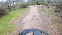
Photos of Plenty Gorge Park Mountain Bike
Videos of Plenty Gorge Park Mountain Bike
trail: Jumps Track 1
0:01 |
458 |
Sep 9, 2023
trail: Quarry Fireroad Entry
0:06 |
203 |
Dec 8, 2019

trail: Rocky
0:19 |
929 |
Feb 23, 2015

trail: Rocky
0:51 |
2405 |
Jan 26, 2015

trail: Rocky
0:47 |
2311 |
Dec 15, 2014

trail: Rocky
3:07 |
2096 |
Oct 16, 2013

trail: Rocky
2:08 |
181 |
Nov 21, 2011

trail: Rocky
0:27 |
2040 |
Nov 20, 2010
Recent Trail Reports
Activity Feed
| username | action | type | title | date |
|---|---|---|---|---|
| Domenicobrasco | comment | report | activity #96508322 | Jun 7, 2026 @ 4:55pm Jun 7, 2026 |
| Domenicobrasco | wishlist | route | activity #96265750 | Jun 4, 2026 @ 5:52pm Jun 4, 2026 |
| vipdrivingschool | ridden | poi | activity #95844118 | May 30, 2026 @ 6:11am May 30, 2026 |
| ferxo88 | wishlist | route | activity #95770875 | May 29, 2026 @ 5:54am May 29, 2026 |
| 251 | add | report | activity #95465983 | May 24, 2026 @ 10:08pm May 24, 2026 |
Recent Comments
| username | type | title | comment | date |
|---|---|---|---|---|
| report | U | Jun 7, 2026 @ 4:55pm Jun 7, 2026 | ||
| trail | So good, make sure to walk it first. It most... | Jan 20, 2026 @ 2:18pm Jan 20, 2026 | ||
| report | Still some other fallen trees in places too,... | Dec 28, 2025 @ 3:02pm Dec 28, 2025 | ||
| trail | Superb trail; short but spicy 😎 | Dec 24, 2025 @ 8:13pm Dec 24, 2025 | ||
| trail | Careful - very steep drop at midway point | Oct 7, 2025 @ 10:25pm Oct 7, 2025 |
Nearby Areas
| name | distance | ||||
|---|---|---|---|---|---|
| Gresswell Forest Nature Conservation Reserve | 6 | 2.9 km | |||
| Quarry Hills Park | 3 | 3 | 3 km | ||
| Westerfolds Park | 7 | 1 | 5.3 km | ||
| Yarra Trails | 9 | 1 | 1 | 5.4 km | |
| Candlebark Park | 16 | 10 | 5.5 km |
Local Badges
-

Completionist0 awarded
Activity Type Stats
| activitytype | trails | distance | descent | descent distance | total vertical | rating | global rank | state rank | photos | reports | routes | ridelogs |
|---|---|---|---|---|---|---|---|---|---|---|---|---|
| Mountain Bike | 218 | 86 miles | 9,465 ft | 34 miles | 440 ft | #86 | #8 | 565 | 2,577 | 28 | 27,044 | |
| E-Bike | 197 | 68 miles | 8,642 ft | 30 miles | 374 ft | #210 | #38 | 1 | 2,545 | 7 | 3,569 | |
| Hike | 38 | 25 miles | 1,352 ft | 6 miles | 440 ft | #1,893 | #56 | 8 | 2,496 | 273 | ||
| Trail Running | 38 | 24 miles | 1,227 ft | 5 miles | 440 ft | #1,214 | #35 | 7 | 2,496 | 1 | 615 |
Frequently Asked Questions About Plenty Gorge Park
▼
What are the highest rated mountain biking trails in Plenty Gorge Park?
The highest rated mountain biking trails in Plenty Gorge Park are:
- Crop Circles (4.3/5)
- Downhill Demon (4.2/5)
- Quary Rock Drop (4.2/5)
- Tiddalik (4.2/5)
- In the Dog Connector (4.2/5)
▼
What is the best time of the year to ride in Plenty Gorge Park?
Based on ride log data, the most popular months to ride in Plenty Gorge Park are:
- October (459 activities)
- February (421 activities)
- November (382 activities)
▼
Where can I park to ride in Plenty Gorge Park?
There are 6 parking locations listed in Plenty Gorge Park. The most popular parking spots are: View all parking and trailhead locations on the map to plan your visit.
▼
What is the longest trail in Plenty Gorge Park?
The longest trail in Plenty Gorge Park is Pipe Track at 3.7 km. View all trails sorted by distance.
Activities
Trails
- By hfilmer PGMTB & contributors
- Admins: PGMTB, ken-oath, PGMTB
- #5310 - 130,412 views
- plenty gorge park activity log | embed map of Plenty Gorge Park mountain bike trails | plenty gorge park mountain biking points of interest polygons
Downloading of trail gps tracks in kml & gpx formats is enabled for Plenty Gorge Park.
You must login to download files.