close
-
Layers w
- Weather Layers
- Pro
- Pro
- Pro
- Pro
- Pro
- Pro
- More Layers
- Pro
- Pro
- Pro
- Pro
-
Upgrade to

3D
Trail Conditions
- Unknown
- Snow Groomed
- Snow Packed
- Snow Covered
- Snow Cover Partial
- Freeze/thaw Cycle
- Icy
- Prevalent Mud
- Wet
- Variable
- Ideal
- Dry
- Very Dry
Trail Flow (Ridden Direction)
Trailforks scans users ridelogs to determine the most popular direction each trail is ridden. A good flowing trail network will have most trails flowing in a single direction according to their intension.
The colour categories are based on what percentage of riders are riding a trail in its intended direction.
The colour categories are based on what percentage of riders are riding a trail in its intended direction.
- > 96%
- > 90%
- > 80%
- > 70%
- > 50%
- < 50%
- bi-directional trail
- no data
Trail Last Ridden
Trailforks scans ridelogs to determine the last time a trail was ridden.
- < 2 days
- < 1 week
- < 2 weeks
- < 1 month
- < 6 months
- > 6 months
Trail Ridden Direction
The intended direction a trail should be ridden.
- Downhill Only
- Downhill Primary
- Both Directions
- Uphill Primary
- Uphill Only
- One Direction
Contribute Details
Colors indicate trail is missing specified detail.
- Description
- Photos
- Description & Photos
- Videos
Trail Popularity ?
Trailforks scans ridelogs to determine which trails are ridden the most in the last 9 months.
Trails are compared with nearby trails in the same city region with a possible 25 colour shades.
Think of this as a heatmap, more rides = more kinetic energy = warmer colors.
- most popular
- popular
- less popular
- not popular
ATV/ORV/OHV Filter
Max Vehicle Width
inches
US Cell Coverage
Legend

Radar Time
Activity Recordings
Trailforks uses anonymized public activity data.
?
Activity Recordings
Trailforks uses anonymized public activity data.
?
Personal Heatmap
▶
Activity Types
all
/
none
▶
Options
2
Date range
month
–
Winter Trails
Warning
A routing network for winter maps does not exist. Selecting trails using the winter trails layer has been disabled.
Missing Trails
Most Popular
Least Popular
Trails are colored based on popularity. The more popular a trail is, the more red. Less popular trails trend towards green.
Jump Magnitude Heatmap
Heatmap of where riders jump on trails. Zoom in to see individual jumps, click circles to view jump details.
BC Backroad Status
![map legend]()
Service Road Atlas is a free to use, community-driven service for viewing and creating reports on the numerous back-country service roads around B.C. and Alberta.

Slope Aspect
Direction the slope faces
Trails Deemphasized
Trails are shown in grey.
Only show trails with no bike usage.
Suggested Layers
Based on selected activity type
Save the current map location and zoom level as your default home location whenever this page is loaded.
Save
No description for Plzeňský has been added yet!
Login or register to submit one.
AKA: Plzeň
This region uses the Uk/Euro style trail grading system.
Stats
- Avg Trail Rating
- Trails (view details)
- 36
- Trails Mountain Bike
- 40
- Trails E-Bike
- 15
- Trails Hike
- 13
- Trails Trail Running
- 13
- Total Distance
- 40 miles
- Total Descent
- 12,421 ft
- Total Vertical
- 2,949 ft
- Highest Trailhead
- 4,131 ft
- Reports
- 175
- Photos
- 120
- Ridden Counter
- 2,575
Sub Regions
- Domažlice (5)
- Klatovy (18)
- Bike Park Špičák (6)
- Modrava (2)
- Sušice (10)
- Plzeň (5)
- Berounka Trails (4)
- Tachov (3)
- Traily Radnice (7)
Popular Plzeňský Mountain Biking Trails
• 50 ★ 4.0 • 4,728 ft • 0 ft • 376 •
The easiest trail in the park, it's currently (Summer 2023) being reworked and stops halfway down the mountain. From there on you continue on . Old name =
• 85 ★ 3.0 • 1,142 ft • 0 ft • 242 •
Popular black difficulty machine groomed. This mountain bike primary trail can be used downhill only. It features berm, drop, jump, gap jump, ladder bridge and wallride. Trail visibility is always easy to follow. On average it takes 1 minutes to complete this trail.
• 20 ★ 4.4 • 2,165 ft • 0 ft • 161 •
Highly rated less popular proline difficulty singletrack. This mountain bike primary trail can be used downhill only and has a hard overall physical rating. It features drop, jump, rock face and skinny. On average it takes 6 minutes to complete this trail.
• 35 ★ 4.7 • 443 ft • 0 ft • 144 •
Short and technical track with bridges and stones, as well as some drops
• 60 ★ 5.0 • 2,247 ft • 0 ft • 120 •
Highly rated moderately popular red difficulty machine groomed. This mountain bike primary trail and has a moderate overall physical rating. It features berm, jump and rock garden. Trail visibility is always easy to follow. On average it takes 5 minutes to complete this trail.
Plzeňský Mountain Bike Routes
• 15 miles • 9,744 ft • 20 •
• 9 miles • 4,151 ft • 8 •
• 21 miles • 8,842 ft • 20 •
• 7 miles • 3,440 ft • 6 •
• 14 miles • 6,271 ft • 9 •
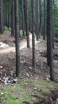
Photos of Plzeňský Mountain Bike
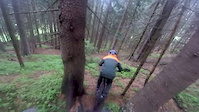
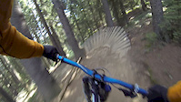
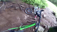
Videos of Plzeňský Mountain Bike
trail: Linkin
0:18 |
14 |
Aug 18, 2025

trail: Black Friday
5:04 |
74 |
Sep 23, 2021

trail: Air & Stone
0:20 |
101 |
Aug 28, 2020

trail: Black Friday
4:40 |
86 |
Sep 10, 2017
trail: Black Friday
0:01 |
105 |
Jul 20, 2017

trail: Black Friday
4:07 |
783 |
Nov 6, 2016
trail: Good Year
0:15 |
212 |
Sep 20, 2016
trail: Black Friday
0:18 |
540 |
Jun 5, 2016
Recent Trail Reports
| status | trail | date | condition | info | user |
|---|---|---|---|---|---|
| Struggle Bike Park Špičák | Jun 14, 2026 @ 9:20am (Europe/Prague) Jun 14, 2026 | Very Dry | JohSch | ||
| Air & Stone Bike Park Špičák | Jun 14, 2026 @ 9:20am (Europe/Prague) Jun 14, 2026 | Ideal | JohSch | ||
| Black Friday Bike Park Špičák | Jun 14, 2026 @ 9:20am (Europe/Prague) Jun 14, 2026 | Ideal | JohSch | ||
| Linkin Sušice | Jun 6, 2026 @ 10:02pm (Europe/Prague) Jun 6, 2026 | Ideal | propadlik | ||
| Lucky Bastard Bike Park Špičák | May 3, 2026 @ 10:35am (Europe/Prague) May 3, 2026 | Very Dry | tomasonthetrail | ||
| Good Year Bike Park Špičák | May 3, 2026 @ 10:35am (Europe/Prague) May 3, 2026 | Very Dry | tomasonthetrail | ||
| Havran_modra Tachov | Apr 5, 2026 @ 3:18pm (Europe/Prague) Apr 5, 2026 | Ideal | vAtWFt | ||
| Morrigan Sušice | Nov 6, 2025 @ 12:11pm (Europe/Prague) Nov 6, 2025 | Unknown | nizeps | ||
| Experts Only Bike Park Špičák | Sep 3, 2025 @ 9:42am Sep 3, 2025 | Ideal | Radlhans | ||
| Čerchov Ridge Domažlice | May 29, 2025 @ 12:27pm May 29, 2025 | Variable | pixelfields |
Activity Feed
| username | action | type | title | date |
|---|---|---|---|---|
| JohSch | add | report | activity #97167082 and 2 more | Jun 17, 2026 @ 12:43am 2 days |
| propadlik | add | report | activity #96400083 | Jun 6, 2026 @ 1:02pm Jun 6, 2026 |
| ViktoriePc6pZB | wishlist | trail | activity #96062130 | Jun 1, 2026 @ 9:43pm Jun 1, 2026 |
| JosefWg7ADm | wishlist | trail | activity #95156030 | May 20, 2026 @ 10:05pm May 20, 2026 |
| Micl0hptl | ridden | trail | activity #94265947 and 2 more | May 7, 2026 @ 10:46pm May 7, 2026 |
Recent Comments
| username | type | title | comment | date |
|---|---|---|---|---|
| trail | Very well built flow trail. Short pedally... | Aug 23, 2025 @ 10:05am Aug 23, 2025 | ||
| trail | new flow-line, currently in very good shape... | Aug 18, 2025 @ 4:48am Aug 18, 2025 | ||
| trail | Aktuálně uplně zničen těžbou.... | Apr 28, 2024 @ 1:21pm Apr 28, 2024 | ||
| trail | liiiiit! sehr guter trail, absolute... | Apr 21, 2024 @ 4:18am Apr 21, 2024 | ||
| trail | Nice trail, but Epona is better. Not too... | Aug 13, 2023 @ 7:11am Aug 13, 2023 |
Local Badges
-

Epic Ride Climb 2k241 awarded -

Climbing 10k Badge36 awarded -

Climbing 100k Badge2 awarded -

Epic Ride Descent 2k241 awarded -

Descent 10k Badge44 awarded -

Descent 100k Badge2 awarded
Bike & Skill Parks
| name | type | city | rating |
|---|---|---|---|
| Bike Park Špičák | bike park | Klatovy | |
| Jump Park | skill park | Klatovy | |
| Pumptrack Zbiroh | skill park | Rokycany | |
| Stribo | skill park | Tachov |
Activity Type Stats
| activitytype | trails | distance | descent | descent distance | total vertical | rating | global rank | state rank | photos | reports | routes | ridelogs |
|---|---|---|---|---|---|---|---|---|---|---|---|---|
| Mountain Bike | 40 | 38 miles | 11,391 ft | 23 miles | 2,949 ft | 117 | 175 | 1 | 15,413 | |||
| E-Bike | 15 | 8 miles | 2,598 ft | 5 miles | 2,740 ft | 157 | 1,018 | |||||
| Hike | 13 | 24 miles | 4,987 ft | 12 miles | 2,949 ft | 140 | 1,176 | |||||
| Trail Running | 13 | 24 miles | 4,987 ft | 12 miles | 2,949 ft | 3 | 140 | 154 |
Activities
Trails
Points of Interest
- By brenthillier
 NSMBA TRAILFORKS & contributors
 - Admins: ČeMBA, ČeMBA, ČeMBA, ČeMBA, ČeMBA, ČeMBA, ČeMBA, ČeMBA, ČeMBA, ČeMBA
- #9745 - 3,024 views
- plzeňský activity log | embed map of Plzeňský mountain bike trails | plzeňský mountain biking points of interest polygons
Downloading of trail gps tracks in kml & gpx formats is enabled for Plzeňský.
You must login to download files.