close
-
Layers w
- Weather Layers
- Pro
- Pro
- Pro
- Pro
- Pro
- Pro
- More Layers
- Pro
- Pro
- Pro
- Pro
-
Upgrade to

3D
Trail Conditions
- Unknown
- Snow Groomed
- Snow Packed
- Snow Covered
- Snow Cover Partial
- Freeze/thaw Cycle
- Icy
- Prevalent Mud
- Wet
- Variable
- Ideal
- Dry
- Very Dry
Trail Flow (Ridden Direction)
Trailforks scans users ridelogs to determine the most popular direction each trail is ridden. A good flowing trail network will have most trails flowing in a single direction according to their intension.
The colour categories are based on what percentage of riders are riding a trail in its intended direction.
The colour categories are based on what percentage of riders are riding a trail in its intended direction.
- > 96%
- > 90%
- > 80%
- > 70%
- > 50%
- < 50%
- bi-directional trail
- no data
Trail Last Ridden
Trailforks scans ridelogs to determine the last time a trail was ridden.
- < 2 days
- < 1 week
- < 2 weeks
- < 1 month
- < 6 months
- > 6 months
Trail Ridden Direction
The intended direction a trail should be ridden.
- Downhill Only
- Downhill Primary
- Both Directions
- Uphill Primary
- Uphill Only
- One Direction
Contribute Details
Colors indicate trail is missing specified detail.
- Description
- Photos
- Description & Photos
- Videos
Trail Popularity ?
Trailforks scans ridelogs to determine which trails are ridden the most in the last 9 months.
Trails are compared with nearby trails in the same city region with a possible 25 colour shades.
Think of this as a heatmap, more rides = more kinetic energy = warmer colors.
- most popular
- popular
- less popular
- not popular
ATV/ORV/OHV Filter
Max Vehicle Width
inches
US Cell Coverage
Legend

Radar Time
Activity Recordings
Trailforks uses anonymized public activity data.
?
Activity Recordings
Trailforks uses anonymized public activity data.
?
Personal Heatmap
▶
Activity Types
all
/
none
▶
Options
2
Date range
month
–
Winter Trails
Warning
A routing network for winter maps does not exist. Selecting trails using the winter trails layer has been disabled.
Missing Trails
Most Popular
Least Popular
Trails are colored based on popularity. The more popular a trail is, the more red. Less popular trails trend towards green.
Jump Magnitude Heatmap
Heatmap of where riders jump on trails. Zoom in to see individual jumps, click circles to view jump details.
BC Backroad Status
![map legend]()
Service Road Atlas is a free to use, community-driven service for viewing and creating reports on the numerous back-country service roads around B.C. and Alberta.

Slope Aspect
Direction the slope faces
Trails Deemphasized
Trails are shown in grey.
Only show trails with no bike usage.
Suggested Layers
Based on selected activity type
Save the current map location and zoom level as your default home location whenever this page is loaded.
SavePodkarpackie Voivodeship or Podkarpackie Province (in Polish: województwo podkarpackie [vɔjɛˈvut͡stfɔ pɔtkarˈpatskʲɛ]), also known as Subcarpathian Voivodeship, is a voivodeship, or province, in extreme-southeastern Poland. Its administrative capital and largest city is Rzeszów. (Historically Lwów was the administrative center of this part of Poland, but after 1945, when Lwów became part of the Soviet Union, that city's role was relinquished to Rzeszów.)
The voivodeship was created on 1 January 1999 out of the former Rzeszów, Przemyśl, Krosno and (partially) Tarnów and Tarnobrzeg Voivodeships, pursuant to the Polish local-government reforms adopted in 1998. The name derives from the region's location near the Carpathian Mountains, and the voivodeship comprises areas of two historic regions of Eastern Europe — Lesser Poland (western and northwestern counties) and Red Ruthenia. In the Interbellum, Subcarpathian Voivodeship belonged to "Poland B", the less-developed, more rural parts of Poland. To boost the local economy, the government of the Second Polish Republic began in the mid-1930s a massive program of industrialization, known as the Central Industrial Region. The program created several major armament factories, including PZL Mielec, PZL Rzeszów, Huta Stalowa Wola, and factories in other Subcarpathian towns such as Dębica, Nowa Dęba, Sanok, Tarnobrzeg and Nowa Sarzyna.
It is bordered by Lesser Poland Voivodeship to the west, Świętokrzyskie Voivodeship to the north-west, Lublin Voivodeship to the north, Ukraine to the east and Slovakia to the south. It covers an area of 17,844 square kilometres (6,890 sq mi), and has a population of 2,096,971 (as at 2006). The voivodeship is mostly hilly or mountainous (see Bieszczady, Beskidy); its northwestern corner is flat. It is one of the most wooded Polish voivodeships (35.9% of total area), within its borders there is whole Bieszczady National Park, and parts of Magura National Park. Furthermore, the creation of Turnicki National Park is planned.
AKA: Subcarpathian
Links
This region uses the Uk/Euro style trail grading system.
Region Details
- 72
- 16
- 80
- 38
- 9
Stats
- Avg Trail Rating
- Trails (view details)
- 216
- Trails Mountain Bike
- 232
- Trails E-Bike
- 80
- Trails Adaptive Bike
- 3
- Trails Winter Fat Bike
- 1
- Trails Horse
- 8
- Trails Hike
- 175
- Trails Trail Running
- 187
- Trails Observed Trials
- 3
- Trails Snowshoe
- 3
- Trails Downhill Ski
- 3
- Trails Backcountry Ski
- 4
- Trails Nordic Ski
- 3
- Total Distance
- 288 miles
- Total Descent
- 73,844 ft
- Total Vertical
- 3,244 ft
- Highest Trailhead
- 3,747 ft
- Reports
- 533
- Photos
- 796
- Ridden Counter
- 4,877
Popular Trail Networks
view all areas »Sub Regions
- Powiat Bieszczadzki (42)
- Czarna (powiat bieszczadzki) (5)
- Lutowiska (32)
- Ustrzyki Dolne (5)
- Czarna (powiat bieszczadzki) (5)
- Powiat Brzozowski (1)
- Dydnia (1)
- Jasienica Rosielna (4)
- Dydnia (1)
- Powiat Dębicki (19)
- Dębica (19)
- Slavic Trails (19)
- Dębica (19)
- Powiat Jarosławski (1)
- Wiązownica (1)
- Wiązownica (1)
- Powiat Jasielski (5)
- Powiat Kolbuszowski (1)
- Cmolas (1)
- Cmolas (1)
- Powiat Krośnieński (Podkarpackie) (31)
- Dukla (14)
- Iwonicz-Zdrój (2)
- Jaśliska (3)
- Korczyna (5)
- Land of Loam (5)
- Krosno (5)
- Rymanów (7)
- Dukla (14)
- Powiat Leski (42)
- Powiat Lubaczowski (1)
- Horyniec-Zdrój (1)
- Horyniec-Zdrój (1)
- Powiat Mielecki (21)
- Mielec (21)
- MTB TRAiLS Mielec (19)
- Mielec (21)
- Powiat Niżański (1)
- Harasiuki (1)
- Harasiuki (1)
- Powiat Przemyski (17)
- Bircza (3)
- Przemyśl (14)
- Fort Trails (5)
- Bircza (3)
- Powiat Przeworski (5)
- Powiat Ropczycko-Sędziszowski (11)
- Ropczyce (10)
- Ropczyce (10)
- Powiat Rzeszowski (24)
- Dynów (1)
- Głogów Małopolski (11)
- Zielone Wzgórze (11)
- Lubenia (5)
- Lubenki Trails (5)
- Rzeszów (7)
- Dynów (1)
- Powiat Sanocki (4)
- Komańcza (4)
- Komańcza (4)
- Powiat Stalowowolski (1)
- Zaklików (1)
- Zaklików (1)
- Powiat Strzyżowski (1)
- Powiat Tarnobrzeski (1)
- Tarnobrzeg (1)
- Tarnobrzeg (1)
- Powiat Łańcucki (1)
- Łańcut (1)
- Łańcut (1)
- Grodzisko Dolne (1)
Popular Podkarpackie Mountain Biking Trails
• 40 ★ 5.0 • 2,822 ft • 0 ft • 70 •
Jedna z trzech tras Enduro MTB Podkarpacie w Gminie Korczyna.
• 20 ★ 4.8 • 2,470 ft • 0 ft • 69 •
Jedna z trzech tras Enduro MTB Podkarpacie w Gminie Korczyna.
• 80 ★ 4.8 • 2,562 ft • 0 ft • 67 •
Jedna z trzech tras Enduro MTB Podkarpacie w Gminie Korczyna.
• 100 ★ 3.7 • 2 miles • 278 ft • 51 •
Trawers. Dziki, lawriujacy pomiedzy drzewami szlak. Jesienia moze byc slabiej widoczny. 3-4 drzewa podwalone, ale w wielu przypadkach wytworzyly sie objazdy.
• 30 ★ 5.0 • 1 mile • 110 ft • 49 •
Jednokierunkowa ścieżka MTB. W tej części tras natkniecie się na kilka podjazdów (w tym jeden opatrzony serpentynami), jest też parę sekcji o umiarkowanych trudnościach technicznych (ciasne zakręty, kładki, garby). Pokonanie...
• 95 ★ 5.0 • 2 miles • 144 ft • 48 • • hike
Popular blue difficulty singletrack. This hike primary trail can be used downhill primary and has a moderate overall physical rating with a 144 ft green climb. On average it takes 21 minutes to complete this trail.
• 100 ★ 5.0 • 3,780 ft • 59 ft • 46 •
Ciekawie przyrodniczo poprowadzona ścieżka, obfitująca w ciasne zakręty. Na trasie odkryjemy kilka niezbyt trudnych serpentynowych zjazdów / podjazdów. Ścieżka ta pozwala "wtoczyć" się na trasy od biwaku "Marakany".
Podkarpackie Mountain Bike Routes
★ 5.0 • 17 miles • 2,424 ft • 5 • Loop •
Pętla po szutrach i starym asfalcie wzdłuż Sanu oraz wokół lokalizacji całkowicie przesiedlonych po...
★ 5.0 • 37 miles • 5,197 ft • 8 • Loop •
Pętla której główna część to Pasmo Jasła, a opcjonalna szutry dokoła Fałowej, bądź atak na...
★ 5.0 • 28 miles • 5,087 ft • 11 • Loop •
Pętla po dwóch pasmach między Cisną i Baligrodem. Pasmo Łopiennika jest dość ciężką...
★ 5.0 • 30 miles • 5,624 ft • 0 •
Krotko, singlowo, momentami szlak niknie - uwazne sledzenie znakow wskazane.
Photos of Podkarpackie Mountain Bike
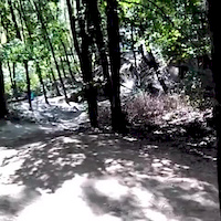
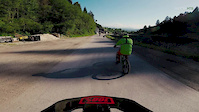
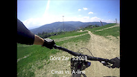
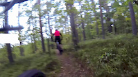
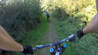
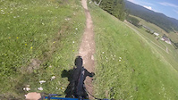
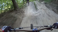
Videos of Podkarpackie Mountain Bike
trail: A-Line
0:10 |
64 |
Dec 4, 2018
trail: A-Line
0:54 |
71 |
Sep 28, 2018
trail: A-Line
2:41 |
53 |
Jul 4, 2018
trail: Biesiadka
0:48 |
396 |
Oct 24, 2017
trail: A-Line
0:57 |
199 |
Sep 30, 2017
trail: A-Line
0:16 |
353 |
Aug 7, 2017

trail: A-Line
4:46 |
63 |
Aug 6, 2016
trail: A-Line
0:53 |
231 |
Aug 1, 2016
Recent Trail Reports
Activity Feed
| username | action | type | title | date |
|---|---|---|---|---|
| klujek | add | route | activity #97254790 | Jun 18, 2026 @ 8:41am 14 hours |
| PaweYDgfo | ridden | trail | activity #97029831 and 5 more | Jun 15, 2026 @ 3:02am Jun 15, 2026 |
| saikhoong | add | video | activity #96783120 | Jun 11, 2026 @ 9:00pm Jun 11, 2026 |
| BartomiejekWrR | ridden | trail | activity #95715307 | May 28, 2026 @ 10:01am May 28, 2026 |
| piotrekraj | add | report | activity #95587620 | May 26, 2026 @ 1:40pm May 26, 2026 |
Recent Comments
| username | type | title | comment | date |
|---|---|---|---|---|
| trail | Jedna z perełek Beskidu Niskiego. Przyjemny,... | Jun 15, 2025 @ 12:03pm Jun 15, 2025 | ||
| trail | Zrywki swoje zrobiły. We Wrześniu koleiny... | Feb 9, 2025 @ 9:42am Feb 9, 2025 | ||
| trail | Miejscówka zaorana - wycinka drzew | Sep 13, 2023 @ 10:44am Sep 13, 2023 | ||
| trail | Miejscówka zaorana ! - wycinka drzewa | Sep 13, 2023 @ 10:43am Sep 13, 2023 | ||
| trail | Miejscówka zaorana - wycinka drzew | Sep 13, 2023 @ 10:42am Sep 13, 2023 |
Local Badges
-

Mountain Biking 100k Badge0 awarded -

Epic Ride 50k359 awarded -
Epic Ride 50k38 awarded -

Epic Mountain Bike Climb 2k1 awarded -

Climbing 10k Badge6 awarded -

Big Ride 30k251 awarded
Bike & Skill Parks
| name | type | city | rating |
|---|---|---|---|
| Fort Trails | bike park | Przemyśl | |
| Pumptrack Mielec | skill park | Mielec | |
| BMX Track | skill park | Jasło | |
| Pumptrack Ustrzyki Dolne | skill park | Ustrzyki Dolne | |
| DirtPark Rzeszów | skill park | Rzeszów |
Local Mountain Biking Directory
-
Stowarzyszenie Chodźmy Na Rower
![Stowarzyszenie Chodźmy Na Rower]()
-
Cyclo Centrum S.C. 42sports.pl
![Cyclo Centrum S.C. 42sports.pl]()
-
GrawitacyjnyBike Shop
-
BicyklonBike Shop
-
Nsb SportBike Shop
-
Fil-bikeBike Shop
Local Trail Supporters
- cnr Biesiadka Trails
- CHnR 42sports.pl
- CNR , CYCLO CENTRUM
- CNR, Cyclo centrum
- 42SPORTS.PL
- Azymut Przemyśl
![]()
Activity Type Stats
| activitytype | trails | distance | descent | descent distance | total vertical | rating | global rank | state rank | photos | reports | routes | ridelogs |
|---|---|---|---|---|---|---|---|---|---|---|---|---|
| Mountain Bike | 231 | 287 miles | 73,780 ft | 164 miles | 3,245 ft | 793 | 533 | 25 | 30,571 | |||
| E-Bike | 80 | 60 miles | 10,131 ft | 27 miles | 2,464 ft | 449 | 3 | 1,695 | ||||
| Adaptive Bike | 2 | |||||||||||
| Horse | 8 | 2 miles | 594 ft | 1 mile | 1,798 ft | 70 | ||||||
| Hike | 175 | 252 miles | 65,531 ft | 146 miles | 3,245 ft | 2 | 445 | 3 | 3,158 | |||
| Trail Running | 187 | 261 miles | 67,133 ft | 151 miles | 3,245 ft | 1 | 468 | 3 | 438 | |||
| Observed Trials | 3 | |||||||||||
| Snowshoe | 3 | 2 | ||||||||||
| Downhill Ski | 3 | 327 | ||||||||||
| Backcountry Ski | 4 | 4 miles | 738 ft | 2 miles | 397 ft | 187 | ||||||
| Nordic Ski | 3 | 63 |
Activities
Trails
- By brenthillier
 NSMBA TRAILFORKS & contributors
 - Admins: PMBA, Poland
- #10674 - 12,530 views
- podkarpackie activity log | embed map of Podkarpackie mountain bike trails | podkarpackie mountain biking points of interest
Downloading of trail gps tracks in kml & gpx formats is enabled for Podkarpackie.
You must login to download files.