close
-
Layers w
- Weather Layers
- Pro
- Pro
- Pro
- Pro
- Pro
- Pro
- More Layers
- Pro
- Pro
- Pro
- Pro
-
Upgrade to

3D
Trail Conditions
- Unknown
- Snow Groomed
- Snow Packed
- Snow Covered
- Snow Cover Partial
- Freeze/thaw Cycle
- Icy
- Prevalent Mud
- Wet
- Variable
- Ideal
- Dry
- Very Dry
Trail Flow (Ridden Direction)
Trailforks scans users ridelogs to determine the most popular direction each trail is ridden. A good flowing trail network will have most trails flowing in a single direction according to their intension.
The colour categories are based on what percentage of riders are riding a trail in its intended direction.
The colour categories are based on what percentage of riders are riding a trail in its intended direction.
- > 96%
- > 90%
- > 80%
- > 70%
- > 50%
- < 50%
- bi-directional trail
- no data
Trail Last Ridden
Trailforks scans ridelogs to determine the last time a trail was ridden.
- < 2 days
- < 1 week
- < 2 weeks
- < 1 month
- < 6 months
- > 6 months
Trail Ridden Direction
The intended direction a trail should be ridden.
- Downhill Only
- Downhill Primary
- Both Directions
- Uphill Primary
- Uphill Only
- One Direction
Contribute Details
Colors indicate trail is missing specified detail.
- Description
- Photos
- Description & Photos
- Videos
Trail Popularity ?
Trailforks scans ridelogs to determine which trails are ridden the most in the last 9 months.
Trails are compared with nearby trails in the same city region with a possible 25 colour shades.
Think of this as a heatmap, more rides = more kinetic energy = warmer colors.
- most popular
- popular
- less popular
- not popular
ATV/ORV/OHV Filter
Max Vehicle Width
inches
US Cell Coverage
Legend

Radar Time
Activity Recordings
Trailforks uses anonymized public activity data.
?
Activity Recordings
Trailforks uses anonymized public activity data.
?
Personal Heatmap
▶
Activity Types
all
/
none
▶
Options
2
Date range
month
–
Winter Trails
Warning
A routing network for winter maps does not exist. Selecting trails using the winter trails layer has been disabled.
Missing Trails
Most Popular
Least Popular
Trails are colored based on popularity. The more popular a trail is, the more red. Less popular trails trend towards green.
Jump Magnitude Heatmap
Heatmap of where riders jump on trails. Zoom in to see individual jumps, click circles to view jump details.
BC Backroad Status
![map legend]()
Service Road Atlas is a free to use, community-driven service for viewing and creating reports on the numerous back-country service roads around B.C. and Alberta.

Slope Aspect
Direction the slope faces
Trails Deemphasized
Trails are shown in grey.
Only show trails with no bike usage.
Suggested Layers
Based on selected activity type
Save the current map location and zoom level as your default home location whenever this page is loaded.
Save
No description for Polom has been added yet!
Login or register to submit one.
 google parking directions
google parking directions Activities Click to view
- Mountain Bike
20 trails
- E-Bike
7 trails
- Hike
19 trails
- Trail Running
19 trails
Region Details
- 8
- 4
- 2
- 4
- 1
Region Status
Open as of Jun 13, 2026Stats
- Avg Trail Rating
- Trails (view details)
- 19
- Trails Mountain Bike
- 20
- Trails E-Bike
- 7
- Trails Horse
- 2
- Trails Hike
- 19
- Trails Trail Running
- 19
- Total Distance
- 17 miles
- Total Descent
- 7,458 ft
- Total Vertical
- 1,990 ft
- Highest Trailhead
- 3,208 ft
- Reports
- 589
- Photos
- 58
- Ridden Counter
- 1,370
Popular Polom Mountain Biking Trails
• 60 ★ 4.8 • 3,458 ft • 0 ft • 157 • • hike
Modrá TZ z u na sedlo . Trail začína ako hladká vrstevnica s pár koreňmi. Po zhruba 200 metroch naberá technickejší charakter vďaka množstvu kameňov a koreňov. Po cca 500 metroch sa trail točí doprava, nasleduje dlhší...
• 40 ★ 4.5 • 1 mile • 58 ft • 131 • • hike
Žltá TZ zo sedla Kojšová do Strečna. Pekný scenerický singletrail bočným hrebeňom, ktorý má asi všetko, čo má zabavný trail ponúkať: odklopené pasáže, prírodné skoky, krátke a prudké výšľapy, prudký zjazd s...
• 40 ★ 3.0 • 2,651 ft • 276 ft • 47 •
Malé a miestami kamenisté spestrenie cestou z Polomu do Višňového. Dá sa to ísť aj smerom hore (je to 100% zjazdné v sedle). Short entertaining trail on the way from to Višňové.
• 25 ★ 4.6 • 3,543 ft • 22 ft • 39 •
Je to pekný ý chodník, akurát v dolnej časti bývajú občas konáre po ťažbe, tak opatrne ;) Pred odbočením naň z červenej značky radšej pomaly, dá sa ľahko prehliadnuť.
• 55 ★ 4.5 • 2,703 ft • 0 ft • 29 •
Moderately popular blue difficulty singletrack. This multi-use trail can be used downhill only. Trail visibility is always easy to follow.
• 30 ★ 1.0 • 4,547 ft • 228 ft • 10 •
Zacina to ako pekna a jasne viditelna byvala zvaznica a konci to pekelnym zjazdom, ktory nie je momentalne uplne zjazdny.
• 35 ★ 3.0 • 2,454 ft • 0 ft • 5 •
Less popular green difficulty singletrack. This multi-use trail can be used downhill only.
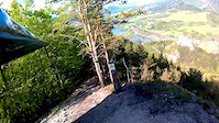
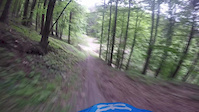
Photos of Polom Mountain Bike
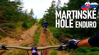
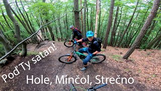
Videos of Polom Mountain Bike


Recent Trail Reports
| status | trail | date | condition | info | user |
|---|---|---|---|---|---|
| Obchazka asfaltu (Bypass of asfalt) | Jun 13, 2026 @ 2:44pm (Europe/Bratislava) Jun 13, 2026 | Ideal | katko | ||
| Rakytie | Jun 13, 2026 @ 2:44pm (Europe/Bratislava) Jun 13, 2026 | Ideal | katko | ||
| Šprintpolom | Jun 2, 2026 @ 6:01am (Europe/Bratislava) Jun 1, 2026 | Ideal | spit1 | ||
| Bočák | May 28, 2026 @ 6:04am (Europe/Bratislava) May 27, 2026 | Ideal | spit1 | ||
| Hrabanka | May 13, 2026 @ 12:43pm (Europe/Bratislava) May 13, 2026 | Unknown | rakezzz | ||
| Polom | Feb 15, 2026 @ 6:06am (Europe/Bratislava) Feb 14, 2026 | Snow Covered | spit1 | ||
| Polom access road | Feb 15, 2026 @ 6:06am (Europe/Bratislava) Feb 14, 2026 | Snow Covered | spit1 | ||
| Červená TZ záver | Nov 23, 2025 @ 6:03am (Europe/Bratislava) Nov 22, 2025 | Snow Covered | spit1 | ||
| Plešiny | Sep 14, 2025 @ 6:02am (Europe/Bratislava) Sep 13, 2025 | Ideal | spit1 | ||
| Ostredok Vrch | Aug 13, 2025 @ 4:20pm Aug 13, 2025 | Dry | katko |
Activity Feed
| username | action | type | title | date |
|---|---|---|---|---|
| katko | add | report | activity #96891970 and 1 more | Jun 13, 2026 @ 10:12am Jun 13, 2026 |
| Martin-Podhora | wishlist | trail | activity #96080032 | Jun 2, 2026 @ 6:39am Jun 2, 2026 |
| spit1 | add | report | activity #96066242 | Jun 2, 2026 @ 12:30am Jun 2, 2026 |
| spit1 | add | report | activity #95695236 | May 28, 2026 @ 3:30am May 28, 2026 |
| spit1 | add | report | activity #95023434 | May 18, 2026 @ 11:41pm May 18, 2026 |
Recent Comments
| username | type | title | comment | date |
|---|---|---|---|---|
| trail | Trasa praktycznie nie istnieje. Wszystko... | Jul 23, 2023 @ 1:44pm Jul 23, 2023 | ||
| trail | dnes som to bol skusit, ale ako pisu aj... | Jun 19, 2022 @ 3:35am Jun 19, 2022 | ||
| trail | Ten koniec mam v plane uplne prerobit aby to... | Sep 5, 2021 @ 4:16am Sep 5, 2021 | ||
| trail | je to tam velmi pekne, do polovice sa stupa po... | Aug 30, 2021 @ 11:49am Aug 30, 2021 | ||
| trail | Išiel som okolo pešo, tak som to bol... | Aug 1, 2021 @ 12:41pm Aug 1, 2021 |
Nearby Areas
| name | distance | ||||
|---|---|---|---|---|---|
| Minčol | 7 | 21 | 5 | 2 | 1.7 km |
| Chata pod Suchým | 4 | 3 | 3 | 1 | 4.5 km |
| Martinské Hole | 8 | 18 | 15 | 2 | 4.6 km |
| Chata Pod Kľačianskou Magurou | 1 | 1 | 5 | 5 km | |
| Stranik | 1 | 5 | 3 | 5.7 km |
Activity Type Stats
| activitytype | trails | distance | descent | descent distance | total vertical | rating | global rank | state rank | photos | reports | routes | ridelogs |
|---|---|---|---|---|---|---|---|---|---|---|---|---|
| Mountain Bike | 20 | 17 miles | 7,457 ft | 9 miles | 1,991 ft | #4,233 | #52 | 58 | 589 | 1,876 | ||
| E-Bike | 7 | 3 miles | 1,066 ft | 1 mile | 764 ft | #3,673 | #53 | 529 | 118 | |||
| Horse | 2 | 2,759 ft | 604 ft | 2,759 ft | 604 ft | 48 | ||||||
| Hike | 19 | 17 miles | 7,352 ft | 9 miles | 1,991 ft | #4,915 | #57 | 585 | 206 | |||
| Trail Running | 19 | 17 miles | 7,352 ft | 9 miles | 1,991 ft | #4,190 | #58 | 585 | 72 |
Frequently Asked Questions About Polom
▼
What are the highest rated mountain biking trails in Polom?
▼
What is the best time of the year to ride in Polom?
Based on ride log data, the most popular months to ride in Polom are:
- July (17 activities)
- June (12 activities)
- August (8 activities)
▼
Where can I park to ride in Polom?
There are 2 parking locations listed in Polom. The most popular parking spots are:
▼
What is the longest trail in Polom?
The longest trail in Polom is Plešiny at 1.1 miles. View all trails sorted by distance.
Activities
Trails
Points of Interest
- By jxxw
 TRAILFORKS & contributors
 - Admins: apply
- #28784 - 2,488 views
- polom activity log | embed map of Polom mountain bike trails | polom mountain biking points of interest
Downloading of trail gps tracks in kml & gpx formats is enabled for Polom.
You must login to download files.