close
-
Layers w
- Weather Layers
- Pro
- Pro
- Pro
- Pro
- Pro
- Pro
- More Layers
- Pro
- Pro
- Pro
- Pro
-
Upgrade to

3D
Trail Conditions
- Unknown
- Snow Groomed
- Snow Packed
- Snow Covered
- Snow Cover Partial
- Freeze/thaw Cycle
- Icy
- Prevalent Mud
- Wet
- Variable
- Ideal
- Dry
- Very Dry
Trail Flow (Ridden Direction)
Trailforks scans users ridelogs to determine the most popular direction each trail is ridden. A good flowing trail network will have most trails flowing in a single direction according to their intension.
The colour categories are based on what percentage of riders are riding a trail in its intended direction.
The colour categories are based on what percentage of riders are riding a trail in its intended direction.
- > 96%
- > 90%
- > 80%
- > 70%
- > 50%
- < 50%
- bi-directional trail
- no data
Trail Last Ridden
Trailforks scans ridelogs to determine the last time a trail was ridden.
- < 2 days
- < 1 week
- < 2 weeks
- < 1 month
- < 6 months
- > 6 months
Trail Ridden Direction
The intended direction a trail should be ridden.
- Downhill Only
- Downhill Primary
- Both Directions
- Uphill Primary
- Uphill Only
- One Direction
Contribute Details
Colors indicate trail is missing specified detail.
- Description
- Photos
- Description & Photos
- Videos
Trail Popularity ?
Trailforks scans ridelogs to determine which trails are ridden the most in the last 9 months.
Trails are compared with nearby trails in the same city region with a possible 25 colour shades.
Think of this as a heatmap, more rides = more kinetic energy = warmer colors.
- most popular
- popular
- less popular
- not popular
ATV/ORV/OHV Filter
Max Vehicle Width
inches
US Cell Coverage
Legend

Radar Time
Activity Recordings
Trailforks uses anonymized public activity data.
?
Activity Recordings
Trailforks uses anonymized public activity data.
?
Personal Heatmap
▶
Activity Types
all
/
none
▶
Options
2
Date range
month
–
Winter Trails
Warning
A routing network for winter maps does not exist. Selecting trails using the winter trails layer has been disabled.
Missing Trails
Most Popular
Least Popular
Trails are colored based on popularity. The more popular a trail is, the more red. Less popular trails trend towards green.
Jump Magnitude Heatmap
Heatmap of where riders jump on trails. Zoom in to see individual jumps, click circles to view jump details.
BC Backroad Status
![map legend]()
Service Road Atlas is a free to use, community-driven service for viewing and creating reports on the numerous back-country service roads around B.C. and Alberta.

Slope Aspect
Direction the slope faces
Trails Deemphasized
Trails are shown in grey.
Only show trails with no bike usage.
Suggested Layers
Based on selected activity type
Save the current map location and zoom level as your default home location whenever this page is loaded.
SavePomurje is a landscape in the north-eastern part of Slovenia and extends along the Mura River. The landscape on the left bank of the Mura is Prekmurje, while the right bank is partly Styria and the other part of Prlekija.
This region uses the Uk/Euro style trail grading system.
Region Details
- 14
- 7
- 4
- 3
- 3
Stats
- Avg Trail Rating
- Trails (view details)
- 31
- Trails Mountain Bike
- 40
- Trails E-Bike
- 26
- Trails Horse
- 11
- Trails Hike
- 15
- Trails Trail Running
- 15
- Total Distance
- 21 miles
- Total Descent
- 3,134 ft
- Total Vertical
- 692 ft
- Highest Trailhead
- 1,264 ft
- Reports
- 191
- Photos
- 22
- Ridden Counter
- 281
Sub Regions
- Goričko (23)
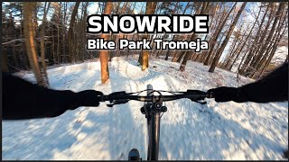
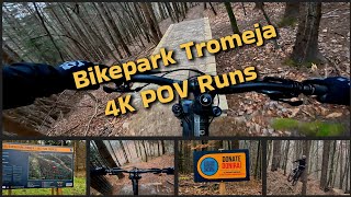
- Bike Park Tromeja (12)
- Dolenci (1)
- Lendava (15)
- Murska Sobota (1)
Popular Pomurje Mountain Biking Trails
• 55 ★ 4.0 • 2,454 ft • 42 ft • 24 •
Two steep downhills that are conected with a steep climb.
• 95 ★ 4.7 • 1,499 ft • 0 ft • 17 •
Popular green difficulty singletrack. This mountain bike primary trail can be used downhill only and has a easy overall physical rating. Trail visibility is always easy to follow. On average it takes 1 minutes to complete this trail.
• 75 ★ 4.0 • 3,340 ft • 0 ft • 11 •
Popular blue difficulty singletrack. This mountain bike primary trail can be used downhill only and has a moderate overall physical rating. Trail visibility is always easy to follow. On average it takes 3 minutes to complete this trail.
• 30 ★ 4.0 • 2,789 ft • 34 ft • 8 •
The finish of the the trail is on a shooting range, so the trail is closed sometimes (not on weekends and holidays) due to shooting. DO NOT RIDE THE LAST 50 M IF THERE ARE WARNINGS ON THE TRAIL.
• 90 ★ 0.0 • 1,194 ft • 0 ft • 7 •
Popular blue difficulty singletrack. This mountain bike primary trail can be used downhill only. It features drop, jump and gap jump. Trail visibility is always easy to follow.
• 70 ★ 0.0 • 374 ft • 0 ft • 5 •
Popular blue difficulty singletrack. This mountain bike primary trail can be used downhill only. It features gap jump. Trail visibility is always easy to follow.
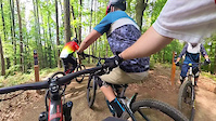
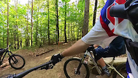
Photos of Pomurje Mountain Bike
Videos of Pomurje Mountain Bike
trail: Rdečka
0:08 |
47 |
May 13, 2024
trail: Lejpa
0:44 |
58 |
May 12, 2024
trail: DIVDŽA
7:56 |
17 |
Jan 10, 2026 , Szentgotthárd

trail: Rdečka
7:56 |
18 |
Jan 10, 2026 , Szentgotthárd

trail: Lejpa
7:56 |
17 |
Jan 10, 2026 , Szentgotthárd
trail: DIVDŽA
4:52 |
112 |
Jan 20, 2025 , Szentgotthárd

trail: Rdečka
4:52 |
93 |
Jan 20, 2025 , Szentgotthárd

trail: Lejpa
4:52 |
149 |
Jan 20, 2025 , Szentgotthárd
Recent Trail Reports
Activity Feed
| username | action | type | title | date |
|---|---|---|---|---|
| tlovrek | add | report | activity #97091494 and 3 more | Jun 16, 2026 @ 12:19am Jun 16, 2026 |
| tlovrek | ridden | trail | activity #96739519 | Jun 11, 2026 @ 8:28am Jun 11, 2026 |
| tlovrek | add | report | activity #96721735 and 3 more | Jun 11, 2026 @ 12:12am Jun 11, 2026 |
| Pips31 | wishlist | trail | activity #96070213 | Jun 2, 2026 @ 2:46am Jun 2, 2026 |
| jencevgen | update | trail | activity #94876443 | May 17, 2026 @ 12:33am May 17, 2026 |
Local Badges
-

Epic Mountain Bike Climb 2k0 awarded -

Climbing 10k Badge0 awarded -

Mountain Biking 100k Badge0 awarded -

Epic Ride Descent 2k0 awarded -

Descent 10k Badge0 awarded -

Descent 100k Badge0 awarded
Bike & Skill Parks
| name | type | city | rating |
|---|---|---|---|
| Pumptrack Odranci | skill park | Odranci |
Activity Type Stats
| activitytype | trails | distance | descent | descent distance | total vertical | rating | global rank | state rank | photos | reports | routes | ridelogs |
|---|---|---|---|---|---|---|---|---|---|---|---|---|
| Mountain Bike | 40 | 21 miles | 3,133 ft | 13 miles | 692 ft | 22 | 191 | 3,660 | ||||
| E-Bike | 26 | 18 miles | 2,434 ft | 11 miles | 614 ft | 149 | 263 | |||||
| Horse | 11 | 11 miles | 1,135 ft | 7 miles | 361 ft | 36 | ||||||
| Hike | 15 | 16 miles | 1,614 ft | 10 miles | 692 ft | 119 | 175 | |||||
| Trail Running | 15 | 16 miles | 1,614 ft | 10 miles | 692 ft | 119 | 82 |
Activities
Trails
Points of Interest
- By zocknroll
 TRAILFORKS TRAILANDIJA & contributors
 - Admins: VjekoslavKrsanac, zocknroll
- #36416 - 2,023 views
- pomurje activity log | embed map of Pomurje mountain bike trails | pomurje mountain biking points of interest
Downloading of trail gps tracks in kml & gpx formats is enabled for Pomurje.
You must login to download files.