close
-
Layers w
- Weather Layers
- Pro
- Pro
- Pro
- Pro
- Pro
- Pro
- More Layers
- Pro
- Pro
- Pro
- Pro
-
Upgrade to

3D
Trail Conditions
- Unknown
- Snow Groomed
- Snow Packed
- Snow Covered
- Snow Cover Partial
- Freeze/thaw Cycle
- Icy
- Prevalent Mud
- Wet
- Variable
- Ideal
- Dry
- Very Dry
Trail Flow (Ridden Direction)
Trailforks scans users ridelogs to determine the most popular direction each trail is ridden. A good flowing trail network will have most trails flowing in a single direction according to their intension.
The colour categories are based on what percentage of riders are riding a trail in its intended direction.
The colour categories are based on what percentage of riders are riding a trail in its intended direction.
- > 96%
- > 90%
- > 80%
- > 70%
- > 50%
- < 50%
- bi-directional trail
- no data
Trail Last Ridden
Trailforks scans ridelogs to determine the last time a trail was ridden.
- < 2 days
- < 1 week
- < 2 weeks
- < 1 month
- < 6 months
- > 6 months
Trail Ridden Direction
The intended direction a trail should be ridden.
- Downhill Only
- Downhill Primary
- Both Directions
- Uphill Primary
- Uphill Only
- One Direction
Contribute Details
Colors indicate trail is missing specified detail.
- Description
- Photos
- Description & Photos
- Videos
Trail Popularity ?
Trailforks scans ridelogs to determine which trails are ridden the most in the last 9 months.
Trails are compared with nearby trails in the same city region with a possible 25 colour shades.
Think of this as a heatmap, more rides = more kinetic energy = warmer colors.
- most popular
- popular
- less popular
- not popular
ATV/ORV/OHV Filter
Max Vehicle Width
inches
US Cell Coverage
Legend

Radar Time
Activity Recordings
Trailforks uses anonymized public activity data.
?
Activity Recordings
Trailforks uses anonymized public activity data.
?
Personal Heatmap
▶
Activity Types
all
/
none
▶
Options
2
Date range
month
–
Winter Trails
Warning
A routing network for winter maps does not exist. Selecting trails using the winter trails layer has been disabled.
Missing Trails
Most Popular
Least Popular
Trails are colored based on popularity. The more popular a trail is, the more red. Less popular trails trend towards green.
Jump Magnitude Heatmap
Heatmap of where riders jump on trails. Zoom in to see individual jumps, click circles to view jump details.
BC Backroad Status
![map legend]()
Service Road Atlas is a free to use, community-driven service for viewing and creating reports on the numerous back-country service roads around B.C. and Alberta.

Slope Aspect
Direction the slope faces
Trails Deemphasized
Trails are shown in grey.
Only show trails with no bike usage.
Suggested Layers
Based on selected activity type
Save the current map location and zoom level as your default home location whenever this page is loaded.
Save
No description for Ponca has been added yet!
Login or register to submit one.
Activities Click to view
- Mountain Bike
10 trails
- E-Bike
8 trails
- Hike
1 trails
- Trail Running
1 trails
Region Details
- 5
- 4
- 1
Region Status
Open as of Feb 22, 2026Stats
- Avg Trail Rating
- Trails (view details)
- 10
- Trails Mountain Bike
- 10
- Trails E-Bike
- 8
- Trails Hike
- 1
- Trails Trail Running
- 1
- Total Distance
- 10 miles
- Total Descent Distance
- 7 miles
- Total Descent
- 3,139 ft
- Total Vertical
- 1,244 ft
- Highest Trailhead
- 2,324 ft
- Reports
- 41
- Photos
- 35
- Ridden Counter
- 1,691
Sub Regions
-
Buffalo River
- 5
- 4
- 1
Popular Ponca Mountain Biking Trails
• 100 ★ 4.0 • 3,904 ft • 194 ft • 399 •
These two trails, which are connected by a dirt road, will get you back to the Buffalo Outdoor Center. This is where you earn your shuttle runs, so expect some climbing.
• 90 ★ 4.0 • 1,217 ft • 0 ft • 365 •
Fun little finish to the trail that takes you back to the parking lot, nothing too difficult or technical.
• 70 ★ 4.5 • 1,509 ft • 0 ft • 332 •
At a third of a mile, this is the shortest downhill trail on the mountain. It’s also a good place to start if you want to get a feel for the terrain. You won’t find any big features, but narrow single track, plenty of boulders and...
• 80 ★ 4.0 • 2 miles • 26 ft • 313 •
If you combine them, these trails add up to nearly six miles and 1,300 feet of descending. They’re a great place to start for riders who are just getting into gravity-driven riding, but the rocks and flowy rollers that can be turned...
• 60 ★ 4.0 • 2,707 ft • 9 ft • 287 •
Good introduction to the bench cut rock features that you will encounter later on in the black trails on the mountain.
• 40 ★ 4.0 • 2 miles • 46 ft • 243 •
If you combine them, these trails add up to nearly six miles and 1,300 feet of descending. They’re a great place to start for riders who are just getting into gravity-driven riding, but the rocks and flowy rollers that can be turned...
• 30 ★ 4.0 • 2,234 ft • 3 ft • 233 •
The trail begins with an off-camber on-and-off rock feature that sets the tone for the rest of the descent. If you forego the alternate line, be on the lookout for a tight and steep roll in into a gap drop.
• 50 ★ 4.4 • 2 miles • 31 ft • 215 •
At two miles, not only is this the longest sustained downhill on the mountain, but it’s also packed with off-camber rock gardens, challenging doubles and plenty of steep and twisty bits. You’ll also have to keep your eyes peeled for...
Ponca Mountain Bike Routes
2,234 ft • 9 ft • 1 • Point to Point •
This descent is technical and rocky, with optional drops and rock-slab rolls. Be sure to scout out the...
18 miles • 2,399 ft • 9 • Race •
Welcome to the 2026 AR Summer Shuttle Series! The Gravity Feed is excited to bring you shredders a proper...
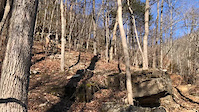
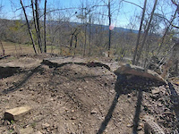
Photos of Ponca Mountain Bike
Videos of Ponca Mountain Bike
trail: Skull Crusher
0:07 |
629 |
Jan 10, 2021

trail: Skull Crusher
0:09 |
638 |
Dec 18, 2019
trail: White Lightning
0:00 |
267 |
Nov 15, 2019

trail: Lower Buffalo River Run
25:20 |
204 |
Jun 13, 2023 , Ponca
Recent Trail Reports
| status | trail | date | condition | info | user |
|---|---|---|---|---|---|
| Upper Buffalo River Run | Feb 22, 2026 @ 1:29pm (America/Chicago) Feb 22, 2026 | Unknown | rnoc3J3E | ||
| Upper Miner's Downhill | Oct 19, 2025 @ 9:17am (America/Indiana/Vincennes) Oct 19, 2025 | Ideal | robbiethetrailtroll OORC | ||
| White Lightning | Oct 19, 2025 @ 9:17am (America/Indiana/Vincennes) Oct 19, 2025 | Ideal | robbiethetrailtroll OORC | ||
| White Lightning Alt. Line | Oct 19, 2025 @ 9:17am (America/Indiana/Vincennes) Oct 19, 2025 | Ideal | robbiethetrailtroll OORC | ||
| Upper Ponca Creek Connector | Dec 3, 2024 @ 5:55am Dec 3, 2024 | Dry | alece | ||
| Lower Buffalo River Run | Dec 3, 2024 @ 5:54am Dec 3, 2024 | Dry | alece | ||
| Mule Kicker | Dec 3, 2024 @ 5:54am Dec 3, 2024 | Dry | alece | ||
| Lower Miner's Downhill | Dec 3, 2024 @ 5:53am Dec 3, 2024 | Dry | alece | ||
| Skull Crusher | Aug 7, 2022 @ 7:01am Aug 7, 2022 | Dry | tbubier | ||
| Lower Ponca Creek Connector | Aug 7, 2022 @ 7:01am Aug 7, 2022 | Dry | tbubier |
Activity Feed
| username | action | type | title | date |
|---|---|---|---|---|
| Deblayden | wishlist | region | activity #96727739 | Jun 11, 2026 @ 4:11am Jun 11, 2026 |
| lakeleatherwoodbikepark | add | event | activity #96292575 | Jun 5, 2026 @ 6:57am Jun 5, 2026 |
| supermario22 | update | route | activity #95664804 | May 27, 2026 @ 3:25pm May 27, 2026 |
| mcclelland2407 | wishlist | trail | activity #94497285 | May 11, 2026 @ 8:44am May 11, 2026 |
| supermario22 | update | route | activity #94093895 | May 5, 2026 @ 8:54am May 5, 2026 |
Recent Comments
| username | type | title | comment | date |
|---|---|---|---|---|
| trail | As I mentioned with the Lower… NOT an out... | Oct 1, 2022 @ 9:09pm Oct 1, 2022 | ||
| trail | Don’t make the mistake I made and climb... | Oct 1, 2022 @ 9:05pm Oct 1, 2022 | ||
| trail | Just rode this and was quite disappointed...... | Apr 19, 2022 @ 11:37am Apr 19, 2022 | ||
| trail | Had me gassed | Apr 5, 2022 @ 11:55am Apr 5, 2022 | ||
| trail | Chunky is the best way to describe it. Fun... | Aug 21, 2021 @ 6:14pm Aug 21, 2021 |
Local Badges
-

Epic Ride Descent 2k10 awarded -

Descent 10k Badge3 awarded -

Descent 100k Badge0 awarded
Activity Type Stats
| activitytype | trails | distance | descent | descent distance | total vertical | rating | global rank | state rank | photos | reports | routes | ridelogs |
|---|---|---|---|---|---|---|---|---|---|---|---|---|
| Mountain Bike | 10 | 10 miles | 3,140 ft | 7 miles | 1,243 ft | #4,535 | #1,530 | 35 | 41 | 1 | 888 | |
| E-Bike | 8 | 8 miles | 2,395 ft | 6 miles | 1,243 ft | #7,386 | #2,226 | 38 | 84 | |||
| Hike | 1 | 2,707 ft | 138 ft | 1,867 ft | 138 ft | #15,797 | #5,798 | 28 | 2 | 224 | ||
| Trail Running | 1 | 2,707 ft | 138 ft | 1,867 ft | 138 ft | #15,455 | #5,602 | 28 | 2 | 10 |
Frequently Asked Questions About Ponca
▼
What are the best places to ride in Ponca?
Ponca has 1 areas to explore for mountain biking. The top rated areas are:
▼
What are the highest rated mountain biking trails in Ponca?
The highest rated mountain biking trails in Ponca are:
- White Lightning Alt. Line (4.3/5)
- Mule Kicker (4.2/5)
- Skull Crusher (4.1/5)
- Lower Miner's Downhill (4.1/5)
- Lower Buffalo River Run (4/5)
▼
What is the best time of the year to ride in Ponca?
Based on ride log data, the most popular months to ride in Ponca are:
- August (8 activities)
- October (8 activities)
- November (6 activities)
▼
Where can I park to ride in Ponca?
There are 2 parking locations listed in Ponca. The most popular parking spots are:
Trails
Points of Interest
- By ptdesign & contributors
- Admins: OZ TRAILS, thomcerny
- #33017 - 3,508 views
- ponca activity log | embed map of Ponca mountain bike trails | ponca mountain biking points of interest
Downloading of trail gps tracks in kml & gpx formats is enabled for Ponca.
You must login to download files.