close
-
Layers w
- Weather Layers
- Pro
- Pro
- Pro
- Pro
- Pro
- Pro
- More Layers
- Pro
- Pro
- Pro
- Pro
-
Upgrade to

3D
Trail Conditions
- Unknown
- Snow Groomed
- Snow Packed
- Snow Covered
- Snow Cover Partial
- Freeze/thaw Cycle
- Icy
- Prevalent Mud
- Wet
- Variable
- Ideal
- Dry
- Very Dry
Trail Flow (Ridden Direction)
Trailforks scans users ridelogs to determine the most popular direction each trail is ridden. A good flowing trail network will have most trails flowing in a single direction according to their intension.
The colour categories are based on what percentage of riders are riding a trail in its intended direction.
The colour categories are based on what percentage of riders are riding a trail in its intended direction.
- > 96%
- > 90%
- > 80%
- > 70%
- > 50%
- < 50%
- bi-directional trail
- no data
Trail Last Ridden
Trailforks scans ridelogs to determine the last time a trail was ridden.
- < 2 days
- < 1 week
- < 2 weeks
- < 1 month
- < 6 months
- > 6 months
Trail Ridden Direction
The intended direction a trail should be ridden.
- Downhill Only
- Downhill Primary
- Both Directions
- Uphill Primary
- Uphill Only
- One Direction
Contribute Details
Colors indicate trail is missing specified detail.
- Description
- Photos
- Description & Photos
- Videos
Trail Popularity ?
Trailforks scans ridelogs to determine which trails are ridden the most in the last 9 months.
Trails are compared with nearby trails in the same city region with a possible 25 colour shades.
Think of this as a heatmap, more rides = more kinetic energy = warmer colors.
- most popular
- popular
- less popular
- not popular
ATV/ORV/OHV Filter
Max Vehicle Width
inches
US Cell Coverage
Legend

Radar Time
Activity Recordings
Trailforks uses anonymized public activity data.
?
Activity Recordings
Trailforks uses anonymized public activity data.
?
Personal Heatmap
▶
Activity Types
all
/
none
▶
Options
2
Date range
month
–
Winter Trails
Warning
A routing network for winter maps does not exist. Selecting trails using the winter trails layer has been disabled.
Missing Trails
Most Popular
Least Popular
Trails are colored based on popularity. The more popular a trail is, the more red. Less popular trails trend towards green.
Jump Magnitude Heatmap
Heatmap of where riders jump on trails. Zoom in to see individual jumps, click circles to view jump details.
BC Backroad Status
![map legend]()
Service Road Atlas is a free to use, community-driven service for viewing and creating reports on the numerous back-country service roads around B.C. and Alberta.

Slope Aspect
Direction the slope faces
Trails Deemphasized
Trails are shown in grey.
Only show trails with no bike usage.
Suggested Layers
Based on selected activity type
Save the current map location and zoom level as your default home location whenever this page is loaded.
Save
No description for Pontassieve has been added yet!
Login or register to submit one.
This region uses the Uk/Euro style trail grading system.
Activities Click to view
- Mountain Bike
70 trails
- E-Bike
60 trails
- Adaptive Bike
0 trails
- Winter Fat Bike
0 trails
- Horse
19 trails
- Hike
54 trails
- Trail Running
52 trails
- Dirtbike/Moto
5 trails
Region Details
- 15
- 1
- 22
- 27
Region Status
Caution as of Jun 15, 2026Stats
- Avg Trail Rating
- Trails (view details)
- 69
- Trails Mountain Bike
- 74
- Trails E-Bike
- 60
- Trails Horse
- 19
- Trails Hike
- 54
- Trails Trail Running
- 52
- Trails Dirtbike/Moto
- 5
- Total Distance
- 35 miles
- Total Descent Distance
- 14 miles
- Total Descent
- 9,225 ft
- Total Vertical
- 2,650 ft
- Highest Trailhead
- 2,942 ft
- Reports
- 117
- Photos
- 9
- Ridden Counter
- 1,018
Sub Regions
-
BardellOne Area Trail
- 12
- 14
- 3
Popular Pontassieve Mountain Biking Trails
• 90 ★ 4.5 • 1,430 ft • 0 ft • 61 •
Popular green difficulty doubletrack. This multi-use trail can be used both directions and has a easy overall physical rating with a 0 ft blue climb. Trail visibility is always easy to follow. On average it takes 1 minutes to complete this trail.
• 80 ★ 3.0 • 2,618 ft • 0 ft • 37 •
Popular green difficulty doubletrack. This multi-use trail can be used downhill primary and has a easy overall physical rating with a 0 ft blue climb. Trail visibility is always easy to follow. On average it takes 3 minutes to complete this trail.
• 90 ★ 4.5 • 1,909 ft • 0 ft • 30 •
Popular blue difficulty singletrack. This mountain bike primary trail can be used uphill only. On average it takes 4 minutes to complete this trail.
• 85 ★ 5.0 • 4,301 ft • 3 ft • 25 •
Popular blue difficulty singletrack. This mountain bike primary trail can be used downhill only. On average it takes 6 minutes to complete this trail.
• 60 ★ 0.0 • 1 mile • 122 ft • 23 •
Moderately popular green difficulty mixed. This mountain bike primary trail can be used both directions with a 122 ft blue climb. On average it takes 12 minutes to complete this trail.
• 100 ★ 0.0 • 2,497 ft • 104 ft • 22 •
Popular green difficulty family friendly singletrack. This mountain bike primary trail can be used both directions and has a easy overall physical rating with a 104 ft green climb. Adaptive MTB rating: amtb green. Trail visibility is always easy to follow.
• 55 ★ 0.0 • 2,523 ft • 0 ft • 18 •
Moderately popular blue difficulty singletrack. This mountain bike primary trail can be used downhill primary. On average it takes 2 minutes to complete this trail.
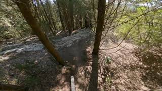
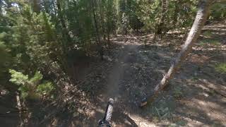
Photos of Pontassieve Mountain Bike
Videos of Pontassieve Mountain Bike
6:01 |
117 |
Mar 25, 2024 , Pontassieve
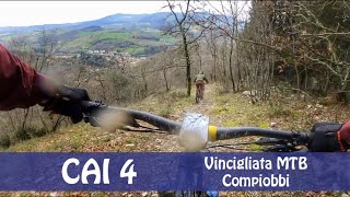
trail: Passeggiata sudest
3:44 |
99 |
Mar 25, 2024 , Pontassieve
6:22 |
118 |
Jan 9, 2024 , Pontassieve
5:31 |
169 |
Jul 25, 2023 , Pontassieve
youtuber
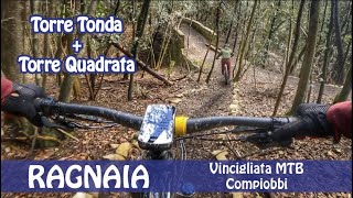
![Excalibur - Bardellone | Pontassieve]()
trail: Excalibur 2021
2:30 |
218 |
Nov 14, 2021 , Pontassieve
Recent Trail Reports
| status | trail | date | condition | info | user |
|---|---|---|---|---|---|
| CAI 3A/B direzione Montepulico | Jun 15, 2026 @ 10:13am (Europe/Rome) Jun 15, 2026 | Ideal | MrOrangeItaly | ||
| Alberaccio-Poggio Ripaghera | May 14, 2026 @ 2:36pm (Europe/San_Marino) May 14, 2026 | Ideal | Giugio | ||
| The Ring (Parte 1) | Apr 30, 2026 @ 10:30pm (Europe/Rome) Apr 30, 2026 | Unknown | 2e53oG | ||
| Ripaghera - Monte Rotondo | Apr 27, 2026 @ 8:08am (Europe/Rome) Apr 26, 2026 | Variable | MrOrangeItaly | ||
| Burraia Bacio | Apr 27, 2026 @ 8:08am (Europe/Rome) Apr 26, 2026 | Variable | MrOrangeItaly | ||
| San Martino 39 prima parte | Nov 15, 2025 @ 2:18pm (Europe/Rome) Nov 15, 2025 | Ideal | MrOrangeItaly | ||
| Radici | Nov 15, 2025 @ 2:18pm (Europe/Rome) Nov 15, 2025 | Ideal | MrOrangeItaly | ||
| Juà | Nov 15, 2025 @ 2:18pm (Europe/Rome) Nov 15, 2025 | Ideal | MrOrangeItaly | ||
| Lancillotto | Nov 15, 2025 @ 2:18pm (Europe/Rome) Nov 15, 2025 | Ideal | MrOrangeItaly | ||
| CAI 4 Monteloro/Molin del Piano | Oct 19, 2025 @ 10:35am (Europe/Rome) Oct 19, 2025 | Ideal | MrOrangeItaly |
Activity Feed
| username | action | type | title | date |
|---|---|---|---|---|
| MrOrangeItaly | add | report | activity #97028140 | Jun 15, 2026 @ 1:34am Jun 15, 2026 |
| Giugio | add | report | activity #94790364 and 1 more | May 15, 2026 @ 10:33pm May 15, 2026 |
| 2e53oG | comment | report | activity #93732301 | Apr 30, 2026 @ 1:30pm Apr 30, 2026 |
| 2e53oG | add | report | activity #93732262 | Apr 30, 2026 @ 1:30pm Apr 30, 2026 |
| MrOrangeItaly | add | report | activity #93500606 and 4 more | Apr 26, 2026 @ 11:06pm Apr 26, 2026 |
Recent Comments
| username | type | title | comment | date |
|---|---|---|---|---|
| report | Not maintained, overgrown | Apr 30, 2026 @ 1:30pm Apr 30, 2026 | ||
| trail | Trail più bello del gruppo Bardellone,... | Apr 25, 2025 @ 11:18am Apr 25, 2025 |
Local Badges
-

Epic Mountain Bike Climb 2k11 awarded -

Climbing 10k Badge12 awarded -

Mountain Biking 100k Badge1 awarded -

Epic Ride Descent 2k11 awarded -

Descent 10k Badge12 awarded -

Descent 100k Badge1 awarded
Activity Type Stats
| activitytype | trails | distance | descent | descent distance | total vertical | rating | global rank | state rank | photos | reports | routes | ridelogs |
|---|---|---|---|---|---|---|---|---|---|---|---|---|
| Mountain Bike | 70 | 35 miles | 9,226 ft | 14 miles | 2,651 ft | #6,966 | #565 | 9 | 118 | 1,555 | ||
| E-Bike | 60 | 21 miles | 6,624 ft | 11 miles | 2,552 ft | #3,957 | #379 | 118 | 256 | |||
| Horse | 19 | 6 miles | 610 ft | 2 miles | 2,005 ft | #2,221 | #144 | 2 | ||||
| Hike | 54 | 21 miles | 5,978 ft | 10 miles | 2,552 ft | #6,533 | #343 | 117 | 68 | |||
| Trail Running | 52 | 20 miles | 5,942 ft | 10 miles | 2,552 ft | #6,162 | #337 | 117 | 3 | |||
| Dirtbike/Moto | 5 | #1,177 | #79 |
Frequently Asked Questions About Pontassieve
▼
What are the best places to ride in Pontassieve?
Pontassieve has 1 areas to explore for mountain biking. The top rated areas are:
▼
What are the highest rated mountain biking trails in Pontassieve?
The highest rated mountain biking trails in Pontassieve are:
- Excalibur 2021 (4.1/5)
- Lockdown (4.1/5)
- Torcicoda alta (4.1/5)
- Torcicoda bassa (4.1/5)
- CAI 4 Monteloro/Molin del Piano (4.1/5)
▼
What is the best time of the year to ride in Pontassieve?
Based on ride log data, the most popular months to ride in Pontassieve are:
- July (12 activities)
- December (7 activities)
- June (5 activities)
▼
Where can I park to ride in Pontassieve?
Check the Pontassieve trail map for trailhead and parking information. Community members regularly update access and parking details for trails in the area.
Activities
Trails
- By MrOrangeItaly & contributors
- Admins: DanielePracchia
- #28885 - 1,511 views
- pontassieve activity log | embed map of Pontassieve mountain bike trails | pontassieve mountain biking points of interest
Downloading of trail gps tracks in kml & gpx formats is enabled for Pontassieve.
You must login to download files.