close
-
Layers w
- Weather Layers
- Pro
- Pro
- Pro
- Pro
- Pro
- Pro
- More Layers
- Pro
- Pro
- Pro
- Pro
-
Upgrade to

3D
Trail Conditions
- Unknown
- Snow Groomed
- Snow Packed
- Snow Covered
- Snow Cover Partial
- Freeze/thaw Cycle
- Icy
- Prevalent Mud
- Wet
- Variable
- Ideal
- Dry
- Very Dry
Trail Flow (Ridden Direction)
Trailforks scans users ridelogs to determine the most popular direction each trail is ridden. A good flowing trail network will have most trails flowing in a single direction according to their intension.
The colour categories are based on what percentage of riders are riding a trail in its intended direction.
The colour categories are based on what percentage of riders are riding a trail in its intended direction.
- > 96%
- > 90%
- > 80%
- > 70%
- > 50%
- < 50%
- bi-directional trail
- no data
Trail Last Ridden
Trailforks scans ridelogs to determine the last time a trail was ridden.
- < 2 days
- < 1 week
- < 2 weeks
- < 1 month
- < 6 months
- > 6 months
Trail Ridden Direction
The intended direction a trail should be ridden.
- Downhill Only
- Downhill Primary
- Both Directions
- Uphill Primary
- Uphill Only
- One Direction
Contribute Details
Colors indicate trail is missing specified detail.
- Description
- Photos
- Description & Photos
- Videos
Trail Popularity ?
Trailforks scans ridelogs to determine which trails are ridden the most in the last 9 months.
Trails are compared with nearby trails in the same city region with a possible 25 colour shades.
Think of this as a heatmap, more rides = more kinetic energy = warmer colors.
- most popular
- popular
- less popular
- not popular
ATV/ORV/OHV Filter
Max Vehicle Width
inches
US Cell Coverage
Legend

Radar Time
Activity Recordings
Trailforks uses anonymized public activity data.
?
Activity Recordings
Trailforks uses anonymized public activity data.
?
Personal Heatmap
▶
Activity Types
all
/
none
▶
Options
2
Date range
month
–
Winter Trails
Warning
A routing network for winter maps does not exist. Selecting trails using the winter trails layer has been disabled.
Missing Trails
Most Popular
Least Popular
Trails are colored based on popularity. The more popular a trail is, the more red. Less popular trails trend towards green.
Jump Magnitude Heatmap
Heatmap of where riders jump on trails. Zoom in to see individual jumps, click circles to view jump details.
BC Backroad Status
![map legend]()
Service Road Atlas is a free to use, community-driven service for viewing and creating reports on the numerous back-country service roads around B.C. and Alberta.

Slope Aspect
Direction the slope faces
Trails Deemphasized
Trails are shown in grey.
Only show trails with no bike usage.
Suggested Layers
Based on selected activity type
Save the current map location and zoom level as your default home location whenever this page is loaded.
Save
No description for Pontremoli has been added yet!
Login or register to submit one.
This region uses the Uk/Euro style trail grading system.
Activities Click to view
- Mountain Bike
7 trails
- E-Bike
8 trails
- Gravel Bike
0 trails
- Horse
6 trails
- Hike
7 trails
- Trail Running
7 trails
Region Details
- 4
- 2
- 1
Region Status
Open as of Jun 3, 2026Stats
- Avg Trail Rating
- Trails (view details)
- 8
- Trails Mountain Bike
- 7
- Trails E-Bike
- 8
- Trails Gravel Bike
- 1
- Trails Horse
- 6
- Trails Hike
- 7
- Trails Trail Running
- 7
- Total Distance
- 1 mile
- Total Descent Distance
- 3,435 ft
- Total Descent
- 447 ft
- Total Vertical
- 413 ft
- Highest Trailhead
- 4,080 ft
- Reports
- 12
- Photos
- 20
- Ridden Counter
- 70
Popular Pontremoli Mountain Biking Trails
• 85 ★ 5.0 • 1 mile • 14 ft • 6 • • hike
Antica mulattiera in parte lastricata che collega il passo della Crocetta al paese di Toplecca, fa parte del percorso della Via Francigena. Presenta un antico ponte medievale e alcuni brevi strappi in salita piuttosto impegnativi.
• 5 ★ 5.0 • 823 ft • 8 ft • 2 •
Breve e facile sentiero che sale sulla Cima dei Piaggi, ottimo punto panoramico a 360 gradi sulla vale Magra e sull'Appennino
Pontremoli Mountain Bike Routes
29 miles • 1,890 ft • 0 • Loop •
1. La ciclovia ha il suo inizio simbolico nel centro storico di Pontremoli, nei pressi del ponte Medievale...
140 miles • 21,089 ft • 0 • Loop •
COSA E’ IL LUNIGIANA TRAIL: il LT è un itinerario a tappe da affrontare in stile “bikepacking”,...
16 miles • 3,929 ft • 0 • Loop •
Percorso che ci porta a salire fin sulla sommità del Monte Molinatico, posto a confine regionale tra...
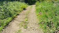
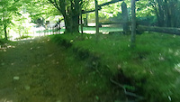
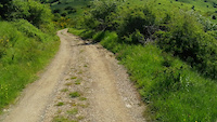
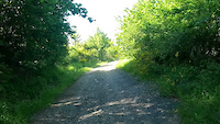
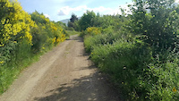
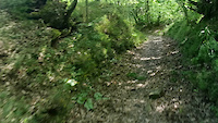
Photos of Pontremoli Mountain Bike
Videos of Pontremoli Mountain Bike
0:33 |
8 |
May 24, 2024
trail: Rifugio Mattei
0:12 |
6 |
May 24, 2024
trail: Rifugio Mattei
0:38 |
7 |
May 24, 2024
trail: Cima dei Piaggi
0:32 |
2 |
May 24, 2024
trail: Passo della Crocetta
0:27 |
3 |
May 23, 2024
trail: Via Francigena
0:45 |
2 |
May 23, 2024
Recent Trail Reports
| status | trail | date | condition | info | user |
|---|---|---|---|---|---|
| Prati di Logarghena a Rocca Sigillina | May 30, 2026 @ 8:42am (Europe/Rome) May 29, 2026 | Ideal | EnricoGenerali | ||
| Cima dei Piaggi | May 30, 2026 @ 8:42am (Europe/Rome) May 29, 2026 | Unknown | EnricoGenerali | ||
| CUCCHERO | Apr 3, 2026 @ 3:41am (Pacific/Midway) Apr 3, 2026 | Ideal | Orso | ||
| Rifugio Mattei | Dec 13, 2025 @ 2:19am (Pacific/Midway) Dec 13, 2025 | Wet | Orso | ||
| Passo della Crocetta | Dec 13, 2025 @ 2:19am (Pacific/Midway) Dec 13, 2025 | Wet | Orso | ||
| Via Francigena | May 23, 2024 @ 12:15pm May 23, 2024 | Unknown | guidof |
Activity Feed
| username | action | type | title | date |
|---|---|---|---|---|
| EnricoGenerali | add | report | activity #96147412 and 1 more | Jun 3, 2026 @ 5:12am Jun 3, 2026 |
| EnricoGenerali | vote | trail | activity #96147124 and 1 more | Jun 3, 2026 @ 5:04am Jun 3, 2026 |
| Orso | add | report | activity #92165490 | Apr 7, 2026 @ 10:54pm Apr 7, 2026 |
| Orso | add | report | activity #90964124 | Mar 20, 2026 @ 11:32pm Mar 20, 2026 |
| Orso | add | trail | activity #90715012 | Mar 16, 2026 @ 4:43pm Mar 16, 2026 |
Recent Comments
| username | type | title | comment | date |
|---|---|---|---|---|
| trail | È colorato come "risalita", ma l' avete... | May 16, 2025 @ 11:11pm May 16, 2025 |
Activity Type Stats
| activitytype | trails | distance | descent | descent distance | total vertical | rating | global rank | state rank | photos | reports | routes | ridelogs |
|---|---|---|---|---|---|---|---|---|---|---|---|---|
| Mountain Bike | 7 | #8,164 | #735 | 12 | 3 | 172 | ||||||
| E-Bike | 8 | 1 mile | 446 ft | 3,435 ft | 413 ft | #3,232 | #307 | 20 | 12 | 1 | 98 | |
| Horse | 6 | #3,302 | #230 | |||||||||
| Hike | 7 | #14,954 | #1,159 | 12 | 20 | |||||||
| Trail Running | 7 | #14,810 | #1,174 | 12 | 5 |
Frequently Asked Questions About Pontremoli
▼
What are the highest rated mountain biking trails in Pontremoli?
The highest rated mountain biking trails in Pontremoli are:
- Via Francigena (4.1/5)
- Cima dei Piaggi (4.1/5)
- CUCCHERO (0/5)
▼
What is the best time of the year to ride in Pontremoli?
Based on ride log data, the most popular months to ride in Pontremoli are:
- October (2 activities)
- November (1 activities)
▼
Where can I park to ride in Pontremoli?
Check the Pontremoli trail map for trailhead and parking information. Community members regularly update access and parking details for trails in the area.
▼
What is the longest trail in Pontremoli?
The longest trail in Pontremoli is CUCCHERO at 1.4 miles. View all trails sorted by distance.
Activities
Trails
Points of Interest
- By singlespeedissimo
 WCT & contributors
 - Admins: DanielePracchia, WCT
- #47581 - 665 views
- pontremoli activity log | embed map of Pontremoli mountain bike trails |
Downloading of trail gps tracks in kml & gpx formats is enabled for Pontremoli.
You must login to download files.