close
-
Layers w
- Weather Layers
- Pro
- Pro
- Pro
- Pro
- Pro
- Pro
- More Layers
- Pro
- Pro
- Pro
- Pro
-
Upgrade to

3D
Trail Conditions
- Unknown
- Snow Groomed
- Snow Packed
- Snow Covered
- Snow Cover Partial
- Freeze/thaw Cycle
- Icy
- Prevalent Mud
- Wet
- Variable
- Ideal
- Dry
- Very Dry
Trail Flow (Ridden Direction)
Trailforks scans users ridelogs to determine the most popular direction each trail is ridden. A good flowing trail network will have most trails flowing in a single direction according to their intension.
The colour categories are based on what percentage of riders are riding a trail in its intended direction.
The colour categories are based on what percentage of riders are riding a trail in its intended direction.
- > 96%
- > 90%
- > 80%
- > 70%
- > 50%
- < 50%
- bi-directional trail
- no data
Trail Last Ridden
Trailforks scans ridelogs to determine the last time a trail was ridden.
- < 2 days
- < 1 week
- < 2 weeks
- < 1 month
- < 6 months
- > 6 months
Trail Ridden Direction
The intended direction a trail should be ridden.
- Downhill Only
- Downhill Primary
- Both Directions
- Uphill Primary
- Uphill Only
- One Direction
Contribute Details
Colors indicate trail is missing specified detail.
- Description
- Photos
- Description & Photos
- Videos
Trail Popularity ?
Trailforks scans ridelogs to determine which trails are ridden the most in the last 9 months.
Trails are compared with nearby trails in the same city region with a possible 25 colour shades.
Think of this as a heatmap, more rides = more kinetic energy = warmer colors.
- most popular
- popular
- less popular
- not popular
ATV/ORV/OHV Filter
Max Vehicle Width
inches
US Cell Coverage
Legend

Radar Time
Activity Recordings
Trailforks uses anonymized public activity data.
?
Activity Recordings
Trailforks uses anonymized public activity data.
?
Personal Heatmap
▶
Activity Types
all
/
none
▶
Options
2
Date range
month
–
Winter Trails
Warning
A routing network for winter maps does not exist. Selecting trails using the winter trails layer has been disabled.
Missing Trails
Most Popular
Least Popular
Trails are colored based on popularity. The more popular a trail is, the more red. Less popular trails trend towards green.
Jump Magnitude Heatmap
Heatmap of where riders jump on trails. Zoom in to see individual jumps, click circles to view jump details.
BC Backroad Status
![map legend]()
Service Road Atlas is a free to use, community-driven service for viewing and creating reports on the numerous back-country service roads around B.C. and Alberta.

Slope Aspect
Direction the slope faces
Trails Deemphasized
Trails are shown in grey.
Only show trails with no bike usage.
Suggested Layers
Based on selected activity type
Save the current map location and zoom level as your default home location whenever this page is loaded.
Save
No description for Pontresina has been added yet!
Login or register to submit one.
This region uses the Uk/Euro style trail grading system.
Activities Click to view
- Mountain Bike
30 trails
- E-Bike
30 trails
- Adaptive Bike
0 trails
- Hike
27 trails
- Trail Running
28 trails
Region Details
- 6
- 7
- 7
- 6
- 2
Region Status
Open as of Jun 15, 2026Stats
- Avg Trail Rating
- Trails (view details)
- 30
- Trails Mountain Bike
- 30
- Trails E-Bike
- 30
- Trails Hike
- 28
- Trails Trail Running
- 28
- Trails Backcountry Ski
- 1
- Total Distance
- 38 miles
- Total Descent Distance
- 20 miles
- Total Descent
- 10,614 ft
- Total Vertical
- 3,835 ft
- Highest Trailhead
- 9,695 ft
- Reports
- 258
- Photos
- 103
- Ridden Counter
- 4,288
Popular Pontresina Mountain Biking Trails
• 100 ★ 4.5 • 1,657 ft • 19 ft • 608 •
Popular green difficulty family friendly singletrack. This mountain bike primary trail. It features berm and jump. Trail visibility is always easy to follow. On average it takes 2 minutes to complete this trail.
• 85 ★ 4.2 • 3 miles • 639 ft • 405 •
Die lokale Mountainbike Route Bernina Express hat den Namen vom legendären Zug der Rhätischen Bahn übernommen, der über den Berninapass fährt, und ist ebenso abwechslungsreich wie inspirierend. Die Rückfahrt von Poschiavo mit dem...
• 85 ★ 4.0 • 4,203 ft • 140 ft • 323 •
Popular blue difficulty alpine singletrack. This multi-use trail can be used both directions and has a moderate overall physical rating with a 140 ft blue climb. On average it takes 10 minutes to complete this trail.
• 80 ★ 5.0 • 1 mile • 61 ft • 258 •
Alternativ flow-trail from Moteratsch down to Pontresina insted using the "Bernina Express"
• 100 ★ 0.0 • 1,135 ft • 0 ft • 211 •
Popular blue difficulty family friendly alpine singletrack. This mountain bike primary trail with a 0 ft blue climb.
• 95 ★ 0.0 • 1,362 ft • 0 ft • 200 •
Popular blue difficulty alpine singletrack. This mountain bike primary trail with a 0 ft black diamond climb.
• 35 ★ 4.2 • 4,423 ft • 7 ft • 138 • • hike
Highly rated less popular black difficulty alpine wilderness trail. This hike primary trail can be used downhill primary and has a moderate overall physical rating. It features rock garden. Trail visibility is always easy to follow. On average it takes 30 minutes to complete this trail.
• 70 ★ 0.0 • 2,188 ft • 0 ft • 117 •
Popular green difficulty family friendly singletrack. This multi-use trail can be used both directions.
Pontresina Mountain Bike Routes
Photos of Pontresina Mountain Bike
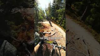
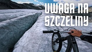
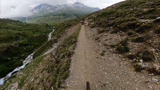
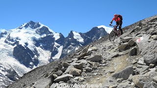
Videos of Pontresina Mountain Bike
youtuber
![Time together #mtb]()
0:30 |
28 |
Jan 28, 2026 , Pontresina
youtuber
![Zjazd z lodowca | Lodowiec Morteratsch |...]()
10:12 |
171 |
Sep 23, 2023 , Pontresina
youtuber
![Fourcla Minor - Pontresina]()
trail: Fuorcla Lej Minor
4:52 |
407 |
Feb 4, 2022 , Pontresina
5:13 |
583 |
Jan 26, 2022 , Pontresina
Recent Trail Reports
Activity Feed
| username | action | type | title | date |
|---|---|---|---|---|
| Fredhu5aPK | add | report | activity #97038510 | Jun 15, 2026 @ 7:02am Jun 15, 2026 |
| ilblog | comment | trail | activity #96277158 | Jun 4, 2026 @ 10:22pm Jun 4, 2026 |
| VilligerRtF70O | ridden | trail | activity #96225604 | Jun 4, 2026 @ 7:23am Jun 4, 2026 |
| trailpapst | update | trail | activity #96140568 | Jun 3, 2026 @ 1:03am Jun 3, 2026 |
| Fredhu5aPK | ridden | trail | activity #86154283 and 7 more | Dec 27, 2025 @ 10:01am Dec 27, 2025 |
Recent Comments
| username | type | title | comment | date |
|---|---|---|---|---|
| trail | The segment contains a lot of stairs that can... | Jun 4, 2026 @ 10:22pm Jun 4, 2026 | ||
| trail | Easy and fast trail, some blue parts but... | Aug 16, 2025 @ 1:28am Aug 16, 2025 | ||
| trail | Really nice and technical trail. Some rocky... | Aug 16, 2025 @ 1:24am Aug 16, 2025 | ||
| trail | Nice trail but technically demanding, a lot of... | Aug 16, 2025 @ 1:21am Aug 16, 2025 | ||
| trail | Fun piece of singletrack. | Jul 15, 2025 @ 5:01pm Jul 15, 2025 |
Local Badges
-

Epic Mountain Bike Climb 2k35 awarded -

Climbing 10k Badge1 awarded -

Mountain Biking 100k Badge0 awarded -

Epic Ride Descent 2k35 awarded -

Descent 10k Badge1 awarded -

Descent 100k Badge0 awarded
Bike & Skill Parks
| name | type | city | rating |
|---|---|---|---|
| Pumptrack Cuntschett | skill park | Pontresina |
Activity Type Stats
| activitytype | trails | distance | descent | descent distance | total vertical | rating | global rank | state rank | photos | reports | routes | ridelogs |
|---|---|---|---|---|---|---|---|---|---|---|---|---|
| Mountain Bike | 30 | 30 miles | 6,555 ft | 12 miles | 3,724 ft | #3,696 | #66 | 103 | 257 | 1 | 1,305 | |
| E-Bike | 30 | 30 miles | 6,555 ft | 12 miles | 3,724 ft | #3,094 | #119 | 279 | 223 | |||
| Hike | 27 | 32 miles | 6,854 ft | 14 miles | 3,750 ft | #4,582 | #96 | 280 | 603 | |||
| Trail Running | 28 | 32 miles | 6,854 ft | 14 miles | 3,750 ft | #4,335 | #88 | 280 | 51 | |||
| Backcountry Ski | 1 | 5 miles | 3,448 ft | 5 miles | 3,448 ft | 34 | 269 |
Frequently Asked Questions About Pontresina
▼
What are the highest rated mountain biking trails in Pontresina?
The highest rated mountain biking trails in Pontresina are:
- Val Minor (4.3/5)
- Pontresina Flowtrail (4.2/5)
- Lagalptraum (4.1/5)
- Bernina Express Uphill Morteratsch - Diavolezza (4.1/5)
- Morteratsch (4.1/5)
▼
What is the best time of the year to ride in Pontresina?
Based on ride log data, the most popular months to ride in Pontresina are:
- July (30 activities)
- August (11 activities)
- June (9 activities)
▼
Where can I park to ride in Pontresina?
Check the Pontresina trail map for trailhead and parking information. Community members regularly update access and parking details for trails in the area.
▼
What is the longest trail in Pontresina?
The longest trail in Pontresina is Lagalptraum at 4.4 km. View all trails sorted by distance.
Activities
Trails
Points of Interest
- By sandragredig & contributors
- Admins: apply
- #24526 - 3,385 views
- pontresina activity log | embed map of Pontresina mountain bike trails |
Downloading of trail gps tracks in kml & gpx formats is enabled for Pontresina.
You must login to download files.