close
-
Layers w
- Weather Layers
- Pro
- Pro
- Pro
- Pro
- Pro
- Pro
- More Layers
- Pro
- Pro
- Pro
- Pro
-
Upgrade to

3D
Trail Conditions
- Unknown
- Snow Groomed
- Snow Packed
- Snow Covered
- Snow Cover Partial
- Freeze/thaw Cycle
- Icy
- Prevalent Mud
- Wet
- Variable
- Ideal
- Dry
- Very Dry
Trail Flow (Ridden Direction)
Trailforks scans users ridelogs to determine the most popular direction each trail is ridden. A good flowing trail network will have most trails flowing in a single direction according to their intension.
The colour categories are based on what percentage of riders are riding a trail in its intended direction.
The colour categories are based on what percentage of riders are riding a trail in its intended direction.
- > 96%
- > 90%
- > 80%
- > 70%
- > 50%
- < 50%
- bi-directional trail
- no data
Trail Last Ridden
Trailforks scans ridelogs to determine the last time a trail was ridden.
- < 2 days
- < 1 week
- < 2 weeks
- < 1 month
- < 6 months
- > 6 months
Trail Ridden Direction
The intended direction a trail should be ridden.
- Downhill Only
- Downhill Primary
- Both Directions
- Uphill Primary
- Uphill Only
- One Direction
Contribute Details
Colors indicate trail is missing specified detail.
- Description
- Photos
- Description & Photos
- Videos
Trail Popularity ?
Trailforks scans ridelogs to determine which trails are ridden the most in the last 9 months.
Trails are compared with nearby trails in the same city region with a possible 25 colour shades.
Think of this as a heatmap, more rides = more kinetic energy = warmer colors.
- most popular
- popular
- less popular
- not popular
ATV/ORV/OHV Filter
Max Vehicle Width
inches
US Cell Coverage
Legend

Radar Time
Activity Recordings
Trailforks uses anonymized public activity data.
?
Activity Recordings
Trailforks uses anonymized public activity data.
?
Personal Heatmap
▶
Activity Types
all
/
none
▶
Options
2
Date range
month
–
Winter Trails
Warning
A routing network for winter maps does not exist. Selecting trails using the winter trails layer has been disabled.
Missing Trails
Most Popular
Least Popular
Trails are colored based on popularity. The more popular a trail is, the more red. Less popular trails trend towards green.
Jump Magnitude Heatmap
Heatmap of where riders jump on trails. Zoom in to see individual jumps, click circles to view jump details.
BC Backroad Status
![map legend]()
Service Road Atlas is a free to use, community-driven service for viewing and creating reports on the numerous back-country service roads around B.C. and Alberta.

Slope Aspect
Direction the slope faces
Trails Deemphasized
Trails are shown in grey.
Only show trails with no bike usage.
Suggested Layers
Based on selected activity type
Save the current map location and zoom level as your default home location whenever this page is loaded.
Save
No description for Porto has been added yet!
Login or register to submit one.
This region uses the Uk/Euro style trail grading system.
Region Details
- 25
- 1
- 24
- 64
- 12
- 1
Stats
- Avg Trail Rating
- Trails (view details)
- 128
- Trails Mountain Bike
- 147
- Trails E-Bike
- 107
- Trails Gravel Bike
- 1
- Trails Horse
- 1
- Trails Hike
- 83
- Trails Trail Running
- 86
- Trails Dirtbike/Moto
- 11
- Total Distance
- 97 miles
- Total Descent
- 26,454 ft
- Total Vertical
- 2,413 ft
- Highest Trailhead
- 2,415 ft
- Reports
- 718
- Photos
- 983
- Ridden Counter
- 2,790
Sub Regions
- Valongo (3)
- Baião (4)
- Gondomar (7)
- Lousada (2)
- Maia (49)
- Alvarelhos (0)
- Facho (0)
- Guilhabreu (27)
- Meia Perna (15)
- Marco De Canaveses (8)
- Melres (4)
- Paços de Ferreira (9)
- Pilar (9)
- Santo Tirso (10)
- Valongo (18)
- Santa Justa (11)
- Vila Nova de Gaia (26)
- Canelas - Gaia (1)
- Serra de Canelas (12)
- Vila Nova de Gaia (8)
Popular Porto Mountain Biking Trails
• 95 ★ 5.0 • 2,356 ft • 10 ft • 57 •
Popular blue difficulty singletrack. This mountain bike primary trail can be used both directions. On average it takes 3 minutes to complete this trail.
• 80 ★ 4.7 • 2,352 ft • 0 ft • 52 •
Technical and fun single-track with lots of roots, jumps and berms. Tricky in wet weather, can get very slippery, but always fun. There are some gap jumps and technical segments there are for medium/advanced riders, so make sure you...
• 90 ★ 4.5 • 3,734 ft • 0 ft • 50 •
Long, technical single track, almost everything natural with just some man-made berms and jumps. Great fun, flowy and fast. Can get tricky on wet weather due to the many roots and slippery rocks.
• 90 ★ 5.0 • 2,111 ft • 148 ft • 50 •
Popular blue difficulty singletrack. This mountain bike primary trail can be used downhill primary and has a easy overall physical rating. It features skinny. On average it takes 3 minutes to complete this trail.
• 100 ★ 5.0 • 1,093 ft • 17 ft • 49 •
Flowy jump trail, mostly gap jumps, some berms and shark fins but you have to link everything together to be able to clear all of it
• 100 ★ 5.0 • 3,196 ft • 5 ft • 47 •
Shorter version of the " " trail with a new line in the top section (before the tarmac) and slight alterations and additions throughout the rest of the trail. This version deviates from the original line after approximately 100m from...
• 100 ★ 4.0 • 2,612 ft • 0 ft • 46 •
Single track com zona inicial rápida mas torna-se técnico, com bastantes curvas apertadas, raízes expostas, off-cambers. Exigente em tempo de chuva.
Porto Mountain Bike Routes
10 miles • 914 ft • 0 • Point to Point •
Última etapa del periplo acompañando al río Duero desde su nacimiento en los Picos de Urbión hasta su...
35 miles • 3,131 ft • 1 • Point to Point •
Etapa que discurre en su totalidad por carreteras asfaltadas carentes de arcén, con un tráfico intenso...
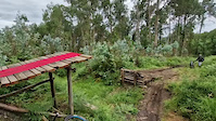
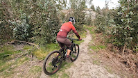
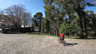
Photos of Porto Mountain Bike
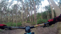
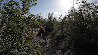
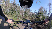
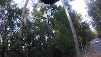
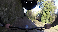
Videos of Porto Mountain Bike
trail: The Elements
0:09 |
87 |
Jun 12, 2023
trail: MBGA | Passo Aqui Há 15 Anos
0:00 |
45 |
Aug 4, 2022
trail: Quebra Cabeças (2026)
3:50 |
135 |
Apr 21, 2022
trail: Sala de Visitas
4:57 |
47 |
Apr 21, 2022
trail: Mosteiro
2:56 |
49 |
Apr 21, 2022
trail: Quebra Cabeças (2026)
3:08 |
45 |
Feb 12, 2022
trail: Sala de Visitas
0:00 |
20 |
Feb 12, 2022
trail: Mosteiro
2:23 |
45 |
Feb 12, 2022
Current Trail Warnings
| status | trail | date | condition | user | info |
|---|---|---|---|---|---|
| Avintes - Zoo - Acesso Vila Nova de Gaia | Jun 13, 2026 @ 3:04pm (Europe/Lisbon) Jun 13, 2026 | Very Dry | sickrifel | fallen trees |
Recent Trail Reports
National Scenic Trails & Official Routes
-
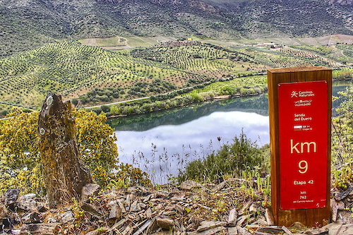
GR 14 Senda del Duero
- Mountain Bike
- E-Bike
- Hike
- Trail Running
Activity Feed
| username | action | type | title | date |
|---|---|---|---|---|
| Jonpfelix | wishlist | region | activity #97371908 | Jun 20, 2026 @ 1:18am 1 day |
| Jonpfelix | wishlist | trail | activity #97371889 | Jun 20, 2026 @ 1:18am 1 day |
| FYMXSi | add | report | activity #97188871 and 1 more | Jun 17, 2026 @ 9:15am Jun 17, 2026 |
| FYMXSi | add | report | activity #97188870 and 1 more | Jun 17, 2026 @ 9:15am Jun 17, 2026 |
| AMG | add | trail | activity #97051341 | Jun 15, 2026 @ 10:32am Jun 15, 2026 |
Recent Comments
| username | type | title | comment | date |
|---|---|---|---|---|
| trail | Com 16 anos eu e os meus amigos costumávamos... | Mar 31, 2026 @ 5:32am Mar 31, 2026 | ||
| trail | O trilho já foi reparado e a parte destruída... | Jan 26, 2025 @ 3:52pm Jan 26, 2025 | ||
| trail | 40% do trilho desde o início está destruído... | Oct 22, 2024 @ 2:18pm Oct 22, 2024 | ||
| report | Boas. Sabes se já houve alguma limpeza... | Jul 16, 2023 @ 11:41am Jul 16, 2023 | ||
| trail | I think it was destroyed by farmers | Jun 18, 2023 @ 3:08pm Jun 18, 2023 |
Local Badges
-

Epic Ride 50k149 awarded -

Epic Mountain Bike Climb 2k0 awarded -
Epic Ride 50k120 awarded -
Epic Ride 50k459 awarded -

Big Ride 30k1,003 awarded -
Big Ride 30k295 awarded
Local Mountain Biking Directory
-
MakeBTTGreatAgain
![MakeBTTGreatAgain]()
-
Vallis Longus Trails
![Vallis Longus Trails]()
-
Mestre Jingas
-
Gaia BikeBike Shop
-
BicivendasBike Shop
-
PedalarBike Shop
Local Trail Supporters
- pandilhas
Activity Type Stats
| activitytype | trails | distance | descent | descent distance | total vertical | rating | global rank | state rank | photos | reports | routes | ridelogs |
|---|---|---|---|---|---|---|---|---|---|---|---|---|
| Mountain Bike | 144 | 97 miles | 26,453 ft | 60 miles | 2,415 ft | 982 | 724 | 9 | 26,352 | |||
| E-Bike | 107 | 72 miles | 15,919 ft | 43 miles | 2,415 ft | 1 | 653 | 6 | 2,884 | |||
| Gravel Bike | 1 | 10 | 2 | 169 | ||||||||
| Horse | 1 | 4,272 ft | 62 ft | 1,552 ft | 36 ft | 51 | ||||||
| Hike | 83 | 80 miles | 17,631 ft | 46 miles | 1,729 ft | 626 | 2 | 1,860 | ||||
| Trail Running | 86 | 81 miles | 18,068 ft | 47 miles | 1,959 ft | 628 | 3 | 99 | ||||
| Dirtbike/Moto | 11 | 5 miles | 1,220 ft | 3 miles | 745 ft | 52 | 3 |
Activities
Trails
Points of Interest
- By brenthillier
 NSMBA TRAILFORKS & contributors
 - Admins: elyari, AMG, marcossantamaria
- #9890 - 12,240 views
- porto activity log | embed map of Porto mountain bike trails | porto mountain biking points of interest
Downloading of trail gps tracks in kml & gpx formats is enabled for Porto.
You must login to download files.