close
-
Layers w
- Weather Layers
- Pro
- Pro
- Pro
- Pro
- Pro
- Pro
- More Layers
- Pro
- Pro
- Pro
- Pro
-
Upgrade to

3D
Trail Conditions
- Unknown
- Snow Groomed
- Snow Packed
- Snow Covered
- Snow Cover Partial
- Freeze/thaw Cycle
- Icy
- Prevalent Mud
- Wet
- Variable
- Ideal
- Dry
- Very Dry
Trail Flow (Ridden Direction)
Trailforks scans users ridelogs to determine the most popular direction each trail is ridden. A good flowing trail network will have most trails flowing in a single direction according to their intension.
The colour categories are based on what percentage of riders are riding a trail in its intended direction.
The colour categories are based on what percentage of riders are riding a trail in its intended direction.
- > 96%
- > 90%
- > 80%
- > 70%
- > 50%
- < 50%
- bi-directional trail
- no data
Trail Last Ridden
Trailforks scans ridelogs to determine the last time a trail was ridden.
- < 2 days
- < 1 week
- < 2 weeks
- < 1 month
- < 6 months
- > 6 months
Trail Ridden Direction
The intended direction a trail should be ridden.
- Downhill Only
- Downhill Primary
- Both Directions
- Uphill Primary
- Uphill Only
- One Direction
Contribute Details
Colors indicate trail is missing specified detail.
- Description
- Photos
- Description & Photos
- Videos
Trail Popularity ?
Trailforks scans ridelogs to determine which trails are ridden the most in the last 9 months.
Trails are compared with nearby trails in the same city region with a possible 25 colour shades.
Think of this as a heatmap, more rides = more kinetic energy = warmer colors.
- most popular
- popular
- less popular
- not popular
ATV/ORV/OHV Filter
Max Vehicle Width
inches
US Cell Coverage
Legend

Radar Time
Activity Recordings
Trailforks uses anonymized public activity data.
?
Activity Recordings
Trailforks uses anonymized public activity data.
?
Personal Heatmap
▶
Activity Types
all
/
none
▶
Options
2
Date range
month
–
Winter Trails
Warning
A routing network for winter maps does not exist. Selecting trails using the winter trails layer has been disabled.
Missing Trails
Most Popular
Least Popular
Trails are colored based on popularity. The more popular a trail is, the more red. Less popular trails trend towards green.
Jump Magnitude Heatmap
Heatmap of where riders jump on trails. Zoom in to see individual jumps, click circles to view jump details.
BC Backroad Status
![map legend]()
Service Road Atlas is a free to use, community-driven service for viewing and creating reports on the numerous back-country service roads around B.C. and Alberta.

Slope Aspect
Direction the slope faces
Trails Deemphasized
Trails are shown in grey.
Only show trails with no bike usage.
Suggested Layers
Based on selected activity type
Save the current map location and zoom level as your default home location whenever this page is loaded.
SavePopular Trail Networks
view all areas »
No description for Portugal has been added yet!
Login or register to submit one.
This region uses the Uk/Euro style trail grading system.
Region Details
- 662
- 44
- 719
- 968
- 386
- 73
- 9
Stats
- Avg Trail Rating
- Trails (view details)
- 2,945
- Trails Mountain Bike
- 2,881
- Trails E-Bike
- 2,232
- Trails Gravel Bike
- 153
- Trails Adaptive Bike
- 179
- Trails Winter Fat Bike
- 105
- Trails Horse
- 87
- Trails Hike
- 2,381
- Trails Trail Running
- 2,422
- Trails Dirtbike/Moto
- 125
- Trails Observed Trials
- 10
- Trails ATV/ORV/OHV
- 16
- Total Distance
- 2,021 miles
- Total Descent
- 683,868 ft
- Total Vertical
- 7,603 ft
- Highest Trailhead
- 7,603 ft
- Reports
- 18,413
- Photos
- 15,515
- Ridden Counter
- 147,582
Articles
Race Report: Trans Madeira Summer 2026 - Days 5 & 6
May 25, 2026 from pinkbike.com
6 days, 35 blind stages, and an island-hopping finale. German elites sweep the overall titles as the gruelling multi-day gauntlet wraps up on the...
Mud, Dust, & 'Gamble': Trans Madeira Delivers Epic Contrast in First Two Days
May 20, 2026 from pinkbike.com
From a Day 1 mud bath to racing above the clouds on Day 2, German elites Christian Textor and Helen Weber open up massive gaps in the Atlantic.

Video: Race Mashup - iXS EDC #1 Santiago de Besteiros, Portugal
Apr 15, 2026 from pinkbike.com
All the race weekend goodness featuring fast times, challenging conditions and plenty of action.
World Cup Heavyweights Head to Portugal for iXS EDC Season Opener
Apr 6, 2026 from pinkbike.com
Finn Iles, Valentina Höll, and Danny Hart lead a stacked field in Santiago de Besteiros as the European Cup becomes the ultimate springboard for...
Sub Regions
- Aveiro (100)
- Águeda (23)
- Aveiro (15)
- Oliveira De Azeméis (3)
- Santa Maria de Lamas (3)
- São João Da Madeira (21)
- Vagos (40)
- Águeda (23)
- Azores (128)
- Ilha de Santa Maria (54)
- Vila do Porto (53)
- Ilha de São Miguel (74)
- Ponta Delgada (70)
- Ribeira Grande (4)
- San Antonio (0)
- Ilha do Faial (0)
- Ilha do Pico (0)
- Ilha de Santa Maria (54)
- Beja (0)
- Braga (120)
- Barcelos (5)
- Braga (28)
- Guimarães (29)
- Terras De Bouro (65)
- Barcelos (5)
- Bragança (3)
- Castelo Branco (9)
- Covilhã (8)
- Vila De Rei (1)
- Covilhã (8)
- Coimbra (118)
- Penacova (9)
- Arganil (1)
- Coimbra (27)
- Eiras (38)
- Figueira Da Foz (23)
- Góis (8)
- Lousã (31)
- Miranda do Corvo (1)
- Penacova (9)
- Évora (5)
- Faro (328)
- Albufeira (27)
- Castro Marim (4)
- Faro (110)
- Marmelete (22)
- Monchique (16)
- Portimão (31)
- São Brás de Alportel (47)
- Tavira (59)
- Vila Nova De Cacela (3)
- Albufeira (27)
- Guarda (125)
- Gouveia (12)
- Guarda (130)
- Manteigas (6)
- Vila Nova De Foz Coa (7)
- Gouveia (12)
- Leiria (154)
- Alcobaça (3)
- Alqueidão Da Serra (7)
- Benedita (4)
- Caldas Da Rainha (14)
- Leiria (105)
- Óbidos (16)
- Peniche (1)
- Porto de Mós (3)
- Reguengo Do Fetal (1)
- Alcobaça (3)
- Lisbon (672)
- Arruda dos Vinhos (77)
- Arruda Dos Vinhos (77)
- Venda Do Pinheiro - Lousa (10)
- Alenquer (16)
- Alhandra (33)
- Alverca do Ribatejo (28)
- Belas (14)
- Cascais (4)
- Charneca da Caparica (18)
- Ericeira (4)
- Lisboa (4)
- Lisbon (60)
- Loures (104)
- Mafra (32)
- Oeiras (2)
- Seixal (2)
- Sintra (14)
- Sobral Monte Agraço (27)
- Torres Vedras (90)
- Vila Franca de Xira (35)
- Arruda dos Vinhos (77)
- Madeira Island (195)
- Calheta (4)
- Câmara de Lobos (2)
- Funchal (141)
- Machico (2)
- Madeira (36)
- Porto Moniz (10)
- Santana (5)
- Calheta (4)
- Portalegre (24)
- Castelo de Vide (18)
- Castelo de Vide (18)
- Porto (144)
- Valongo (3)
- Baião (4)
- Gondomar (7)
- Lousada (2)
- Maia (49)
- Marco De Canaveses (8)
- Melres (4)
- Paços de Ferreira (9)
- Santo Tirso (10)
- Valongo (18)
- Vila Nova de Gaia (26)
- Valongo (3)
- Santarém (241)
- Ferreira do Zêzere (1)
- Abrantes (2)
- Alcanede (13)
- Almoster (5)
- Entroncamento (2)
- Moçarria (7)
- Proença-a-Nova (1)
- Santarém (63)
- Tomar (7)
- Torres Novas (70)
- Tremês (68)
- Setúbal (171)
- Viana do Castelo (225)
- Arga De Cima (16)
- Caminha (10)
- Cepões (47)
- Ponte de Lima (15)
- Valença Do Minho (5)
- Verdoejo (23)
- Viana do Castelo (122)
- Vila Nova de Cerveira (3)
- Arga De Cima (16)
- Vila Real (14)
- Viseu (77)
- Mangualde (13)
- Oliveira de Frades (17)
- Santiago De Bestieiros (1)
- Tarouca (5)
- Viseu (11)
- Vouzela (28)
- Mangualde (13)
- Fundão (1)
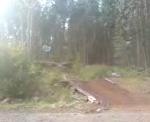
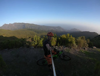
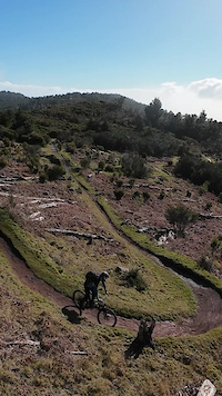
Popular Portugal Mountain Biking Trails
• 100 ★ 4.4 • 2,287 ft • 24 ft • 1,050 •
Primeira parte do Trilho enquadrado nas Zonas Altas do Funchal - São Roque, depois entramos nas arvores de eucaliptos, tem que ir pelo trilho sempre há direita. Trilho longo e um pouco puxado fisicamente, parte inicial com muitos Rock...
• 100 ★ 4.8 • 2 miles • 0 ft • 986 •
Trilho de terra com Rock Gardens na segunda parte. com apenas 2 saltos. Trilho muito rápido com uma subida na sua primeira parte. Trilho aberto de Raíz para o Enduro World Series. Levou 3 meses a construir com a autorização dos...
• 95 ★ 4.8 • 2 miles • 13 ft • 972 •
Trilho rapido e tecnico, zona inicial de terra e pedra solta um pouco enclinado, pequenos regos, zona aberta. Depois fica mais plana e com um flow constante. Na zona dos eucaliptos começa as zonas mais engraçadas, Flow, rapido,...
• 95 ★ 4.6 • 4,049 ft • 0 ft • 965 •
RATBOY Trail Primeiramente entre 2008 e 2009 foi a pista criada para o projecto '10TH DEGREE' que nunca chegou a ser rodado e a qual esteve em modo secret, podemos ver partes dessa pista lá ao lado com grandes gaps que nunca chegaram a...
• 85 ★ 4.6 • 3,159 ft • 6 ft • 955 •
Bom para iniciantes, trilho muito bonito e fácil, pouco inclinado, para subir o nível, basta largar os travões, costuma ser bastante húmido. No fim, continuar no estradão sempre em frente e pela esquerda, vão encontrar o trilho da...
• 75 ★ 4.9 • 2 miles • 309 ft • 933 •
Dos trilhos mais belos do Mundo. Trilho inicialmente feito por antepassados para se deslocarem da zona norte para o sul, onde a pé era difícil circular. Em 2013, 2014 e 2015 foi sendo alvo de algumas intervenções a nível do solo...
• 85 ★ 4.3 • 1 mile • 27 ft • 925 •
Trilho com pequena parte final de pedal, de resto sempre descida com curvas fechadas de tabela, piso de terra, raízes e alguma pedra fixa.
• 100 ★ 4.5 • 5,013 ft • 9 ft • 877 •
Highly rated popular blue difficulty singletrack. This mountain bike primary trail can be used downhill primary and has a moderate overall physical rating with a 9 ft blue climb. It features drop, jump, rock garden and other. Trail visibility is always easy to follow. On average it takes 9 minutes to complete this trail.
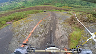
Portugal Mountain Bike Routes
★ 5.0 • 21 miles • 3,956 ft • 17 • Loop •
Track de la carrera de enduro celebrada en el mes de febrero de 2024. Recorre los mejores senderos de la...
★ 5.0 • 21 miles • 3,259 ft • 14 •
Passeio de 25 de Abril de 2025 de organização dos Ecotrilhos e da coletividade da Calhandriz
★ 4.5 • 23 miles • 3,838 ft • 20 • Loop •
Inicio junto á Penha Longa e subida em direcção ao trilho para chegar ao . No fim do Flow seguimos pelo...
★ 5.0 • 10 miles • 239 ft • 8 • Point to Point •
Começando no Pico do Arieiro para acabar no Funchal, pouco pedal, muita descida, com bike de DH vai bem...
★ 5.0 • 17 miles • 3,691 ft • 9 • Point to Point •
LIGAÇÃO 1 Saída das lareiras ao pé da champery entrar no estradão por baixo da pista de motocross e...
18 miles • 874 ft • 1 • Loop •
This Blue Trail, of moderate difficulty, initially follows the same path as the Green Trail before...
Photos of Portugal Mountain Bike
Videos of Portugal Mountain Bike
featured
![Montado]()
trail: Montado do Pereiro
5:18 |
299 |
Jul 21, 2009
featured
![Camacha]()
trail: Camacha Jump Line
0:17 |
469 |
May 31, 2008
0:11 |
4 |
Mar 7, 2026
0:59 |
5 |
Jan 28, 2026
trail: Baloiço 1
0:20 |
7 |
Jan 12, 2026
0:29 |
11 |
Jan 1, 2026
0:38 |
15 |
Nov 13, 2025
trail: Porto da Cruz
0:31 |
21 |
Nov 12, 2025
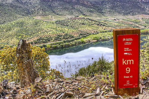
National Scenic Trails & Official Routes
-
GR 14 Senda del Duero
- Mountain Bike
- E-Bike
- Hike
- Trail Running
Recent Comments
| username | type | title | comment | date |
|---|---|---|---|---|
| trail | Attention: The trail is actually undriveble;... | Jun 17, 2026 @ 12:24pm 2 days | ||
| trail | I liked it. But after the last pin there are... | Jun 2, 2026 @ 3:39pm Jun 2, 2026 | ||
| trail | Liked it | Jun 2, 2026 @ 3:35pm Jun 2, 2026 | ||
| trail | Liked it | Jun 2, 2026 @ 3:34pm Jun 2, 2026 | ||
| trail | Liked it | Jun 2, 2026 @ 3:32pm Jun 2, 2026 |
Bike & Skill Parks
| name | type | city | rating |
|---|---|---|---|
| Louzanpark | bike park | Lousã | |
| Ponte de Lima Bike Park | bike park | Arga De Cima | |
| Pé do Negro MTB Center | bike park | Cepões | |
| Pista of Parque Urbano ( P.U. ) | bike park | Ponta Delgada | |
| Bike Park Porto Moniz | skill park | Madeira |
Upcoming Local Events
Activity Type Stats
| activitytype | trails | distance | descent | descent distance | total vertical | rating | global rank | state rank | photos | reports | routes | ridelogs |
|---|---|---|---|---|---|---|---|---|---|---|---|---|
| Mountain Bike | 2,881 | 1,902 miles | 633,412 ft | 1,143 miles | 5,915 ft | #25 | 15,381 | 18,402 | 280 | 329,758 | ||
| E-Bike | 2,232 | 1,470 miles | 420,315 ft | 847 miles | 5,909 ft | #21 | 38 | 16,665 | 126 | 36,758 | ||
| Gravel Bike | 153 | 155 miles | 33,730 ft | 68 miles | 5,213 ft | #24 | 972 | 37 | 2,210 | |||
| Adaptive Bike | 179 | 115 miles | 26,401 ft | 53 miles | 4,321 ft | #22 | 1,779 | 5 | 5 | |||
| Winter Fat Bike | 105 | 49 miles | 16,519 ft | 30 miles | 3,212 ft | #26 | 1 | 1,218 | ||||
| Horse | 87 | 60 miles | 9,823 ft | 29 miles | 4,117 ft | #35 | 2,720 | 4 | 7 | |||
| Hike | 2,381 | 1,743 miles | 540,735 ft | 992 miles | 7,602 ft | #24 | 75 | 17,324 | 26 | 27,911 | ||
| Trail Running | 2,422 | 1,733 miles | 545,098 ft | 999 miles | 7,602 ft | #24 | 17,398 | 29 | 7,834 | |||
| Dirtbike/Moto | 125 | 55 miles | 13,222 ft | 31 miles | 4,088 ft | #31 | 2,720 | 1 | 69 | |||
| Observed Trials | 10 | 4 miles | 942 ft | 3 miles | 794 ft | #30 | 1 | 30 | ||||
| ATV/ORV/OHV | 16 | 25 miles | 1,165 ft | 5 miles | 4,035 ft | #35 | 1 | 2,080 | 21 |
Activities
- Portugal Mountain Biking Trails
- Portugal E-Biking Trails
- Portugal Gravel Biking Trails
- Portugal Adaptive Biking Trails
- Portugal Winter Fat Biking Trails
- Portugal Horseback Trails
- Portugal Hiking Trails
- Portugal Trail Running Trails
- Portugal Dirtbiking Trails
- Portugal Observed Trials Trails
- Portugal ATVing/Offroading Trails
Trails
- By canadaka
 Trailforks & contributors
 - Admins: elyari, AMG, marcossantamaria
- #3152 - 86,228 views
- portugal activity log | embed map of Portugal mountain bike trails | portugal mountain biking points of interest polygons
Downloading of trail gps tracks in kml & gpx formats is enabled for Portugal.
You must login to download files.