close
-
Layers w
- Weather Layers
- Pro
- Pro
- Pro
- Pro
- Pro
- Pro
- More Layers
- Pro
- Pro
- Pro
- Pro
-
Upgrade to

3D
Trail Conditions
- Unknown
- Snow Groomed
- Snow Packed
- Snow Covered
- Snow Cover Partial
- Freeze/thaw Cycle
- Icy
- Prevalent Mud
- Wet
- Variable
- Ideal
- Dry
- Very Dry
Trail Flow (Ridden Direction)
Trailforks scans users ridelogs to determine the most popular direction each trail is ridden. A good flowing trail network will have most trails flowing in a single direction according to their intension.
The colour categories are based on what percentage of riders are riding a trail in its intended direction.
The colour categories are based on what percentage of riders are riding a trail in its intended direction.
- > 96%
- > 90%
- > 80%
- > 70%
- > 50%
- < 50%
- bi-directional trail
- no data
Trail Last Ridden
Trailforks scans ridelogs to determine the last time a trail was ridden.
- < 2 days
- < 1 week
- < 2 weeks
- < 1 month
- < 6 months
- > 6 months
Trail Ridden Direction
The intended direction a trail should be ridden.
- Downhill Only
- Downhill Primary
- Both Directions
- Uphill Primary
- Uphill Only
- One Direction
Contribute Details
Colors indicate trail is missing specified detail.
- Description
- Photos
- Description & Photos
- Videos
Trail Popularity ?
Trailforks scans ridelogs to determine which trails are ridden the most in the last 9 months.
Trails are compared with nearby trails in the same city region with a possible 25 colour shades.
Think of this as a heatmap, more rides = more kinetic energy = warmer colors.
- most popular
- popular
- less popular
- not popular
ATV/ORV/OHV Filter
Max Vehicle Width
inches
US Cell Coverage
Legend

Radar Time
Activity Recordings
Trailforks uses anonymized public activity data.
?
Activity Recordings
Trailforks uses anonymized public activity data.
?
Personal Heatmap
▶
Activity Types
all
/
none
▶
Options
2
Date range
month
–
Winter Trails
Warning
A routing network for winter maps does not exist. Selecting trails using the winter trails layer has been disabled.
Missing Trails
Most Popular
Least Popular
Trails are colored based on popularity. The more popular a trail is, the more red. Less popular trails trend towards green.
Jump Magnitude Heatmap
Heatmap of where riders jump on trails. Zoom in to see individual jumps, click circles to view jump details.
BC Backroad Status
![map legend]()
Service Road Atlas is a free to use, community-driven service for viewing and creating reports on the numerous back-country service roads around B.C. and Alberta.

Slope Aspect
Direction the slope faces
Trails Deemphasized
Trails are shown in grey.
Only show trails with no bike usage.
Suggested Layers
Based on selected activity type
Save the current map location and zoom level as your default home location whenever this page is loaded.
SavePowderface trailhead is off of Hwy 66, just past the winter gate [Closed Dec. 1 - May 15]. There is an older outhouse and an info kiosk, plus a few picnic tables. The trails in this area are maintained by Alberta Parks.
Primary Trail Type: Cross-Country
eBikes Allowed:
No
AKA: Powder Face
Land Status: Regional Recreation Area
 google parking directions
 Access Info:
The trailhead is a few hundred metres past the winter gate, on the right.
Activities Click to view
- Mountain Bike
12 trails
- E-Bike
7 trails
- Horse
4 trails
- Hike
37 trails
- Trail Running
37 trails
- Snowshoe
0 trails
- Backcountry Ski
0 trails
Region Details
- 1
- 8
- 2
Region Status
Open as of 1 dayStats
- Avg Trail Rating
- Trails (view details)
- 12
- Trails Mountain Bike
- 12
- Trails E-Bike
- 7
- Trails Horse
- 4
- Trails Hike
- 37
- Trails Trail Running
- 37
- Total Distance
- 37 miles
- Total Descent
- 7,679 ft
- Total Vertical
- 2,186 ft
- Highest Trailhead
- 7,155 ft
- Reports
- 433
- Photos
- 226
- Ridden Counter
- 5,392
Popular Powderface Mountain Biking Trails
• 65 ★ 3.4 • 2 miles • 316 ft • 802 •
The trail links and trails. Most people ride it from south to north, maximizing the descent/fun. From the south it climbs on a smooth, wide track that begs for a bit of head-to-head competition with your buddies. At the first "summit"...
• 50 ★ 3.7 • 6 miles • 340 ft • 379 •
It's a pretty mellow ride, with some punchy climbs to keep it interesting. Keep a sharp eye out for trees across the trail, at least until you get East of the Trail. The trail runs quite close to the creek, and there are often some very...
• 60 ★ 3.8 • 4 miles • 633 ft • 374 •
This trail can be ridden in both directions. I prefer riding North to South, parking at the start of the (where hwy66 turns to a gravel road at the intersection with Little Elbow Campground). Ride up the to the intersection of the...
• 65 ★ 2.7 • 5 miles • 1,673 ft • 357 •
The trail has a split personality. The east half is wide, mellow and almost qualifies as beginner trail. From the Powderface trailhead, the trail goes straight up what is basically a rocky jeep road. Once you're over the initial hump,...
• 55 ★ 2.5 • 4,931 ft • 66 ft • 160 •
Little piece of single track that cuts part of the road from .
• 45 ★ 5.0 • 2 miles • 18 ft • 151 • • hike
Connects the summit of with . Trail surface is a mix of single track and eroded off-camber. This trail is much less utilized than the primary climb trail, so watch for downed trees and other obstacles.
• 55 ★ 4.3 • 2 miles • 2,154 ft • 95 • • hike
Primary trail to access the summit of . This is an extremely popular hiking trail, expect foot traffic. As a mountain bike climb trail it is easy to follow, but many sections are steep and difficult to pedal. Expect to push, but the...
• 35 ★ 2.5 • 6 miles • 665 ft • 73 • • hike
This old gem makes up the return leg on the - Loop [page 91 of Backcountry Biking in the Canadian Rockies, 2nd ed.]. A mix of singletrack, doubletrack, 4x4 trail and horse track, this is backcountry riding. It's not well signed, so...
Powderface Mountain Bike Routes
★ 5.0 • 7 miles • 879 ft • 3 • Loop •
Leaves from Powderface parking lot on the NW corner of the lot. Head up and take the first intersection to...
★ 3.7 • 31 miles • 3,520 ft • 2 • Loop •
Elbow Loop is comprised of two trails: and Little Elbow. Bridges destroyed in the 2013 floods have been...
★ 4.2 • 7 miles • 884 ft • 3 • Loop •
Old school Kananaskis classic. Most people ride it clockwise to maximize the DH fun. For the experienced...
★ 4.0 • 17 miles • 2,435 ft • 4 • Loop •
- Start at Powderface parking lot - Ride on wide track to junction of - Ride up down to - Turn left onto...
13 miles • 2,245 ft • 3 • Loop •
Powderface Long Loop - to Powderface Trail to Trail
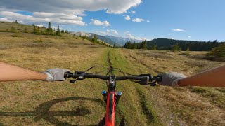
Photos of Powderface Mountain Bike
Videos of Powderface Mountain Bike

trail: Powderface Creek
6:59 |
538 |
Jul 14, 2017
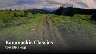
trail: Powderface Ridge
6:30 |
84 |
Sep 3, 2025 , Bragg Creek
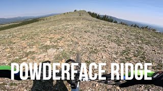
trail: Powderface Ridge
16:54 |
58 |
Sep 1, 2025 , Bragg Creek
2:17 |
94 |
Aug 19, 2025
trail: Powderface Ridge
2:17 |
51 |
Aug 19, 2025 , Bragg Creek
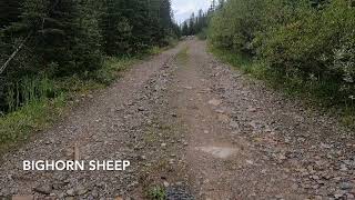
trail: Prairie Mountain Backside
6:54 |
883 |
Jan 13, 2011
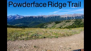
![Powderface Ridge [Powderface]](https://ev1.pinkbike.org/tf/vt/1/yvt-172687-4.jpg)
trail: Powderface Ridge
23:47 |
367 |
Jul 4, 2023 , Bragg Creek
trail: Powderface Ridge
16:53 |
415 |
Jun 5, 2023 , Bragg Creek
Current Trail Warnings
| status | trail | date | condition | user | info |
|---|---|---|---|---|---|
| Powderface Ridge | Jun 5, 2026 @ 2:15pm (America/Edmonton) Jun 5, 2026 | Unknown | bainer66 | Still very snowy on top half. Many trees... |
Recent Trail Reports
| status | trail | date | condition | info | user |
|---|---|---|---|---|---|
| Prairie Mountain Summit | Jun 17, 2026 @ 11:30am (America/Creston) 1 day | Ideal | kinglis | ||
| Prairie Creek | Jun 13, 2026 @ 11:42am (America/Creston) Jun 13, 2026 | Variable | mountainmaneuvers | ||
| Trail Creek Trail | Jun 13, 2026 @ 11:42am (America/Creston) Jun 13, 2026 | Variable | mountainmaneuvers | ||
| Powderface Creek | Jun 13, 2026 @ 11:42am (America/Creston) Jun 13, 2026 | Variable | mountainmaneuvers | ||
| Prairie Mountain Backside | Jun 8, 2026 @ 7:47am (America/Creston) Jun 8, 2026 | Variable | kinglis | ||
| Prairie Link | May 10, 2026 @ 4:49pm (America/Edmonton) May 10, 2026 | Ideal | SilverFox24 | ||
| Powderface East Ridge Trail | Aug 13, 2025 @ 9:54pm Aug 13, 2025 | Ideal | thodder | ||
| Ford Creek Trail | Jul 26, 2025 @ 10:18am Jul 26, 2025 | Dry | Thefifelife | ||
| Trail Creek Connector | Jul 7, 2025 @ 12:08pm Jul 7, 2025 | Wet | jjfm | ||
| Forgetmenot Summit | Apr 4, 2024 @ 1:10pm Apr 4, 2024 | Unknown | markholloway Trailforks |
Activity Feed
| username | action | type | title | date |
|---|---|---|---|---|
| Brackow | ridden | trail | activity #97231621 | Jun 17, 2026 @ 9:35pm 20 hours |
| kinglis | add | report | activity #97212776 and 2 more | Jun 17, 2026 @ 3:29pm 1 day |
| guywhobikessometimes | wishlist | trail | activity #97164054 | Jun 16, 2026 @ 10:54pm 2 days |
| kinglis | add | report | activity #96999239 and 1 more | Jun 14, 2026 @ 1:11pm Jun 14, 2026 |
| mountainmaneuvers | add | report | activity #96919728 and 2 more | Jun 13, 2026 @ 3:09pm Jun 13, 2026 |
Recent Comments
| username | type | title | comment | date |
|---|---|---|---|---|
| trail | Good trail for running or hiking. A few small... | May 24, 2026 @ 2:22pm May 24, 2026 | ||
| trail | Hiked from Little Elbow campsite to the lower... | May 18, 2026 @ 3:24pm May 18, 2026 | ||
| trail | Not a good trail for mountain biking. Avoid. | Aug 30, 2025 @ 8:09pm Aug 30, 2025 | ||
| trail | Great views up top, some loose rock and roots... | Aug 19, 2025 @ 2:56pm Aug 19, 2025 | ||
| trail | Overgrown. Not a MTB trail. Horses destroyed... | Jul 26, 2025 @ 10:19am Jul 26, 2025 |
Nearby Areas
| name | distance | ||||
|---|---|---|---|---|---|
| Little Elbow Provincial Recreation Area | 4 | 3.1 km | |||
| Prairie Mountain | 1 | 6 | 5 | 3 | 5.2 km |
| Moose Mountain | 4 | 11 | 10 | 4 | 7.5 km |
| Station Flats | 2 | 10 | 8 km | ||
| Mclean Creek Off Highway Vehicle PLUZ | 1 | 4 | 9 km |
Local Badges
-

Completionist0 awarded
Activity Type Stats
| activitytype | trails | distance | descent | descent distance | total vertical | rating | global rank | state rank | photos | reports | routes | ridelogs |
|---|---|---|---|---|---|---|---|---|---|---|---|---|
| Mountain Bike | 12 | 35 miles | 7,680 ft | 18 miles | 2,185 ft | #5,001 | #68 | 190 | 430 | 11 | 4,560 | |
| E-Bike | 7 | 31 miles | 4,846 ft | 14 miles | 2,185 ft | #3,792 | #36 | 5 | 366 | 3 | 205 | |
| Horse | 4 | 14 miles | 2,539 ft | 9 miles | 1,204 ft | #1,238 | #15 | 103 | 1 | 1 | ||
| Hike | 37 | 37 miles | 7,680 ft | 18 miles | 2,185 ft | #1,537 | #17 | 31 | 433 | 1 | 1,878 | |
| Trail Running | 37 | 37 miles | 7,680 ft | 18 miles | 2,185 ft | #3,713 | #31 | 433 | 1 | 973 |
Frequently Asked Questions About Powderface
▼
What are the highest rated mountain biking trails in Powderface?
The highest rated mountain biking trails in Powderface are:
- Beaver Lodge Trail (4.1/5)
- Trail Creek Connector (4.1/5)
- Prairie Mountain Backside (4.1/5)
- Prairie Mountain Summit (4.1/5)
- Powderface Ridge (3.8/5)
▼
What is the best time of the year to ride in Powderface?
Based on ride log data, the most popular months to ride in Powderface are:
- August (79 activities)
- July (77 activities)
- September (66 activities)
▼
Where can I park to ride in Powderface?
There are 9 parking locations listed in Powderface. The most popular parking spots are: View all parking and trailhead locations on the map to plan your visit.
▼
What is the longest trail in Powderface?
The longest trail in Powderface is Ford Creek Trail at 9.5 miles. View all trails sorted by distance.
Activities
Trails
- By pinkrobe & contributors
- Admins: BCT, MMBTS
- #8512 - 17,546 views
- powderface activity log | embed map of Powderface mountain bike trails | powderface mountain biking points of interest
Downloading of trail gps tracks in kml & gpx formats is enabled for Powderface.
You must login to download files.