close
-
Layers w
- Weather Layers
- Pro
- Pro
- Pro
- Pro
- Pro
- Pro
- More Layers
- Pro
- Pro
- Pro
- Pro
-
Upgrade to

3D
Trail Conditions
- Unknown
- Snow Groomed
- Snow Packed
- Snow Covered
- Snow Cover Partial
- Freeze/thaw Cycle
- Icy
- Prevalent Mud
- Wet
- Variable
- Ideal
- Dry
- Very Dry
Trail Flow (Ridden Direction)
Trailforks scans users ridelogs to determine the most popular direction each trail is ridden. A good flowing trail network will have most trails flowing in a single direction according to their intension.
The colour categories are based on what percentage of riders are riding a trail in its intended direction.
The colour categories are based on what percentage of riders are riding a trail in its intended direction.
- > 96%
- > 90%
- > 80%
- > 70%
- > 50%
- < 50%
- bi-directional trail
- no data
Trail Last Ridden
Trailforks scans ridelogs to determine the last time a trail was ridden.
- < 2 days
- < 1 week
- < 2 weeks
- < 1 month
- < 6 months
- > 6 months
Trail Ridden Direction
The intended direction a trail should be ridden.
- Downhill Only
- Downhill Primary
- Both Directions
- Uphill Primary
- Uphill Only
- One Direction
Contribute Details
Colors indicate trail is missing specified detail.
- Description
- Photos
- Description & Photos
- Videos
Trail Popularity ?
Trailforks scans ridelogs to determine which trails are ridden the most in the last 9 months.
Trails are compared with nearby trails in the same city region with a possible 25 colour shades.
Think of this as a heatmap, more rides = more kinetic energy = warmer colors.
- most popular
- popular
- less popular
- not popular
ATV/ORV/OHV Filter
Max Vehicle Width
inches
US Cell Coverage
Legend

Radar Time
Activity Recordings
Trailforks uses anonymized public activity data.
?
Activity Recordings
Trailforks uses anonymized public activity data.
?
Personal Heatmap
▶
Activity Types
all
/
none
▶
Options
2
Date range
month
–
Winter Trails
Warning
A routing network for winter maps does not exist. Selecting trails using the winter trails layer has been disabled.
Missing Trails
Most Popular
Least Popular
Trails are colored based on popularity. The more popular a trail is, the more red. Less popular trails trend towards green.
Jump Magnitude Heatmap
Heatmap of where riders jump on trails. Zoom in to see individual jumps, click circles to view jump details.
BC Backroad Status
![map legend]()
Service Road Atlas is a free to use, community-driven service for viewing and creating reports on the numerous back-country service roads around B.C. and Alberta.

Slope Aspect
Direction the slope faces
Trails Deemphasized
Trails are shown in grey.
Only show trails with no bike usage.
Suggested Layers
Based on selected activity type
Save the current map location and zoom level as your default home location whenever this page is loaded.
SaveThis region is Unsanctioned, Ride at your own Risk!
The Prahova Valley is one of the areas with the highest tourist potential in the country having one of the best tourism facilities in Romania.
The main tourist destinations are:
On the Prahova Valley:
The Sinaia Resort.
The Bușteni Resort.
The Azuga Resort.
The Bucegi Mountains.
On the Teleajen River Valley:
The Vălenii de Munte Resort.
Cheia.
Slănic.
The Zăganul Mountains
The Ciucaș Mountains.
On the Doftana River Valley:
The Teleaga Resort.
Valea Doftanei.
The Gârbova Mountains.
The city of Ploiești.
The city of Câmpina.
This region uses the Uk/Euro style trail grading system.
Region Details
- 21
- 30
- 25
- 6
- 3
Stats
- Avg Trail Rating
- Trails (view details)
- 86
- Trails Mountain Bike
- 86
- Trails E-Bike
- 82
- Trails Horse
- 26
- Trails Hike
- 74
- Trails Trail Running
- 73
- Trails Dirtbike/Moto
- 18
- Trails ATV/ORV/OHV
- 11
- Trails Snowmobile
- 3
- Trails Snowshoe
- 1
- Trails Downhill Ski
- 2
- Trails Backcountry Ski
- 4
- Trails Nordic Ski
- 1
- Total Distance
- 182 miles
- Total Descent
- 71,281 ft
- Total Vertical
- 7,477 ft
- Highest Trailhead
- 8,113 ft
- Reports
- 152
- Photos
- 59
- Ridden Counter
- 2,145
Sub Regions
Popular Prahova Mountain Biking Trails
• 100 ★ 4.4 • 2 miles • 19 ft • 101 •
The youngest member of the Bike Resort Sinaia family, is the track which accurately depicts the origin and spirit of mountain biking. Rated as a medium trail regarding its degree of difficulty, is an authentic single-trail addressed to...
• 60 ★ 5.0 • 4 miles • 67 ft • 78 •
Moderately popular green difficulty alpine mixed. This multi-use trail can be used downhill primary and has a moderate overall physical rating with a 67 ft blue climb. It features berm. Trail visibility is always easy to follow. On average it takes 19 minutes to complete this trail.
• 80 ★ 4.5 • 2 miles • 2 ft • 72 •
The trail is full of roots and in some sections quite steep. It is demanding if you go at speed.
• 40 ★ 4.5 • 1 mile • 7 ft • 71 •
Happy Bear is the V.I.P. trail of the resort and, at the same time, one of the most famous downhill trails in Romania. Happy Bear, a progressive, demanding and fast trail, has been, until now, the host of four national downhill...
• 80 ★ 3.9 • 2 miles • 66 ft • 61 •
The is the romantic side of the bike resort, as it represents, at the same time, the trail that can be covered by all riders, from beginners to advanced riders. The is 2.8 km long and is made up of a forest road crossed by numerous...
• 95 ★ 4.5 • 4,833 ft • 0 ft • 31 •
Loosey Goosey stage, as part of the Red Mountain Enduro stage race https://redmountainenduro.ro/enduro-stage-race/
• 95 ★ 3.5 • 2,956 ft • 227 ft • 30 •
Transfer up from the main road to start. Can also be used as a riding trail, linking to half way down. it goes along , a few meters from it. primarily designed for going uphill, especially on an ebike.
• 100 ★ 0.0 • 3,953 ft • 0 ft • 28 •
One of the stages in the Red Mountain Enduro race. The first part, from the earthquake station down to the meadow is super technical, steep and very tricky. It is a deep rut, with many tight turns and the posibility to cut over many...
Prahova Mountain Bike Routes
★ 5.0 • 4 miles • 383 ft • 1 • Loop •
Loop - created by CS MTB SPORTS ACADEMY powered by Florin Cruceanu
11 miles • 3,451 ft • 10 • Loop •
At the end of June we are putting together a mountain bike festival, up in the mountains, in the heart of...
12 miles • 4,407 ft • 10 • Loop •
At the end of June we are putting together a mountain bike festival, up in the mountains, in the heart of...
★ 5.0 • 29 miles • 1,388 ft • 0 • Point to Point •
A really nice ~50km route, mostly downhill starting from Azuga to Campina trough Baiului Montains....
15 miles • 3,879 ft • 9 • Out & Back •
Alternate race route for Red Mountain Enduro 2024
★ 5.0 • 19 miles • 2,129 ft • 0 • Loop •
Maratonul vinului short one 31km
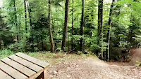
Photos of Prahova Mountain Bike
Videos of Prahova Mountain Bike
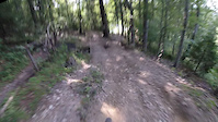
trail: Happy Bear Trail Sinaia
0:19 |
128 |
Sep 19, 2020
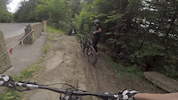
trail: Happy Bear Trail Sinaia
0:09 |
143 |
Sep 19, 2020
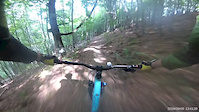
trail: Happy Bear Trail Sinaia
0:10 |
185 |
Jul 5, 2020
trail: Poteca Afinarilor
0:23 |
360 |
Sep 13, 2019
trail: Happy Bear Trail Sinaia
2:37 |
205 |
Jun 20, 2018
trail: Happy Bear Trail Sinaia
0:43 |
2946 |
May 29, 2018
4:00 |
239 |
May 14, 2018
trail: Happy Bear Trail Sinaia
5:50 |
113 |
Aug 8, 2017
Recent Trail Reports
| status | trail | date | condition | info | user |
|---|---|---|---|---|---|
| Valea Berii - Muntele Roşu | Aug 15, 2025 @ 11:20am Aug 15, 2025 | Very Dry | 3sixtee | ||
| Loosey Goosey Maneciu | Aug 15, 2025 @ 11:20am Aug 15, 2025 | Very Dry | 3sixtee | ||
| Loosey Goosey 2 Maneciu | Aug 15, 2025 @ 11:20am Aug 15, 2025 | Very Dry | 3sixtee | ||
| Căsuţa din Poveşti Maneciu | Aug 15, 2025 @ 11:20am Aug 15, 2025 | Very Dry | 3sixtee | ||
| Transfer Gummy Bear Maneciu | Aug 15, 2025 @ 11:20am Aug 15, 2025 | Very Dry | 3sixtee | ||
| Gummy Bear Maneciu | Aug 15, 2025 @ 11:20am Aug 15, 2025 | Very Dry | 3sixtee | ||
| Fairy Trail Sinaia Mountain Bike Resort | Aug 14, 2025 @ 3:55am Aug 14, 2025 | Dry | Gilius38 VMBC | ||
| Ranger Smith Maneciu | Aug 5, 2025 @ 2:28pm Aug 5, 2025 | Ideal | xuvmzdD6 | ||
| Malademna Maneciu | Aug 5, 2025 @ 2:28pm Aug 5, 2025 | Ideal | xuvmzdD6 | ||
| Forestier Valea Grecului Azuga | Jun 8, 2025 @ 8:16am Jun 8, 2025 | Prevalent Mud | Mariuswfe5wI |
Activity Feed
| username | action | type | title | date |
|---|---|---|---|---|
| andreibrebulet | add | trail | activity #97114928 | Jun 16, 2026 @ 9:04am 3 days |
| torpila | wishlist | trail | activity #96206358 and 4 more | Jun 3, 2026 @ 10:11pm Jun 3, 2026 |
| torpila | wishlist | trail | activity #96206348 and 3 more | Jun 3, 2026 @ 10:09pm Jun 3, 2026 |
| torpila | wishlist | trail | activity #96206334 and 1 more | Jun 3, 2026 @ 10:08pm Jun 3, 2026 |
| torpila | wishlist | trail | activity #96206270 and 8 more | Jun 3, 2026 @ 10:06pm Jun 3, 2026 |
Recent Comments
| username | type | title | comment | date |
|---|---|---|---|---|
| trail | Really great in the upper part until you reach... | Oct 26, 2024 @ 11:27pm Oct 26, 2024 | ||
| trail | Great fun. Really steep but can be ridden... | Aug 30, 2024 @ 1:26pm Aug 30, 2024 | ||
| trail | Great trail, quite steep, testing your balls,... | Sep 10, 2023 @ 10:09pm Sep 10, 2023 | ||
| trail | Please keep in mind that this trail was... | May 15, 2023 @ 6:48am May 15, 2023 | ||
| trail | va trebui sa cautam o varianta de poteca... | Jun 9, 2020 @ 1:37am Jun 9, 2020 |
Local Badges
-

Epic Ride Descent 2k3 awarded -

Big Ride 30k7 awarded -
Big Ride 30k87 awarded -

Descent 100k Badge0 awarded -

Descent 10k Badge1 awarded -

Climbing 10k Badge1 awarded
Bike & Skill Parks
| name | type | city | rating |
|---|---|---|---|
| Azuga Mountain Bike Resort | bike park | Azuga | |
| Sinaia Mountain Bike Resort | bike park | Sinaia | |
| Azuga Skill park | skill park | Azuga |
Upcoming Local Events
Local Trail Supporters
- Gondola Sinaia
- Richea Vasile
- Raidextrem
![]()
Local Trail Supporters
- Gondola Sinaia
- Richea Vasile
- Raidextrem
![]()
Activity Type Stats
| activitytype | trails | distance | descent | descent distance | total vertical | rating | global rank | state rank | photos | reports | routes | ridelogs |
|---|---|---|---|---|---|---|---|---|---|---|---|---|
| Mountain Bike | 86 | 178 miles | 66,490 ft | 109 miles | 6,453 ft | 59 | 152 | 10 | 3,276 | |||
| E-Bike | 82 | 173 miles | 63,875 ft | 106 miles | 6,453 ft | 150 | 8 | 683 | ||||
| Horse | 26 | 49 miles | 10,906 ft | 24 miles | 5,121 ft | 10 | ||||||
| Hike | 74 | 162 miles | 56,686 ft | 95 miles | 7,477 ft | 141 | 555 | |||||
| Trail Running | 73 | 161 miles | 56,171 ft | 94 miles | 7,477 ft | 140 | 51 | |||||
| Dirtbike/Moto | 18 | 54 miles | 16,906 ft | 35 miles | 5,354 ft | 9 | ||||||
| ATV/ORV/OHV | 11 | 38 miles | 11,883 ft | 25 miles | 5,256 ft | 8 | 4 | |||||
| Snowmobile | 3 | 9 miles | 2,743 ft | 6 miles | 2,090 ft | 1 | ||||||
| Snowshoe | 1 | 1 mile | 33 ft | 1,516 ft | 292 ft | 1 | 1 | |||||
| Downhill Ski | 2 | 3 miles | 33 ft | 1,578 ft | 1,654 ft | 1 | 352 | |||||
| Backcountry Ski | 4 | 8 miles | 2,415 ft | 4 miles | 3,255 ft | 2 | 231 | |||||
| Nordic Ski | 1 | 1 mile | 33 ft | 1,516 ft | 292 ft | 1 | 148 |
Activities
Trails
- By punksovereign & contributors
- Admins: pufalot
- #6353 - 3,809 views
- prahova activity log | embed map of Prahova mountain bike trails | prahova mountain biking points of interest
Downloading of trail gps tracks in kml & gpx formats is enabled for Prahova.
You must login to download files.