close
-
Layers w
- Weather Layers
- Pro
- Pro
- Pro
- Pro
- Pro
- Pro
- More Layers
- Pro
- Pro
- Pro
- Pro
-
Upgrade to

3D
Trail Conditions
- Unknown
- Snow Groomed
- Snow Packed
- Snow Covered
- Snow Cover Partial
- Freeze/thaw Cycle
- Icy
- Prevalent Mud
- Wet
- Variable
- Ideal
- Dry
- Very Dry
Trail Flow (Ridden Direction)
Trailforks scans users ridelogs to determine the most popular direction each trail is ridden. A good flowing trail network will have most trails flowing in a single direction according to their intension.
The colour categories are based on what percentage of riders are riding a trail in its intended direction.
The colour categories are based on what percentage of riders are riding a trail in its intended direction.
- > 96%
- > 90%
- > 80%
- > 70%
- > 50%
- < 50%
- bi-directional trail
- no data
Trail Last Ridden
Trailforks scans ridelogs to determine the last time a trail was ridden.
- < 2 days
- < 1 week
- < 2 weeks
- < 1 month
- < 6 months
- > 6 months
Trail Ridden Direction
The intended direction a trail should be ridden.
- Downhill Only
- Downhill Primary
- Both Directions
- Uphill Primary
- Uphill Only
- One Direction
Contribute Details
Colors indicate trail is missing specified detail.
- Description
- Photos
- Description & Photos
- Videos
Trail Popularity ?
Trailforks scans ridelogs to determine which trails are ridden the most in the last 9 months.
Trails are compared with nearby trails in the same city region with a possible 25 colour shades.
Think of this as a heatmap, more rides = more kinetic energy = warmer colors.
- most popular
- popular
- less popular
- not popular
ATV/ORV/OHV Filter
Max Vehicle Width
inches
US Cell Coverage
Legend

Radar Time
Activity Recordings
Trailforks uses anonymized public activity data.
?
Activity Recordings
Trailforks uses anonymized public activity data.
?
Personal Heatmap
▶
Activity Types
all
/
none
▶
Options
2
Date range
month
–
Winter Trails
Warning
A routing network for winter maps does not exist. Selecting trails using the winter trails layer has been disabled.
Missing Trails
Most Popular
Least Popular
Trails are colored based on popularity. The more popular a trail is, the more red. Less popular trails trend towards green.
Jump Magnitude Heatmap
Heatmap of where riders jump on trails. Zoom in to see individual jumps, click circles to view jump details.
BC Backroad Status
![map legend]()
Service Road Atlas is a free to use, community-driven service for viewing and creating reports on the numerous back-country service roads around B.C. and Alberta.

Slope Aspect
Direction the slope faces
Trails Deemphasized
Trails are shown in grey.
Only show trails with no bike usage.
Suggested Layers
Based on selected activity type
Save the current map location and zoom level as your default home location whenever this page is loaded.
SaveIl Pratomagno è una dorsale che si innalza tra il Valdarno superiore e il Casentino a nord-ovest della città di Arezzo; interessa l'omonima provincia e, in piccola parte, la porzione sud-orientale di quella di Firenze.
La vetta più alta del massiccio montuoso raggiunge quota 1592 metri s.l.m. ed è denominata Croce di Pratomagno; altre cime elevate sono Poggio Masserecci (1548 metri s.l.m.) e il Monte Secchieta (1449 metri s.l.m.) che divide la provincia di Arezzo da quella di Firenze.
La Croce del Pratomagno è un monumento che fu inaugurato il 2 settembre 1928: si tratta di una grande croce modulare in ferro che domina tutto il massiccio ed è visibile anche da grande distanza. Nel novembre 1966 a causa del maltempo crollò la parte alta che fu in seguito ricollocata nel 1969; il 27 luglio 2013 è stata fatta l'inaugurazione del nuovo restauro e della riqualificazione del luogo a cura del Servizio Edilizia della Provincia di Arezzo.
I territori comunali che si estendono sulle pendici del Pratomagno sono quelli di Poppi, Montemignaio, Castel San Niccolò, Ortignano Raggiolo, Castel Focognano, Talla, Loro Ciuffenna, Castelfranco Piandiscò in provincia di Arezzo; Reggello, Pelago, Rufina e Londa in provincia di Firenze.
La dorsale è nettamente delimitata ad est, sud ed ovest dal fiume Arno.
Sulla cima del Pratomagno si schiantò il trasvolatore ed eroe della prima guerra mondiale australiano Herbert John Louis Hinkler durante un tentativo di viaggio dall'Inghilterra all'Australia. Una lapide commemorativa ricorda il tragico evento avvenuto probabilmente l'8 gennaio 1933.
Il versante ovest della montagna è particolarmente adatto al volo libero in parapendio e deltaplano, attività praticata nella zona sopra Reggello e Vallombrosa. Scendendo il versante est lungo la strada panoramica si accede alla vallata del Casentino. Il primo paese abitato che si incontra è l'antico borgo in pietra di Quota. Soprattutto d'estate, il Pratomagno è meta di cicloamatori ed escursionisti. Il Pratomagno è un luogo assai panoramico, soprattutto verso la direttrice sud-sud ovest; lo sguardo spazia infatti dall'Appennino Tosco-Emiliano fino al Monte Amiata e al Monte Cetona verso il Lazio, e fino alle vette che dividono l'Umbria dalle Marche (Monti Sibillini).
This region uses the Uk/Euro style trail grading system.
Activities Click to view
- Mountain Bike
56 trails
- E-Bike
55 trails
- Horse
24 trails
- Hike
49 trails
- Trail Running
49 trails
Region Details
- 4
- 1
- 5
- 26
Region Status
Open as of Jun 22, 2026Stats
- Avg Trail Rating
- Trails (view details)
- 51
- Trails Mountain Bike
- 56
- Trails E-Bike
- 55
- Trails Gravel Bike
- 1
- Trails Horse
- 24
- Trails Hike
- 49
- Trails Trail Running
- 49
- Total Distance
- 36 miles
- Total Descent Distance
- 23 miles
- Total Descent
- 13,419 ft
- Total Vertical
- 4,431 ft
- Highest Trailhead
- 4,997 ft
- Reports
- 116
- Photos
- 2
- Ridden Counter
- 816
Popular Pratomagno Mountain Biking Trails
• 100 ★ 4.7 • 1 mile • 0 ft • 48 •
Popular black difficulty singletrack. This mountain bike primary trail can be used downhill primary with a 0 ft black diamond climb. On average it takes 20 minutes to complete this trail.
• 100 ★ 5.0 • 2 miles • 769 ft • 43 •
Popular green difficulty family friendly machine groomed. This mountain bike primary trail can be used both directions and has a moderate overall physical rating with a 769 ft blue climb. Trail visibility is always easy to follow. On average it takes 31 minutes to complete this trail.
• 100 ★ 5.0 • 1 mile • 48 ft • 36 •
Popular red difficulty singletrack. This mountain bike primary trail can be used both directions. On average it takes 40 minutes to complete this trail.
• 95 ★ 4.0 • 2,625 ft • 298 ft • 13 •
Popular red difficulty singletrack. This mountain bike primary trail can be used both directions with a 298 ft black diamond climb. Trail visibility is sometimes hard to follow. On average it takes 24 minutes to complete this trail.
• 90 ★ 5.0 • 1 mile • 125 ft • 13 •
Popular green difficulty family friendly doubletrack. This mountain bike primary trail can be used both directions and has a moderate overall physical rating with a 125 ft green climb. On average it takes 11 minutes to complete this trail.
• 90 ★ 5.0 • 4,006 ft • 0 ft • 11 •
Popular blue difficulty singletrack. This mountain bike primary trail can be used downhill only and has a moderate overall physical rating. It features jump and rock garden. Trail visibility is always easy to follow.
• 60 ★ 4.0 • 1,831 ft • 12 ft • 10 •
Moderately popular red difficulty singletrack. This mountain bike primary trail can be used both directions and has a moderate overall physical rating with a 12 ft black diamond climb. Trail visibility is sometimes hard to follow. On average it takes 8 minutes to complete this trail.
• 55 ★ 3.0 • 3,045 ft • 237 ft • 10 •
Moderately popular blue difficulty alpine singletrack. This mountain bike primary trail can be used both directions and has a moderate overall physical rating with a 237 ft blue climb. On average it takes 14 minutes to complete this trail.
Videos of Pratomagno Mountain Bike
youtuber
![This was my BEST ride of 2025!]()
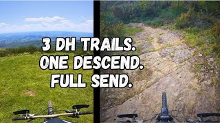
trail: ALBERETA PS2
10:41 |
60 |
Dec 29, 2025 , Loro Ciufenna
youtuber
![Albereta PS2 + PS3 - Pratomagno]()
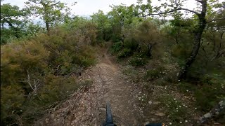
trail: ALBERETA PS2
6:01 |
350 |
Jun 7, 2023 , Loro Ciufenna
Recent Trail Reports
Activity Feed
| username | action | type | title | date |
|---|---|---|---|---|
| Avoig88 | add | report | activity #97645187 and 1 more | Jun 23, 2026 @ 12:24pm 3 days |
| mchesi | add | report | activity #97235163 and 2 more | Jun 17, 2026 @ 11:45pm Jun 17, 2026 |
| Avoig88 | add | report | activity #95354587 and 1 more | May 23, 2026 @ 2:18pm May 23, 2026 |
| DinoRAv1IY | ridden | trail | activity #94352901 | May 9, 2026 @ 9:51am May 9, 2026 |
| Avoig88 | add | report | activity #93701340 and 3 more | Apr 30, 2026 @ 3:00am Apr 30, 2026 |
Nearby Areas
| name | distance | ||||
|---|---|---|---|---|---|
| Reggello Secchieta Vallombrosa area | 17 | 22 | 15 | 4 | 5.3 km |
| Chianti Valdarno | 28 | 15 | 3 | 11.3 km | |
| Galatrona | 1 | 2 | 1 | 1 | 13.6 km |
| BardellOne Area Trail | 12 | 14 | 14.2 km | ||
| Fonte Santa & Incontro natural trail area | 27 | 18 | 7 | 3 | 14.6 km |
Local Badges
-

Completionist0 awarded
Activity Type Stats
| activitytype | trails | distance | descent | descent distance | total vertical | rating | global rank | state rank | photos | reports | routes | ridelogs |
|---|---|---|---|---|---|---|---|---|---|---|---|---|
| Mountain Bike | 56 | 36 miles | 13,419 ft | 23 miles | 4,432 ft | #5,793 | #293 | 2 | 116 | 815 | ||
| E-Bike | 55 | 36 miles | 13,419 ft | 23 miles | 4,432 ft | #2,794 | #190 | 114 | 483 | |||
| Gravel Bike | 1 | #10,113 | #475 | |||||||||
| Horse | 24 | 19 miles | 6,076 ft | 11 miles | 3,930 ft | #1,120 | #57 | 7 | ||||
| Hike | 49 | 33 miles | 11,188 ft | 21 miles | 4,432 ft | #5,019 | #142 | 115 | 56 | |||
| Trail Running | 49 | 35 miles | 12,477 ft | 22 miles | 4,432 ft | #3,966 | #128 | 116 | 53 |
Frequently Asked Questions About Pratomagno
▼
What are the highest rated mountain biking trails in Pratomagno?
The highest rated mountain biking trails in Pratomagno are:
- Mucche (4.2/5)
- Freeride (4.2/5)
- Strada Delle Casacce (4.2/5)
- ALBERETA PS2 (4.2/5)
- Vipereta (4.1/5)
▼
What is the best time of the year to ride in Pratomagno?
Based on ride log data, the most popular months to ride in Pratomagno are:
- September (1 activities)
- October (1 activities)
- December (1 activities)
▼
Where can I park to ride in Pratomagno?
Check the Pratomagno trail map for trailhead and parking information. Community members regularly update access and parking details for trails in the area.
▼
What is the longest trail in Pratomagno?
The longest trail in Pratomagno is Acquafredda at 3.0 miles. View all trails sorted by distance.
Activities
- By natgianni
 & contributors
 - Admins: apply
- #45486 - 2,732 views
- pratomagno activity log | embed map of Pratomagno mountain bike trails | pratomagno mountain biking points of interest
Downloading of trail gps tracks in kml & gpx formats is enabled for Pratomagno.
You must login to download files.