close
-
Layers w
- Weather Layers
- Pro
- Pro
- Pro
- Pro
- Pro
- Pro
- More Layers
- Pro
- Pro
- Pro
- Pro
-
Upgrade to

3D
Trail Conditions
- Unknown
- Snow Groomed
- Snow Packed
- Snow Covered
- Snow Cover Partial
- Freeze/thaw Cycle
- Icy
- Prevalent Mud
- Wet
- Variable
- Ideal
- Dry
- Very Dry
Trail Flow (Ridden Direction)
Trailforks scans users ridelogs to determine the most popular direction each trail is ridden. A good flowing trail network will have most trails flowing in a single direction according to their intension.
The colour categories are based on what percentage of riders are riding a trail in its intended direction.
The colour categories are based on what percentage of riders are riding a trail in its intended direction.
- > 96%
- > 90%
- > 80%
- > 70%
- > 50%
- < 50%
- bi-directional trail
- no data
Trail Last Ridden
Trailforks scans ridelogs to determine the last time a trail was ridden.
- < 2 days
- < 1 week
- < 2 weeks
- < 1 month
- < 6 months
- > 6 months
Trail Ridden Direction
The intended direction a trail should be ridden.
- Downhill Only
- Downhill Primary
- Both Directions
- Uphill Primary
- Uphill Only
- One Direction
Contribute Details
Colors indicate trail is missing specified detail.
- Description
- Photos
- Description & Photos
- Videos
Trail Popularity ?
Trailforks scans ridelogs to determine which trails are ridden the most in the last 9 months.
Trails are compared with nearby trails in the same city region with a possible 25 colour shades.
Think of this as a heatmap, more rides = more kinetic energy = warmer colors.
- most popular
- popular
- less popular
- not popular
ATV/ORV/OHV Filter
Max Vehicle Width
inches
US Cell Coverage
Legend

Radar Time
Activity Recordings
Trailforks uses anonymized public activity data.
?
Activity Recordings
Trailforks uses anonymized public activity data.
?
Personal Heatmap
▶
Activity Types
all
/
none
▶
Options
2
Date range
month
–
Winter Trails
Warning
A routing network for winter maps does not exist. Selecting trails using the winter trails layer has been disabled.
Missing Trails
Most Popular
Least Popular
Trails are colored based on popularity. The more popular a trail is, the more red. Less popular trails trend towards green.
Jump Magnitude Heatmap
Heatmap of where riders jump on trails. Zoom in to see individual jumps, click circles to view jump details.
BC Backroad Status
![map legend]()
Service Road Atlas is a free to use, community-driven service for viewing and creating reports on the numerous back-country service roads around B.C. and Alberta.

Slope Aspect
Direction the slope faces
Trails Deemphasized
Trails are shown in grey.
Only show trails with no bike usage.
Suggested Layers
Based on selected activity type
Save the current map location and zoom level as your default home location whenever this page is loaded.
Save
No description for Prescott has been added yet!
Login or register to submit one.
Activities Click to view
- Mountain Bike
444 trails
- E-Bike
165 trails
- Gravel Bike
40 trails
- Adaptive Bike
55 trails
- Winter Fat Bike
30 trails
- Horse
131 trails
- Hike
454 trails
- Trail Running
434 trails
- Dirtbike/Moto
70 trails
- Observed Trials
5 trails
- ATV/ORV/OHV
48 trails
- Snowmobile
0 trails
- Snowshoe
0 trails
- Nordic Ski
0 trails
Region Details
- 51
- 5
- 84
- 169
- 105
- 28
Region Status
Open as of 8 hoursStats
- Avg Trail Rating
- Trails (view details)
- 470
- Trails Mountain Bike
- 444
- Trails E-Bike
- 165
- Trails Gravel Bike
- 40
- Trails Adaptive Bike
- 55
- Trails Winter Fat Bike
- 30
- Trails Horse
- 131
- Trails Hike
- 454
- Trails Trail Running
- 434
- Trails Dirtbike/Moto
- 70
- Trails Observed Trials
- 5
- Trails ATV/ORV/OHV
- 48
- Total Distance
- 702 miles
- Total Descent
- 102,027 ft
- Total Vertical
- 7,925 ft
- Highest Trailhead
- 7,928 ft
- Reports
- 6,760
- Photos
- 3,225
- Ridden Counter
- 159,440
Articles

Race Report: Epic Rides Whiskey Off-Road in The Arizona Desert
Apr 29, 2025 from pinkbike.com
The Whiskey Off-Road isn't just a race, it's the race of all races in these parts.

Debbi Kalsow: a Different Kind of Pioneer
Oct 5, 2019 from pinkbike.com
Fifteen year old girl scores a victory that alters the course of her sport.

Local Flavours: The Complete Guide to Riding in Prescott, Arizona
Oct 1, 2019 from pinkbike.com
Prescott, Arizona is a rad town with loads of space and top-notch trails to ride
Sub Regions
-
Alto Pit
- 1
- 4
-
Bean Peaks
- 4
- 17
- 1
-
Bradshaw Mountains
- 12
- 10
- 4
-
Brownlow / Pioneer Park
- 4
- 15
- 15
-
Constellation trails
- 3
- 10
-
Goldwater Lakes
- 5
- 12
- 5
-
Granite Basin
- 8
- 22
- 3
-
Granite Dells
- 9
- 8
- 30
- 15
-
Granite Gardens
- 1
-
Lynx Lake Recreation Area
- 2
- 3
- 4
- 1
-
Spence Basin
- 8
- 13
- 6
-
Storm Trails
- 4
- 3
- 19
- 2
-
Thumb Butte
- 1
- 39
- 6
Popular Prescott Mountain Biking Trails
• 95 ★ 4.4 • 1 mile • 8 ft • 2,139 •
A fun trail that connects Trail #318, or 'White Rock' as everyone calls it, and Javelina Trail #332. This is a reroute of a social trail that has several rock features built in. The top, off Trail #318, winds and twists a bit before...
• 100 ★ 4.5 • 4,354 ft • 166 ft • 2,050 •
The trail winds through the trees and a disc golf course on the lower end near Trail #392. Small rock obstacles and a few B lines make the trail fun. There are no extreme climbs or overly technical areas. The White Rock parking area is...
• 100 ★ 4.3 • 2 miles • 97 ft • 1,918 •
Trail #318 passes through an area of pinyon and ponderosa pine, scrub oak, manzanita, and prickly pear cactus. It's a challenging climb for the first 1/4 mile with many rock obstacles. Once you reach the first summit it mellows out a...
• 100 ★ 4.5 • 2,500 ft • 73 ft • 1,787 •
Mr. Bean is uphill only for bikes, but both-ways for hikers. Hikers may not use any of the other downhill-only trails in Bean Peaks to descend. They must stay on and Mr. Bean. Dogs must be on-leash at all times.
• 95 ★ 4.4 • 4 miles • 738 ft • 1,757 •
Official Prescott National Forest trail that starts at the White Rock trailhead.
• 100 ★ 4.3 • 4,229 ft • 206 ft • 1,756 •
is uphill only for bikes, but both-ways for hikers. Hikers may not use any of the other downhill-only trails in Bean Peaks to descend. They must stay on and Mr. Bean. Dogs must be on-leash at all times.
• 100 ★ 4.4 • 2 miles • 308 ft • 1,719 •
is uphill only for bikes, but both-ways for hikers. Hikers may not use any of the other downhill-only trails in Bean Peaks to descend. They must stay on , , Mr. Bean and Franks & Beans. Dogs must be on-leash at all times.
• 95 ★ 3.6 • 3,806 ft • 30 ft • 1,608 •
Popular blue difficulty singletrack. This multi-use trail can be used both directions and has a easy overall physical rating with a 30 ft blue climb. On average it takes 6 minutes to complete this trail.
Prescott Mountain Bike Routes
★ 3.8 • 57 miles • 6,063 ft • 13 • Loop •
Prescott Circle Trail is a series of network trails that form a loop around town. A majority of the trails...
★ 5.0 • 9 miles • 1,066 ft • 7 • Loop •
This is a great loop that can be ridden in about an hour with minimal stopping. Most riders will do this...
★ 5.0 • 35 miles • 2,906 ft • 5 •
Start at North Peavine trailhead (by hwy 89A), ride South on Peavine to left on Headwaters trail to right...
★ 5.0 • 12 miles • 1,342 ft • 5 • Loop •
Riding the direction shown provides a fairly easy 3.5 mile climb (non-technical, usually 2-5% grade)...
★ 4.0 • 25 miles • 3,029 ft • 28 • Loop •
This is a nice moderate trail ride that covers some of the best social and system trails in the Thumb...
★ 4.0 • 18 miles • 2,281 ft • 13 • Loop •
A fun loop around the south end of the area starting from that covers most of the climbing in the first...
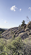
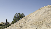
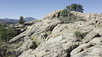
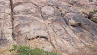
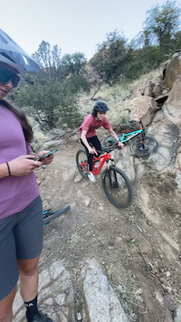
Photos of Prescott Mountain Bike
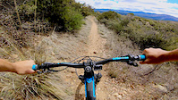
Videos of Prescott Mountain Bike
trail: Gauntlet
0:14 |
4 |
Jun 10, 2026
trail: Pyro
0:04 |
32 |
Apr 18, 2026
trail: Magma
0:22 |
12 |
Apr 18, 2026
trail: Magma
0:21 |
15 |
Apr 18, 2026
trail: Rattler
0:05 |
256 |
Jun 7, 2023
trail: Wolverton Mountain
0:00 |
227 |
Apr 15, 2020

trail: 318 West Trail
0:00 |
143 |
Apr 15, 2020

trail: Connector
0:00 |
106 |
Apr 15, 2020
Current Trail Warnings
| status | trail | date | condition | user | info |
|---|---|---|---|---|---|
| Cool Beans | Jun 20, 2026 @ 6:02am (America/Phoenix) Jun 20, 2026 | Dry | flahb75 | Major erosion (major ruts or slumping,... |
Recent Trail Reports
| status | trail | date | condition | info | user |
|---|---|---|---|---|---|
| 328 Piglet | Jun 25, 2026 @ 6:10am (America/Phoenix) 8 hours | Ideal | mej16489 | ||
| 316 Pine Lakes | Jun 25, 2026 @ 6:10am (America/Phoenix) 8 hours | Ideal | mej16489 | ||
| Angus | Jun 25, 2026 @ 6:10am (America/Phoenix) 8 hours | Ideal | mej16489 | ||
| 760 Noodle | Jun 25, 2026 @ 6:10am (America/Phoenix) 8 hours | Ideal | mej16489 | ||
| 706 Vista | Jun 25, 2026 @ 6:10am (America/Phoenix) 8 hours | Ideal | mej16489 | ||
| 735 Tatanka | Jun 25, 2026 @ 6:10am (America/Phoenix) 8 hours | Ideal | mej16489 | ||
| 332 Javelina | Jun 25, 2026 @ 6:10am (America/Phoenix) 8 hours | Ideal | mej16489 | ||
| 317 Ridge Top | Jun 23, 2026 @ 5:41am (America/Phoenix) 2 days | Dry | mej16489 | ||
| 707 Willy Nilly Tractor | Jun 23, 2026 @ 5:41am (America/Phoenix) 2 days | Dry | mej16489 | ||
| 325 Firewater | Jun 23, 2026 @ 5:41am (America/Phoenix) 2 days | Dry | mej16489 |
Activity Feed
| username | action | type | title | date |
|---|---|---|---|---|
| mej16489 | add | report | activity #97762698 and 4 more | Jun 25, 2026 @ 6:02am 8 hours |
| mej16489 | add | report | activity #97762696 and 5 more | Jun 25, 2026 @ 6:02am 8 hours |
| munson745 | wishlist | trail | activity #97743564 | Jun 24, 2026 @ 7:54pm 19 hours |
| munson745 | wishlist | region | activity #97741178 | Jun 24, 2026 @ 7:05pm 19 hours |
| PMass | ridden | trail | activity #97730155 | Jun 24, 2026 @ 4:08pm 22 hours |
Recent Comments
| username | type | title | comment | date |
|---|---|---|---|---|
| trail | super fun flow trail..needs some work rode it... | Jun 22, 2026 @ 9:35pm 3 days | ||
| trail | This Trail is great--watch out for the massive... | Jun 22, 2026 @ 9:33pm 3 days | ||
| trail | This is a fun trail but there are a few... | Jun 22, 2026 @ 12:37pm Jun 22, 2026 | ||
| trail | A well built climbing trail. As good as a... | Jun 22, 2026 @ 12:35pm Jun 22, 2026 | ||
| trail | A well built climbing trail. As good as a... | Jun 22, 2026 @ 12:35pm Jun 22, 2026 |
Local Badges
-

Completionist11 awarded -
Completionist0 awarded -
Completionist28 awarded -
Completionist0 awarded -
Completionist1 awarded -

Top 10 Trails12 awarded
Bike & Skill Parks
| name | type | city | rating |
|---|---|---|---|
| PMBA Pump Track | skill park | Prescott |
Local Mountain Biking Directory
-
Prescott Mountain Bike Alliance
![Prescott Mountain Bike Alliance]()
-
Soul Ride
![Soul Ride]()
-
Chain Events
![Chain Events]()
-
Bikesmith Cycle & FitnessBike Shop
-
Ironclad BicyclesBike Shop
![Ironclad Bicycles]()
-
High Gear Bike ShopBike Shop
![High Gear Bike Shop]()
Local Products
Activity Type Stats
| activitytype | trails | distance | descent | descent distance | total vertical | rating | global rank | state rank | photos | reports | routes | ridelogs |
|---|---|---|---|---|---|---|---|---|---|---|---|---|
| Mountain Bike | 444 | 677 miles | 97,667 ft | 309 miles | 7,927 ft | #55 | #20 | 3,096 | 6,750 | 148 | 126,943 | |
| E-Bike | 165 | 324 miles | 51,352 ft | 148 miles | 7,927 ft | #97 | #652 | 12 | 6,137 | 5 | 5,021 | |
| Gravel Bike | 40 | 71 miles | 4,488 ft | 24 miles | 2,753 ft | #67 | #759 | 355 | 2 | 445 | ||
| Adaptive Bike | 55 | 97 miles | 8,028 ft | 33 miles | 4,377 ft | #17 | #1,170 | 487 | 1 | 9 | ||
| Winter Fat Bike | 30 | 88 miles | 13,399 ft | 38 miles | 3,104 ft | #18 | #797 | 163 | 1 | |||
| Horse | 131 | 344 miles | 57,116 ft | 168 miles | 7,900 ft | #24 | #318 | 691 | 1 | 115 | ||
| Hike | 454 | 686 miles | 98,619 ft | 311 miles | 7,927 ft | #46 | #38 | 98 | 6,665 | 24 | 16,952 | |
| Trail Running | 434 | 630 miles | 86,686 ft | 285 miles | 7,927 ft | #56 | #33 | 6 | 6,661 | 11 | 5,491 | |
| Dirtbike/Moto | 70 | 277 miles | 47,749 ft | 132 miles | 7,927 ft | #33 | #16 | 4 | 629 | 1 | 366 | |
| Observed Trials | 5 | 14 miles | 1,677 ft | 7 miles | 1,572 ft | #46 | #16 | 3 | 19 | |||
| ATV/ORV/OHV | 48 | 201 miles | 29,259 ft | 94 miles | 7,927 ft | #23 | #15 | 4 | 617 | 71 |
Frequently Asked Questions About Prescott
▼
What are the best places to ride in Prescott?
Prescott has 14 areas to explore for mountain biking. The top rated areas are:
▼
What are the highest rated mountain biking trails in Prescott?
The highest rated mountain biking trails in Prescott are:
- 705 Happy Ending (4.6/5)
- Lakeshore (4.5/5)
- Sundog Trail (4.5/5)
- Magic Bean (4.5/5)
- Jelly Bean (4.4/5)
▼
What is the best time of the year to ride in Prescott?
Based on ride log data, the most popular months to ride in Prescott are:
- July (1,284 activities)
- May (1,154 activities)
- April (1,119 activities)
▼
Where can I park to ride in Prescott?
There are 42 parking locations listed in Prescott. The most popular parking spots are: View all parking and trailhead locations on the map to plan your visit.
Activities
- Prescott Mountain Biking Trails
- Prescott E-Biking Trails
- Prescott Gravel Biking Trails
- Prescott Adaptive Biking Trails
- Prescott Winter Fat Biking Trails
- Prescott Horseback Trails
- Prescott Hiking Trails
- Prescott Trail Running Trails
- Prescott Dirtbiking Trails
- Prescott Observed Trials Trails
- Prescott ATVing/Offroading Trails
Trails
Points of Interest
- Old rail car Sight
- Sign: history of "The Yavapai" Information
- Old Hwy 89A Bridge
- Horse tie up Other
- Lynx Ruins Viewing Platform Sight
- Cowboy's Prayer Sight
- Skull Valley Overlook Viewpoint
- Boblett Cemetery Sight
- Old rail car Sight
- Trail Map Information
- Mount Union (7,963 ft)
- Mount Davis (7,897 ft)
- Mount Tritle (7,769 ft)
- By canadaka
 Trailforks & contributors
 - Admins: PMBA, UMC-s, rowbearto-Prescott
- #4980 - 117,262 views
- prescott activity log | embed map of Prescott mountain bike trails | prescott mountain biking points of interest
Downloading of trail gps tracks in kml & gpx formats is enabled for Prescott.
You must login to download files.