close
-
Layers w
- Weather Layers
- Pro
- Pro
- Pro
- Pro
- Pro
- Pro
- More Layers
- Pro
- Pro
- Pro
- Pro
-
Upgrade to

3D
Trail Conditions
- Unknown
- Snow Groomed
- Snow Packed
- Snow Covered
- Snow Cover Partial
- Freeze/thaw Cycle
- Icy
- Prevalent Mud
- Wet
- Variable
- Ideal
- Dry
- Very Dry
Trail Flow (Ridden Direction)
Trailforks scans users ridelogs to determine the most popular direction each trail is ridden. A good flowing trail network will have most trails flowing in a single direction according to their intension.
The colour categories are based on what percentage of riders are riding a trail in its intended direction.
The colour categories are based on what percentage of riders are riding a trail in its intended direction.
- > 96%
- > 90%
- > 80%
- > 70%
- > 50%
- < 50%
- bi-directional trail
- no data
Trail Last Ridden
Trailforks scans ridelogs to determine the last time a trail was ridden.
- < 2 days
- < 1 week
- < 2 weeks
- < 1 month
- < 6 months
- > 6 months
Trail Ridden Direction
The intended direction a trail should be ridden.
- Downhill Only
- Downhill Primary
- Both Directions
- Uphill Primary
- Uphill Only
- One Direction
Contribute Details
Colors indicate trail is missing specified detail.
- Description
- Photos
- Description & Photos
- Videos
Trail Popularity ?
Trailforks scans ridelogs to determine which trails are ridden the most in the last 9 months.
Trails are compared with nearby trails in the same city region with a possible 25 colour shades.
Think of this as a heatmap, more rides = more kinetic energy = warmer colors.
- most popular
- popular
- less popular
- not popular
ATV/ORV/OHV Filter
Max Vehicle Width
inches
US Cell Coverage
Legend

Radar Time
Activity Recordings
Trailforks uses anonymized public activity data.
?
Activity Recordings
Trailforks uses anonymized public activity data.
?
Personal Heatmap
▶
Activity Types
all
/
none
▶
Options
2
Date range
month
–
Winter Trails
Warning
A routing network for winter maps does not exist. Selecting trails using the winter trails layer has been disabled.
Missing Trails
Most Popular
Least Popular
Trails are colored based on popularity. The more popular a trail is, the more red. Less popular trails trend towards green.
Jump Magnitude Heatmap
Heatmap of where riders jump on trails. Zoom in to see individual jumps, click circles to view jump details.
BC Backroad Status
![map legend]()
Service Road Atlas is a free to use, community-driven service for viewing and creating reports on the numerous back-country service roads around B.C. and Alberta.

Slope Aspect
Direction the slope faces
Trails Deemphasized
Trails are shown in grey.
Only show trails with no bike usage.
Suggested Layers
Based on selected activity type
Save the current map location and zoom level as your default home location whenever this page is loaded.
Save
No description for Pretoria has been added yet!
Login or register to submit one.
Activities Click to view
- Mountain Bike
97 trails
- E-Bike
60 trails
- Gravel Bike
0 trails
- Adaptive Bike
0 trails
- Hike
138 trails
- Trail Running
142 trails
Region Details
- 27
- 5
- 65
Region Status
Open as of Jul 9, 2025Stats
- Avg Trail Rating
- Trails (view details)
- 97
- Trails Mountain Bike
- 97
- Trails E-Bike
- 60
- Trails Hike
- 142
- Trails Trail Running
- 142
- Total Distance
- 43 miles
- Total Descent
- 4,842 ft
- Total Vertical
- 584 ft
- Highest Trailhead
- 5,081 ft
- Reports
- 34
- Photos
- 4
- Ridden Counter
- 6,458
Sub Regions
-
Fort Klapperkop
- 7
-
Groenkloof Nature Reserve
- 4
- 20
-
Hedianga Farm
- 36
-
Voortrekker Monument
- 2
Popular Pretoria Mountain Biking Trails
• 75 ★ 0.0 • 1,398 ft • 3 ft • 63 •
Popular blue difficulty singletrack. This mountain bike primary trail can be used downhill primary. On average it takes 3 minutes to complete this trail.
• 100 ★ 0.0 • 2 miles • 228 ft • 61 •
Popular blue difficulty singletrack. This multi-use trail can be used both directions and has a moderate overall physical rating with a 228 ft blue climb. Trail visibility is always easy to follow. On average it takes 8 minutes to complete this trail.
• 70 ★ 0.0 • 3,484 ft • 11 ft • 60 •
Popular blue difficulty singletrack. This mountain bike primary trail can be used downhill primary. On average it takes 3 minutes to complete this trail.
• 85 ★ 0.0 • 777 ft • 16 ft • 59 •
Popular blue difficulty singletrack. This mountain bike primary trail can be used downhill primary. On average it takes minutes to complete this trail.
• 85 ★ 0.0 • 1,055 ft • 20 ft • 54 •
Popular blue difficulty singletrack. This mountain bike primary trail can be used uphill primary. On average it takes 1 minutes to complete this trail.
• 85 ★ 0.0 • 1,404 ft • 32 ft • 52 •
Popular blue difficulty singletrack. This mountain bike primary trail can be used downhill primary. On average it takes 2 minutes to complete this trail.
• 95 ★ 0.0 • 5,115 ft • 224 ft • 46 •
Popular blue difficulty singletrack. This multi-use trail can be used both directions and has a moderate overall physical rating with a 224 ft blue climb. Trail visibility is always easy to follow. On average it takes 9 minutes to complete this trail.
• 65 ★ 0.0 • 1 mile • 104 ft • 44 •
Moderately popular blue difficulty singletrack. This mountain bike primary trail can be used both directions and has a moderate overall physical rating with a 104 ft blue climb. Trail visibility is always easy to follow. On average it takes 13 minutes to complete this trail.
Pretoria Mountain Bike Routes
5 miles • 1,073 ft • 0 • Loop •
Loop around Fort Klapperkop. Harder than expected, with some uphill and downhill rock steps. Note the...
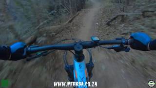
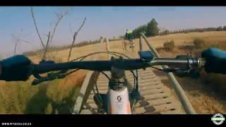
Videos of Pretoria Mountain Bike
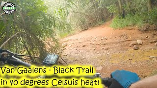
17:28 |
491 |
Jan 10, 2020
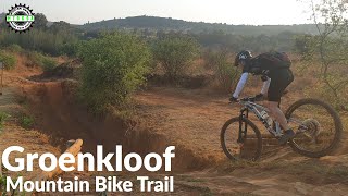
13:49 |
682 |
Dec 17, 2019

13:59 |
703 |
Dec 17, 2019
18:22 |
3270 |
Dec 17, 2019

8:08 |
725 |
Dec 17, 2019
19:40 |
1049 |
Dec 17, 2019

14:57 |
862 |
Dec 17, 2019
14:57 |
538 |
Dec 17, 2019
Recent Trail Reports
| status | trail | date | condition | info | user |
|---|---|---|---|---|---|
| Klapperkop XC Trail | Apr 13, 2025 @ 7:02am Apr 13, 2025 | Variable | jd-shred | ||
| Klapperkop XC North | Apr 13, 2025 @ 7:02am Apr 13, 2025 | Variable | jd-shred | ||
| Klapperkop XC West | Apr 13, 2025 @ 7:02am Apr 13, 2025 | Variable | jd-shred | ||
| XC West 002 | Apr 13, 2025 @ 7:02am Apr 13, 2025 | Variable | jd-shred | ||
| Klapprkop Downhill | Apr 13, 2025 @ 7:02am Apr 13, 2025 | Variable | jd-shred | ||
| XC West 001 | Feb 1, 2025 @ 6:26am Feb 1, 2025 | Dry | BernardRoode | ||
| Access Road | Feb 1, 2025 @ 6:26am Feb 1, 2025 | Dry | BernardRoode | ||
| Johan Rissik Scenic Drive | Nov 8, 2023 @ 12:20am Nov 8, 2023 | Ideal | eHn9nsic | ||
| North Perimeter Rd | Oct 7, 2022 @ 2:02pm Oct 7, 2022 | Unknown | BernardRoode | ||
| Klapperkop XC East | Oct 7, 2022 @ 2:02pm Oct 7, 2022 | Unknown | BernardRoode |
Activity Feed
| username | action | type | title | date |
|---|---|---|---|---|
| cliffnel | ridden | route | activity #96088157 | Jun 2, 2026 @ 9:01am Jun 2, 2026 |
| Paranoid006 | wishlist | region | activity #91868072 | Apr 3, 2026 @ 8:06pm Apr 3, 2026 |
| Finch6 | add | trail | activity #88624825 | Feb 9, 2026 @ 7:10am Feb 9, 2026 |
| Martin2b3opr | wishlist | region | activity #83879940 | Nov 9, 2025 @ 1:09pm Nov 9, 2025 |
| mOUI16 | add | supporter | activity #83207299 | Oct 29, 2025 @ 4:29am Oct 29, 2025 |
Local Badges
-

10 Green Trails40 awarded -

10 Blue Trails70 awarded -

Epic Ride Climb 2k54 awarded -

Climbing 10k Badge75 awarded -

Climbing 100k Badge8 awarded -

Epic Ride Descent 2k55 awarded
Bike & Skill Parks
| name | type | city | rating |
|---|---|---|---|
| Record Deal Pump Track | skill park | Pretoria | |
| Pretoria Pump Track by Velosolutions | skill park | Pretoria |
Activity Type Stats
| activitytype | trails | distance | descent | descent distance | total vertical | rating | global rank | state rank | photos | reports | routes | ridelogs |
|---|---|---|---|---|---|---|---|---|---|---|---|---|
| Mountain Bike | 97 | 43 miles | 4,843 ft | 18 miles | 584 ft | #4,581 | #76 | 2 | 34 | 1 | 13,022 | |
| E-Bike | 60 | 36 miles | 3,848 ft | 15 miles | 584 ft | #2,194 | #96 | 32 | 263 | |||
| Hike | 138 | 42 miles | 4,787 ft | 18 miles | 584 ft | #1,977 | #53 | 34 | 140 | |||
| Trail Running | 142 | 42 miles | 4,787 ft | 18 miles | 584 ft | #2,077 | #60 | 34 | 144 |
Frequently Asked Questions About Pretoria
▼
What are the best places to ride in Pretoria?
Pretoria has 3 areas to explore for mountain biking. The top rated areas are:
▼
What are the highest rated mountain biking trails in Pretoria?
The highest rated mountain biking trails in Pretoria are:
- Snakey Downhill (4/5)
- Southern Climb (4/5)
- Onion Hill (4/5)
- Singletrack (3.8/5)
- Klapperkop XC Trail (0/5)
▼
What is the best time of the year to ride in Pretoria?
Based on ride log data, the most popular months to ride in Pretoria are:
- July (25 activities)
- May (19 activities)
- October (16 activities)
▼
Where can I park to ride in Pretoria?
There are 4 parking locations listed in Pretoria. The most popular parking spots are: View all parking and trailhead locations on the map to plan your visit.
Activities
Trails
Points of Interest
- By wesseljacobsz
 TRAILFORKS WAM SBP SWW & contributors
 - Admins: Gauteng
- #9264 - 5,843 views
- pretoria activity log | embed map of Pretoria mountain bike trails | pretoria mountain biking points of interest
Downloading of trail gps tracks in kml & gpx formats is enabled for Pretoria.
You must login to download files.