close
-
Layers w
- Weather Layers
- Pro
- Pro
- Pro
- Pro
- Pro
- Pro
- More Layers
- Pro
- Pro
- Pro
- Pro
-
Upgrade to

3D
Trail Conditions
- Unknown
- Snow Groomed
- Snow Packed
- Snow Covered
- Snow Cover Partial
- Freeze/thaw Cycle
- Icy
- Prevalent Mud
- Wet
- Variable
- Ideal
- Dry
- Very Dry
Trail Flow (Ridden Direction)
Trailforks scans users ridelogs to determine the most popular direction each trail is ridden. A good flowing trail network will have most trails flowing in a single direction according to their intension.
The colour categories are based on what percentage of riders are riding a trail in its intended direction.
The colour categories are based on what percentage of riders are riding a trail in its intended direction.
- > 96%
- > 90%
- > 80%
- > 70%
- > 50%
- < 50%
- bi-directional trail
- no data
Trail Last Ridden
Trailforks scans ridelogs to determine the last time a trail was ridden.
- < 2 days
- < 1 week
- < 2 weeks
- < 1 month
- < 6 months
- > 6 months
Trail Ridden Direction
The intended direction a trail should be ridden.
- Downhill Only
- Downhill Primary
- Both Directions
- Uphill Primary
- Uphill Only
- One Direction
Contribute Details
Colors indicate trail is missing specified detail.
- Description
- Photos
- Description & Photos
- Videos
Trail Popularity ?
Trailforks scans ridelogs to determine which trails are ridden the most in the last 9 months.
Trails are compared with nearby trails in the same city region with a possible 25 colour shades.
Think of this as a heatmap, more rides = more kinetic energy = warmer colors.
- most popular
- popular
- less popular
- not popular
ATV/ORV/OHV Filter
Max Vehicle Width
inches
US Cell Coverage
Legend

Radar Time
Activity Recordings
Trailforks uses anonymized public activity data.
?
Activity Recordings
Trailforks uses anonymized public activity data.
?
Personal Heatmap
▶
Activity Types
all
/
none
▶
Options
2
Date range
month
–
Winter Trails
Warning
A routing network for winter maps does not exist. Selecting trails using the winter trails layer has been disabled.
Missing Trails
Most Popular
Least Popular
Trails are colored based on popularity. The more popular a trail is, the more red. Less popular trails trend towards green.
Jump Magnitude Heatmap
Heatmap of where riders jump on trails. Zoom in to see individual jumps, click circles to view jump details.
BC Backroad Status
![map legend]()
Service Road Atlas is a free to use, community-driven service for viewing and creating reports on the numerous back-country service roads around B.C. and Alberta.

Slope Aspect
Direction the slope faces
Trails Deemphasized
Trails are shown in grey.
Only show trails with no bike usage.
Suggested Layers
Based on selected activity type
Save the current map location and zoom level as your default home location whenever this page is loaded.
Save
No description for Prineville has been added yet!
Login or register to submit one.
Activities Click to view
- Mountain Bike
80 trails
- E-Bike
40 trails
- Adaptive Bike
0 trails
- Winter Fat Bike
0 trails
- Horse
16 trails
- Hike
94 trails
- Trail Running
96 trails
- Snowshoe
7 trails
- Backcountry Ski
7 trails
- Nordic Ski
8 trails
Region Details
- 10
- 1
- 35
- 26
- 4
- 1
Region Status
Open as of 18 hoursStats
- Avg Trail Rating
- Trails (view details)
- 87
- Trails Mountain Bike
- 80
- Trails E-Bike
- 40
- Trails Horse
- 16
- Trails Hike
- 96
- Trails Trail Running
- 96
- Trails Dirtbike/Moto
- 2
- Trails ATV/ORV/OHV
- 2
- Trails Snowshoe
- 7
- Trails Backcountry Ski
- 7
- Trails Nordic Ski
- 8
- Total Distance
- 173 miles
- Total Descent
- 28,705 ft
- Total Vertical
- 4,048 ft
- Highest Trailhead
- 6,923 ft
- Reports
- 270
- Photos
- 88
- Ridden Counter
- 3,867
Articles
Video: Black Sage Fest 2019 Short Film
Dec 15, 2019 from pinkbike.com
Clay Porter was on hand to document the third year of the Black Sage Fest Series.
Podcast: Soundbites from Jordie Lunn, Casey Brown, Nicholi Rogtakin & More at Black Sage & Proving Grounds
Oct 1, 2019 from pinkbike.com
Some of the best riders in the world converge upon this mecca of jumps and features in Prineville, Oregon.
Embedded: 17-Year Old Jaxson Riddle Tries Out for Rampage at Proving Grounds
Sep 17, 2019 from pinkbike.com
Follow 17-year old Jaxson Riddle’s journey as battles through crashes and mechanicals in hopes of qualifying for Red Bull Rampage at the...

Video: Remy Metailler Rides All the Lines of the Proving Grounds Rampage Qualifier
Sep 12, 2019 from pinkbike.com
Looks like a big dirt playground.
Sub Regions
-
66 Trails
- 1
- 5
- 4
- 1
-
66 Trails North
- 1
-
Bandit Springs
- 6
- 1
-
Barnes Butte
- 14
- 10
- 3
- 1
-
Lemon Gulch
-
Ochoco Creek Park
- 5
-
Ochocos
- 4
- 8
-
Potlid
Popular Prineville Mountain Biking Trails
• 90 ★ 4.4 • 11 miles • 1,850 ft • 304 •
By far the most popular trail in the Ochoco National Forest, involves a short (1.5mile-3.5mile depending on route) climb to the open summit where you will encounter 360º panoramic views of Central Oregon. This is followed by one of the...
• 80 ★ 4.8 • 4 miles • 66 ft • 133 •
was an existing but overgrown and unused trail that was fully rehabbed in 2018 by Dirt Mechanics with funding from COTA and an RTP Grant. The trail can be shuttled and this is how most people will want to enjoy it as climbing up the...
• 75 ★ 4.4 • 9 miles • 1,985 ft • 124 •
is typically ridden as a complete loop with , by either riding 7 miles of pavement from the bottom of Lookout, or shuttling to the start of . Either option makes for a long, strenuous day out. Do not be deceived by the relatively short...
• 85 ★ 2.5 • 2,784 ft • 19 ft • 113 •
Fun trail in a downhill direction with fast, flowy sections and lots of optional features that can be ridden if desired.
• 95 ★ 2.0 • 4,472 ft • 207 ft • 105 •
This is a wide, easy machine-build trail. Ideal for climbing up to the or as a descent trail for new riders.
• 95 ★ 2.0 • 3,269 ft • 123 ft • 104 •
Fun XC trail that gives a longer option up to the rim. Mostly straightforward but has a couple tricky sections to spice it up. When you hit the utility road continue straight onto Trashalanche! or if you want to test your legs take a...
• 90 ★ 0.0 • 2,667 ft • 0 ft • 96 •
Popular green difficulty singletrack. This mountain bike primary trail can be used both directions. On average it takes 1 minutes to complete this trail.
• 80 ★ 3.4 • 4,459 ft • 138 ft • 93 •
Popular green difficulty singletrack. This mountain bike primary trail can be used both directions and has a easy overall physical rating with a 138 ft green climb. On average it takes 8 minutes to complete this trail.
Prineville Mountain Bike Routes
★ 4.5 • 26 miles • 5,207 ft • 2 • Loop •
This is the classic loop in the Ochocos. Most prefer to begin at the old ranger station parking area at...
4 miles • 641 ft • 4 •
Area Description: If you live in Prineville, these trails are right out your door! They also make a great...
3 miles • 92 ft • 2 •
Area Description: If you live in Prineville, these trails are right out your door! They also make a great...
15 miles • 3,156 ft • 2 •
This loop will give you the best of Cougar and Scotty with some tough climbs and ripping DH. Parking at...
★ 2.0 • 12 miles • 2,623 ft • 2 • Loop •
This is a good route option if you want to ride without a shuttle. It doesn't climb back up the Scotty...
4,419 ft • 30 ft • 0 •
Short road connection between and Cougar Creek Trail
Photos of Prineville Mountain Bike
Videos of Prineville Mountain Bike
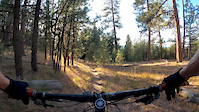
trail: Scotty Creek
13:06 |
366 |
Nov 25, 2019
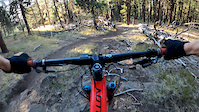
trail: Lookout Mountain Trail
3:00 |
199 |
Nov 14, 2019
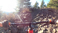
trail: Lookout Mountain Trail
6:31 |
174 |
Nov 13, 2019
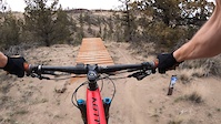
trail: Lookout Mountain Trail
12:53 |
403 |
Nov 13, 2019
trail: Let 'er Buck
0:20 |
476 |
Nov 6, 2019
trail: The Crossing
2:25 |
152 |
Nov 5, 2019
trail: Lookout Mountain Trail
0:47 |
528 |
Sep 26, 2016

trail: Lookout Mountain Trail
22:16 |
72 |
Jan 21, 2026 , Prineville
Recent Trail Reports
| status | trail | date | condition | info | user |
|---|---|---|---|---|---|
| Lookout Mountain Trail | Jun 16, 2026 @ 9:05pm (America/Los_Angeles) 2 days | Unknown | ebtrail420 | ||
| Independent Mine | Jun 16, 2026 @ 9:04pm (America/Los_Angeles) 2 days | Unknown | ebtrail420 | ||
| Round Mountain Trail | Jun 16, 2026 @ 9:03pm (America/Los_Angeles) 2 days | Unknown | ebtrail420 | ||
| Scotty Creek | May 10, 2026 @ 9:28pm (America/Los_Angeles) May 10, 2026 | Ideal | sbdoug | ||
| Cougar Creek Trail | Feb 5, 2026 @ 10:16am (America/Los_Angeles) Feb 5, 2026 | Variable | J5kuilema | ||
| The Crossing | Nov 1, 2025 @ 12:51pm (America/Los_Angeles) Nov 1, 2025 | Unknown | Vande77665 | ||
| Pebbles | Nov 1, 2025 @ 12:51pm (America/Los_Angeles) Nov 1, 2025 | Unknown | Vande77665 | ||
| Let 'er Buck | Nov 1, 2025 @ 12:30pm (America/Los_Angeles) Nov 1, 2025 | Unknown | Vande77665 | ||
| Roblem Child | Oct 21, 2025 @ 5:33pm (America/Boise) Oct 21, 2025 | Dry | matt8rossi | ||
| South Central | Oct 21, 2025 @ 5:33pm (America/Boise) Oct 21, 2025 | Dry | matt8rossi |
Activity Feed
| username | action | type | title | date |
|---|---|---|---|---|
| ifrankie | add | report | activity #97270941 and 1 more | Jun 18, 2026 @ 12:48pm 18 hours |
| trekkingboy99 | wishlist | region | activity #97186676 | Jun 17, 2026 @ 8:42am 2 days |
| ebtrail420 | add | report | activity #97161026 and 2 more | Jun 16, 2026 @ 9:03pm 2 days |
| JakeArch | wishlist | route | activity #96622696 | Jun 9, 2026 @ 12:19pm Jun 9, 2026 |
| usertlj | ridden | region | activity #96050557 | Jun 1, 2026 @ 5:07pm Jun 1, 2026 |
Recent Comments
| username | type | title | comment | date |
|---|---|---|---|---|
| trail | This trail is actually so sick. Steep chutey... | Apr 5, 2026 @ 6:55pm Apr 5, 2026 | ||
| trail | You're kidding right | Apr 3, 2026 @ 10:00pm Apr 3, 2026 | ||
| report | Not fun on bowhead reach or anything for that... | Apr 1, 2025 @ 9:43am Apr 1, 2025 | ||
| report | Not fun on Bowhead Reach or anything really | Apr 1, 2025 @ 9:42am Apr 1, 2025 | ||
| trail | 10-11-24 ride. Top is brown pow, but overall,... | Oct 12, 2024 @ 8:27am Oct 12, 2024 |
Local Badges
-

Epic Ride Climb 2k68 awarded -

Climbing 10k Badge20 awarded -

Climbing 100k Badge0 awarded -

Epic Ride Descent 2k88 awarded -

Descent 10k Badge22 awarded -

Descent 100k Badge0 awarded
Bike & Skill Parks
| name | type | city | rating |
|---|---|---|---|
| Prineville Bike Park | skill park | Prineville | |
| Prineville Adventure Park | skill park | Prineville |
Activity Type Stats
| activitytype | trails | distance | descent | descent distance | total vertical | rating | global rank | state rank | photos | reports | routes | ridelogs |
|---|---|---|---|---|---|---|---|---|---|---|---|---|
| Mountain Bike | 80 | 144 miles | 26,522 ft | 64 miles | 4,049 ft | #1,382 | #522 | 85 | 254 | 6 | 4,412 | |
| E-Bike | 40 | 37 miles | 6,204 ft | 17 miles | 2,799 ft | #3,098 | #1,128 | 100 | 147 | |||
| Horse | 16 | 43 miles | 6,329 ft | 17 miles | 3,520 ft | #1,050 | #683 | 44 | 1 | |||
| Hike | 94 | 155 miles | 25,938 ft | 65 miles | 4,049 ft | #615 | #282 | 1 | 252 | 1 | 628 | |
| Trail Running | 96 | 155 miles | 25,938 ft | 65 miles | 4,049 ft | #1,059 | #391 | 252 | 1 | 246 | ||
| Dirtbike/Moto | 2 | 9 miles | 1,614 ft | 4 miles | 974 ft | 38 | 15 | |||||
| ATV/ORV/OHV | 2 | 9 miles | 1,614 ft | 4 miles | 974 ft | 38 | 4 | |||||
| Snowshoe | 7 | 13 miles | 2,060 ft | 6 miles | 738 ft | #856 | #398 | 6 | 4 | |||
| Backcountry Ski | 7 | 13 miles | 2,060 ft | 6 miles | 738 ft | #476 | #119 | 1 | 6 | 9 | ||
| Nordic Ski | 8 | 14 miles | 2,228 ft | 7 miles | 738 ft | #885 | #356 | 7 | 14 |
Frequently Asked Questions About Prineville
▼
What are the best places to ride in Prineville?
Prineville has 12 areas to explore for mountain biking. The top rated areas are:
▼
What are the highest rated mountain biking trails in Prineville?
The highest rated mountain biking trails in Prineville are:
- Scotty Creek (4.3/5)
- Lookout Mountain Trail (4.2/5)
- Potlid (4.2/5)
- Quadruple Bypass (4.1/5)
- Motherlode (4.1/5)
▼
What is the best time of the year to ride in Prineville?
Based on ride log data, the most popular months to ride in Prineville are:
- June (50 activities)
- July (32 activities)
- October (31 activities)
▼
Where can I park to ride in Prineville?
There are 35 parking locations listed in Prineville. The most popular parking spots are: View all parking and trailhead locations on the map to plan your visit.
Activities
Trails
- By brenthillier
 NSMBA TRAILFORKS & contributors
 - Admins: COTA, COTA
- #12329 - 12,164 views
- prineville activity log | embed map of Prineville mountain bike trails | prineville mountain biking points of interest polygons
Downloading of trail gps tracks in kml & gpx formats is enabled for Prineville.
You must login to download files.