close
-
Layers w
- Weather Layers
- Pro
- Pro
- Pro
- Pro
- Pro
- Pro
- More Layers
- Pro
- Pro
- Pro
- Pro
-
Upgrade to

3D
Trail Conditions
- Unknown
- Snow Groomed
- Snow Packed
- Snow Covered
- Snow Cover Partial
- Freeze/thaw Cycle
- Icy
- Prevalent Mud
- Wet
- Variable
- Ideal
- Dry
- Very Dry
Trail Flow (Ridden Direction)
Trailforks scans users ridelogs to determine the most popular direction each trail is ridden. A good flowing trail network will have most trails flowing in a single direction according to their intension.
The colour categories are based on what percentage of riders are riding a trail in its intended direction.
The colour categories are based on what percentage of riders are riding a trail in its intended direction.
- > 96%
- > 90%
- > 80%
- > 70%
- > 50%
- < 50%
- bi-directional trail
- no data
Trail Last Ridden
Trailforks scans ridelogs to determine the last time a trail was ridden.
- < 2 days
- < 1 week
- < 2 weeks
- < 1 month
- < 6 months
- > 6 months
Trail Ridden Direction
The intended direction a trail should be ridden.
- Downhill Only
- Downhill Primary
- Both Directions
- Uphill Primary
- Uphill Only
- One Direction
Contribute Details
Colors indicate trail is missing specified detail.
- Description
- Photos
- Description & Photos
- Videos
Trail Popularity ?
Trailforks scans ridelogs to determine which trails are ridden the most in the last 9 months.
Trails are compared with nearby trails in the same city region with a possible 25 colour shades.
Think of this as a heatmap, more rides = more kinetic energy = warmer colors.
- most popular
- popular
- less popular
- not popular
ATV/ORV/OHV Filter
Max Vehicle Width
inches
US Cell Coverage
Legend

Radar Time
Activity Recordings
Trailforks uses anonymized public activity data.
?
Activity Recordings
Trailforks uses anonymized public activity data.
?
Personal Heatmap
▶
Activity Types
all
/
none
▶
Options
2
Date range
month
–
Winter Trails
Warning
A routing network for winter maps does not exist. Selecting trails using the winter trails layer has been disabled.
Missing Trails
Most Popular
Least Popular
Trails are colored based on popularity. The more popular a trail is, the more red. Less popular trails trend towards green.
Jump Magnitude Heatmap
Heatmap of where riders jump on trails. Zoom in to see individual jumps, click circles to view jump details.
BC Backroad Status
![map legend]()
Service Road Atlas is a free to use, community-driven service for viewing and creating reports on the numerous back-country service roads around B.C. and Alberta.

Slope Aspect
Direction the slope faces
Trails Deemphasized
Trails are shown in grey.
Only show trails with no bike usage.
Suggested Layers
Based on selected activity type
Save the current map location and zoom level as your default home location whenever this page is loaded.
Save
No description for Prospect has been added yet!
Login or register to submit one.
Activities Click to view
- Mountain Bike
19 trails
- Winter Fat Bike
0 trails
- Hike
29 trails
- Trail Running
29 trails
- Snowmobile
0 trails
Region Details
- 4
- 4
- 9
- 2
Region Status
Open as of Apr 27, 2025Stats
- Avg Trail Rating
- Trails (view details)
- 19
- Trails Mountain Bike
- 21
- Trails E-Bike
- 1
- Trails Hike
- 29
- Trails Trail Running
- 29
- Trails Snowshoe
- 1
- Trails Backcountry Ski
- 1
- Total Distance
- 15 miles
- Total Descent
- 2,060 ft
- Total Vertical
- 245 ft
- Highest Trailhead
- 1,455 ft
- Reports
- 69
- Photos
- 14
- Ridden Counter
- 1,668
Sub Regions
-
Hinckley State Forest
- 3
- 9
- 2
Popular Prospect Mountain Biking Trails
• 75 ★ 4.0 • 1,903 ft • 96 ft • 120 • • mtb
Popular blue difficulty singletrack. This mountain bike primary trail can be used both directions and has a moderate overall physical rating with a 96 ft blue climb. On average it takes 2 minutes to complete this trail.
• 100 ★ 0.0 • 909 ft • 32 ft • 120 • • mtb
Popular blue difficulty singletrack. This mountain bike primary trail can be used both directions and has a moderate overall physical rating with a 32 ft blue climb. On average it takes 1 minutes to complete this trail.
• 85 ★ 3.5 • 2 miles • 154 ft • 115 • • mtb
Popular blue difficulty singletrack. This mountain bike primary trail can be used both directions and has a moderate overall physical rating with a 154 ft blue climb. On average it takes 9 minutes to complete this trail.
• 75 ★ 3.0 • 1 mile • 39 ft • 114 • • mtb
Popular green difficulty singletrack. This mountain bike primary trail can be used both directions and has a easy overall physical rating with a 39 ft green climb. On average it takes 6 minutes to complete this trail.
• 70 ★ 4.0 • 1,926 ft • 3 ft • 110 • • mtb
Popular black diamond difficulty singletrack. This mountain bike primary trail can be used downhill primary and has a moderate overall physical rating with a 3 ft black diamond climb. On average it takes 3 minutes to complete this trail.
• 100 ★ 3.0 • 1 mile • 225 ft • 107 • • mtb
Popular blue difficulty singletrack. This mountain bike primary trail can be used both directions and has a moderate overall physical rating with a 225 ft blue climb. On average it takes 11 minutes to complete this trail.
• 60 ★ 0.0 • 2,844 ft • 47 ft • 105 • • mtb
Moderately popular blue difficulty singletrack. This mountain bike primary trail can be used both directions and has a moderate overall physical rating with a 47 ft blue climb. On average it takes 4 minutes to complete this trail.
• 95 ★ 0.0 • 3,831 ft • 98 ft • 103 • • mtb
Popular blue difficulty singletrack. This mountain bike primary trail can be used both directions and has a moderate overall physical rating with a 98 ft blue climb. On average it takes 6 minutes to complete this trail.
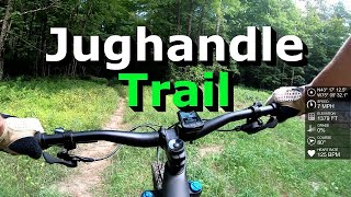
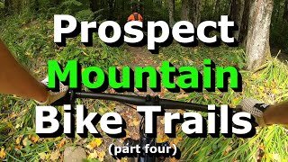
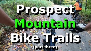
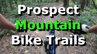
Photos of Prospect Mountain Bike
Videos of Prospect Mountain Bike
trail: BC Bypass
2:10 |
152 |
Sep 5, 2022 , Prospect

trail: BC to Roberts
4:33 |
229 |
Aug 27, 2021 , Prospect

trail: Old Trail
4:35 |
310 |
Apr 20, 2021 , Prospect
trail: Bear Trail
2:57 |
246 |
Oct 4, 2020 , Prospect
trail: Fast Trail
3:28 |
259 |
Oct 3, 2020 , Prospect
trail: Old Trail
3:54 |
328 |
Oct 3, 2020 , Prospect
trail: BC to Roberts
3:34 |
226 |
Oct 3, 2020 , Prospect
Recent Trail Reports
| status | trail | date | condition | info | user |
|---|---|---|---|---|---|
| Ravine 4 Alternate | Apr 27, 2025 @ 11:17am Apr 27, 2025 | Wet | ColinrPpqde | ||
| Ravine 4 | Apr 27, 2025 @ 11:17am Apr 27, 2025 | Wet | ColinrPpqde | ||
| Ravine 2 | Apr 27, 2025 @ 11:17am Apr 27, 2025 | Wet | ColinrPpqde | ||
| Ravine 3 | Sep 23, 2024 @ 7:00am Sep 23, 2024 | Ideal | Bill41306061 | ||
| Ravine Access Trail | Jul 26, 2024 @ 5:11pm Jul 26, 2024 | Variable | Challabuck | ||
| Connector | Apr 20, 2024 @ 5:38am Apr 20, 2024 | Ideal | ColinrPpqde | ||
| Old Trail | Apr 20, 2024 @ 5:38am Apr 20, 2024 | Ideal | ColinrPpqde | ||
| Ravine Exit | Nov 15, 2023 @ 7:05am Nov 15, 2023 | Ideal | Challabuck | ||
| Ravine 1 | Nov 15, 2023 @ 7:05am Nov 15, 2023 | Variable | Challabuck | ||
| Ridge Drop | Sep 5, 2023 @ 7:41pm Sep 5, 2023 | Dry | cjf27 |
Activity Feed
| username | action | type | title | date |
|---|---|---|---|---|
| hykerwilson | wishlist | region | activity #95483845 | May 25, 2026 @ 6:41am May 25, 2026 |
| sherpa914 | wishlist | region | activity #94006063 | May 3, 2026 @ 9:35pm May 3, 2026 |
| bassment45 | wishlist | region | activity #93956625 | May 3, 2026 @ 9:36am May 3, 2026 |
| WPt4Ac | wishlist | region | activity #79859111 | Sep 7, 2025 @ 11:38am Sep 7, 2025 |
| Chrissx0W | wishlist | region | activity #72047246 | May 20, 2025 @ 10:23am May 20, 2025 |
Recent Comments
| username | type | title | comment | date |
|---|---|---|---|---|
| trail | Major logging clear cut walk zone (about .25... | Nov 17, 2023 @ 11:54am Nov 17, 2023 | ||
| trail | Start from Roberts Road for the best experience. | Sep 5, 2023 @ 8:00pm Sep 5, 2023 | ||
| trail | Not really a black but fun nonetheless | Jun 21, 2019 @ 7:41pm Jun 21, 2019 |
Local Badges
-

Epic Ride Climb 2k1 awarded -

Climbing 10k Badge2 awarded -

Climbing 100k Badge0 awarded -

Epic Ride Descent 2k1 awarded -

Descent 10k Badge2 awarded -

Descent 100k Badge0 awarded
Activity Type Stats
| activitytype | trails | distance | descent | descent distance | total vertical | rating | global rank | state rank | photos | reports | routes | ridelogs |
|---|---|---|---|---|---|---|---|---|---|---|---|---|
| Mountain Bike | 19 | 15 miles | 2,060 ft | 8 miles | 246 ft | #5,857 | #1,982 | 14 | 71 | 1,902 | ||
| E-Bike | 1 | 54 | 34 | |||||||||
| Hike | 29 | 15 miles | 2,060 ft | 8 miles | 246 ft | #8,348 | #2,934 | 71 | 69 | |||
| Trail Running | 29 | 15 miles | 2,060 ft | 8 miles | 246 ft | #8,574 | #2,859 | 71 | 10 | |||
| Snowshoe | 1 | 4 | ||||||||||
| Backcountry Ski | 1 | 1 |
Frequently Asked Questions About Prospect
▼
What are the best places to ride in Prospect?
Prospect has 2 areas to explore for mountain biking. The top rated areas are:
▼
What are the highest rated mountain biking trails in Prospect?
The highest rated mountain biking trails in Prospect are:
- South Side Ridge (4.1/5)
- Ravine 4 (4/5)
- Ravine 3 (4/5)
- Ridge Drop (4/5)
- Old Trail (3.9/5)
▼
What is the best time of the year to ride in Prospect?
Based on ride log data, the most popular months to ride in Prospect are:
- July (86 activities)
- August (85 activities)
- May (76 activities)
▼
Where can I park to ride in Prospect?
- By CloudSpin
 AFTA & contributors
 - Admins: AFTA
- #23846 - 2,114 views
- prospect activity log | embed map of Prospect mountain bike trails | prospect mountain biking points of interest
Downloading of trail gps tracks in kml & gpx formats is enabled for Prospect.
You must login to download files.