close
-
Layers w
- Weather Layers
- Pro
- Pro
- Pro
- Pro
- Pro
- Pro
- More Layers
- Pro
- Pro
- Pro
- Pro
-
Upgrade to

3D
Trail Conditions
- Unknown
- Snow Groomed
- Snow Packed
- Snow Covered
- Snow Cover Partial
- Freeze/thaw Cycle
- Icy
- Prevalent Mud
- Wet
- Variable
- Ideal
- Dry
- Very Dry
Trail Flow (Ridden Direction)
Trailforks scans users ridelogs to determine the most popular direction each trail is ridden. A good flowing trail network will have most trails flowing in a single direction according to their intension.
The colour categories are based on what percentage of riders are riding a trail in its intended direction.
The colour categories are based on what percentage of riders are riding a trail in its intended direction.
- > 96%
- > 90%
- > 80%
- > 70%
- > 50%
- < 50%
- bi-directional trail
- no data
Trail Last Ridden
Trailforks scans ridelogs to determine the last time a trail was ridden.
- < 2 days
- < 1 week
- < 2 weeks
- < 1 month
- < 6 months
- > 6 months
Trail Ridden Direction
The intended direction a trail should be ridden.
- Downhill Only
- Downhill Primary
- Both Directions
- Uphill Primary
- Uphill Only
- One Direction
Contribute Details
Colors indicate trail is missing specified detail.
- Description
- Photos
- Description & Photos
- Videos
Trail Popularity ?
Trailforks scans ridelogs to determine which trails are ridden the most in the last 9 months.
Trails are compared with nearby trails in the same city region with a possible 25 colour shades.
Think of this as a heatmap, more rides = more kinetic energy = warmer colors.
- most popular
- popular
- less popular
- not popular
ATV/ORV/OHV Filter
Max Vehicle Width
inches
US Cell Coverage
Legend

Radar Time
Activity Recordings
Trailforks uses anonymized public activity data.
?
Activity Recordings
Trailforks uses anonymized public activity data.
?
Personal Heatmap
▶
Activity Types
all
/
none
▶
Options
2
Date range
month
–
Winter Trails
Warning
A routing network for winter maps does not exist. Selecting trails using the winter trails layer has been disabled.
Missing Trails
Most Popular
Least Popular
Trails are colored based on popularity. The more popular a trail is, the more red. Less popular trails trend towards green.
Jump Magnitude Heatmap
Heatmap of where riders jump on trails. Zoom in to see individual jumps, click circles to view jump details.
BC Backroad Status
![map legend]()
Service Road Atlas is a free to use, community-driven service for viewing and creating reports on the numerous back-country service roads around B.C. and Alberta.

Slope Aspect
Direction the slope faces
Trails Deemphasized
Trails are shown in grey.
Only show trails with no bike usage.
Suggested Layers
Based on selected activity type
Save the current map location and zoom level as your default home location whenever this page is loaded.
SaveThis region is Unsanctioned, Ride at your own Risk!
No description for Púchov has been added yet! Login or register to submit one.Activities Click to view
- Mountain Bike
67 trails
- E-Bike
35 trails
- Gravel Bike
0 trails
- Adaptive Bike
0 trails
- Hike
49 trails
- Trail Running
49 trails
Region Details
- 13
- 1
- 6
- 25
- 7
Region Status
Open as of 1 dayStats
- Avg Trail Rating
- Trails (view details)
- 52
- Trails Mountain Bike
- 67
- Trails E-Bike
- 35
- Trails Hike
- 49
- Trails Trail Running
- 49
- Total Distance
- 49 miles
- Total Descent
- 12,877 ft
- Total Vertical
- 2,324 ft
- Highest Trailhead
- 3,231 ft
- Reports
- 380
- Photos
- 161
- Ridden Counter
- 1,086
Sub Regions
-
Maríkovský Singeltrack
- 2
- 3
- 2
-
Púchovské traily
- 1
- 1
- 8
- 2
Popular Púchov Mountain Biking Trails
• 95 ★ 5.0 • 3,074 ft • 3 ft • 82 •
Trail je svižný,veľmi zábavný,bez exponovaných pasaží,preto kto má nášlapy pedále nieje potrebné nikde vypínať. Povrch je čistý, upravený a rýchlo býva po daždi suchý..
• 70 ★ 4.7 • 6 miles • 1,436 ft • 72 •
Highly rated popular black diamond difficulty singletrack. This multi-use trail can be used downhill primary and has a hard overall physical rating with a 1,436 ft black diamond climb. On average it takes 1 hour33 minutes to complete this trail.
• 75 ★ 4.8 • 2 miles • 192 ft • 65 •
Highly rated popular blue difficulty wilderness trail. This multi-use trail can be used one direction and has a moderate overall physical rating. On average it takes 21 minutes to complete this trail.
• 85 ★ 3.5 • 4,308 ft • 145 ft • 53 •
Pekný trail s čistým upravovaným chodníkom s koreňmi,ktorý býva rýchlo suchý.
• 30 ★ 5.0 • 3 miles • 282 ft • 44 •
Highly rated less popular blue difficulty wilderness trail. This multi-use trail can be used uphill primary and has a moderate overall physical rating with a 282 ft blue climb. On average it takes 39 minutes to complete this trail.
• 75 ★ 4.5 • 841 ft • 0 ft • 43 •
Popular black diamond difficulty singletrack. This multi-use trail can be used downhill only and has a moderate overall physical rating with a 0 ft blue climb. On average it takes 2 minutes to complete this trail.
• 90 ★ 4.0 • 2 miles • 204 ft • 42 •
Popular blue difficulty singletrack. This multi-use trail can be used downhill primary and has a moderate overall physical rating. On average it takes 7 minutes to complete this trail.
• 90 ★ 4.5 • 1 mile • 57 ft • 40 •
Popular green difficulty singletrack. This multi-use trail can be used downhill primary and has a easy overall physical rating with a 57 ft green climb. On average it takes 7 minutes to complete this trail.
Púchov Mountain Bike Routes
★ 5.0 • 15 miles • 2,086 ft • 5 • Loop •
Technical up and downhill singletrack in Javorniky. Accessible from Horna Marikova, Certov or from Chata...
★ 5.0 • 16 miles • 2,454 ft • 10 • Point to Point •
Menší okruh Maríkovského, tak ak ho ja rád chodievam, z Čertova do Čertova. Obsahuje podobné...
20 miles • 2,405 ft • 3 •
Marikovský cez Stratenec Marikovský cez Stratenec Marikovský cez Stratenec
17 miles • 2,416 ft • 0 • Loop •
Marikovský singletrack z Portáše doporučený směr.
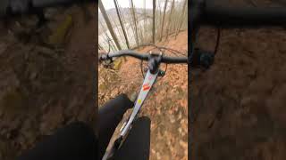
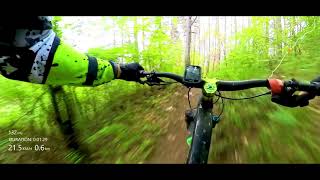
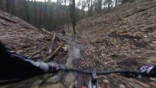
Photos of Púchov Mountain Bike
Videos of Púchov Mountain Bike
trail: Slippyak
0:18 |
132 |
Mar 6, 2024 , Púchov
trail: VK Trail 12,5%
2:51 |
188 |
May 15, 2023 , Púchov
trail: Pod Holíšom
9:28 |
451 |
Sep 22, 2021 , Púchov

trail: Žliabovica
0:25 |
780 |
Nov 18, 2018 , Púchov
trail: Žliabovica
6:54 |
789 |
Mar 19, 2018 , Púchov
Recent Trail Reports
| status | trail | date | condition | info | user |
|---|---|---|---|---|---|
| 911 TRAIL | Jun 19, 2026 @ 8:56am (Europe/Bratislava) 1 day | Variable | Malarkie | ||
| KWIIK TRAIL | May 30, 2026 @ 11:59am (Europe/Bratislava) May 30, 2026 | Dry | xPeHax | ||
| PEKELNY TRAIL | May 20, 2026 @ 8:29am (Europe/Bratislava) May 19, 2026 | Variable | bobris01 | ||
| AL TRAIL | May 19, 2026 @ 1:01pm (Europe/Bratislava) May 19, 2026 | Variable | bobris01 | ||
| MODRY TRAIL | May 19, 2026 @ 1:01pm (Europe/Bratislava) May 19, 2026 | Variable | bobris01 | ||
| PREPOJOVAK | May 19, 2026 @ 1:01pm (Europe/Bratislava) May 19, 2026 | Ideal | bobris01 | ||
| ELLIOT | May 19, 2026 @ 1:01pm (Europe/Bratislava) May 19, 2026 | Ideal | bobris01 | ||
| Pod Holíšom | May 15, 2026 @ 4:05pm (Europe/Bratislava) May 15, 2026 | Ideal | kiwibibo | ||
| TockoZlab | May 6, 2026 @ 1:44pm (Europe/Bratislava) May 6, 2026 | Unknown | nemesishard | ||
| Maríkovský access | Apr 18, 2026 @ 10:00am (Europe/Bratislava) Apr 18, 2026 | Ideal | TomYti |
Activity Feed
| username | action | type | title | date |
|---|---|---|---|---|
| Malarkie | add | report | activity #97300110 | Jun 18, 2026 @ 11:56pm 1 day |
| xPeHax | add | report | activity #96609065 | Jun 9, 2026 @ 8:53am Jun 9, 2026 |
| xPeHax | comment | report | activity #95833048 | May 30, 2026 @ 2:58am May 30, 2026 |
| xPeHax | add | report | activity #95832973 and 1 more | May 30, 2026 @ 2:56am May 30, 2026 |
| Malarkie | ridden | trail | activity #95772337 and 1 more | May 29, 2026 @ 6:24am May 29, 2026 |
Recent Comments
| username | type | title | comment | date |
|---|---|---|---|---|
| report | Všechno Ok | May 30, 2026 @ 2:58am May 30, 2026 | ||
| trail | pekny hravy trail, navrat na 911 trail je... | May 19, 2026 @ 11:35pm May 19, 2026 | ||
| trail | Novovybudovaná vrchná čast trailu s názvom... | May 12, 2026 @ 8:16am May 12, 2026 | ||
| report | Zanechaj mi tu prosím nejaký instagram alebo... | May 11, 2026 @ 6:47am May 11, 2026 | ||
| report | naspet na Kobylinec ako? | May 11, 2026 @ 2:38am May 11, 2026 |
Local Badges
-

10 Blue Trails22 awarded -

Epic Ride Climb 2k36 awarded -

Climbing 10k Badge28 awarded -

Climbing 100k Badge7 awarded -

Epic Ride Descent 2k37 awarded -

Descent 10k Badge29 awarded
Activity Type Stats
| activitytype | trails | distance | descent | descent distance | total vertical | rating | global rank | state rank | photos | reports | routes | ridelogs |
|---|---|---|---|---|---|---|---|---|---|---|---|---|
| Mountain Bike | 67 | 49 miles | 12,877 ft | 25 miles | 2,323 ft | #1,587 | #18 | 147 | 380 | 4 | 6,640 | |
| E-Bike | 35 | 8 miles | 2,520 ft | 5 miles | 1,089 ft | #316 | #4 | 14 | 322 | 298 | ||
| Hike | 49 | 47 miles | 11,693 ft | 24 miles | 2,323 ft | #1,913 | #20 | 361 | 1 | 556 | ||
| Trail Running | 49 | 47 miles | 11,693 ft | 24 miles | 2,323 ft | #1,459 | #18 | 361 | 1 | 84 |
Frequently Asked Questions About Púchov
▼
What are the best places to ride in Púchov?
Púchov has 2 areas to explore for mountain biking. The top rated areas are:
▼
What are the highest rated mountain biking trails in Púchov?
The highest rated mountain biking trails in Púchov are:
- Maríkovský Singeltrack up (4.5/5)
- Maríkovský Singletrack (4.5/5)
- Maríkovský Singletrack - Nový (4.5/5)
- 911 TRAIL (4.4/5)
- KWIIK TRAIL (4.3/5)
▼
What is the best time of the year to ride in Púchov?
Based on ride log data, the most popular months to ride in Púchov are:
- August (20 activities)
- July (18 activities)
- September (15 activities)
▼
Where can I park to ride in Púchov?
There are 1 parking locations listed in Púchov. The most popular parking spots are:
Activities
Trails
- By Manusko & contributors
- Admins: jxxw
- #16312 - 5,221 views
- púchov activity log | embed map of Púchov mountain bike trails | púchov mountain biking points of interest
Downloading of trail gps tracks in kml & gpx formats is enabled for Púchov.
You must login to download files.