close
-
Layers w
- Weather Layers
- Pro
- Pro
- Pro
- Pro
- Pro
- Pro
- More Layers
- Pro
- Pro
- Pro
- Pro
-
Upgrade to

3D
Trail Conditions
- Unknown
- Snow Groomed
- Snow Packed
- Snow Covered
- Snow Cover Partial
- Freeze/thaw Cycle
- Icy
- Prevalent Mud
- Wet
- Variable
- Ideal
- Dry
- Very Dry
Trail Flow (Ridden Direction)
Trailforks scans users ridelogs to determine the most popular direction each trail is ridden. A good flowing trail network will have most trails flowing in a single direction according to their intension.
The colour categories are based on what percentage of riders are riding a trail in its intended direction.
The colour categories are based on what percentage of riders are riding a trail in its intended direction.
- > 96%
- > 90%
- > 80%
- > 70%
- > 50%
- < 50%
- bi-directional trail
- no data
Trail Last Ridden
Trailforks scans ridelogs to determine the last time a trail was ridden.
- < 2 days
- < 1 week
- < 2 weeks
- < 1 month
- < 6 months
- > 6 months
Trail Ridden Direction
The intended direction a trail should be ridden.
- Downhill Only
- Downhill Primary
- Both Directions
- Uphill Primary
- Uphill Only
- One Direction
Contribute Details
Colors indicate trail is missing specified detail.
- Description
- Photos
- Description & Photos
- Videos
Trail Popularity ?
Trailforks scans ridelogs to determine which trails are ridden the most in the last 9 months.
Trails are compared with nearby trails in the same city region with a possible 25 colour shades.
Think of this as a heatmap, more rides = more kinetic energy = warmer colors.
- most popular
- popular
- less popular
- not popular
ATV/ORV/OHV Filter
Max Vehicle Width
inches
US Cell Coverage
Legend

Radar Time
Activity Recordings
Trailforks uses anonymized public activity data.
?
Activity Recordings
Trailforks uses anonymized public activity data.
?
Personal Heatmap
▶
Activity Types
all
/
none
▶
Options
2
Date range
month
–
Winter Trails
Warning
A routing network for winter maps does not exist. Selecting trails using the winter trails layer has been disabled.
Missing Trails
Most Popular
Least Popular
Trails are colored based on popularity. The more popular a trail is, the more red. Less popular trails trend towards green.
Jump Magnitude Heatmap
Heatmap of where riders jump on trails. Zoom in to see individual jumps, click circles to view jump details.
BC Backroad Status
![map legend]()
Service Road Atlas is a free to use, community-driven service for viewing and creating reports on the numerous back-country service roads around B.C. and Alberta.

Slope Aspect
Direction the slope faces
Trails Deemphasized
Trails are shown in grey.
Only show trails with no bike usage.
Suggested Layers
Based on selected activity type
Save the current map location and zoom level as your default home location whenever this page is loaded.
SavePuebla, officially Free and Sovereign State of Puebla, is one of the 32 states which comprise the Federal Entities of Mexico. It is divided into 217 municipalities and its capital is the city of Puebla.
It is located in east-central Mexico and is bordered by the states of Veracruz to the north and east, Hidalgo, México, Tlaxcala and Morelos to the west, and Guerrero and Oaxaca to the south. The origins of the state lie in the city of Puebla, which was founded by the Spanish in this valley in 1531 to secure the trade route between Mexico City and the port of Veracruz. By the end of the 18th century, the area had become a colonial province with its own governor, which would become the State of Puebla, after the Mexican War of Independence in the early 19th century. Since that time the area, especially around the capital city, has continued to grow economically, mostly through industry, despite being the scene of a number of battles, the most notable of which being the Battle of Puebla. Today, the state is one of the most industrialized in the country, but since most of its development is concentrated in Puebla and other cities, many of its rural areas are undeveloped.
Culturally, the state is home to the china poblana, mole poblano, active literary and arts scenes, and festivals such as Cinco de Mayo, Ritual of Quetzalcoatl, Day of the Dead celebrations (especially in Huaquechula) and Carnival (especially in Huejotzingo). It is home to five major indigenous groups: Nahuas, the Totonacs, the Mixtecs, the Popolocas and the Otomi, which can mostly be found in the far north and the far south of the state.
source: Puebla - Wikipedia
Links
Region Details
- 15
- 23
- 75
- 30
- 6
- 3
Stats
- Avg Trail Rating
- Trails (view details)
- 152
- Trails Mountain Bike
- 152
- Trails E-Bike
- 130
- Trails Horse
- 17
- Trails Hike
- 105
- Trails Trail Running
- 103
- Trails Dirtbike/Moto
- 20
- Trails ATV/ORV/OHV
- 7
- Total Distance
- 154 miles
- Total Descent
- 57,421 ft
- Total Vertical
- 9,592 ft
- Highest Trailhead
- 13,141 ft
- Reports
- 586
- Photos
- 375
- Ridden Counter
- 4,502
Popular Trail Networks
view all areas »Sub Regions
- Atlixco (Municipality) (1)
- Atlixco (1)
- Puebla (Municipality) (34)
- San Pedro Cholula (Municipality) (71)
- Cholula (71)
- Tehuacan (Municipality) (46)
- Tehuacán (45)
- Tetela de Ocampo (Municipality) (4)
- Pahuatlán (1)
- Ozolco Trail Network (9)
- Parque Nacional Pico de Orizaba (0)
Popular Puebla (State) Mountain Biking Trails
• 80 ★ 5.0 • 564 ft • 0 ft • 157 •
Trail técnico con curvas cerradas y una inclinacion de 45 grados.
• 95 ★ 5.0 • 1,496 ft • 0 ft • 141 •
Trail raíz que originalmente era muy sencillo, ahora cuenta con dos drops y un salto.
• 90 ★ 5.0 • 1,913 ft • 0 ft • 107 •
Popular green difficulty singletrack. This mountain bike primary trail can be used both directions and has a easy overall physical rating. On average it takes 2 minutes to complete this trail.
• 5 ★ 5.0 • 351 ft • 0 ft • 98 •
Pista de varias curvas, con buena pendiente e inclinación terminando con pequeños escalones.
• 55 ★ 5.0 • 1,676 ft • 10 ft • 96 •
Moderately popular blue difficulty singletrack. This mountain bike primary trail can be used downhill primary and has a moderate overall physical rating with a 10 ft green climb. It features roller coaster. On average it takes 1 minutes to complete this trail.
• 65 ★ 5.0 • 778 ft • 0 ft • 88 •
Trail sencillo fluido, con leves curvas e inclinación pequeña.
Puebla (State) Mountain Bike Routes
★ 5.0 • 8 miles • 774 ft • 0 • Loop •
Ruta empezando de Domingo Arenas bajando hacia la nopalera y terminando en Huejotzingo
15 miles • 2,212 ft • 1 •
ruta de mtb bajando la cañada y subiendo ala iglesia cristo rey y antenas en san bernardino chalchihuapan
4 miles • 546 ft • 0 • Loop •
Easy ride assending to the top of the hill and down in its road loops, just in the center of Metepec town....
24 miles • 5,220 ft • 0 • Loop •
Carrera Rey de la Montaña 2019 en su versión mediana (40km). La pista empieza en el centro de San...
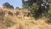
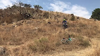
Photos of Puebla (State) Mountain Bike
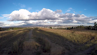
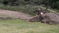
Videos of Puebla (State) Mountain Bike

trail: Forty UB Willy
0:07 |
67 |
Mar 22, 2021
trail: Mortal Combat - Miura Sender
0:04 |
41 |
Mar 22, 2021
trail: El Bosque
2:02 |
144 |
Nov 13, 2019
trail: motocross
3:27 |
73 |
Jul 25, 2016

trail: Mortal Combat - Miura Sender
2:05 |
45 |
Jun 6, 2016
trail: Forty UB Willy
0:16 |
121 |
May 25, 2016
trail: Mortal Combat - Miura Sender
0:15 |
28 |
May 25, 2016
Recent Trail Reports
Activity Feed
| username | action | type | title | date |
|---|---|---|---|---|
| delmonhii | like | directory | activity #96629635 | Jun 9, 2026 @ 2:27pm Jun 9, 2026 |
| bikelogistics | add | report | activity #96392264 and 1 more | Jun 6, 2026 @ 11:36am Jun 6, 2026 |
| bikelogistics | checkin | trail | activity #95871733 | May 30, 2026 @ 11:21am May 30, 2026 |
| bikelogistics | add | report | activity #95871670 and 1 more | May 30, 2026 @ 11:20am May 30, 2026 |
| bikelogistics | add | report | activity #94976693 and 1 more | May 18, 2026 @ 8:10am May 18, 2026 |
Recent Comments
| username | type | title | comment | date |
|---|---|---|---|---|
| report | Se va poner de a indio | Dec 17, 2025 @ 10:54am Dec 17, 2025 | ||
| trail | RESPETA EL SENDERO Y EL TRABAJO DE LOS... | Feb 1, 2025 @ 10:46am Feb 1, 2025 | ||
| trail | RESPETA EL SENDERO Y EL TRABAJO DE LOS... | Feb 1, 2025 @ 10:46am Feb 1, 2025 | ||
| trail | una maravilla, felicidades | Mar 25, 2024 @ 10:12am Mar 25, 2024 | ||
| trail | Cual es la mejor forma de volver a subir al... | Oct 17, 2023 @ 6:32pm Oct 17, 2023 |
Local Badges
-

Completionist0 awarded -

Epic Mountain Bike Climb 2k1 awarded -

10 Blue Trails0 awarded -

Top 10 Trails0 awarded -
10 Blue Trails1 awarded -
Top 10 Trails28 awarded
Bike & Skill Parks
| name | type | city | rating |
|---|---|---|---|
| Murciélagos Bike Park | bike park | Tehuacán | |
| Bikeyard Mexico | skill park | Cholula |
Local Trail Supporters
![]()
![]()
![]()
- Hosteria el trébol
- BIKE LOGISTICS STORE
![]()
Activity Type Stats
| activitytype | trails | distance | descent | descent distance | total vertical | rating | global rank | state rank | photos | reports | routes | ridelogs |
|---|---|---|---|---|---|---|---|---|---|---|---|---|
| Mountain Bike | 152 | 154 miles | 57,421 ft | 99 miles | 9,593 ft | 366 | 583 | 16 | 25,429 | |||
| E-Bike | 130 | 114 miles | 41,020 ft | 70 miles | 6,942 ft | 525 | 6 | 941 | ||||
| Horse | 17 | 32 miles | 10,046 ft | 17 miles | 5,075 ft | 108 | 1 | |||||
| Hike | 105 | 121 miles | 38,888 ft | 71 miles | 9,593 ft | 428 | 1 | 948 | ||||
| Trail Running | 103 | 114 miles | 35,404 ft | 66 miles | 9,593 ft | 9 | 428 | 3 | 324 | |||
| Dirtbike/Moto | 20 | 24 miles | 5,778 ft | 12 miles | 5,325 ft | 105 | 1 | |||||
| ATV/ORV/OHV | 7 | 18 miles | 2,093 ft | 8 miles | 5,325 ft | 104 | 1 |
Activities
Trails
Points of Interest
- By denitopia
 TRAILFORKS VTA & contributors
 - Admins: MAG
- #12713 - 8,609 views
- puebla (state) activity log | embed map of Puebla (State) mountain bike trails | puebla (state) mountain biking points of interest
Downloading of trail gps tracks in kml & gpx formats is enabled for Puebla (State).
You must login to download files.