close
-
Layers w
- Weather Layers
- Pro
- Pro
- Pro
- Pro
- Pro
- Pro
- More Layers
- Pro
- Pro
- Pro
- Pro
-
Upgrade to

3D
Trail Conditions
- Unknown
- Snow Groomed
- Snow Packed
- Snow Covered
- Snow Cover Partial
- Freeze/thaw Cycle
- Icy
- Prevalent Mud
- Wet
- Variable
- Ideal
- Dry
- Very Dry
Trail Flow (Ridden Direction)
Trailforks scans users ridelogs to determine the most popular direction each trail is ridden. A good flowing trail network will have most trails flowing in a single direction according to their intension.
The colour categories are based on what percentage of riders are riding a trail in its intended direction.
The colour categories are based on what percentage of riders are riding a trail in its intended direction.
- > 96%
- > 90%
- > 80%
- > 70%
- > 50%
- < 50%
- bi-directional trail
- no data
Trail Last Ridden
Trailforks scans ridelogs to determine the last time a trail was ridden.
- < 2 days
- < 1 week
- < 2 weeks
- < 1 month
- < 6 months
- > 6 months
Trail Ridden Direction
The intended direction a trail should be ridden.
- Downhill Only
- Downhill Primary
- Both Directions
- Uphill Primary
- Uphill Only
- One Direction
Contribute Details
Colors indicate trail is missing specified detail.
- Description
- Photos
- Description & Photos
- Videos
Trail Popularity ?
Trailforks scans ridelogs to determine which trails are ridden the most in the last 9 months.
Trails are compared with nearby trails in the same city region with a possible 25 colour shades.
Think of this as a heatmap, more rides = more kinetic energy = warmer colors.
- most popular
- popular
- less popular
- not popular
ATV/ORV/OHV Filter
Max Vehicle Width
inches
US Cell Coverage
Legend

Radar Time
Activity Recordings
Trailforks uses anonymized public activity data.
?
Activity Recordings
Trailforks uses anonymized public activity data.
?
Personal Heatmap
▶
Activity Types
all
/
none
▶
Options
2
Date range
month
–
Winter Trails
Warning
A routing network for winter maps does not exist. Selecting trails using the winter trails layer has been disabled.
Missing Trails
Most Popular
Least Popular
Trails are colored based on popularity. The more popular a trail is, the more red. Less popular trails trend towards green.
Jump Magnitude Heatmap
Heatmap of where riders jump on trails. Zoom in to see individual jumps, click circles to view jump details.
BC Backroad Status
![map legend]()
Service Road Atlas is a free to use, community-driven service for viewing and creating reports on the numerous back-country service roads around B.C. and Alberta.

Slope Aspect
Direction the slope faces
Trails Deemphasized
Trails are shown in grey.
Only show trails with no bike usage.
Suggested Layers
Based on selected activity type
Save the current map location and zoom level as your default home location whenever this page is loaded.
Save
No description for Puglia has been added yet!
Login or register to submit one.
This region uses the Uk/Euro style trail grading system.
Region Details
- 8
- 1
- 9
- 18
Stats
- Avg Trail Rating
- Trails (view details)
- 41
- Trails Mountain Bike
- 50
- Trails E-Bike
- 41
- Trails Horse
- 2
- Trails Hike
- 40
- Trails Trail Running
- 37
- Trails Dirtbike/Moto
- 1
- Total Distance
- 22 miles
- Total Descent
- 7,056 ft
- Total Vertical
- 3,105 ft
- Highest Trailhead
- 3,452 ft
- Reports
- 39
- Photos
- 25
- Ridden Counter
- 286
Sub Regions
- Bari (1)
- Bari (2)
- Bari (2)
- Barletta-Andria-Trani (6)
- Andria (6)
- Andria (6)
- Brindisi (4)
- Fasano (4)
- Fasano (4)
- Foggia (36)
- San Giovanni Rotondo (28)
- Vieste (8)
- Gargano (0)
- San Giovanni Rotondo (28)
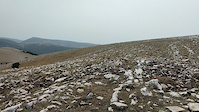
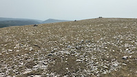
Popular Puglia Mountain Biking Trails
• 50 ★ 5.0 • 3,058 ft • 6 ft • 26 •
Moderately popular red difficulty singletrack. This mountain bike primary trail can be used downhill only and has a moderate overall physical rating with a 6 ft blue climb. Trail visibility is always easy to follow. On average it takes 23 minutes to complete this trail.
• 100 ★ 5.0 • 1,811 ft • 0 ft • 18 •
Popular red difficulty singletrack. This mountain bike primary trail can be used downhill primary and has a moderate overall physical rating. It features rock face, rock garden and other. Trail visibility is always easy to follow. On average it takes 3 minutes to complete this trail.
• ★ 0.0 • 1,158 ft • 0 ft • 17 •
Green difficulty dirt/gravel road. This mountain bike primary trail can be used both directions with a 0 ft blue climb. On average it takes 8 minutes to complete this trail.
• 5 ★ 0.0 • 1 mile • 39 ft • 16 •
Less popular blue difficulty singletrack. This mountain bike primary trail can be used downhill only and has a moderate overall physical rating with a 39 ft blue climb. It features drop, jump and pump track. On average it takes 18 minutes to complete this trail.
• 100 ★ 4.7 • 3,253 ft • 0 ft • 15 •
Trail selvaggio e molto tecnico. Terreno smosso e inconsistente, con parecchi passaggi tecnici e tratti molto scassati.
• 100 ★ 2.5 • 3,144 ft • 276 ft • 13 •
Spartifiamme per raggiungere il centro del mondo di Serra Cicibizzo.
• 85 ★ 5.0 • 1,762 ft • 0 ft • 9 •
Bob è un sentiero veloce con salti e curve con appoggio. I salti sono tutti evitabili. Occhio al doppio finale!
• 70 ★ 5.0 • 2,323 ft • 23 ft • 8 •
è un sentiero da guidare. Puoi inventare le tue linee. Naturale, con contropendenze, curve senza appoggio e tratti con una pendenza medio-bassa. Qualche salto lungo il sentiero, evitabili.
Puglia Mountain Bike Routes
★ 5.0 • 34 miles • 1,442 ft • 0 • Loop •
NOICATTARO SAN MADERNO RUTIGLIANO UP AND DOWN
★ 5.0 • 39 miles • 5,613 ft • 0 • Loop •
Percorso entusiasmante e ricco di adrenalina
19 miles • 2,024 ft • 1 •
Partendo dal Poggio Active Hotel si raggiunge Borgo Celano e quindi il Convento di San Matteo Apostolo...
19 miles • 2,071 ft • 0 •
Dal Poggio Active Hotel percorrendo strade bianche ed una mulattiera, si raggiunge Località Pantano per...
22 miles • 3,218 ft • 0 •
Una escursione dal kilometraggio limitato ma resa emozionante dalla presenza di due discese ( Canale di S....
15 miles • 1,014 ft • 0 • Loop •
1° MEDIOFONDO ALL BIKE CORGOM Gara realizzata da All Bike di Ruvo di puglia ( vendita e riparazione bici...
Photos of Puglia Mountain Bike
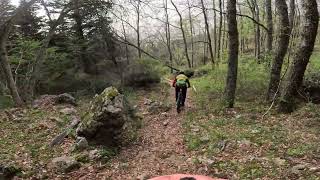
Videos of Puglia Mountain Bike
trail: Monte Calvo
0:10 |
21 |
Sep 1, 2022
trail: Monte Calvo
0:14 |
25 |
Sep 1, 2022
trail: Bob Pedale
0:04 |
433 |
Dec 8, 2019
trail: Campo Da Calcio
7:51 |
136 |
Sep 12, 2024 , san giovanni rotondo
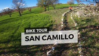
trail: San Camillo Trail
3:14 |
66 |
Sep 12, 2024 , san giovanni rotondo
trail: Gasdotto
4:11 |
89 |
Sep 12, 2024 , san giovanni rotondo
trail: Gasdotto
6:32 |
62 |
Sep 12, 2024 , san giovanni rotondo
trail: Scout Forestale
3:10 |
83 |
Sep 12, 2024 , san giovanni rotondo
Recent Trail Reports
| status | trail | date | condition | info | user |
|---|---|---|---|---|---|
| Umbra toboga DH Vieste | Jun 1, 2026 @ 3:49pm (Europe/Rome) Jun 1, 2026 | Unknown | Sprizz2021 | ||
| Torre del Chianconcello Vieste | Aug 18, 2025 @ 1:01pm Aug 18, 2025 | Dry | MonesTrail | ||
| DH del Tubo Fasano | Aug 16, 2025 @ 6:53pm Aug 16, 2025 | Dry | succhiafort3 | ||
| MaPiNi San Giovanni Rotondo | Jan 5, 2025 @ 10:41am Jan 5, 2025 | Variable | jinbe | ||
| Mapini - parte alta San Giovanni Rotondo | Jan 5, 2025 @ 10:41am Jan 5, 2025 | Variable | jinbe | ||
| Connessione Coppa L'Arena San Giovanni Rotondo | Jan 5, 2025 @ 10:41am Jan 5, 2025 | Variable | jinbe | ||
| Discesa Santa Croce San Giovanni Rotondo | Oct 9, 2024 @ 1:21am Oct 9, 2024 | Unknown | jinbe | ||
| Coppa L'Arena San Giovanni Rotondo | Sep 8, 2024 @ 4:49am Sep 8, 2024 | Dry | PateG | ||
| Il Cristo DH Bari | Jun 25, 2024 @ 6:51am Jun 25, 2024 | Very Dry | succhiafort3 | ||
| antenna extreme dh Bari | Jun 25, 2024 @ 6:51am Jun 25, 2024 | Very Dry | succhiafort3 |
Activity Feed
| username | action | type | title | date |
|---|---|---|---|---|
| Sprizz2021 | add | report | activity #96014110 | Jun 1, 2026 @ 6:49am Jun 1, 2026 |
| Philippano | ridden | trail | activity #94689917 | May 14, 2026 @ 7:55am May 14, 2026 |
| AntoniopJJgHo | ridden | route | activity #93058626 | Apr 20, 2026 @ 8:01pm Apr 20, 2026 |
| GZmtSBH | wishlist | route | activity #89062965 | Feb 17, 2026 @ 2:35am Feb 17, 2026 |
| Stephanwq9lM3 | ridden | trail | activity #78999790 | Aug 26, 2025 @ 12:31pm Aug 26, 2025 |
Recent Comments
| username | type | title | comment | date |
|---|---|---|---|---|
| trail | Seems like an XC racetrack. Obviously on... | Apr 14, 2025 @ 8:07am Apr 14, 2025 | ||
| trail | The indicated direction is the wrong way and... | May 11, 2024 @ 11:06pm May 11, 2024 |
Local Badges
-

Epic Mountain Bike Climb 2k0 awarded -

Climbing 10k Badge0 awarded -

Mountain Biking 100k Badge0 awarded -

Epic Ride Descent 2k0 awarded -

Descent 10k Badge0 awarded -

Descent 100k Badge0 awarded
Bike & Skill Parks
| name | type | city | rating |
|---|---|---|---|
| S.Pietro Vernotico | skill park | ||
| san fernandino | skill park |
Activity Type Stats
| activitytype | trails | distance | descent | descent distance | total vertical | rating | global rank | state rank | photos | reports | routes | ridelogs |
|---|---|---|---|---|---|---|---|---|---|---|---|---|
| Mountain Bike | 49 | 22 miles | 7,057 ft | 14 miles | 3,104 ft | 24 | 42 | 21 | 27,342 | |||
| E-Bike | 41 | 14 miles | 5,814 ft | 11 miles | 3,104 ft | 1 | 39 | 7 | 1,279 | |||
| Horse | 2 | 3 | ||||||||||
| Hike | 40 | 16 miles | 5,427 ft | 12 miles | 3,104 ft | 41 | 2 | 762 | ||||
| Trail Running | 37 | 15 miles | 4,715 ft | 11 miles | 3,094 ft | 40 | 55 | |||||
| Dirtbike/Moto | 1 | 3 | 1 |
Activities
Trails
Points of Interest
- By brenthillier
 NSMBA TRAILFORKS & contributors
 - Admins: denitopia, marcoangeletti, cemoorelife
- #9477 - 7,637 views
- puglia activity log | embed map of Puglia mountain bike trails | puglia mountain biking points of interest
Downloading of trail gps tracks in kml & gpx formats is enabled for Puglia.
You must login to download files.