close
-
Layers w
- Weather Layers
- Pro
- Pro
- Pro
- Pro
- Pro
- Pro
- More Layers
- Pro
- Pro
- Pro
- Pro
-
Upgrade to

3D
Trail Conditions
- Unknown
- Snow Groomed
- Snow Packed
- Snow Covered
- Snow Cover Partial
- Freeze/thaw Cycle
- Icy
- Prevalent Mud
- Wet
- Variable
- Ideal
- Dry
- Very Dry
Trail Flow (Ridden Direction)
Trailforks scans users ridelogs to determine the most popular direction each trail is ridden. A good flowing trail network will have most trails flowing in a single direction according to their intension.
The colour categories are based on what percentage of riders are riding a trail in its intended direction.
The colour categories are based on what percentage of riders are riding a trail in its intended direction.
- > 96%
- > 90%
- > 80%
- > 70%
- > 50%
- < 50%
- bi-directional trail
- no data
Trail Last Ridden
Trailforks scans ridelogs to determine the last time a trail was ridden.
- < 2 days
- < 1 week
- < 2 weeks
- < 1 month
- < 6 months
- > 6 months
Trail Ridden Direction
The intended direction a trail should be ridden.
- Downhill Only
- Downhill Primary
- Both Directions
- Uphill Primary
- Uphill Only
- One Direction
Contribute Details
Colors indicate trail is missing specified detail.
- Description
- Photos
- Description & Photos
- Videos
Trail Popularity ?
Trailforks scans ridelogs to determine which trails are ridden the most in the last 9 months.
Trails are compared with nearby trails in the same city region with a possible 25 colour shades.
Think of this as a heatmap, more rides = more kinetic energy = warmer colors.
- most popular
- popular
- less popular
- not popular
ATV/ORV/OHV Filter
Max Vehicle Width
inches
US Cell Coverage
Legend

Radar Time
Activity Recordings
Trailforks uses anonymized public activity data.
?
Activity Recordings
Trailforks uses anonymized public activity data.
?
Personal Heatmap
▶
Activity Types
all
/
none
▶
Options
2
Date range
month
–
Winter Trails
Warning
A routing network for winter maps does not exist. Selecting trails using the winter trails layer has been disabled.
Missing Trails
Most Popular
Least Popular
Trails are colored based on popularity. The more popular a trail is, the more red. Less popular trails trend towards green.
Jump Magnitude Heatmap
Heatmap of where riders jump on trails. Zoom in to see individual jumps, click circles to view jump details.
BC Backroad Status
![map legend]()
Service Road Atlas is a free to use, community-driven service for viewing and creating reports on the numerous back-country service roads around B.C. and Alberta.

Slope Aspect
Direction the slope faces
Trails Deemphasized
Trails are shown in grey.
Only show trails with no bike usage.
Suggested Layers
Based on selected activity type
Save the current map location and zoom level as your default home location whenever this page is loaded.
Save
No description for Punta Ala has been added yet!
Login or register to submit one.
This region uses the Uk/Euro style trail grading system.
Activities Click to view
- Mountain Bike
75 trails
- E-Bike
38 trails
- Gravel Bike
6 trails
- Adaptive Bike
6 trails
- Winter Fat Bike
2 trails
- Hike
70 trails
- Trail Running
70 trails
Region Details
- 15
- 6
- 20
- 21
Region Status
Caution as of Jun 13, 2026Stats
- Avg Trail Rating
- Trails (view details)
- 71
- Trails Mountain Bike
- 75
- Trails E-Bike
- 38
- Trails Gravel Bike
- 6
- Trails Adaptive Bike
- 6
- Trails Winter Fat Bike
- 2
- Trails Horse
- 3
- Trails Hike
- 70
- Trails Trail Running
- 70
- Total Distance
- 63 miles
- Total Descent
- 20,139 ft
- Total Vertical
- 1,810 ft
- Highest Trailhead
- 1,820 ft
- Reports
- 1,476
- Photos
- 188
- Ridden Counter
- 14,567
Articles
Throwback Thursday: EWS #1, Punta Ala - A Decade Later
May 18, 2023 from pinkbike.com
Today marks a decade since the Enduro World Series held its first ever race in Punta Ala, Italy.
Throwback Thursday: 22 Bikes from the First Ever EWS Race
Sep 26, 2019 from pinkbike.com
26" wheels, triple chainrings and Tracy Moseley winning on a prototype 29er. Things have definitely changed since the EWS first tackled the slopes...
Sub Regions
-
Bandite Trail Area
- 1
- 20
- 21
Popular Punta Ala Mountain Biking Trails
• 85 ★ 4.3 • 2 miles • 0 ft • 523 •
This was a flowy trail connected to the "301". Now it's scarred, carved and full of loose rocks. Still, a great example of how we like them trails here. GNARLY ;)
• 100 ★ 2.5 • 3,481 ft • 184 ft • 509 •
Popular green difficulty singletrack. This mountain bike primary trail can be used both directions and has a easy overall physical rating with a 184 ft green climb. It features skinny. On average it takes 7 minutes to complete this trail.
• 90 ★ 4.2 • 4,701 ft • 6 ft • 490 •
Easy, light blue or maybe green in some sections. Toboga with some loose rocks.
• 75 ★ 4.3 • 1 mile • 27 ft • 473 •
The longest trail in area. quite technical, rock gardens and some jumps.
• 80 ★ 4.5 • 2 miles • 7 ft • 472 •
A fast fun flowing single track with a super technical section at middle way of the trail.
• 95 ★ 3.4 • 1,129 ft • 0 ft • 440 •
Simpler trail then the main , full of berms and very flowy, suitable for everybody
• 90 ★ 4.4 • 4,324 ft • 9 ft • 356 •
Highly rated popular green difficulty singletrack. This mountain bike primary trail can be used downhill primary with a 9 ft green climb. It features berm. On average it takes 6 minutes to complete this trail.
Punta Ala Mountain Bike Routes
★ 3.5 • 22 miles • 3,206 ft • 3 • Loop •
Punta Ala Trail Center's enduro trails are numerous and range from flowy and fast to steep and technical,...
★ 3.0 • 12 miles • 1,771 ft • 2 •
simple tour around the main trails of cala violina, the guardian, torretta and moscatello
31 miles • 3,720 ft • 4 •
A long ride out in the wild woods and hills that reach far into the countryside around Punta Ala Trail...
★ 2.8 • 17 miles • 3,978 ft • 14 •
The main route to ride the most famous trails in the Tirli area. moderate difficulties
20 miles • 2,623 ft • 2 • Loop •
This is pure mountain biking as we understand it: out in the forest, on singletrack, tackling some...
12 miles • 1,165 ft • 3 •
A great way to discover the luxury port village of Punta Ala, which sits a little south of Punta Ala Trail...
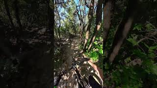
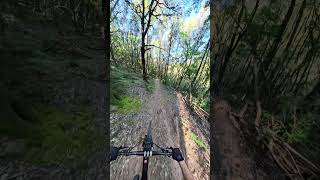
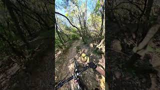
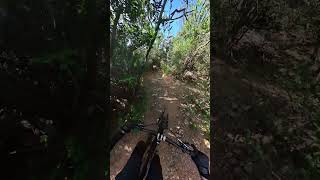
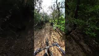
Photos of Punta Ala Mountain Bike
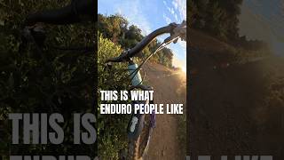
Videos of Punta Ala Mountain Bike
trail: 301
2:33 |
1087 |
Mar 22, 2016
trail: Trail 3
4:16 |
1236 |
Jul 29, 2014
youtuber
![The Guardian - Cala Violina | Punta Ala Trail...]()
trail: The Guardian
0:23 |
12 |
Jun 7, 2026 , Punta Ala
trail: Torretta upper
0:02 |
27 |
Dec 22, 2025 , Punta Ala
Current Trail Warnings
| status | trail | date | condition | user | info |
|---|---|---|---|---|---|
| Sasserelli | Jun 10, 2026 @ 1:22pm (Europe/Vatican) Jun 10, 2026 | Dry | whurr | Too many stones and tree branches in the... | |
| Rock'oh | Jun 5, 2026 @ 2:25pm (Europe/Rome) Jun 5, 2026 | Dry | notyoungnotalent | All ridable, average black diamond trail,... | |
| Carpineta | Jun 4, 2026 @ 3:57pm (Europe/Rome) Jun 4, 2026 | Dry | K1maxX | i didnt look behind the first bush but... |
Recent Trail Reports
Activity Feed
| username | action | type | title | date |
|---|---|---|---|---|
| Sula81 | wishlist | route | activity #97165897 and 1 more | Jun 16, 2026 @ 11:59pm 2 days |
| alessandrocorsi | ridden | trail | activity #96945077 | Jun 14, 2026 @ 1:44am Jun 14, 2026 |
| whurr | add | report | activity #96880978 and 5 more | Jun 13, 2026 @ 8:31am Jun 13, 2026 |
| whurr | add | report | activity #96808811 | Jun 12, 2026 @ 9:07am Jun 12, 2026 |
| whurr | comment | route | activity #96790155 | Jun 12, 2026 @ 1:48am Jun 12, 2026 |
Recent Comments
| username | type | title | comment | date |
|---|---|---|---|---|
| trail | Geiler Trail, vor allem der untere Part! Mal... | May 14, 2026 @ 4:05am May 14, 2026 | ||
| trail | FunTrail, with e-MTB very fast! | Oct 13, 2025 @ 1:19pm Oct 13, 2025 | ||
| trail | Oktober 2025 ist dieser Track fast ganz... | Oct 2, 2025 @ 4:14am Oct 2, 2025 | ||
| trail | non a trovato l’entrata di trail , penso que... | Sep 29, 2025 @ 8:46am Sep 29, 2025 | ||
| trail | Den Trail gibt es nicht mehr- ein... | Sep 29, 2025 @ 8:01am Sep 29, 2025 |
Local Badges
-

10 Green Trails106 awarded -

10 Blue Trails51 awarded -

Epic Ride Climb 2k148 awarded -

Climbing 10k Badge57 awarded -

Climbing 100k Badge0 awarded -

Epic Ride Descent 2k182 awarded
Local Trail Supporters
- PuntAla Camping Resort
Activity Type Stats
| activitytype | trails | distance | descent | descent distance | total vertical | rating | global rank | state rank | photos | reports | routes | ridelogs |
|---|---|---|---|---|---|---|---|---|---|---|---|---|
| Mountain Bike | 75 | 63 miles | 20,138 ft | 37 miles | 1,811 ft | #1,070 | #23 | 188 | 1,475 | 10 | 7,119 | |
| E-Bike | 38 | 15 miles | 3,222 ft | 8 miles | 1,775 ft | #2,140 | #207 | 1,066 | 7 | 2,147 | ||
| Gravel Bike | 6 | #190 | #106 | 17 | 77 | |||||||
| Adaptive Bike | 6 | #174 | #365 | 1 | ||||||||
| Winter Fat Bike | 2 | #153 | #247 | 1 | ||||||||
| Horse | 3 | 4 miles | 446 ft | 2 miles | 220 ft | 219 | ||||||
| Hike | 70 | 62 miles | 19,373 ft | 35 miles | 1,811 ft | #2,019 | #71 | 1,472 | 105 | |||
| Trail Running | 70 | 62 miles | 19,373 ft | 35 miles | 1,811 ft | #1,529 | #49 | 1,472 | 53 |
Frequently Asked Questions About Punta Ala
▼
What are the best places to ride in Punta Ala?
Punta Ala has 1 areas to explore for mountain biking. The top rated areas are:
▼
What are the highest rated mountain biking trails in Punta Ala?
The highest rated mountain biking trails in Punta Ala are:
- Rock'oh (4.6/5)
- 301 (4.4/5)
- Sasserelli (4.3/5)
- Cala Violina trail (4.2/5)
- The Guardian (4.2/5)
▼
What is the best time of the year to ride in Punta Ala?
Based on ride log data, the most popular months to ride in Punta Ala are:
- June (119 activities)
- August (92 activities)
- October (79 activities)
▼
Where can I park to ride in Punta Ala?
There are 1 parking locations listed in Punta Ala. The most popular parking spots are:
Activities
Trails
- By thomasdaddi
 & contributors
 - Admins: DanielePracchia, Lumberjacks
- #5828 - 37,272 views
- punta ala activity log | embed map of Punta Ala mountain bike trails | punta ala mountain biking points of interest
Downloading of trail gps tracks in kml & gpx formats is enabled for Punta Ala.
You must login to download files.