close
-
Layers w
- Weather Layers
- Pro
- Pro
- Pro
- Pro
- Pro
- Pro
- More Layers
- Pro
- Pro
- Pro
- Pro
-
Upgrade to

3D
Trail Conditions
- Unknown
- Snow Groomed
- Snow Packed
- Snow Covered
- Snow Cover Partial
- Freeze/thaw Cycle
- Icy
- Prevalent Mud
- Wet
- Variable
- Ideal
- Dry
- Very Dry
Trail Flow (Ridden Direction)
Trailforks scans users ridelogs to determine the most popular direction each trail is ridden. A good flowing trail network will have most trails flowing in a single direction according to their intension.
The colour categories are based on what percentage of riders are riding a trail in its intended direction.
The colour categories are based on what percentage of riders are riding a trail in its intended direction.
- > 96%
- > 90%
- > 80%
- > 70%
- > 50%
- < 50%
- bi-directional trail
- no data
Trail Last Ridden
Trailforks scans ridelogs to determine the last time a trail was ridden.
- < 2 days
- < 1 week
- < 2 weeks
- < 1 month
- < 6 months
- > 6 months
Trail Ridden Direction
The intended direction a trail should be ridden.
- Downhill Only
- Downhill Primary
- Both Directions
- Uphill Primary
- Uphill Only
- One Direction
Contribute Details
Colors indicate trail is missing specified detail.
- Description
- Photos
- Description & Photos
- Videos
Trail Popularity ?
Trailforks scans ridelogs to determine which trails are ridden the most in the last 9 months.
Trails are compared with nearby trails in the same city region with a possible 25 colour shades.
Think of this as a heatmap, more rides = more kinetic energy = warmer colors.
- most popular
- popular
- less popular
- not popular
ATV/ORV/OHV Filter
Max Vehicle Width
inches
US Cell Coverage
Legend

Radar Time
Activity Recordings
Trailforks uses anonymized public activity data.
?
Activity Recordings
Trailforks uses anonymized public activity data.
?
Personal Heatmap
▶
Activity Types
all
/
none
▶
Options
2
Date range
month
–
Winter Trails
Warning
A routing network for winter maps does not exist. Selecting trails using the winter trails layer has been disabled.
Missing Trails
Most Popular
Least Popular
Trails are colored based on popularity. The more popular a trail is, the more red. Less popular trails trend towards green.
Jump Magnitude Heatmap
Heatmap of where riders jump on trails. Zoom in to see individual jumps, click circles to view jump details.
BC Backroad Status
![map legend]()
Service Road Atlas is a free to use, community-driven service for viewing and creating reports on the numerous back-country service roads around B.C. and Alberta.

Slope Aspect
Direction the slope faces
Trails Deemphasized
Trails are shown in grey.
Only show trails with no bike usage.
Suggested Layers
Based on selected activity type
Save the current map location and zoom level as your default home location whenever this page is loaded.
Save
No description for Pyramid Bench has been added yet!
Login or register to submit one.
 google parking directions
Primary Trail Type: Cross-Country
Land Status: National Park
google parking directions Activities Click to view
- Mountain Bike
76 trails
- E-Bike
75 trails
- Horse
73 trails
- Hike
76 trails
- Trail Running
76 trails
- Snowshoe
64 trails
- Backcountry Ski
1 trails
- Nordic Ski
4 trails
Region Details
- 6
- 4
- 48
- 17
- 1
Region Status
Open as of Jun 14, 2026Stats
- Avg Trail Rating
- Trails (view details)
- 81
- Trails Mountain Bike
- 76
- Trails E-Bike
- 75
- Trails Gravel Bike
- 1
- Trails Winter Fat Bike
- 1
- Trails Horse
- 74
- Trails Hike
- 76
- Trails Trail Running
- 76
- Trails Snowshoe
- 64
- Trails Backcountry Ski
- 1
- Trails Nordic Ski
- 4
- Total Distance
- 82 miles
- Total Descent
- 12,493 ft
- Total Vertical
- 1,952 ft
- Highest Trailhead
- 5,365 ft
- Reports
- 840
- Photos
- 246
- Ridden Counter
- 11,341
Popular Pyramid Bench Mountain Biking Trails
• 100 ★ 4.5 • 4,634 ft • 15 ft • 455 •
A fun downhill with some cool fall lines, natural rock features and lower section improvements by the Jasper Trail Alliance featuring some twisty berms, hidden hits and rock huck/drop at the end.
• 100 ★ 3.6 • 4,682 ft • 220 ft • 437 •
A popular route to access the trails of the Pyramid Bench commonly refered to as "The Church Climb", it is the easiest way onto the bench from unless you take Pyramid Lake road to access . A fairly sustained climb right from the parking...
• 100 ★ 4.4 • 1 mile • 92 ft • 345 •
Quick connector to the trails of the bench, fairly steep climb, fun downhill.
• 85 ★ 4.5 • 1 mile • 111 ft • 321 •
Steep continuous sustained climb to the summit, technical fall line back to the or continue on all the way to town via the Pyramid Lake road.
• 95 ★ 4.2 • 3,593 ft • 247 ft • 298 •
Rooty and rocky trail with several scenic view points. Moderately heavy horse traffic at times
• 100 ★ 4.6 • 3,963 ft • 25 ft • 250 •
Short section of single track through an area of forest that has been thinned for forest fire protection. Moderately techy with some rocky bits, tight corners, descents, and short punchy climbs.
• 95 ★ 4.0 • 1,427 ft • 0 ft • 242 •
Alternate route fork of trail. Steep rooty fall line trail.
• 75 ★ 2.6 • 5,184 ft • 188 ft • 229 •
Trail starts out easy at the parking lot growing more technical as you progress with several stretched of very technical roots and rocks in flat sections.. Several great views and good wildlife watching potential near the lakes
Pyramid Bench Mountain Bike Routes
★ 5.0 • 5 miles • 664 ft • 3 • Loop •
All-around intermediate riding with flowy and technical sections. Beautiful open views throughout this...
★ 4.0 • 6 miles • 655 ft • 3 • Loop •
Quintessential Jasper riding. Moderate climbing all the way up, and pure fun all the way down. is Jasper's...
10 miles • 827 ft • 4 • Loop •
A fun easy ride with a bit of everything in it. A long climb with a long flowy downhill. A few little...
★ 1.7 • 15 miles • 2,171 ft • 3 • Loop •
Start from Parking Lot 2 - Cabin Creek This trail is not for the faint of heart. Although the distance is...
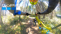
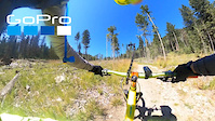
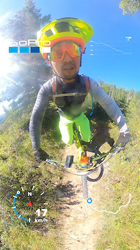
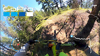
Photos of Pyramid Bench Mountain Bike
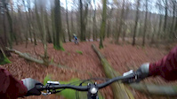
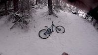
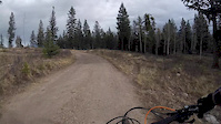
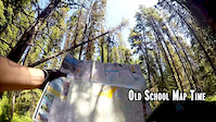
Videos of Pyramid Bench Mountain Bike
trail: Razorback
19:43 |
205 |
Sep 2, 2020
trail: Trail 8 (Mina Lake)
10:01 |
126 |
Aug 18, 2020
trail: Town Trail
3:36 |
56 |
Aug 17, 2020
trail: Razorback - South Fork
3:13 |
98 |
Aug 17, 2020
trail: Trail 2 (Church trail)
10:39 |
206 |
Feb 8, 2019
trail: Trail 8a
0:51 |
251 |
Jan 7, 2017
trail: Water Tower
4:27 |
880 |
Nov 6, 2016
trail: Trail 3 (Highlakes)
7:34 |
774 |
Jul 18, 2015
Recent Trail Reports
Activity Feed
| username | action | type | title | date |
|---|---|---|---|---|
| DelSneath | wishlist | route | activity #97090115 | Jun 15, 2026 @ 11:33pm Jun 15, 2026 |
| FlorianuMV5q9 | wishlist | trail | activity #97044497 and 1 more | Jun 15, 2026 @ 8:50am Jun 15, 2026 |
| andrewfromjasper | add | report | activity #97021175 and 2 more | Jun 14, 2026 @ 8:33pm Jun 14, 2026 |
| andrewfromjasper | add | report | activity #96968042 and 1 more | Jun 14, 2026 @ 7:47am Jun 14, 2026 |
| BigGrubba | add | report | activity #96824256 | Jun 12, 2026 @ 1:14pm Jun 12, 2026 |
Recent Comments
| username | type | title | comment | date |
|---|---|---|---|---|
| trail | Park in town by the pool and ride up trail 2 | May 6, 2026 @ 6:37am May 6, 2026 | ||
| trail | I was living there | May 6, 2026 @ 4:51am May 6, 2026 | ||
| trail | where did you park your car? | May 6, 2026 @ 4:21am May 6, 2026 | ||
| trail | Not good. Overgrown | Sep 1, 2025 @ 10:01am Sep 1, 2025 | ||
| trail | This trail is pretty ass. Rode three humped... | Aug 14, 2025 @ 8:12pm Aug 14, 2025 |
Nearby Areas
| name | distance | ||||
|---|---|---|---|---|---|
| Whistlers Bench | 6 | 5 | 5 | 2 | 3.6 km |
| Maligne Canyon and Jasper Park Lodge | 20 | 4 | 6 | 4.2 km | |
| Old Fort Point / Valley of the Five Lakes | 2 | 3 | 8 | 6.3 km | |
| Jasper National Park | 10 | 10 | 8 | 18.3 km | |
| Brule | 6 | 16 | 1 | 35.7 km |
Local Badges
-

Completionist0 awarded
Local Trail Supporters
- Jasper Trails Alliance
Activity Type Stats
| activitytype | trails | distance | descent | descent distance | total vertical | rating | global rank | state rank | photos | reports | routes | ridelogs |
|---|---|---|---|---|---|---|---|---|---|---|---|---|
| Mountain Bike | 76 | 77 miles | 12,290 ft | 33 miles | 1,952 ft | #1,780 | #25 | 250 | 841 | 6 | 7,082 | |
| E-Bike | 75 | 77 miles | 12,290 ft | 33 miles | 1,952 ft | #1,963 | #18 | 828 | 266 | |||
| Gravel Bike | 1 | #850 | #21 | 20 | ||||||||
| Winter Fat Bike | 1 | #850 | #21 | 2 | 2 | |||||||
| Horse | 73 | 77 miles | 12,287 ft | 33 miles | 1,952 ft | #396 | #8 | 330 | ||||
| Hike | 76 | 77 miles | 12,228 ft | 33 miles | 1,952 ft | #2,848 | #23 | 1 | 838 | 695 | ||
| Trail Running | 76 | 77 miles | 12,228 ft | 33 miles | 1,952 ft | #2,167 | #18 | 838 | 764 | |||
| Snowshoe | 64 | 69 miles | 10,535 ft | 29 miles | 1,932 ft | #232 | #7 | 93 | 26 | |||
| Backcountry Ski | 1 | #457 | #15 | 1 | 7 | |||||||
| Nordic Ski | 4 | 5 miles | 180 ft | 5,043 ft | 1,480 ft | #1,153 | #25 | 1 | 96 |
Frequently Asked Questions About Pyramid Bench
▼
What are the highest rated mountain biking trails in Pyramid Bench?
The highest rated mountain biking trails in Pyramid Bench are:
- Water Tower (4.5/5)
- Fire Escape (4.4/5)
- Razorback (4.3/5)
- Trail 8 (Mina Lake) (4.2/5)
- Trail 2h (4.2/5)
▼
What is the best time of the year to ride in Pyramid Bench?
Based on ride log data, the most popular months to ride in Pyramid Bench are:
- July (239 activities)
- August (144 activities)
- June (98 activities)
▼
Where can I park to ride in Pyramid Bench?
There are 5 parking locations listed in Pyramid Bench. The most popular parking spots are:
- Townsite Parking
- Parking Lot 2 - Cabin Creek
- Townsite Parking
- Parking - Pyramid Boat Launch
- Parking Lot 14 - Whistler Mountain
▼
What is the longest trail in Pyramid Bench?
The longest trail in Pyramid Bench is Trail 3 (Highlakes) at 5.3 miles. View all trails sorted by distance.
Activities
Trails
Points of Interest
- Saturday Night Lake Campground (Backcountry #41) Camping
- Minnow Lake Campground (Backcountry #43) Camping
- Minnow Lake Campground (Backcountry #43) Camping
- Viewpoint - Red Chairs
- Viewpoint - Top of the bench
- Viewpoint - Edge of the Bench
- Viewpoint - Mina Lake
- Pyramid Island Viewpoint
- Cabin Lake Viewpoint
- High Lakes Viewpoint
- By Samfrikinhowe & contributors
- Admins: JPCA, andrewfromjasper
- #12291 - 11,100 views
- pyramid bench activity log | embed map of Pyramid Bench mountain bike trails | pyramid bench mountain biking points of interest polygons
Downloading of trail gps tracks in kml & gpx formats is enabled for Pyramid Bench.
You must login to download files.