close
-
Layers w
- Weather Layers
- Pro
- Pro
- Pro
- Pro
- Pro
- Pro
- More Layers
- Pro
- Pro
- Pro
- Pro
-
Upgrade to

3D
Trail Conditions
- Unknown
- Snow Groomed
- Snow Packed
- Snow Covered
- Snow Cover Partial
- Freeze/thaw Cycle
- Icy
- Prevalent Mud
- Wet
- Variable
- Ideal
- Dry
- Very Dry
Trail Flow (Ridden Direction)
Trailforks scans users ridelogs to determine the most popular direction each trail is ridden. A good flowing trail network will have most trails flowing in a single direction according to their intension.
The colour categories are based on what percentage of riders are riding a trail in its intended direction.
The colour categories are based on what percentage of riders are riding a trail in its intended direction.
- > 96%
- > 90%
- > 80%
- > 70%
- > 50%
- < 50%
- bi-directional trail
- no data
Trail Last Ridden
Trailforks scans ridelogs to determine the last time a trail was ridden.
- < 2 days
- < 1 week
- < 2 weeks
- < 1 month
- < 6 months
- > 6 months
Trail Ridden Direction
The intended direction a trail should be ridden.
- Downhill Only
- Downhill Primary
- Both Directions
- Uphill Primary
- Uphill Only
- One Direction
Contribute Details
Colors indicate trail is missing specified detail.
- Description
- Photos
- Description & Photos
- Videos
Trail Popularity ?
Trailforks scans ridelogs to determine which trails are ridden the most in the last 9 months.
Trails are compared with nearby trails in the same city region with a possible 25 colour shades.
Think of this as a heatmap, more rides = more kinetic energy = warmer colors.
- most popular
- popular
- less popular
- not popular
ATV/ORV/OHV Filter
Max Vehicle Width
inches
US Cell Coverage
Legend

Radar Time
Activity Recordings
Trailforks uses anonymized public activity data.
?
Activity Recordings
Trailforks uses anonymized public activity data.
?
Personal Heatmap
▶
Activity Types
all
/
none
▶
Options
2
Date range
month
–
Winter Trails
Warning
A routing network for winter maps does not exist. Selecting trails using the winter trails layer has been disabled.
Missing Trails
Most Popular
Least Popular
Trails are colored based on popularity. The more popular a trail is, the more red. Less popular trails trend towards green.
Jump Magnitude Heatmap
Heatmap of where riders jump on trails. Zoom in to see individual jumps, click circles to view jump details.
BC Backroad Status
![map legend]()
Service Road Atlas is a free to use, community-driven service for viewing and creating reports on the numerous back-country service roads around B.C. and Alberta.

Slope Aspect
Direction the slope faces
Trails Deemphasized
Trails are shown in grey.
Only show trails with no bike usage.
Suggested Layers
Based on selected activity type
Save the current map location and zoom level as your default home location whenever this page is loaded.
Save
No description for Qatar has been added yet!
Login or register to submit one.
Region Details
- 1
- 1
- 12
- 4
Local Trail Association
Stats
- Avg Trail Rating
- Trails (view details)
- 18
- Trails Mountain Bike
- 21
- Trails E-Bike
- 13
- Trails Horse
- 5
- Trails Hike
- 16
- Trails Trail Running
- 15
- Trails Dirtbike/Moto
- 6
- Trails ATV/ORV/OHV
- 5
- Total Distance
- 138 miles
- Total Descent Distance
- 59 miles
- Total Descent
- 1,840 ft
- Total Vertical
- 238 ft
- Highest Trailhead
- 239 ft
- Reports
- 16
- Photos
- 27
- Ridden Counter
- 48
Sub Regions
- Al Ghuwayriya (1)
- Al Jumayliyah (0)
- Al Nasraniya (1)
- Al Ruwais (0)
- Al Wakrah (3)
- Doha (14)
- Zekreet (0)
- Zekreet (0)
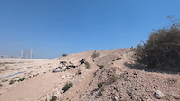
Popular Qatar Mountain Biking Trails
• 85 ★ 4.0 • 3 miles • 59 ft • 12 •
This artificially made trail around the outskirts of the city is flowy Cross Country Mountain Bike Trail with features that will definitely bring out your best Mountain BIke Handling skills. It is made possible by Team Industrial and...
• 70 ★ 0.0 • 3 miles • 166 ft • 10 •
One of the firsts Mountain Bike Trails in Doha, this trail has been passed on from group to group, and is currently managed by a group called "Camp Banayad". This trail is regarded as one of the most technical trail in Qatar but it is a...
• 60 ★ 4.0 • 2,552 ft • 39 ft • 4 •
Moderately popular green difficulty doubletrack. This mountain bike primary trail can be used one direction and has a easy overall physical rating with a 39 ft green climb. It features pump track and rock garden. Trail visibility is always easy to follow.
• ★ 0.0 • 4,393 ft • 18 ft • 3 •
Firat phase of Education City Cross Country Short circuit built by Qatar Foundation. Features newly planted trees and expertly lined trail borders. Very beginner friendly, beware of soft sand on some parts and off camber soft sand...
• 100 ★ 0.0 • 3,202 ft • 9 ft • 3 •
Popular white difficulty family friendly singletrack. This mountain bike primary trail can be used both directions and has a easy overall physical rating with a 9 ft green climb. Adaptive MTB rating: amtb green. Trail visibility is always easy to follow.
• 5 ★ 0.0 • 16 miles • 150 ft • 2 •
Less popular green difficulty singletrack. This multi-use trail can be used both directions and has a moderate overall physical rating with a 150 ft blue climb. Trail visibility is always easy to follow. On average it takes 1 hour34 minutes to complete this trail.
• 5 ★ 0.0 • 2 miles • 19 ft • 2 •
Service road for the pipeline in the area. Layin' Pipe serves as a main trunkline and access point for several other trails in the area.
• 5 ★ 0.0 • 9 miles • 136 ft • 1 •
The name says it all, The Brutalizer will make mince of you without proper suspension and picking a good line. The track is very rocky, corrugated(washboarded) and generally in poor condition for all but the most plush rigs. The track...
Qatar Mountain Bike Routes
★ 5.0 • 18 miles • 279 ft • 0 •
Tour of Zekreet area from south to north and back as a loop.
36 miles • 355 ft • 0 • Loop •
Loop from just past the fence line near Teleport out to the coast and back. Mixed terrain between rock,...
13 miles • 123 ft • 0 • Loop •
The route is a well established track starting from near the Al Nasraniya interchange. The current sign...
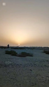
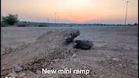
Photos of Qatar Mountain Bike
Videos of Qatar Mountain Bike
trail: Duhail Trail
0:24 |
6 |
Mar 7, 2026
trail: Al Sad Beginner Trail
0:16 |
15 |
May 21, 2025

trail: Al Sad Beginner Trail
0:27 |
24 |
Feb 19, 2025

trail: Al Sad Beginner Trail
3:20 |
74 |
Dec 4, 2024

trail: Al Sad Beginner Trail
6:52 |
26 |
Nov 26, 2024

trail: Al Sad Beginner Trail
0:38 |
28 |
Nov 14, 2024
trail: Al Sad Beginner Trail
0:40 |
25 |
Nov 10, 2024

trail: Al Sad Beginner Trail
10:21 |
30 |
Nov 4, 2024
Recent Comments
| username | type | title | comment | date |
|---|---|---|---|---|
| trail | My next trail to try out.! ;-) | Nov 6, 2024 @ 9:28am Nov 6, 2024 |
Activity Type Stats
| activitytype | trails | distance | descent | descent distance | total vertical | rating | global rank | state rank | photos | reports | routes | ridelogs |
|---|---|---|---|---|---|---|---|---|---|---|---|---|
| Mountain Bike | 20 | 138 miles | 1,841 ft | 59 miles | 240 ft | #83 | 27 | 16 | 3 | 6,437 | ||
| E-Bike | 13 | 93 miles | 1,365 ft | 34 miles | 200 ft | #76 | 15 | 2 | 13 | |||
| Horse | 5 | 72 miles | 512 ft | 28 miles | 187 ft | #52 | 2 | |||||
| Hike | 16 | 101 miles | 1,280 ft | 46 miles | 200 ft | #90 | 15 | 61 | ||||
| Trail Running | 15 | 64 miles | 1,050 ft | 32 miles | 164 ft | #95 | 16 | 12 | ||||
| Dirtbike/Moto | 6 | 76 miles | 541 ft | 29 miles | 187 ft | #46 | 2 | |||||
| ATV/ORV/OHV | 5 | 72 miles | 512 ft | 28 miles | 187 ft | #40 | 2 |
Activities
Trails
Points of Interest
- By canadaka
 Trailforks & contributors
 - Admins: apply
- #22398 - 5,770 views
- qatar activity log | embed map of Qatar mountain bike trails |
Downloading of trail gps tracks in kml & gpx formats is enabled for Qatar.
You must login to download files.